Syrdarya Region of Uzbekistan: Tourism Opportunities from Fishing to Parachuting
Read more
Podrobno.uz [uz]
podrobno.uz

Syrdarya Region of Uzbekistan: Tourism Opportunities from Fishing to Parachuting

When discussing travel destinations in Uzbekistan, famous places like Samarkand, Bukhara, Khiva, or the mountain regions often take center stage. However, the Syrdarya Region appears less frequently on tourist routes, although it combines traditional agricultural and industrial landscapes with unique attractions for tourists: from recreational bases by the river to ancient settlements and parachuting zones.

A correspondent from Podrobno.uz, together with representatives of the Tourism Committee, traveled to this region to assess its tourism potential. During the trip, they managed to speak with fishermen on the Syrdarya, learn the history of a settlement estimated to be 2,5 thousand years old, visit local shrines, and experience a flight over the region.

Relaxing on the Banks of the Syrdarya

The first stop on the route was the Ravon Arena recreation base, located on the banks of the Syrdarya, within the Mahalla civic assembly of Sholikor. This base is near a village of the same name and borders Kazakhstan. It began operating in May 2026 and offers various options for water recreation.

The base grounds feature cottages, a bathhouse, an outdoor pool, hot tubs, and areas for grilling. Guests staying overnight receive free charging for electric vehicles. Here, one can spend several hours relaxing with family or engaging in fishing. Fishing is free, but renting a hot tub costs 200 thousand soms. Fish species include carp and white catfish. Fishermen come here not only from nearby areas but also from Tashkent.

One fisherman, Shukhrat, reported starting his interest in fishing in 2026, and his largest catch was a carp weighing about one kilogram. Another visitor noted that the optimal time for fishing is summer, starting from late June, and the season usually ends by the end of October. During the visit, several fishermen were catching fish: two were cleaning carp, and one interviewee shared a memory of catching a fish weighing about 40 kilograms. They were shown gear, including equipment for the 'flat' fishing method.

The base plans expansion, with plans to build additional cottages. Although work has not yet begun, the development of the area could increase its appeal for those seeking an escape from urban environments.

Khvana Havast Kitchen: Traces of an Ancient City

Next, the route led the group to a historical site in the region—the Khvana Havast settlement, located in the Havastabad mahalla of the Khvast district. Local residents claim that the history of this place dates back approximately 2,5 thousand years.

Farrukh Ashirbaev, the mahalla chairman, stated that the settlement covers an area of about 10 hectares, and its central part is a hill approximately 20 meters high. According to local legends, the fortress was once surrounded by water, and Khvast was situated at the intersection of caravan routes.

Interest in the settlement is driven not only by its age but also by archaeological discoveries. Excavations were conducted in the 1980s and again in 2004–2005. According to the interviewee, researchers found artifacts at a depth of about 11 meters, but the work was suspended due to the appearance of saline water in the area.

Among the discovered items were pitchers, fragments of ovens, kitchen utensils, as well as evidence of baths, mills, and craft workshops. Figurines related to the images of Anahita and the Humo bird were found. Local residents say that the ancient city consisted of seven guzar—separate quarters where different types of crafts developed; for example, wooden combs were made in one of them. These findings provide insight into the life of the settlement many centuries ago.

Currently, local residents aim to transform Khvana Havast into an open-air museum to preserve heritage and provide tourist access. This is currently just an idea, but the monument itself is already attracting interest from those who wish to learn more about the region's past.

Shrines and Local Legends

The historical richness of the Syrdarya Region is not limited to archaeological monuments; the region also has mausoleums and burial sites of great significance for pilgrims and local residents. Farrukh Ashirbaev specified that there are about 12 such sites in the vicinity.

One direction of religious tourism is the Bobojobor mausoleum. Rudibek Abdunabiev, the imam-khateeb of the Zangiyota Jome mosque in the Mirzaabad district of the Syrdarya Region, noted that this place is connected to a legend about the Arab origin of the saint and the spread of Islam in the area.

Other revered sites mentioned include the mausoleums of Bibi Hadicha, Sherbobo, Yusuf Bobo, and Khodjamurod Bobo. Pilgrims visit these places with various requests, such as praying for children and family well-being. Visitors arrive not only from different parts of Uzbekistan but also from neighboring countries such as Tajikistan.

Some shrines are undergoing improvement. For instance, craftsmen from Samarkand worked on the site associated with Bibi Hadicha. The Sadu Said Jome mosque provides amenities for visitors, and funds for infrastructure improvement were allocated back in 2017, with work ongoing.

These places preserve not only religious significance but also local traditions passed down through generations. For travelers, this is an additional opportunity to learn about the region's history through traditions and the stories of local residents.

Extreme Tourism: A View of the Region from Above

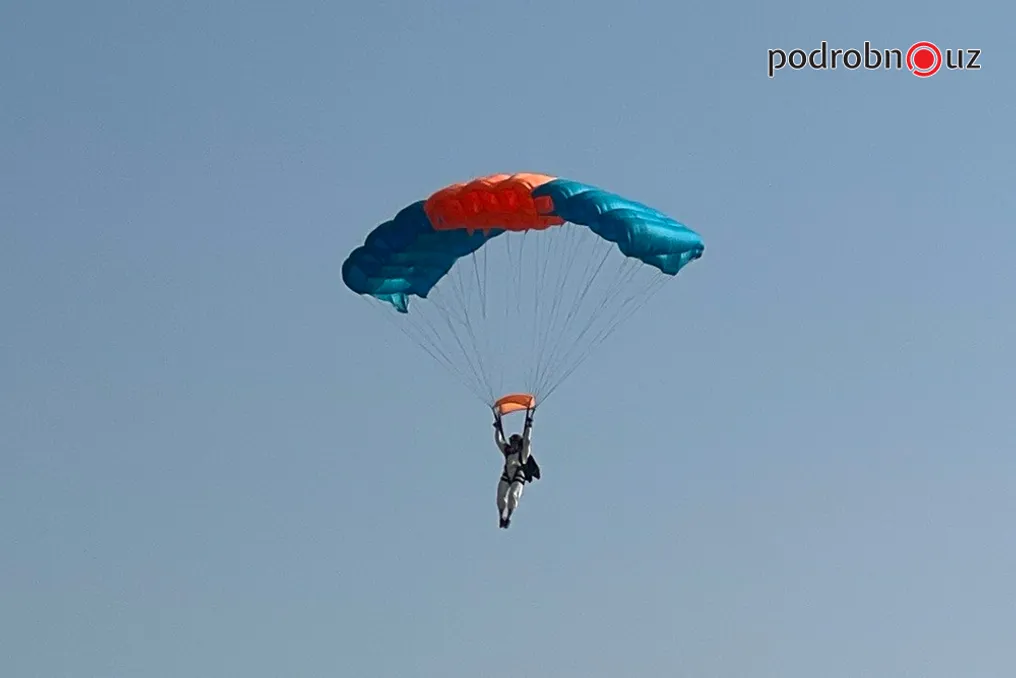
The route, which began with quiet relaxation by the river and viewing centuries-old sights, transitioned to a completely different format of experiencing the region—visiting the Skydive facility, from where the Syrdarya Region can be viewed from a bird's-eye view.

The facility offers two types of jumps: tandem with an instructor or solo. The first option suits beginners, as the participant jumps under the guidance of an experienced specialist throughout the flight. Solo jumps require prior training and a three-hour briefing.

Ascent is made using an An-2 aircraft, known as a 'crop duster'. Jumps are performed from an altitude of about 1,200 meters using an 'Arbalet-1' parachute, whose wing area is 27 square meters. Thorough preparation is required before takeoff and landing, especially for those jumping alone. Participants are thoroughly briefed on the jump procedure, introduced to the equipment, onboard conduct rules, and actions at each stage. Special attention is paid to exiting the aircraft, parachute deployment, and landing technique. The facility also has simulators and a parachute pack mockup for skill practice.

Participants only board the plane after completing the training. For those not yet ready to jump, sightseeing flights are available: a 15-minute tour costs one million soms, and a 30-minute tour costs two million, with longer excursions available upon individual arrangement.

The correspondent also experienced this firsthand. Before the jump, the instructor Alexey used humor to relieve tension, stating: 'If the parachute doesn't open, you can bring it back, we will pack it up and fly another round.' After the briefing, the plane ascended to the required height. The most thrilling moments were the first seconds after exiting the cockpit, after which the parachute opened and the descent began. The instructor maintained radio contact, helping with orientation and preparing for landing.

Conclusion

The trip demonstrated that the Syrdarya Region is capable of offering diverse travel formats: from quiet relaxation by the water and exploring an ancient settlement with its archaeological heritage, to visiting shrines with local legends and experiencing extreme activities at the jumping facility.

Nevertheless, the region's potential has not been fully realized. Some historical sites require further study and improvement, and plans for developing tourism infrastructure still need to be implemented. Despite this, the region can already become an attractive destination for a short trip, especially for those who seek to combine nature, history exploration, and new experiences.
Similar stories

Navoi Region is Becoming a Popular Tourist Destination Thanks to Unique Natural and Historical Sites
Read more
nuz.uz

Navoi Region is Becoming a Popular Tourist Destination Thanks to Unique Natural and Historical Sites

The Navoi Region is gradually revealing a completely different facet of Uzbekistan to travelers—one that is unique, mysterious, and highly diverse. This region offers an introduction to ancient petroglyphs, a turquoise lake in the desert, caravanserais of the Great Silk Road, and hospitable ethnic villages.

Uzbekistan as a whole is a country where every trip enriches knowledge about a new history, combining Eastern hospitality with age-old traditions. Ancient cities preserve the memory of great civilizations, while natural landscapes amaze with their diversity. Millions of foreign guests visit the country annually, interested in educational, health, sports, and gastronomic tourism.

The tourist map of Uzbekistan is not limited only to Samarkand, Bukhara, and Khiva; every region possesses its own treasures awaiting discovery by the general public. One such region is the Navoi Region, located in the center of the country. Although this region is the largest by area and is known primarily for its industry and contribution to the economy, there is another world hidden behind the industrial facade.

This world includes the vast expanses of the Kyzylkum, ancient rock carvings, historical monuments of the Great Silk Road, the picturesque Aidarkul lake, and small settlements where the traditional way of life is still maintained. Here, one can take a walk in the desert, see traces of ancient civilizations, stay in a national yurt, taste local cuisine, and get acquainted with the culture of the local people. The Navoi Region is transforming into a destination that offers not just an excursion, but a deep immersion into the history, nature, and traditions of the region.

There are places where history is not presented in museum exhibits but is literally carved into stone. Such a place is the Sarmyshsai gorge, located in the Navbahor district of the Navoi Region. Sarmyshsai is famous for numerous petroglyphs, i.e., rock drawings left by ancient inhabitants. These images are of high value to historians and archaeologists as they provide insight into the world thousands of years ago: the occupations of people, their food sources, and the region's animal life.

On the rocks, images of various animals are preserved, including bulls, bison, wild horses, mountain goats, argali, camels, as well as predators such as lions, leopards, and cheetahs. Some compositions are dedicated to hunting, daily life, economic activities, and the rituals of ancient inhabitants. According to available information, about ten thousand rock carvings have been discovered in this area, covering dozens of subjects and thematic images. Most of the drawings were created using stone and metal tools, and over time, their surface has acquired a characteristic dark patina.

Of particular interest are the images of animals that no longer exist in the local nature, allowing one to trace the changes in the region's fauna in the past. In addition to petroglyphs, there are inscriptions in Arabic on the rocks, indicating the significance of this territory in later historical periods. Today, Sarmyshsai is recognized as a state museum-reserve and is considered an important archaeological site and a promising tourist zone.

Malik Khamidovich Mamedov, head of the Sarmyshsai State Museum-Reserve, spoke about the development of the area and the measures taken for visitors. He reported that the reserve was established according to Decree No. 440 of the Cabinet of Ministers of the Republic of Uzbekistan from 2019. After its creation, the main focus was on ensuring conditions for local and foreign tourists. Previously, the road to the gorge was in poor condition, which created difficulties for arrivals. With the support of the republic's leadership, the region, and the Agency for Cultural Heritage, more than twenty kilometers of asphalt road have been repaired. Benches have now been installed in the area, and pedestrian paths of about three kilometers have been developed. Work is underway to install binoculars so that visitors can view the rock carvings without climbing difficult mountain sections. Tourists from Italy, Spain, England, Canada, and other countries visit the reserve, and the management strives to ensure comfort for everyone, especially for elderly guests who find it difficult to move in the mountains.

The total area of the reserve is approximately five thousand hectares, with the most densely petroglyph-covered section stretching along the gorge for about two and a half kilometers. Malik Mamedov emphasized that the stones preserve drawings of ancestors depicting animals, hunting and agricultural tools, crafts, flora elements, and people themselves, and each drawing serves as a testament to the lives of ancient generations. Future plans include the development of tourist infrastructure, including the creation of a 32-hectare tourist center, the development of a master plan, and strengthening measures to preserve cultural heritage.

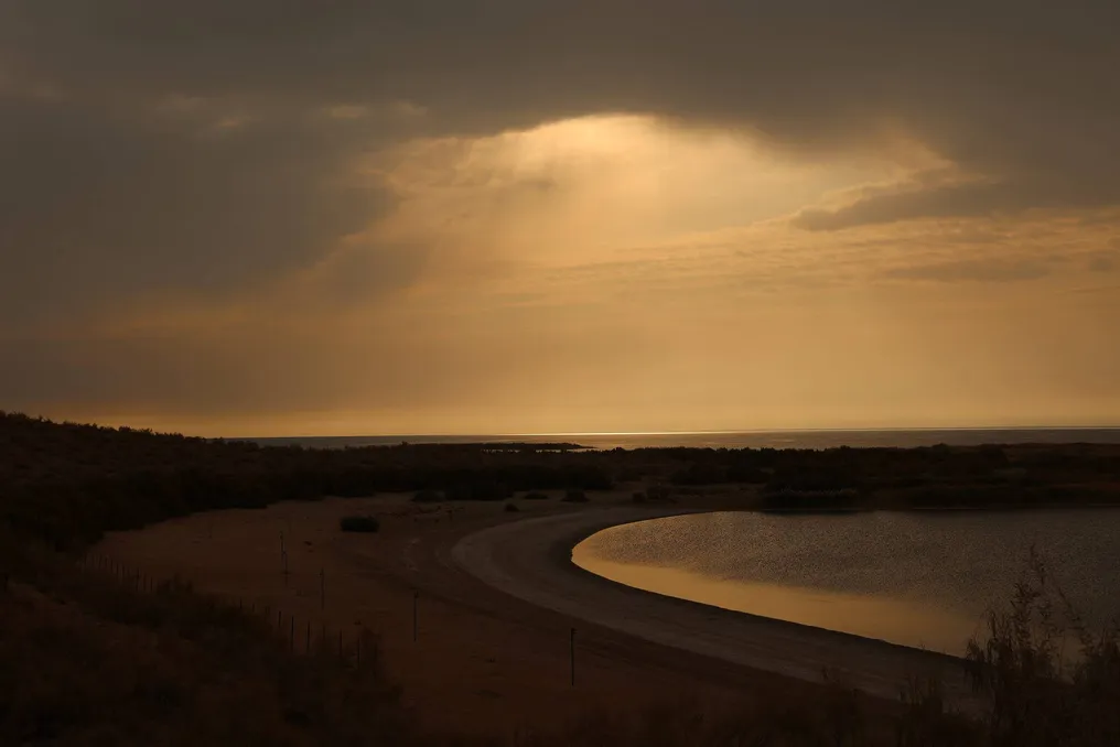
After studying the ancient rock carvings, the route can continue to one of the most unusual natural places in Uzbekistan—the Aidarkul lake. It is often called a turquoise sea located in the middle of the desert. The sight of the vast water surface surrounded by the sandy expanses of the Kyzylkum makes a strong impression, changing the perception of the desert: instead of endless sands, a lake with beaches, birds, and rich underwater life opens up before the traveler.

Aidarkul is one of the largest lakes in Uzbekistan, located on the border of the Navoi and Jizzakh regions, and is part of the Aidar-Arnasay lake system. Its formation history is unique: in its modern form, the lake appeared in 1969 after a powerful flood on the Syr Darya River. Part of the water was diverted into the Arnasay lowlands to prevent the overflow of the Chardarin Reservoir, which led to the formation of a large body of water among arid desert landscapes.

Over time, Aidarkul has become an important part of the local ecosystem. Its shores serve as a stopping and habitat place for many migratory and waterfowl, such as pelicans, herons, swans, and ducks, as well as rare species listed in the Red Book. The lake is also rich in fish: carp, pikeperch, catfish, bream, and lele inhabit its waters, attracting both leisure enthusiasts and fishermen.

The main advantage of this place is its special atmosphere. Tourists can spend time on the sandy shore, swim in the warm season, watch birds, or simply enjoy the silence broken only by the wind. Trips through the desert, acquaintance with nature, and accommodation in traditional yurt camps are organized for visitors, as well as camel rides. Relaxation here is becoming increasingly comfortable: some camps are equipped with air-conditioned yurts and all necessary amenities.

Historical and natural attractions are only part of the region's tourism potential. Currently, the Navoi Region is actively working on developing infrastructure, creating new routes, and attracting investment in the tourism sector. The region aims to increase tourist flow to six million people within the next two years, including attracting up to one million foreign guests.

The scale of development is reflected in statistics: since the beginning of 2026, over three million tourists have visited the region, of which 551 thousand are foreign citizens. Over the last five years, the number of foreign tourists has increased 21 times, and domestic tourists by 2.5 times. Over nine years, 355 hotels and guesthouses have been built in the region, leading to a 20-fold increase in the hotel fund. Currently, 373 accommodation facilities with a total capacity of 9,348 places and 106 tourism organizations are operating.

By the end of 2027, it is planned to open another 120 accommodation facilities, as well as create about 30 new tour operators and travel agencies. One of the key projects will be the 'Ancient Karmana' tourist center with an investment cost of 100 billion soms. This project involves the reconstruction of Karmana Street, spanning 2.4 kilometers, in an ethnic style and the integration of historical monuments, a market, and recreation areas into a single tourist route. The Kosim Shaykh complex will occupy a special place in this route, some structures of which date back to the 16th century.

The Karman district also preserves evidence of the Silk Road era, such as Rabat-i Malik—an architectural monument from the 11th century, built during the reign of Shams al-Mulk Nasir of the Karakhanid dynasty. Initially, this complex served as a fortified residence for rulers and later turned into a caravanserai.

Uzbekistan's Partnership with Turkey and the OIC Summit Contribute to Expanding the Country's Economic Opportunities
Read more
uza.uz

Uzbekistan's Partnership with Turkey and the OIC Summit Contribute to Expanding the Country's Economic Opportunities

Geographical location dictates the directions of trade flows, but it does not determine a state's economic significance. The space located between Samarkand and the Bosphorus can be interpreted either as a series of national borders or as a transit route connecting various production centers, transport hubs, and seaports.

For Uzbekistan, the key task is to transform its intra-continental location from a source of constant costs into a tangible advantage. This advantage must be based on the country becoming a conduit not only for goods but also for investment, technological, and production links.

Popular