The landscapes of South Africa tell fascinating geographical stories. Among the most outstanding natural features of the region are the Namib desert mountains, the winding river valleys of the Eastern Cape, and the vast Fish River Canyon. These three road trips allow exploration of the region's most remarkable natural characteristics.
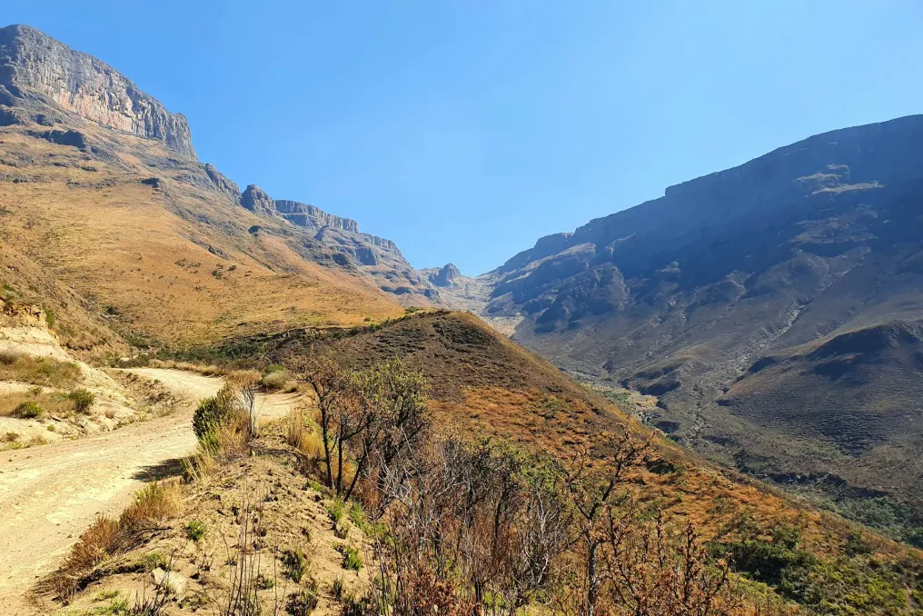
The relationship between geography and travel is vividly illustrated by the Senai Pass. This well-known route connects KwaZulu-Natal with the mountainous kingdom of Lesotho. It ascends to the Drakensberg escarpment, reaching the summit of Senai at an altitude of approximately 2876 meters above sea level.
The journey begins in Underberg and follows the foothills of the southern Drakensberg towards the South African border post. After this point, the landscape changes abruptly as the road winds through steep mountain slopes via a series of switchbacks. The ascent reveals increasingly expansive views of the valleys below, and the vegetation gradually transforms with increasing altitude.
At the summit, travelers cross into Lesotho, where the mountainous terrain turns into a high plateau. Lesotho is known as the Mountain Kingdom—the only country in the world situated entirely above 1000 meters. Its dramatic topography is characterized by rolling grasslands, deep river valleys, and rugged mountain peaks.
For those wishing to extend their trip, the road to Mokhotlong offers additional opportunities to admire the country's central mountain range. The Katse Dam is another significant geographical and engineering landmark, part of the Lesotho Highlands Water Project.
Traveling over the Senai Pass requires a suitable 4x4 off-road vehicle and driving experience; organized tours are available from Underberg for those lacking the necessary experience. Accessibility may also depend on weather conditions, so it is crucial to check information in advance.
In the Eastern Cape, the Baboonskloof route offers a journey through one of South Africa's most geographically diverse wilderness areas. This path runs between the towns of Willowmore and Patensie, traversing a landscape composed of rising mountain ranges, narrow valleys, rocky formations, and winding rivers.
The name Baboonskloof translates to 'Baboon Valley,' accurately describing this remarkable wildlife corridor. As part of the Cape Floral Region, the large conservation area includes an exceptional diversity of plant types and landscapes.
One defining feature of the route is how the road follows the natural contours of the mountains. Travelers encounter narrow mountain passes, dramatic cliffs, and river crossings as the landscape shifts from dry, stony terrain to greener valleys. The Baboonskloof River plays a vital role in this ecosystem, sustaining vegetation and wildlife in an otherwise harsh environment.
The Nuweklouw Pass provides a particularly impressive introduction to this region, where towering rock formations create natural gateways into the valley. Further on, the surrounding mountains display traces of millions of years of geological processes, including erosion and the formation of deep valleys.
Baboonskloof is also listed as a UNESCO World Heritage Site, recognized for its exceptional biodiversity and ecological significance. Currently, access to the Baboonskloof reserve is restricted for 4x4 vehicles due to flood damage. A 4x4 vehicle is required to travel between the western and eastern gates, while Krugerkopkloof remains accessible to non-4x4 visitors, provided entry is made through the eastern gates. Visitors approaching from Patensie or Gqeberha must follow designated access roads via N2, R331, and R332, with alternative access from Humansdorp. As repairs continue, driving conditions and access procedures may change, so visitors should check the latest park notifications before departing.
Water has played a crucial role in shaping the landscapes of South Africa, especially in its drier regions. One of the best ways to appreciate this is by following the Orange River through the Northern Cape and into southern Namibia before heading to the magnificent Fish River Canyon.
The journey can begin near Noordoewer, where the Orange River forms the international border between South Africa and Namibia. Despite the surrounding arid scenery, the river sustains a surprisingly green corridor of vegetation, agriculture, and wildlife.
Following the roads toward Ausenkerr and Ai-Ais, travelers encounter a striking contrast between the lush riverbanks and the surrounding rocky desert landscape. The route also provides an opportunity to assess how water influences settlement patterns and agricultural activities in regions with limited rainfall.
From Ai-Ais, the trip continues towards Hobas and the Fish River Canyon—one of Africa's most impressive geological monuments. The canyon, stretching about 160 kilometers, was formed by millions of years of geological activity and erosion. Its massive rock walls expose various geological strata, offering a glimpse into the region's ancient history.
Geographically, the canyon is particularly interesting because its formation involved both tectonic activity and the destructive force of flowing water. The Fish River gradually carved the landscape, creating the vast gorge visible today. From the canyon viewpoints, visitors can appreciate the scale of this geological formation from above, while Ai-Ais offers a different perspective from the southern end of the canyon, where natural hot springs provide a pleasant contrast to the surrounding desert.
This road trip is especially suited for travelers interested in the relationship between water, geology, and life in arid conditions. The changing panorama also serves as a reminder that even in South Africa's driest landscapes, rivers remain powerful forces of transformation.