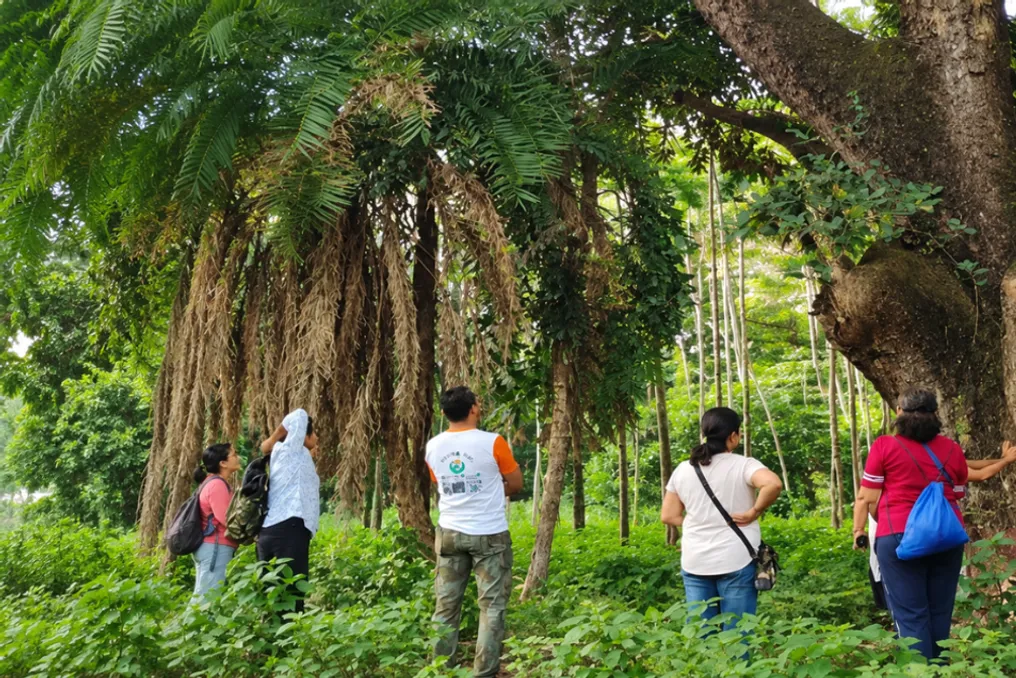
In October 2026, seven residents of Pune gathered at Madhavrao Sindhi Garden, located near the Mula River. Crossing the river, two fishermen guided their boat past a dense array of trees. These residents brought smartphones and measuring tapes to document trees that people could pass by every day without giving them due consideration.
They photographed individual trees, recorded their species, measured trunk circumferences, and logged their locations in a phone application. Each such entry added to the growing map of greenery along the banks of the Pune River. Although this might seem like a small weekend event, for these volunteers, knowing the exact location of the trees could be crucial when the city makes decisions about future development.
Why are Pune residents counting trees?
The volunteers are part of the Pune River Revival (PRR) group, which began more systematic tree mapping in 2024 amid concerns over a Rs 4,727 crore Pune embankment development project. This plan involves creating walking zones, recreational spaces, and other structures along the banks of the Mula and Mutha rivers. The group aimed to obtain clearer information about the trees and other living organisms already thriving in the area, which required going beyond simple trunk counting.
Volunteer Ragunandan Patil told Mongabay that they started systematic tree mapping in 2024. Previously, the group kept manual records but lacked the technical knowledge for proper documentation. Today, volunteers use the iNaturalist app, which allows uploading photos and locations of plants and animals, helping to identify species and create a database for consultation with others.
During mapping excursions, volunteers spread out along sections of the shoreline, taking pictures and measurements as they progressed. Each entry helps answer an important question: if a patch of greenery disappears tomorrow, who will know what was there? Over 500 trees were under threat of felling. Residents began working.
This issue became particularly acute on Ganeshkhind Road, where plans to widen the busy thoroughfare threatened 529 trees, including mature trees estimated to be decades old. When residents approached PRR, volunteers documented over 500 trees within a month. These records helped assign names, numbers, and locations to the trees that people feared losing.
The concern extended beyond the mapping group. On April 18 and 19, 2026, residents, artists, and environmentalists united to map trees, living paintings, and music, drawing attention to the proposed road expansion between Sancheti Hospital and Savitribai Phule University. According to the initial proposal, 469 trees were slated for transplantation and 60 for removal. Environmentalists questioned the viability of old trees surviving after relocation. Artist Janaki Gandhi told Pune Mirror: 'I grew up among these trees, and they are part of every Punekar's heritage. Through art, we want people to see each tree as a living individual, not just an obstacle in a road construction plan.' Citizens also filed objections and sought changes to the road construction project.
By September 2026, the Pune Municipal Corporation adjusted its proposal, reducing the number of trees to be removed from 529 to 33. This meant that 496 trees could be saved according to the revised plan. This change resulted from broader citizen action and the efforts of conservation groups. Mapping helped document what was at risk and provided residents with another way to advocate for their position.
What can a sacred grove teach a growing city?
Along the rivers, PRR also drew attention to Ram-Mula Devrai, a sacred grove where the Ram and Mula rivers meet. Devrai is a forested area traditionally protected by local communities because it is considered the habitat of a village deity. In an urban setting, such a grove can also serve as a refuge for plants, birds, and other wildlife. Reports cited by Mongabay record about 1000 historical trees and at least 450 species of plants and animals in this grove, including 160 species of birds, as well as the Bengal monitor lizard and a checkered python.
To help more people discover this place, volunteers organized butterfly and insect walks, tree painting contests, and other events. They also suggested ways visitors could enjoy the space while preserving its greenery. Their efforts demonstrated how people can explore and appreciate natural spaces while keeping their vegetation untouched.
From the riverbanks to the hilltops, more and more people are joining this movement. In other parts of Pune, citizens are creating similar registries. On the Chathushrungi, Taljai, and ARAI hills, the Green Hills Group uses the TrackMyTree app to register saplings, their locations, species, and caretakers. Reviewing these records allows volunteers to understand which trees are surviving and where they need attention.
Along the Mula River, PRR and JeevitNadi volunteers also used ConnecTree, a tool developed by the Pune Knowledge Cluster, to document trees and saplings along the riverbank. The Pune Municipal Corporation states that it conducts tree counts every five years, but community groups argue that accessible and regularly updated records are also important, especially when residents want to understand how a proposed project might affect their neighborhood.
Returning to the river, the work boils down to photography, measurement, and location saved on a phone. The same simple steps taken by seven volunteers that October morning can one day provide residents with a record they can refer to when an old tree is marked for removal. And as Pune grows, these records give its residents something valuable: a clearer picture of the trees around them and a stronger voice in how to protect them.