Chief Forecaster Reports Super El Niño Stimulating Typhoons in Western Pacific
Read more
CGTN
cgtn.com

Chief Forecaster Reports Super El Niño Stimulating Typhoons in Western Pacific

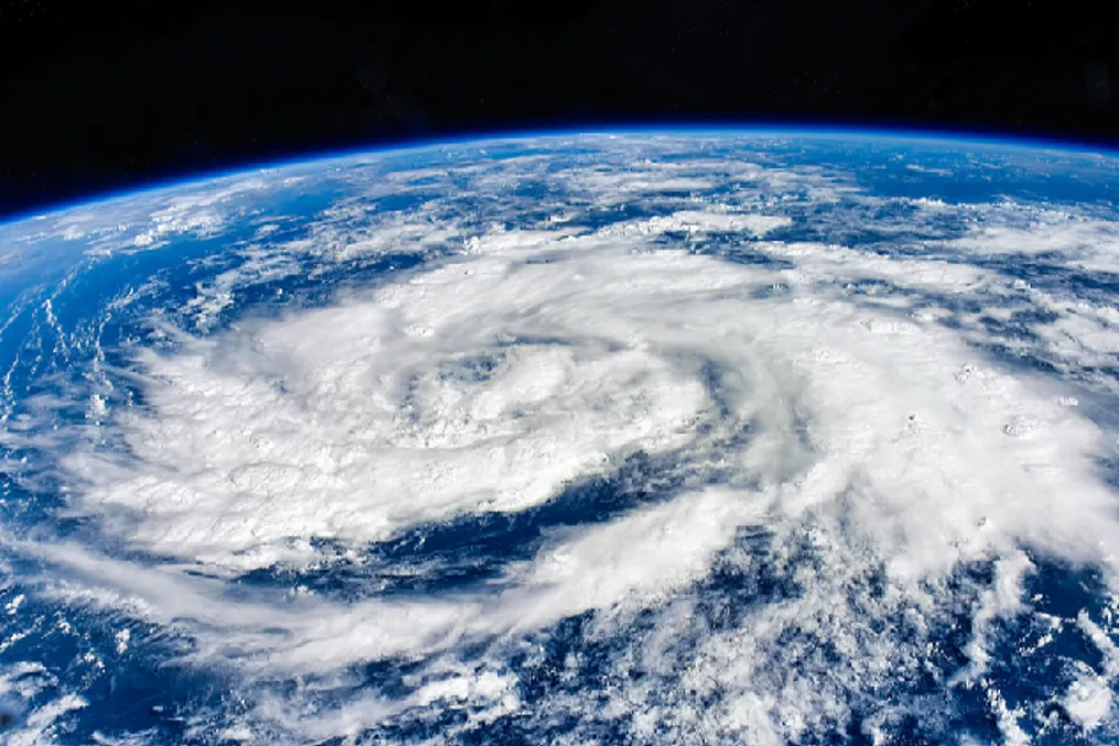
The existing super El Niño phenomenon has intensified typhoon activity in the Western Pacific Ocean. According to data from the chief forecaster of China's National Climate Center, 32 typhoons have already formed in the Northwest Pacific and the South China Sea this year, which is the highest annual figure since the beginning of the 21st century.

On average, this region has seen 24.3 typhoons per year over the last century. Previous records exceeding 30 typhoons were set only in 2004 and 2013, with 31 typhoons recorded in 2013.

Zhao Junhu, chief forecaster at the National Climate Center, noted that under the influence of the developing super El Niño, the subtropical high-pressure area remained further north from summer, shifting by an average of about two degrees latitude northward between August and October. This shift of the subtropical high-pressure area favors the formation of typhoons. From July to October this year, 23 typhoons formed, and the number and intensity of storms significantly exceeded average figures.

The high number of typhoons occurs against the backdrop of broader climate change. Monitoring by the National Climate Center showed that the super El Niño event originated in the central and eastern equatorial Pacific in September and reached record strength by October.

Zhao also stated that next summer, super El Niño is expected to make the subtropical high-pressure area over the Northwest Pacific stronger, promoting its shift westward and southward. This will likely lead to a decrease in the number of forming typhoons, although their intensity is expected to remain high, and trajectories will predominantly head west. The typhoon pattern next autumn will depend on how El Niño develops from summer to autumn next year.

Similar stories

Strong El Niño is expected to maintain intense rainfall in Rio Grande do Sul until summer
Read more
olhardigital.com.br

Strong El Niño is expected to maintain intense rainfall in Rio Grande do Sul until summer

Rio Grande do Sul recorded a significant number of deaths linked to storms between August and September. Furthermore, there are three other incidents in November that are still under investigation, bringing the total fatalities associated with extreme weather events over four months to 12.

The current situation is directly related to the action of an exceptionally strong El Niño. Projections indicate that during spring and summer, there will be above-average rainfall and high temperatures.

Severe weather episodes began in early July, first in Northern Rio Grande do Sul, and soon spread to other areas. In the Serra region, one incident involved a residence being swept away by the force of the water in the locality of Linha Alcântara, in Bento Gonçalves, towards the Taquari Valley.

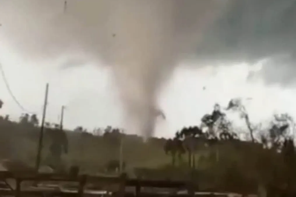
Intense winds also caused considerable damage. In July, a tornado crossed three municipalities in the state's Northwest. In the following month, another tornado hit the Southern Region, registering wind gusts exceeding 300 km/h. Rain accompanied by hail also caused damage in several cities.

In September and October, new storms hit areas that had already been affected, but this time with greater intensity and scope.

According to the Civil Defense of RS, there were three deaths related to bad weather in August and six in September, which was the deadliest month of the period. Among the registered incidents, landslides, vehicles swept away by water, and electric shocks caused by broken cables stand out.

In November, three additional deaths were placed under investigation to verify if there was a direct link to the storms. Thus, Rio Grande do Sul totals 12 deaths in four months due to heavy rains, intense winds, hail, and river levels rising.

Climatologist Francisco Eliseu Aquino points out that atmospheric systems have shown greater intensity in the last decade. According to the specialist, this trend could lead to both an increase in the frequency and severity of the phenomena.

Super El Niño breaks 40-year warming record and triggers alerts in Brazil
Read more
olhardigital.com.br

Super El Niño breaks 40-year warming record and triggers alerts in Brazil

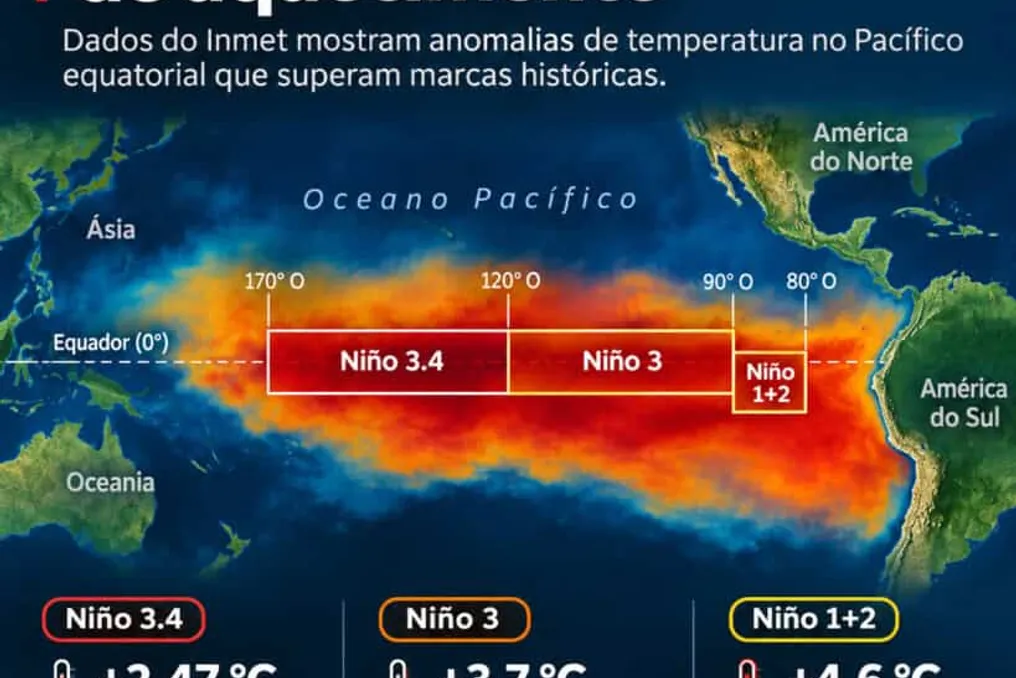
According to information released by Olhar Digital, data provided by the National Institute of Meteorology (Inmet) indicates that the El Niño phenomenon reached a historic warming level in October. The anomaly registered in the Niño 3.4 region reached 2.47 °C above average, surpassing the 2.07 °C level observed in October 1982.

Weekly measurements also set new records. In the Niño 3 region, the temperature registered 3.7 °C above average in the last week of the month, exceeding the 1981 mark. In the Niño 1+2 area, near Peru and Ecuador, the difference was over 4.6 °C, matching the peak of June 1983.

When the phenomenon was confirmed in June this year, the World Meteorological Organization (WMO) was already signaling a high probability of intense severity. At that time, climatologist Carlos Nobre, who holds a Ph.D. in Meteorology from the Massachusetts Institute of Technology (MIT) in the USA and is internationally recognized for global warming, warned about the seriousness of the scenario of a possible 'Super El Niño.'

The specialist stated that 'The chances of this being one of the most intense events ever recorded are extremely high. Therefore, we need to be very prepared.' He emphasized that the global outlook has undergone drastic changes, given that continuous ocean warming and energy accumulation in the atmosphere cause extreme events, previously uncommon, to occur much more frequently in recent decades.

Inmet's temperature records confirm that temperatures in various parts of the country exceeded the limits of the last four decades, realizing the scenario predicted by specialists. According to Nobre, the phenomenon also reached unprecedented levels in oceanic measurements conducted since the 1950s.

This unprecedented thermal alteration profoundly modifies atmospheric dynamics. With warmer seas, evaporation increases, which drives severe and simultaneous events, exactly as the specialist had anticipated.

The North and Northeast regions feel the effect directly on humidity. The scientist explained that 'Typically, El Niño leads to a period of severe drought, heatwaves in the Amazon, and much of the Northeast, which is what is happening.' He added a warning, mentioning that due to the drought and heatwaves, vegetation becomes highly flammable, and organized crime is causing fires, most of which are illegal and intended for deforestation.

In contrast, the South of the country faces a situation of excess water. 'Instead of drought, there is excessive rainfall. Throughout Southern Brazil, even some part of Southern Mato Grosso do Sul, there is excess rain, as predicted.'

The warming also intensifies severe and atypical occurrences in the atmosphere of the Southern region. The researcher pointed out that 'There are also climatic phenomena, extratropical cyclones, low-pressure systems; they are stronger. And not just excessive rain, but strong winds are breaking records, as are tornadoes.'

Nobre stressed that the modification in the climate pattern imposes serious challenges on cities without adequate infrastructure. In the Southern states, there was a record number of tornadoes, something very rare in those locations. Thus, the entire system has never been prepared for tornadoes like those in the center-southeastern region of the United States, which historically present them.

To prevent future tragedies, the specialist advocates that the country adopt the urban protection models used in regions accustomed to such events in the United States. He cited the example of houses with underground areas, where people can shelter during a tornado, preserving themselves even if the structure is damaged by strong wind.

Physical mechanisms explain how ocean heat provides so much energy. With warmed oceans, evaporation is significantly higher, and the atmosphere reacts with faster winds in the southern hemisphere. This accelerated airflow enhances precipitation volumes. 'Rain in the Pacific, up to the coast of South America, increases significantly, and the phenomenon gains strength. This induces severe droughts in several places, especially in South America, the Amazon, and the Northeast.'

Additionally, a meteorological phenomenon occurs where the speed of the subtropical jet stream, the atmospheric wind current of the southern hemisphere, grows considerably when crossing South America. This increase in speed causes the air to rise with greater intensity, being a main factor for intense rains.

The specialist adds that the effects persist even after the official end of the phenomenon in the Pacific, as they are maintained by the warming of the Atlantic Ocean. This dynamic extends both periods of drought and extreme floods.

Given this complex scenario, prevention becomes crucial to protect millions of Brazilians. Data from the National Center for Monitoring and Alerts of Natural Disasters (Cemaden) show that tens of millions of people live in areas susceptible to floods and landslides.

The survey details the exact proportion of the population exposed to risk in the national territory. The climatologist recalled a 2018 study that analyzed almost a thousand municipalities, measuring how many people were subject to excessive rain, flooding, flash floods, inundations, and landslides. Out of more than 100 million Brazilians assessed in that study, 10 million were in risk zones and 2 million in areas of very high risk, the latter of which should not remain there.

With historical records from October confirming the accelerated pace of climate change, the country must prioritize adaptation. The alert issued by the researcher summarizes the magnitude of the challenge presented: 'So, we have to be prepared because, with global warming, all hydrometeorological phenomena will be breaking records worldwide—and certainly in our country.'
Super El Niño Forecast for 2026: Transforming Climate Projections into Early Response Measures
Read more
cgtn.com

Super El Niño Forecast for 2026: Transforming Climate Projections into Early Response Measures

Ahead of COP31 in Antalya, Turkey, concerns are growing regarding global climate risks associated with the projected super El Niño of 2026. Understanding the potential impact of this phenomenon and improving early warning and disaster prevention systems is critically important for enhancing climate resilience. An expert from CGTS invited Zhan Chao, an associate professor at the College of Ecology and Environmental Protection of Beijing Forestry University, to discuss the climatic consequences of super El Niño, the uncertainties in climate forecasting, and ways to transform scientific predictions into proactive disaster prevention.

The 31st session of the Conference of the Parties (COP31) to the UNFCCC will begin on November 9, 2026, in Antalya, Turkey. Meanwhile, abnormal warming continues in the central and eastern equatorial Pacific Ocean.

Recent data from China's National Climate Center indicates that the super El Niño event in the Eastern Pacific officially formed in September 2026 and reached the level of the strongest recorded El Niño by October, with an expected peak in late autumn or early winter.

Since the center of maximum warming is located in the eastern equatorial Pacific, East Pacific El Niño causes more pronounced atmospheric teleconnection effects and usually has a stronger influence on the global climate. Against the backdrop of global warming, warming caused by strong El Niño events tends to significantly raise the average global surface temperature.

According to data from the China Meteorological Administration on global surface temperature, the world's average surface temperature in 2023, 2024, and 2025 exceeded pre-industrial levels (1850-1900) by 1.42, 1.50, and 1.41 degrees Celsius, respectively. Compounded by this super El Niño, studies show a high probability that 2026 will surpass 2024 to become the warmest year in history.

For China, in the East Asian monsoon region, the climatic impact of this powerful signal will affect winter and spring and extend until 2027. The China Meteorological Administration forecasts that temperatures across the country during the upcoming winter will generally be above normal, with slightly more frequent cold waves and sharp temperature fluctuations, demonstrating a 'colder early winter and warmer late winter' pattern.

The total precipitation nationwide is expected to be above average, while northern China may experience frequent intense cold spells and snowfall, and southern China faces a high risk of episodic rain, snow, and frosty weather at low temperatures. In spring and summer of 2027, even though El Niño is expected to weaken rapidly by its end, its lagged impacts on China's climate will remain significant, manifesting as more extreme weather conditions and climatic phenomena, particularly higher temperatures and more intense, widespread summer heatwaves.

It is important to note that El Niño does not generate individual weather events directly; instead, it alters the probability distribution of extreme weather events by exciting atmospheric teleconnection wave patterns, modulating the intensity and position of the subtropical high pressure in the Northwest Pacific, and changing the circulation of the East Asian monsoon.

Due to subsurface ocean temperature anomalies, stochastic atmospheric disturbances (such as western wind bursts), and complex modulation of interdecadal signals under global warming, even super-sized El Niño events can differ in the intensity of tropical atmospheric forcing response and the spatial distribution of their impact.

On the other hand, numerical models have inherent forecasting errors regarding the oceanic forcing signal itself; for example, projections from the North American Multi-Model Ensemble for the peak amplitudes of the 1997 and 2015 super El Niño events showed a systematic overestimation of approximately 0.2 degrees Celsius.

Therefore, scientific climate forecasts are inherently probabilistic forecasts, not deterministic certainties. Furthermore, although El Niño is a powerful forcing signal, it is far from the only driving factor. Climatic anomalies in China are also jointly modulated by numerous boundary conditions and climate regimes, including the Indian Ocean basin regime, the North Atlantic Oscillation, Arctic sea ice, and Eurasian snow cover. Any specific weather event that ultimately materializes is the result of a confluence of multiple factors, meaning that macro-scale climate probabilities cannot be directly equated to the inevitable occurrence of micro-scale individual events.

Statistically warmer or wetter seasonal averages do not preclude the occurrence of localized, episodic extremely cold events or a sudden shift from drought to flood. Ultimately, El Niño shifts the 'odds' for extreme weather, rather than dictating any specific weather event.

Bridging the gap between probabilistic climate forecasts and deterministic disaster prevention actions is both a key agenda item for advancing the Global Goal on Adaptation at COP31 in Antalya and a central priority in implementing China's 15th Five-Year Plan for combating climate change.

To address these forecasting uncertainties, current research focuses on improving coordinated observations in the subsurface equatorial Pacific, in several ocean basins, and in mid-to-high latitudes to enhance model initial conditions, as well as strengthening systematic bias correction for multi-model ensembles and combined dynamic and statistical downscaling to improve prognostic capability and spatial accuracy of regional extremes.

In terms of management and action, the UN is accelerating its 'Early Warning for All' initiative to achieve universal coverage of early warning systems by the end of 2027. Concurrently, China is implementing the provisions of the 15th Five-Year Plan regarding climate risk assessment, early warning, and adaptation, in line with requirements for high-quality meteorological development. By continuing to provide international public goods for early warning through platforms such as Fengyun meteorological satellites, China further strengthens the emergency response communication mechanism led by meteorological early warnings, relying on improved operational coordination across various timeframes to shift disaster management towards pre-disaster preventive measures.

Popular