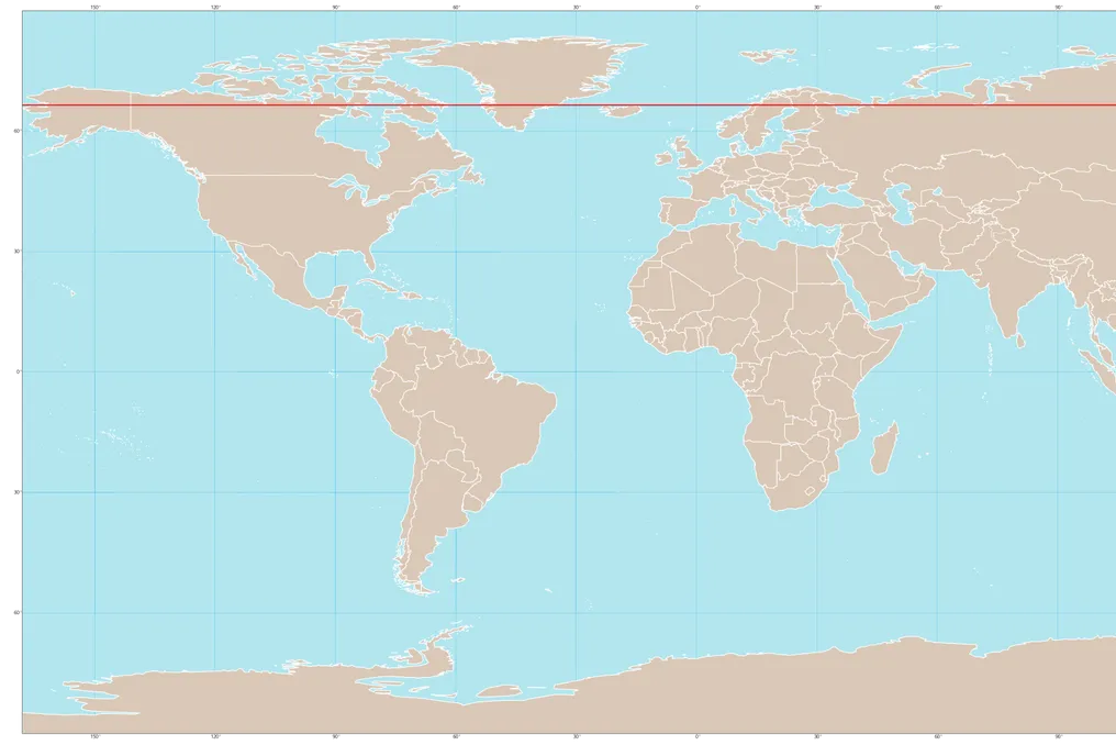
An imaginary line known as the Arctic Circle delineates the northernmost extent of the planet, encompassing icy territories of Canada, Russia, and Scandinavia. In this region, the atmosphere generally exhibits a predictable pattern, with winds blowing from west to east, moving from Canada towards Russia.
For most of the year, the frigid air of the North Pole remains contained within a wind structure called the polar vortex. Although it is common for this vortex to show instabilities and ruptures during winter, allowing Arctic cold to reach lower latitudes, this year's disruption occurred earlier than any previous record.
Although the vortex has destabilized in November on past occasions—specifically in 1958, 1968, and 2025—these events always occurred between the 27th and 30th of the month. However, this time, the structure began to weaken in the first week, much earlier than the previous historical benchmark.
Earliest recorded disruption
Scientists from the European Centre for Medium-Range Weather Forecasts (ECMWF), Tim Stockdale and Frédéric Vitart, stated that, to their knowledge, this is the earliest stratospheric vortex disruption ever observed. MIT climatologist Judah Cohen reinforced this assessment, stating that it is almost certainly the largest and earliest documented polar vortex rupture.
Mechanism of operation
It is important to note that this wind system is not near the ground; it circulates in the stratosphere, at an altitude ranging between 10 and 50 km. To assess the condition of the vortex, meteorologists monitor wind speed at 60 degrees north latitude, at approximately 30 km altitude.
This year's data shows unusual variations. On October 25, wind speed registered about 80 km/h. Eight days later, on November 2, this speed had dropped to less than 20 km/h, when the expected average for that date was approximately 90 km/h, and the lowest value ever recorded was 49 km/h. On the 7th, the Polar Vortex Earth monitoring service indicated that the wind was almost still, reaching only 1 meter per second, equivalent to 3.6 km/h.
For the event to be formally classified as a 'major sudden stratospheric warming' (SSW), there must be an inversion in wind direction, causing it to blow from east to west. European model simulations predict that this change will occur in a few days, with all 50 simulations indicating that the reversal will happen by November 21.
Consequences of high-altitude warming
When a sudden warming occurs in the stratosphere—which causes the weakening or inversion of the vortex winds—the formed atmospheric barrier can fragment or slide southward. In this specific case, the barrier elongated and split into two smaller wind systems, according to Laura Ciasto, a NOAA meteorologist, the American agency for oceans and atmosphere.
The paradox lies in the fact that increased temperature at higher altitudes often results in lower temperatures at the surface. With the weakened vortex, cold air can escape through the gaps. According to Cohen, this increases the probability of cold waves affecting densely populated areas in the United States, Europe, and East Asia.
Winter forecasts
According to the Met Office, the British meteorological service, climate impacts take two to six weeks to reach the surface and do not always result in snow or extreme cold. Grahame Madge, a spokesperson for the Met Office, summarized that the early arrival might even mitigate the impact, given that Siberia and the Arctic have not yet reached the cold levels seen in February. He classified the event as 'exceptional, but not necessarily worrying.'
In the short term, Cohen predicts the opposite of what is expected: milder weather in eastern North America for much of November. Other effects may emerge at the end of the month, being more likely in December, or only in January. The BBC Weather monthly forecast for the UK points to a possible colder phase in early December, although with low confidence.
Météo-France maintains a stance of uncertainty, as the consequences depend on the evolution of the disruption, its location, and whether it manages to descend to the lower layers of the atmosphere.
Causes of the anticipation
The exact reasons remain unknown. ECMWF scientists admitted not knowing why the disruption occurred so early, but suggested that El Niño could have increased the probability of this event. Although 2026 is an El Niño year, a phenomenon that tends to weaken the vortex in late winter, between January and March, Madge speculates that this year's El Niño intensity may have accelerated the process.
Cohen presents a different view, attributing the trigger to a record high-pressure system over Scandinavia and northwestern Russia, a pattern ironically more common in La Niña years. Regarding climate change, Cohen believes it may play a role, but classifies this idea as speculation, given that no research has confirmed the connection to date. Furthermore, climate models diverge on whether excess CO2 will make SSWs more or less frequent.
The only current certainty is that the wind barrier opened prematurely, and what exactly will escape through this opening is still uncertain.