Witsrand Reserve in the Northern Cape: White Dunes Amidst the Kalahari Desert
Read more
Getaway
getaway.co.za

Witsrand Reserve in the Northern Cape: White Dunes Amidst the Kalahari Desert

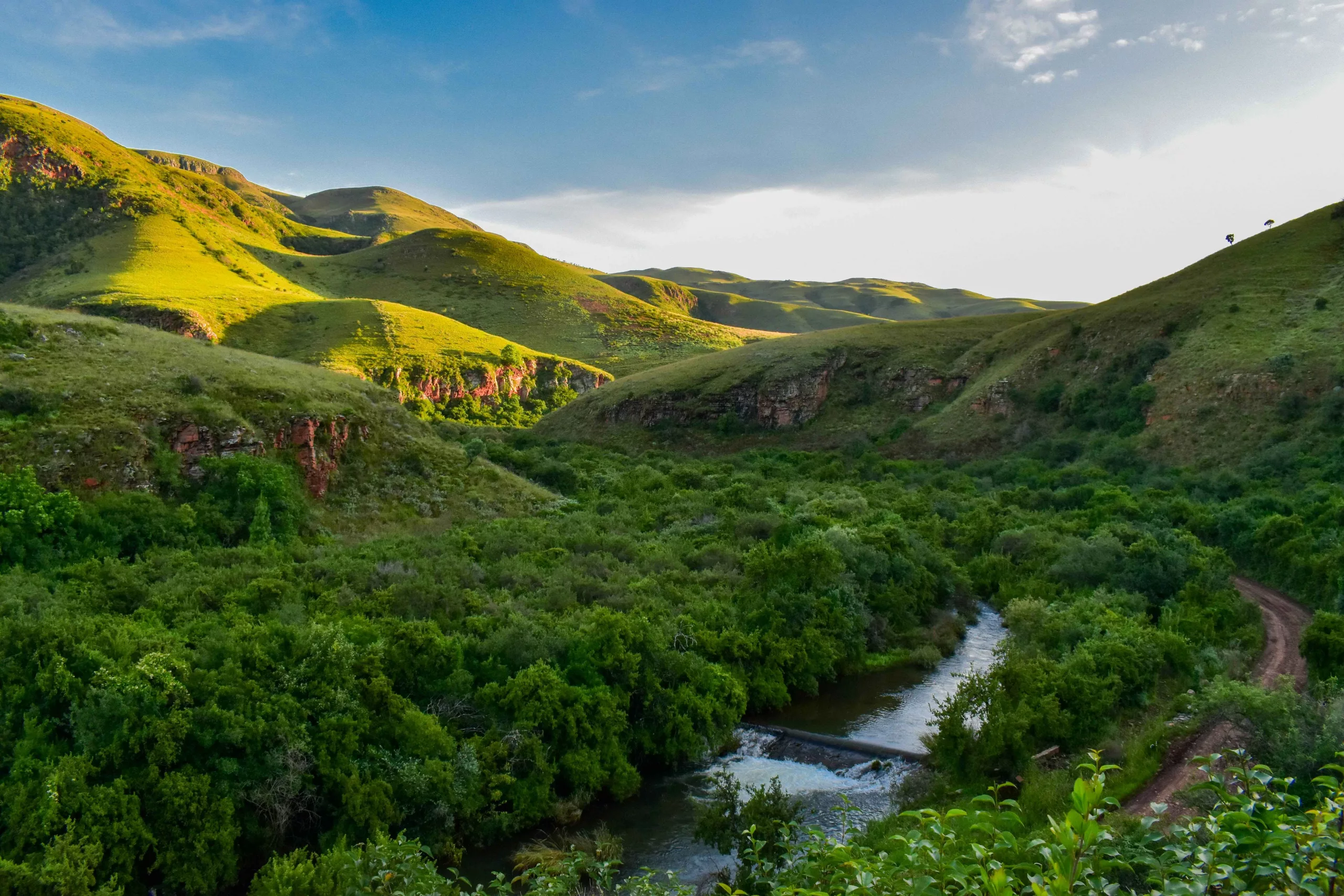
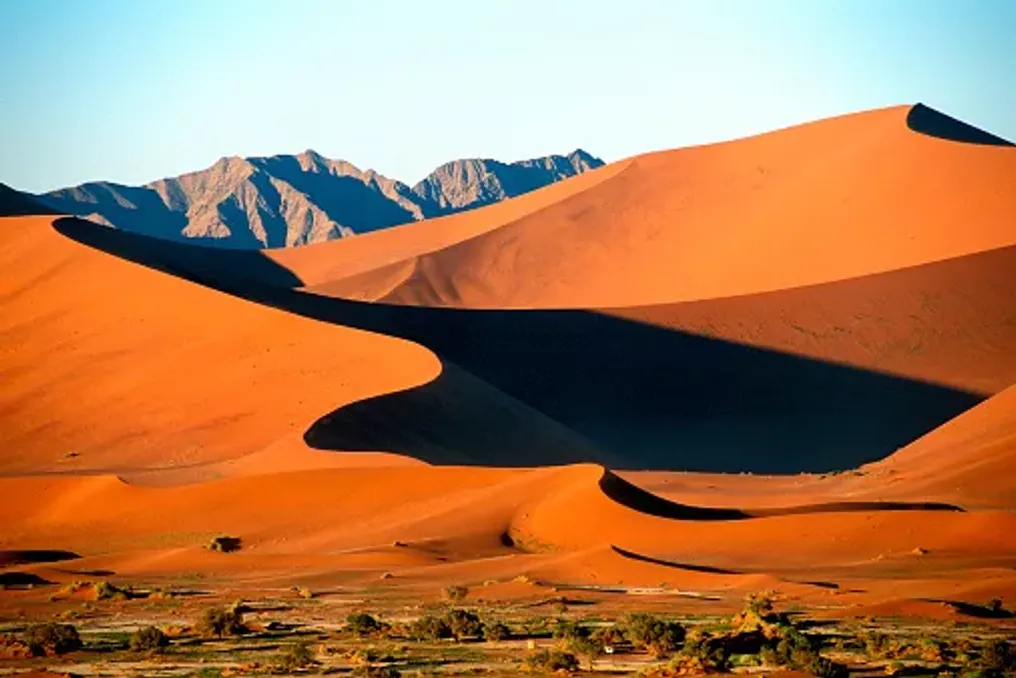
In the heart of the Green Kalahari in the Northern Cape lies an extraordinary landscape that disrupts the usual palette of reddish earth and sparse desert vegetation. Here, tall white dunes suddenly rise, creating one of South Africa's most peculiar natural contrasts.

This is Witsrand Reserve, a remote wilderness area where the dunes are as fascinating for their geological history as they are for the mysterious sounds they sometimes emit. These dunes, known as Roaring Sands of the Kalahari or Brulsand in Afrikaans, are part of a landscape offering much more than just unusual photographic opportunities.

Witsrand offers visitors the chance to experience another side of the Northern Cape through wildlife encounters, hiking trails, bird watching, outdoor adventures, and exceptionally clear night skies.

The first thing visitors notice at Witsrand is the striking contrast between the light dunes and the surrounding reddish terrain. While much of the Kalahari is characterized by iron-rich sand and resilient vegetation, the central dune field of Witsrand appears almost alien.

The reserve protects about 3,500 hectares of this unique landscape, where the white dunes sharply contrast with the red earth, acacia forests, and the distant Langberg Mountains.

It is believed that the dunes formed around an isolated massif of buried hills, under which groundwater played a significant role in shaping the landscape. Over millions of years, this moisture gradually washed away the reddish iron oxide from the sand grains, leaving behind pale quartz sand, which gave the reserve its name. This resulted in a remarkable geological feature, making Witsrand one of the most distinctive landscapes of the Green Kalahari.

One of the most intriguing attractions of Witsrand is something visitors can hear rather than see. The reserve is home to the famous Brulsand, or roaring sands—a phenomenon where the dunes emit a deep, resonant hum or roar under certain conditions.

This sound occurs when countless sand grains rub against each other. With sufficiently dry sand and appropriate conditions, this movement can generate an almost musical vibration that spreads across the dunes. This unusual natural phenomenon has brought Witsrand into the ranks of South Africa's most captivating geological destinations. However, this sound cannot be guaranteed during every visit, as humidity, temperature, and sand condition affect the occurrence of this phenomenon.

For travelers, this makes exploring the dunes particularly interesting. Even without the audible roar, the scale, texture, and unusual color of the landscape provide plenty of reasons for admiration.

Similar stories

Dinosaur Traces Discovered in Remote Ntumbwe Reserve, Zimbabwe
Read more
getaway.co.za

Dinosaur Traces Discovered in Remote Ntumbwe Reserve, Zimbabwe

In the deep Zambezi Valley, within the remote Ntumbwe Reserve, an amazing prehistoric secret is hidden beneath the sands of the riverbed. It is here, in Ntumbwe, that huge three-toed tracks preserved in sandstone provide insight into the world that existed about 140 million years ago.

Following its opening to non-hunting tourism in June 2026, travelers have gained a new opportunity to explore this little-known wilderness, discover ancient trails, and experience one of Zimbabwe's most remote nature conservation landscapes.

Located in northern Zimbabwe, the Ntumbwe Reserve is situated in the Chwar South region of the Zambezi Valley, near the famous Mana Pools National Park. This area is part of the UNESCO World Heritage site Mana Pools, Sapi and Chwar and is known for its biodiversity, crisscrossing river systems, and vast wildlife.

However, besides elephants, predators, and birds, Ntumbwe has another reason for fame: an impressive collection of dinosaur fossil tracks. These tracks are preserved along sections of the Ntumbwe River, where exposed sandstone displays imprints left by prehistoric animals millions of years ago. Some of them are clearly discernible, featuring three forward-pointing toes and visible claw marks.

For visitors, this experience differs from viewing dinosaur fossils in a museum. These are tracks left directly in the landscape, allowing tourists to stand next to the imprints and follow the paths of animals that once moved through this ancient environment.

The first scientific attention to this area was drawn in 1984 when geologist Tim Broderick and his wife Trish began documenting these tracks. Further excavations in 1990 uncovered additional tracks under the riverbed, revealing a much longer trail than initially assumed. Today, the Ntumbwe trails are considered one of the outstanding sites with dinosaur footprints in Southern Africa.

The most striking prints belong to large bipedal dinosaurs, some reaching approximately 40–43 cm from heel to toe tip. Their three-toed shape is particularly recognizable and offers clues about the animals that left them. Scientists believe that some of the larger tracks were left by theropods—a group of predominantly carnivorous dinosaurs that walked on two legs. The tracks are linked to dinosaurs of the Allosaurid family, although the imprints themselves cannot determine the exact species responsible.

One of the most significant discoveries was made during the 1990 excavations when researchers found additional prints under the riverbed. The initial trail, which showed 14 prints, was ultimately documented as being about 48 meters long, with 45 registered prints. However, the site holds more than just massive tracks. Researchers also identified clusters of much smaller tracks, some only a few centimeters in diameter. This led to speculation about whether certain areas might have served as nursery grounds for young dinosaurs.

Collectively, these findings indicate that the Ntumbwe River landscape once supported diverse prehistoric animals. Fossil tracks are known as trace fossils. Unlike bones, which provide evidence of an animal's physical structure, trace fossils preserve evidence of how the animal moved and behaved. By studying the distance between individual prints, their depth, shape, and placement, paleontologists can estimate the animal's size, direction of movement, and walking speed. A sequence of prints, for example, can show whether the animal was walking or moving faster. Multiple trails can also give insight into how different animals moved in the same environment.

In Ntumbwe, these prints represent an extraordinary record of prehistoric activity. They also help researchers understand the ancient environments in which dinosaurs lived, including the conditions that allowed their tracks to be preserved. The sandy surfaces along the river serve as a natural window into this distant past, making the site particularly interesting for visitors who value geology, paleontology, and natural history.

Visitors should remember that these are protected scientific sites. Fossils and tracks should be observed without disturbing them, and any finds should be reported to the relevant authorities, not collected. For decades, this area was known as Chwar South safari zone and functioned as a trophy hunting concession. In June 2026, it entered a new chapter, opening up to non-hunting tourism.

This transition is managed by a long-term partnership between the Zimbabwe Parks and Wildlife Management Authority (ZimParks) and the Chwar Conservation Fund, which operates under a 25-year conservation mandate. The goal is to create a tourism model that supports landscape protection while creating opportunities for local communities. Tourism revenue is directed towards conservation efforts, helping to fund the management and long-term protection of this vital ecosystem.

The change also introduces travelers to a direction that remained relatively unknown compared to Zimbabwe's more famous safari areas. Instead of focusing solely on traditional wildlife viewing, Ntumbwe offers a combination of wildlife exploration, walking safaris, birdwatching, and prehistoric discoveries.

While the dinosaur trails are the main attraction, the vast Ntumbwe landscape has much more to offer. The area supports elephants, lions, leopards, African wild dogs, buffalo, and several antelope species, including the sable and the increasingly rare roan antelope. Wildlife viewing is part of the experience, though visitors should understand that this is a remote wilderness, not a traditional high-density safari spot. Animals can be elusive, and exploring the landscape often requires patience.

Walking safaris offer the chance to experience the bush at a slower pace, with experienced guides helping visitors identify animal tracks, plants, birds, and other details easily missed from a vehicle. The wilderness is also home to approximately 400 recorded bird species, making it an attractive destination for bird lovers. Notable species include the African Pitta, Pelsa's Owl, Narina Trogon, and Crested Turkey.

For those wishing to explore independently, self-drive safaris are available, with an extensive network of intersecting forest roads providing access to various parts of the reserve. Visitors can choose between camping and a more comfortable lodge experience at Chenje Camp. The recently renovated camp reopened in June 2026, transforming a former hunting base into an intimate tented retreat along the Chenje River. The camp features six ensuite luxury tents, flexible bed configurations, and offers both all-inclusive safari packages and accommodation-only options for independent visitors. Its unspoiled location allows wildlife to move freely across the surrounding landscape, and walking trails provide opportunities to explore the riverine environment.

Chenje Camp is also conveniently located for visitors interested in the dinosaur trails, which are about a 40-minute drive away. Those preferring a more independent experience can utilize Kanga Camp, which offers another way to experience the remote area.

Getting to Ntumbwe requires some planning, as it is a remote area with rugged terrain and limited infrastructure. The reserve can be accessed through designated entrances, including Mkanga Gate and the Chwar Bridge. Chenje Camp is about a 25-minute drive from the Mkanga Park gate when traveling from Harare, and the journey from Mana Pools takes about three hours from the west. Visitors should book accommodation and activities in advance, especially if planning to join organized walks or multi-day wildlife tours. Independent visitors must be prepared for rough forest roads and ensure their vehicles are suitable for these conditions. It is also advisable to contact the conservation fund before traveling to inquire about current road conditions, access requirements, and event availability.

For bookings and further information, visitors can contact the Chwar Conservation Fund via the official Ntumbwe Wilderness website. Ntumbwe offers something entirely different from traditional safaris in Zimbabwe. Here, the wildlife tells two stories simultaneously: one about the wild animals that continue to inhabit the Zambezi Valley, and another about the prehistoric animals that once roamed its ancient landscapes. The opportunity to stand next to dinosaur tracks preserved for millions of years is reason enough to visit. But thanks to the shift to conservation-managed tourism, walking safaris, and remarkable biodiversity, Ntumbwe also presents an opportunity to discover a lesser-known corner of Zimbabwe, contributing to the protection of one of its important wildlife areas.
Map of South African Myths: Seven Places Where Legends Endure
Read more
getaway.co.za

Map of South African Myths: Seven Places Where Legends Endure

The landscapes of South Africa are impressive in themselves, but deeper exploration reveals even more intriguing aspects. This mythical map offers curious travelers a different kind of journey, one rooted in ancient beliefs and folklore. Although some of the listed locations are well-known attractions, they are viewed through a different lens. Seven locations are presented that plunge visitors into the heart of South Africa.

In the lush Limpopo forest resides Modjadji, the spiritual abode of the Rain Queen of the Balobedu people. It is said that she can summon rain through her rituals, making her a living legend. Her lineage has been passed down from queen to queen for centuries. According to legends, the Rain Queen's power can bring either fertility or famine. The place exudes an otherworldly atmosphere.

On the coast of the Eastern Cape stands a massive arch rock, shaped by centuries of crashing waves. However, the Khoisan people claim it is not the result of erosion, but of love. The legend tells of a beautiful girl who fell in love with a sea creature. When her family rejected the union, the creature called its people from the ocean. They pierced the cliffs so he could reach her, and both vanished into the sea. Locals still assert that the waves here make strange sounds; it might be the wind, but it is believed to be the voices of the sea folk.

Stone Circle of Adam is an ancient ring of stones that some believe is over 75,000 years old. Alternative historians and traditional San folklore consider this site a celestial observatory used by early civilizations, possibly even celestial beings. Others believe it possesses spiritual energy and alignment connected to ley lines.

The San people, the earliest inhabitants of South Africa, believed that caves and mountains served as spiritual portals. Their rock art is found in areas such as the Cederberg and Drakensberg mountain ranges, as well as other parts of the country, telling stories of trance dances, animal spirits, and journeys to the spirit world. These images are sacred records of interactions with the divine.

Table Mountain is steeped in folklore, and the story varies depending on who asks. Some claim it is the resting place of a sleeping giant. Another myth recounts a smoking contest between a local pirate named Van Hankes and the Devil. Their duel created the 'tablecloth,' the misty cloud that hovers over the mountain peak. Others believe a cloud dragon inhabits the mist.

Tokoloshe is perhaps South Africa's most frightening mythical creature. It is a small, goblin-like being said to cause illness, death, or general chaos if angered. During the day, it is invisible to adults, but it comes alive at night. Rural areas of KwaZulu-Natal and the Drakensberg region are hotspots for Tokoloshe sightings, and many still place bricks under beds to lift them off the ground and out of Tokoloshe's reach.

Within Kruger National Park, there are not only the Big Five but also ghostly tales and tribal myths associated with this vast expanse. One story speaks of the White Lion, a sacred and almost mythical creature believed to appear only to those with pure hearts. Others recount ancestral spirits guiding animals and warning rangers of danger through dreams or signs.

How Wind Shapes the Desert: Dune Dynamics in Sossusvlei, Namibia
Read more
getaway.co.za

How Wind Shapes the Desert: Dune Dynamics in Sossusvlei, Namibia

Sossusvlei, one of Namibia's most impressive landscapes, is characterized by high red dunes, vast ridges, and ancient trees. However, behind this beauty lies a fascinating story of how wind, sand, and time interact to shape this terrain.

Located in the Namib Desert, the Sossusvlei dunes are constantly transforming under the influence of natural forces. Their changing shapes and hues demonstrate the natural processes behind this unusual landscape, while nearby clay pans and riverbeds offer insight into the region's geological past.

The sand that makes up the Namib Sand Sea has traveled a significant distance. Much of this material originates from the interior regions of Southern Africa, where weathering breaks down rocks into fine particles.

Rivers, particularly the Orange River, transport sedimentary deposits towards the Atlantic Ocean. Coastal currents then carry the sand northward, depositing it on beaches, from where the wind can pick it up and move it inland.

Over millions of years, this combination of river transport, ocean currents, and wind has led to the formation of the extensive dune fields that are characteristic of the Namib.

In 2013, the Namib Sand Sea was inscribed as a UNESCO World Heritage Site in recognition of its exceptional dune formations and the natural processes that shape them.

Wind acts as the primary sculptor of the desert. It moves loose sand across the surface, carrying fine grains in the air and pushing others along the ground. When the wind loses energy, the sand settles and begins to accumulate. Repeated cycles of erosion and deposition gradually form dunes: grains move up the windward slope and then slide down the steeper surfaces.

The resulting shapes depend on the wind direction, the presence of sand, and the surrounding topography. Some dunes form long parallel ridges, while others take the shape of crescents or rise as multi-armed structures.

Sossusvlei is known for its magnificent star dunes, which form where the wind blows from multiple directions. Instead of migrating along a single path, these formations accumulate sand around a central peak, creating radially spreading ridges.

Other wind regimes generate different forms, including linear and crescentic dunes. The combination of these formations illustrates how changing wind conditions create the diverse landscape of the Namib Sand Sea.

The distinctive red-orange hues of the dunes are largely due to iron oxide coating the sand grains. This rusty compound forms as a result of the prolonged weathering of iron-containing minerals.

Colors vary across the Namib depending on the sand composition and the amount of iron oxide present. Furthermore, sunlight affects the appearance of the dunes throughout the day. At sunrise, the low angle of light lends soft pink and golden tones to the ridges. By noon, the colors may appear brighter, and shadows become more pronounced along the slopes. At sunset, the dunes can take on deep orange and crimson shades, making Sossusvlei a popular spot for photographers.

Despite their immense size, the dunes are in constant flux. The wind carries sand from some areas and deposits it in others, gradually altering their slopes and ridges. Some dunes migrate across the desert floor, while others maintain their general position but change shape as sand moves across their surface. Their movement depends on wind strength, sand availability, and the environment.

Scientists use satellite imagery to observe these changes over time, identifying patterns that are difficult to notice from the ground. Thus, dunes are not static monuments of an ancient desert, but active geological formations continuously responding to the forces that created them.

Although the Namib is extremely arid, water has also played a role in shaping its landscape. The Tsauchab River periodically flows from the Naukluft Mountains towards Sossusvlei, usually remaining dry but sometimes carrying water after heavy rains. When enough water reaches the basin, it can collect in a clay pan, creating a stark contrast with the surrounding red dunes.

The nearby Deadvlei tells a similar story. Its white clay floor and dark, ancient camel-thorn trees reflect changes in the riverbed and water availability over time. These features demonstrate the interaction of wind, water, and climate in creating the characteristic look of the desert.

The dunes of Sossusvlei are more than just a scenic backdrop. Visitors can explore the landscape on foot, photograph the changing colors, and study the geological features that make this part of Namibia so unique. Dune 45 is a popular stop on the drive from Sesriem, especially at sunrise when the light highlights the red and gold tones of the dunes. Tourists can climb its slopes to enjoy panoramic views of the surrounding sand sea. For a more challenging adventure, Big Daddy rises above Deadvlei, offering breathtaking views of the white pan and the surrounding dunes. Climbing any of these dunes requires caution, especially as the sand gets hot later in the day. Deadvlei is one of the most recognizable attractions in the area, where skeletons of dark camel-thorn trees stand against the pale clay pan surrounded by high red dunes. This contrast makes it a favorite spot for landscape photography.

Hidden Valley offers a quieter alternative for visitors willing to hike from the designated parking area. Its relative seclusion allows one to experience the desert away from busier viewpoints. A short drive from the park entrance, Sesriem Canyon reveals another side of the region. Carved by the Tsauchab River over time, the narrow gorge exposes rock layers and illustrates the power of rare water flow in an otherwise arid environment. A walk through the canyon provides a useful contrast to the vast dunes and an opportunity to study the geological history of the area.

Hot air balloon rides offer an unforgettable perspective on the Namib dune fields. From above, it is easier to appreciate the vast ridges, valleys, and changing patterns as morning light spreads across the landscape. Guided nature tours, scenic flights, and selected hiking trips also allow visitors to discover the region's wildlife and diverse terrain. After dark, the remote location and limited artificial lighting make stargazing another memorable experience.

Tourists should plan outdoor activities for cooler times of day, bring sufficient water and sun protection, and check park access conditions before traveling. For the sandy areas leading to Deadvlei and Sossusvlei, a 4x4 vehicle or park shuttle is usually required.

The Sossusvlei dunes are the result of an extraordinary natural journey connecting the interior of Southern Africa with the Atlantic coast, before the wind carries the sand inland. Their shapes reveal changing wind regimes, their colors reflect mineral composition and sunlight, and their shifting slopes demonstrate that even the most majestic landscapes are never entirely still. For travelers, understanding these processes adds another dimension to the experience. Beyond photographs and towering red ridges, Sossusvlei represents a living chronicle of how wind, water, and time continue to shape one of Africa's most remarkable deserts.

Popular