Agricultural producers can prepare the land, select suitable seeds, and care for the harvest for months, but it is impossible to guarantee timely rainfall. An unfavorable period without rain can lead to soil drying, planting problems, and the loss of all annual income. By the time the damage becomes obvious, opportunities to take action may have run out.
Researchers from IIT Bombay are studying the possibility of detecting such risks in advance, even before the first signs appear in the fields. Four weeks of advance warning can significantly change the situation. This is what KrishiDrought, an artificial intelligence-based portal that uses satellite imagery and climate data to forecast agricultural drought conditions up to a month ahead, realizes.
The platform was launched on October 28, 2026, and provides weekly forecasts across India, helping users identify areas where soil moisture may deteriorate in the coming weeks.
How early warning can protect crops
Drought is traditionally associated with a prolonged lack of rainfall. However, for agriculture, the problem goes beyond the general amount of precipitation in the region. Agricultural drought occurs when soil moisture is insufficient to meet crop needs. Even with some rain, prolonged dry periods, changes in weather conditions, and significant loss of moisture from the soil can cause problems for crops.
Therefore, it is critically important to understand not only the volume of precipitation but also how much moisture the soil retains. Traditional drought assessment methods mainly focus on identifying already developed conditions. KrishiDrought applies a more proactive approach, trying to predict how soil moisture conditions may change over the next few weeks.
The main goal is to give farmers, government agencies, and other stakeholders more time to consider measures such as irrigation planning, crop management, and drought preparation.
Can satellites predict when the soil will dry out?
The platform was developed by the Ecohydrology Research Group led by Professor Karthikeyan Lanka in collaboration with the Centre for Research in Engineering Resources (CSRE) and the IIT Bombay Climate Research Centre. It integrates multiple sources of environmental information, including satellite observations, hydroclimatic datasets, dynamic forecasts, and advanced deep learning models.
Simply put, satellite data allows researchers to track changing conditions over large areas, including fluctuations in soil moisture. Hydroclimatic information provides additional details on the relationship between water, precipitation, and climate, while dynamic forecasts help assess the evolution of environmental conditions. AI-based deep learning models integrate this diverse input data to identify patterns and generate future soil moisture forecasts.
The resulting forecasts are available with an approximate spatial resolution of 9 km and are presented at the district level.
Map showing where drought may develop
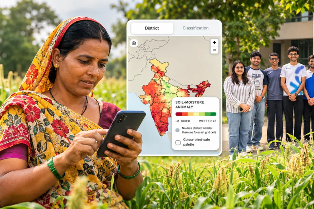
One of the useful features of the platform is its map-based interface, which allows users to examine drought conditions in different parts of India. The map uses color coding to simplify information interpretation: shades approaching red indicate soil moisture conditions drier than normal, while green denotes conditions wetter than normal.
Users can select individual states and districts to view forecasts across four different time windows: one, two, three, and four weeks out. This allows them to explore not only the current situation but also how soil moisture conditions might evolve over the next month.
For example, if it is predicted that soil drought conditions will intensify in a district, farmers and agricultural authorities can use this information to assess the need to adjust irrigation systems or other crop management measures. It is important to note that the forecasts are intended as a supplementary decision-making resource, not a replacement for local agricultural councils.
What can four extra weeks mean for farmers?
The broader idea behind KrishiDrought is to make agricultural planning less dependent on reacting to a crisis after it begins. As weather conditions become increasingly difficult to predict, access to timely environmental information helps farmers and authorities make more informed decisions. Even a few weeks of advance notice can provide extra time to assess water availability, plan irrigation, and consider steps to reduce potential crop losses.
The portal is publicly available at KrishiDrought.in, providing its forecasts to farmers, government institutions, and other stakeholders. For a farmer, a few extra weeks can be immensely valuable: it could mean having the opportunity to organize water for thirsty crops, revise irrigation schedules, or seek consultation before drought damages the harvest.
KrishiDrought represents an attempt to return this time to the hands of farmers. By combining satellite data, climate science, and AI, IIT Bombay researchers hope to make drought preparedness more proactive, helping farmers look ahead, make informed decisions, and cope with an uncertain growing season with better information and a little more confidence.