Gabon's Forest Elephants: A Study of Tropical Forest Conservation Frontiers
Read more
Getaway
getaway.co.za

Gabon's Forest Elephants: A Study of Tropical Forest Conservation Frontiers

In the depths of Central African rainforests live African forest elephants, moving through some of the continent's most outstanding wild landscapes. These elusive animals, often hidden under the dense canopy of the forest, are less common than their savanna relatives, but their impact on the environment is immense.

They play a key role in maintaining the ecosystems they inhabit, promoting long-distance seed dispersal and shaping the structure of tropical forests. Gabon is one of the most crucial countries for the survival of these animals, as the country is covered with vast tropical forests and holds a significant portion of the world's remaining forest elephants, making it one of the main conservation hubs in Central Africa.

However, protecting these animals requires more than just species preservation; it involves protecting associated habitats, combating illegal ivory trade, and finding ways for wildlife and rural communities to coexist.

The African forest elephant (Loxodonta cyclotis) is a distinct species, different from the more familiar African savanna elephant. It is found predominantly in the tropical forests of Central and West Africa and possesses several physical characteristics adapted to life under the tropical forest canopy.

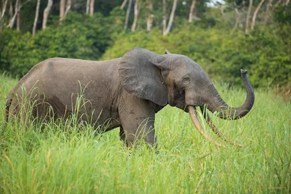
Forest elephants are generally smaller than their savanna counterparts, have straighter, downward-pointing tusks, and rounder ears. Their smaller size helps them navigate dense vegetation, and their diet mainly consists of fruits, leaves, bark, and other plant material growing in the forest.

Unlike elephants roaming open grasslands, forest elephants are difficult to spot. Dense vegetation hinders tracking, and their movements often take them far from roads and frequented areas. They are particularly associated with forest clearings known as baobabs, where mineral-rich soil and accessible water attract elephants and other wildlife.

These clearings provide some of the best opportunities for observing forest elephants in their natural habitat, although a sighting cannot be guaranteed. Forest elephants are sometimes called 'gardeners of the rainforest,' and this is not accidental. Their feeding habits and extensive movements influence plant distribution and contribute to the restoration of forest ecosystems.

Fruits form an important part of the forest elephant's diet. As they move through the tropical forest, elephants consume fruits and transport seeds over significant distances before depositing them in their excrement. This process, known as seed dispersal, helps plants colonize new territories and supports the regeneration of tropical forests. Some tree species rely heavily on large animals for seed dispersal, making elephants a vital contribution to the long-term health and diversity of these ecosystems.

Their movements also connect different parts of the forest, helping to maintain ecological links that might otherwise be disrupted by habitat fragmentation. Elephants impact their surroundings through feeding, trampling, and moving vegetation. Their activities can alter the structure of forest habitats, creating opportunities for various plant species and other animals.

Forest clearings, or baobabs, hold special significance. These open spaces in the dense tropical forest often contain mineral-rich water and open ground that attract elephants, gorillas, buffalo, and many other species.

In Indvindo National Park

In places like Baie Langue in Indvindo National Park, these natural gathering spots offer researchers and visitors the chance to observe wildlife that would otherwise remain hidden under the forest canopy. However, the link between elephants and forest regeneration is complex. Their impact varies depending on the plant species, habitat, and local conditions. It is clear that their disappearance would have consequences extending far beyond the loss of a single species.

A crucial part of elephant protection is understanding where they move. Their ranges can span hundreds of square kilometers, encompassing various habitats in search of food, water, and suitable conditions. Studies conducted in the Wonga-Wongwe presidential reserve in Gabon used GPS tracking to study their movements. A study involving 17 collared elephants showed that they traveled an average of about 2840 km annually, with an average range of about 713 square kilometers.

These results demonstrate why conservation cannot be limited to individual national parks or isolated patches of forest. Elephants need space to move, and their survival depends on maintaining connectivity between habitats. Roads, settlements, and agricultural development can disrupt these movements, increasing the likelihood of human contact and hindering access to certain areas for elephants.

Therefore, protecting ecological corridors and managing lands outside officially protected areas are vital elements of Gabon's broader nature conservation efforts.

Gabon is one of the most important remaining habitats for African forest elephants. Its vast tropical forests are part of the Congo Basin—the second-largest tropical forest region in the world, stretching across several Central African countries. A nationwide study published in 2021 estimated that there were about 95,000 forest elephants remaining in Gabon. Although this estimate carried significant uncertainty, it confirmed the country's exceptional importance for this species.

Gabon has also established an extensive network of national parks protecting vital tropical forest habitats, laying the foundation for wildlife research and conservation. Located in northern Gabon, Minkebe National Park protects a vast area of relatively untouched tropical forest. Historically, it supported a significant population of forest elephants but was also subjected to intense poaching pressure. Between 2004 and 2014, researchers counted that the park lost approximately 78–81% of its forest elephant population, mainly due to illegal ivory hunting. The scale of the decline highlighted how quickly even remote wilderness areas can suffer from organized poaching networks.

On the western coast of Gabon, Loango National Park is known for its unusual combination of tropical forest, lagoons, wetlands, beaches, and coastal habitats. The park is particularly interesting because it demonstrates the diversity of environments utilized by forest elephants. It is also part of a wider landscape supporting gorillas, chimpanzees, hippos, buffalo, and diverse birdlife. Its combination of coastal and forest scenery has made Loango one of Gabon's most unique natural destinations.

In eastern Gabon, Indvindo National Park protects vast tropical forests, rivers, and impressive waterfalls. Baie Langue is located here, one of the country's most famous forest clearings. This clearing attracts forest elephants and other wildlife, making it an important site for ecological research and observation. Its remote location also illustrates the challenges of wildlife monitoring in large, densely vegetated landscapes.

Lope National Park offers a different view of Gabon's nature, presenting a landscape where tropical forest meets savanna. This mix of habitats supports rich biodiversity and provides opportunities to study how animals utilize different environments. The park is also recognized as a UNESCO World Heritage site, reflecting its ecological and archaeological significance.

Despite Gabon's importance as a conservation hub, forest elephants are still classified as critically endangered. Their populations face a range of interconnected threats, many of which extend beyond national borders. Illegal ivory trade has had a devastating impact on forest elephants across Central Africa. Their relatively slow reproductive rate means that populations require many years to recover from significant losses. Even protected areas are vulnerable when poaching networks operate in remote forest landscapes. The dramatic decline in Minkebe remains a stark example of the consequences.

Effective protection requires continuous investment in anti-poaching patrols, intelligence gathering, law enforcement, and cooperation between neighboring countries. As forests and agricultural lands increasingly intersect, human-elephant conflict has become a critical conservation issue. Forest elephants sometimes raid crops, damaging fields and threatening the livelihoods of farming communities. For families dependent on harvests, the loss of food or income can create significant hardship. This can lead to retaliatory actions against elephants, undermining conservation efforts and creating tension between local communities and conservation authorities. Solving this problem requires more than just asking for tolerance of elephant presence. Practical measures, community involvement, and support for affected households are necessary to ensure coexistence.

In 2025, Gabon initiated a two-year project involving the government, the Wildlife Conservation Society, and Space for Giants to support efforts toward more peaceful human-elephant coexistence. While national parks provide vital refuges, elephants do not recognize protected boundaries. Many move through forests used for logging and other economic activities. Therefore, responsible forestry, careful infrastructure planning, and the protection of ecological corridors are essential.

The challenge lies in finding ways to balance economic development with the ecological needs of a species that requires large, connected landscapes to survive. Gabon's forest elephants represent more than just one of Africa's most prominent wildlife populations. Their movements, feeding habits, and relationships with other species are woven into the ecological functioning of the tropical forest. By protecting them, we preserve the forests that sustain countless other plants and animals, and we acknowledge the needs of the people who share these landscapes. The country's conservation efforts demonstrate both the opportunities and the difficulties associated with protecting vast wilderness areas. Its national parks, research programs, and community initiatives lay an important foundation, but long-term success will depend on sustainable protection and cooperation.
Similar stories

Marine nature of the Bazaruto archipelago protects the coast of Mozambique
Read more
getaway.co.za

Marine nature of the Bazaruto archipelago protects the coast of Mozambique

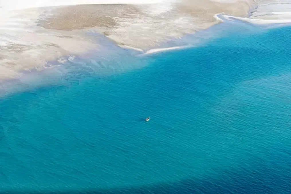
The Bazaruto Archipelago, located off the coast of Mozambique, is known for its white sandy beaches and turquoise waters, but beneath this picturesque surface lies a unique marine ecosystem. It hosts coral reefs, seagrass meadows, and mangrove swamps that support one of the most remarkable wildlife populations in the Indian Ocean.

This protected landscape in southern Mozambique is home to dugongs, dolphins, sea turtles, manta rays, and a vast diversity of marine life. These underwater ecosystems are vital not only for biodiversity conservation but also for sustaining the lives of coastal communities whose existence is closely tied to the sea.

Although tourism has contributed to Bazaruto's fame, the archipelago's greatest value lies beneath the water. Protecting these waters means preserving a complex network of habitats that supports wildlife, fisheries, and the ecological health of the Mozambican coastline.

The archipelago is located near the Inhambane province, close to the mainland settlements of Vilanculo and Inhassoro, and consists of five islands: Bazaruto, Benguerra, Magaruque, Santa Carolina, and Bangue.

These islands are part of the Bazaruto National Park, which was established in 1971 to protect the region's exceptional marine and terrestrial biodiversity. The protected area includes coral reefs, seagrass beds, mangroves, coastal dunes, sandbanks, and surrounding oceanic environments.

These environments are closely interconnected, forming a network of ecosystems that support marine species at different stages of their life. Fish use seagrass meadows and mangroves as nursery grounds, coral reefs provide shelter and feeding areas, and sandy beaches serve as important nesting sites for sea turtles.

The archipelago's location along the Mozambique Channel also makes it part of the broader Western Indian Ocean ecosystem. Its waters support both resident and migratory marine animals traveling along the East African coast.

Despite the fact that the islands and beaches attract visitors from around the world, Bazaruto's protected status reflects something more than just tourist appeal: the necessity of conserving one of the region's most valuable marine environments.

Gorongosa National Park Restores Wildlife and Supports Local Communities in Mozambique
Read more
getaway.co.za

Gorongosa National Park Restores Wildlife and Supports Local Communities in Mozambique

A significant conservation initiative is underway in central Mozambique, transforming a landscape previously scarred by war into one of Africa's most inspiring wildlife recovery stories.

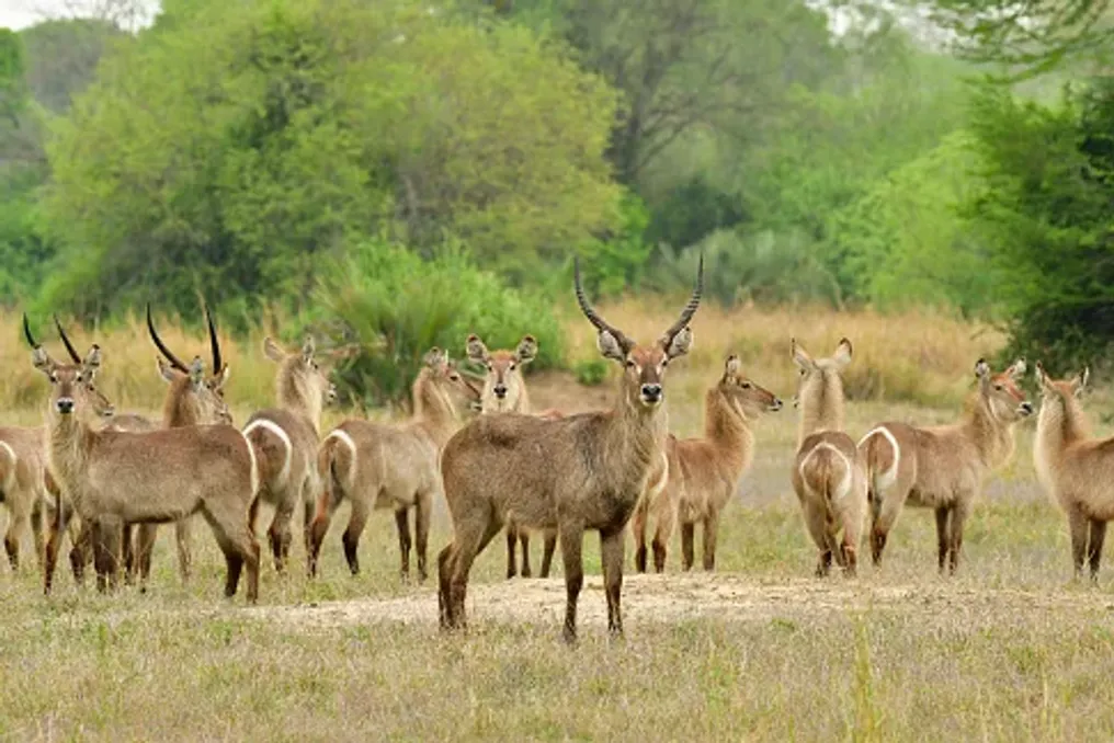
In Gorongosa National Park, elephants roam freely, lions move across the savanna, and researchers study the exceptional biodiversity of nearby mountain forests. However, the park's revival goes beyond simply bringing back animals; it also involves ecosystem restoration, supporting local livelihoods, and demonstrating the dependence of future conservation on the people living alongside wildlife.

Established in 1960, Gorongosa National Park is located in Sofala Province, Mozambique, at the southern end of the Great Rift Valley. Its territory encompasses open grasslands, forested savanna, seasonal wetlands, rivers, and mountain habitats, forming a mosaic of environments that supports a vast diversity of wildlife. For a long time, the park was considered one of Africa's premier safari destinations.

This reputation was undermined during the Mozambican civil war, which lasted from 1977 to 1992. Wildlife populations suffered massive losses due to poaching for meat and ivory, and the conflict disrupted park protection and management. In the following years, the task was not only to restore a renowned safari destination but also to reconstruct an ecosystem whose natural balance had been severely disturbed.

The restoration began gaining momentum in the early 2000s with the Gorongosa Restoration Project, which laid the foundation for long-term rehabilitation. In 2008, the Government of Mozambique and the Carr Foundation established a public-private partnership focused on biodiversity and ecotourism conservation, as well as human development in surrounding communities. This agreement was extended for another 25 years in 2018.

The approach recognized that a functioning national park requires more than just protected boundaries. Animals need healthy habitats, rangers need resources for protection, and neighboring communities must have opportunities to benefit from a thriving natural environment.

The restoration of Gorongosa's fauna required years of work in monitoring, habitat management, anti-poaching efforts, and carefully planned animal reintroductions. The goal is not merely to increase animal numbers but to create a functioning ecosystem where various species can perform their ecological roles.

Large herbivores, such as elephants, buffalo, and zebras, influence the landscape through grazing, vegetation consumption, seed dispersal, and movement across biotopes. Predators, in turn, help regulate prey populations and contribute to complex relationships that shape the ecosystem.

Restoration efforts included the return of species such as African wild dogs, also known as painted wolves, as well as zebras, hyenas, and leopards. These efforts are supported by veterinary teams, wildlife monitoring, and constant protection.

The results are measurable. According to the Gorongosa Restoration Project report for 2024, aerial surveys counted 110,513 large animals within the national park, the highest figure recorded by the project to date. The same report documented the translocation of seven hyenas, 32 zebras, and two leopards during the year.

These figures provide an encouraging snapshot of the recovery, although population counts alone are not enough to tell the whole story. Long-term success also depends on habitat quality, species diversity, genetic health, and the ability of wildlife populations to withstand future environmental threats.

Wildlife recovery depends on the people working behind the scenes. The Gorongosa Department of Wildlife employs rangers and specialists responsible for law enforcement, animal management, reintroductions, and human-wildlife coexistence. Official department information states that over 300 people work there, with the workforce predominantly from Mozambique.

Their activities range from wildlife observation and emergency response to preventing poaching and assisting in managing human-wildlife encounters.

For visitors, the result can be a memorable sighting of elephants crossing a floodplain or a predator resting in the shade. Behind these moments is a sustained effort to protect the conditions that allow wildlife to survive.

More Than Just the Park's Savanna and Floodplains

Beyond the park's more famous savannas and floodplains, there is another world. Mount Gorongosa rises above the surrounding landscape, supporting tropical forest, mountain grasslands, and diverse habitats, making the broader Gorongosa ecosystem particularly vital for biodiversity.

The mountain is not just a picturesque backdrop for safaris on the plains below. Its forests play a crucial role in regional water supply systems, and its diverse habitats provide homes for plants and animals that might be overlooked in the more conventional narrative of African megafauna.

The montane forests collect and regulate water, helping to sustain the streams and rivers that feed the surrounding landscape. Rivers originating on Mount Gorongosa are especially important for the national park's floodplains and the wildlife dependent upon them.

However, these forests face pressure from deforestation and loss of natural vegetation. Protecting them requires a holistic approach that considers the entire landscape: from mountain slopes and agricultural lands to rivers and wetlands. Thus, forest restoration is closely linked to the future of the savanna below.

Damage to the mountain watersheds can affect water availability and habitat health throughout the wider ecosystem.

Gorongosa has also become an important center for ecological research. Its scientific program supports the study of biodiversity, animal behavior, ecology, and long-term ecosystem restoration. Researchers use wildlife observations, field studies, and other monitoring methods to understand how species and habitats respond to conservation measures. The park's scientific work also provides opportunities for student training and the development of expertise in nature conservation in Mozambique.

This research helps answer practical questions: How do large herbivores impact vegetation? How does fire shape the savanna? Which habitats require urgent protection? And how can conservation managers determine if interventions yield long-term results? The answers help inform local decisions, turning Gorongosa into a living laboratory where restoration can be studied and improved over time.

One of the most significant aspects of the Gorongosa approach is the recognition that wildlife cannot be protected in isolation from the lives of people in the surrounding region. Communities living near protected areas depend on the land for sustenance, income, and natural resources. When conservation restricts access to resources without offering viable alternatives, it can create tension. However, when it creates opportunities and improves livelihoods, local residents can become active partners in environmental protection.

Thus, the Gorongosa restoration program extends beyond park boundaries, incorporating initiatives in agriculture, education, healthcare, and sustainable development. A prime example is the coffee cultivation program on Mount Gorongosa. Launched in 2014, this initiative introduced Arabica grown under local shade trees. This agroforestry approach offers farmers a commercial crop while helping to restore tree cover and reduce pressure on deforestation for agriculture. The coffee is processed locally and sold in Mozambican and international markets.

The model links environmental restoration with household income. Instead of viewing agriculture and forest conservation as competing priorities, it seeks to make them mutually supportive. The program has expanded significantly. According to official Gorongosa product information, over 1,600 farmers cultivate coffee on an area exceeding 500 hectares. A broader agricultural portfolio also includes honey, chili, and cashew, creating additional opportunities for producers in communities around the park.

These enterprises are important because conservation must be economically viable for the people whose daily decisions affect the landscape. A farmer who can earn income from a shaded crop has a practical incentive to help preserve the trees that support it. Although farmers still face challenges related to weather, markets, transport, and production costs, this demonstrates how carefully designed agricultural programs can promote both rural development and environmental restoration.

Gorongosa's programs for local communities also address needs beyond farming. The restoration project supports educational initiatives, medical services, and youth opportunities, recognizing that healthy communities are an integral part of a sustainable conservation landscape. Education can help youth develop skills and explore future professions, including science, tourism, and conservation. Health initiatives can improve access to basic services in rural areas, while agricultural support can help households strengthen food security and income.

These programs are not separate from the park's ecological mission. They are part of a broader strategy where biodiversity protection and human well-being improvement are viewed as interconnected goals. This link is particularly crucial in the Gorongosa mountain area, where forest protection must consider the needs of people living and farming on its slopes. Long-term success depends on finding ways for communities to benefit from healthy landscapes without depleting the resources they depend on.

For travelers, Gorongosa offers a chance to witness the history of conservation unfolding in real time. The park's appeal lies in the diversity of landscapes and activities: from wildlife viewing on open plains to exploring the mountain environment and learning about conservation work. The park's savannas and seasonal wetlands serve as habitats for elephants, lions, buffalo, hippos, zebras, and many other species. Lake Urema and its surrounding floodplains are defining features of the landscape, changing with the seasons as water levels rise and fall.

Guided tours allow visitors to observe wildlife while learning about the interconnections between animals, vegetation, and water. Birdwatching is another attraction, as the park's diverse habitats support rich avian diversity. Wildlife sightings are not guaranteed, and the experience depends on factors such as season, rainfall, and animal movements. This unpredictability is part of what distinguishes visiting functioning wildlife from a mere attraction.

The Gorongosa Mountains offer a contrasting experience to the open plains. Visitors can explore mountainous terrain, forested slopes, and waterfalls, including Murumbodzi Waterfall, located in the mountain landscape. Hiking and other activities should be organized through authorized park operators, with access depending on conditions and current visitor plans. This side of Gorongosa is particularly valuable for travelers interested in plants, landscapes, and conservation outside of traditional safari. It also provides insight into the ecological links between the montane forests and the rich lowlands. The Gorongosa restoration work adds an extra dimension to the visit. Tourism can help generate income for conservation and local livelihoods, and tours offer opportunities to learn about the park's ecological and social programs. Official visitor information describes accommodation options and available activities. Travelers should check current access conditions and seasonal specifics.

Ciudad Perdida: Ancient Archaeological Site in the Colombian Jungle
Read more
getaway.co.za

Ciudad Perdida: Ancient Archaeological Site in the Colombian Jungle

Deep within the Sierra Nevada de Santa Marta tropical forest in Colombia stand ancient stone terraces amidst tall trees, rushing rivers, and misty mountains. This outstanding archaeological site, known as Ciudad Perdida or the Lost City, offers insight into the achievements of the Tayrona civilization and the indigenous heritage that continues to shape the region.

This multi-day trek passes through the tropical forest, crosses rivers, and follows steep mountain trails before reaching a network of stone platforms built centuries ago. However, Ciudad Perdida is more than just a remote archaeological find. Local communities call it Tayrona, and it is located on ancestral lands where cultural traditions, spiritual beliefs, and environmental stewardship are closely intertwined with the land.

Ciudad Perdida is situated on the northern slopes of the Sierra Nevada de Santa Marta, a mountain range that rises sharply from the Caribbean coast of Colombia. Archaeologists generally date the earliest settlement of the site to the seventh or eighth century, although its development continued for several centuries.

Architecture and Settlement Structure

Built by the ancestors of the region's indigenous people, Tayrona became an important center in a wider network of settlements connected by mountain trails. Its elevated position above the Buritaca River basin placed it in a landscape of exceptional ecological diversity, where tropical forests meet changing mountain climates.

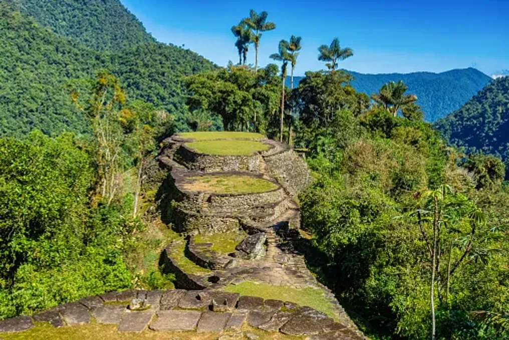
The settlement was not a city with monumental stone palaces. Instead, its architecture reflects a deep understanding of the terrain, including carefully designed terraces, stone staircases, retaining walls, and circular platforms adapted to the steep hillsides.

Over 200 archaeological structures have been identified at the site. The stone terraces supported round houses built from perishable materials such as wood and thatch, while paved paths connected different parts of the settlement.

The builders also developed systems for rainwater management and slope stabilization. Retaining walls supported the terraces, and stone pathways helped link residential areas, public spaces, and other structures on uneven terrain.

Rather than leveling the landscape, the builders worked in accordance with its natural contours. The result was a complex arrangement of platforms and paths that merge with the surrounding forest, demonstrating the engineering skills and ecological knowledge of the people who lived there.

Discovery and Scientific Study

Although local communities knew about the region and its history, Ciudad Perdida attracted widespread archaeological attention only in 1975 when remnants were discovered by individuals searching for pre-Columbian artifacts. This discovery followed a period of looting that damaged archaeological sites throughout the Sierra Nevada.

Subsequent archaeological expeditions documented the settlement, and the Institute of Anthropology and History of Colombia, known as ICANH, began a program of research, conservation, and restoration in 1976. This work helped establish Tayrona as one of Colombia's most important archaeological sites. Its terraces and paths provide valuable evidence of how communities organized settlements, managed steep topography, and maintained connections in the mountainous region.

Today, conservation remains a central element of site management. The stone structures are subject to heavy rainfall, vegetation growth, and human activity. Their protection requires careful visitor management and respect for the broader landscape.

Walking among the terraces offers a different experience compared to visiting archaeological sites dominated by monumental buildings. At Tayrona, the ruins are integrated into the forest, and the structures are interspersed with vegetation, uneven ground, and changes in elevation.

Circular foundations indicate where houses once stood, and larger platforms suggest areas used for public events and daily life. Stairs connect different levels, and paved paths show how people moved through the settlement.

Most information about the city's history comes from archaeological data rather than surviving written records. Therefore, the terraces are more than picturesque ruins; they offer clues about a society whose achievements were closely tied to the surrounding landscape.

Cultural Significance and Management

Ciudad Perdida is located on the ancestral territory of four indigenous peoples: the Kogi, also known as Kaggaba; the Arhuaco, or Iku; the Wiwa, and the Kankuamo. These communities maintain cultural, spiritual, and historical ties to the Sierra Nevada de Santa Marta. Their connection to the mountains extends beyond individual archaeological sites to encompass rivers, forests, peaks, and broader territories that sustain their traditions and way of life.

For these communities, the Sierra Nevada is not merely a scenic mountain range. It is part of a living cultural landscape where the health of the natural environment and the well-being of its inhabitants are closely interwoven. Consequently, Tayrona cannot be viewed simply as an abandoned city. Its importance continues through the living heritage of the indigenous peoples, who recognize the landscape as part of their ancestral world.

The Sierra Nevada is a place where environmental conservation and indigenous beliefs are closely linked. Traditional authorities continue to emphasize the importance of caring for the land and respecting sacred sites.

In October 2026, this interconnectedness was reflected in the temporary closure of the archaeological park. At the request of traditional indigenous authorities, ICANH announced that the site would be closed from October 1st to 15th to allow the land a period of rest and time for internal spiritual practices. The park subsequently reopened to visitors on October 16, 2026, with regular operating hours of 7:00 AM to 3:00 PM. This decision illustrates why access to Tayrona cannot be understood solely from a tourism schedule: the cultural and spiritual practices of the indigenous peoples are a vital consideration in site management.

Travelers can approach this experience with greater understanding by listening to authorized guides, adhering to local protocols, and recognizing that visiting an archaeological site does not mean the entire surrounding area is open for unrestricted exploration.

Journey to the Lost City

Reaching the Lost City requires significantly more effort than visiting a typical attraction. The journey usually begins in Santa Marta, a coastal town that serves as the main base for organizing treks into the Sierra Nevada. From Santa Marta, travelers travel by road to the rural settlement of Machete Pelao, also known as El Mamei, from where the route begins. The trail passes through forested hills, river valleys, and rural communities before reaching the archaeological park.

Most routes take four days round trip, although options ranging from three to six days may be available depending on the operator and itinerary. The hike involves humid conditions, steep ascents, muddy trails, and river crossings. Heavy rains can make certain sections particularly challenging.

Accommodation is typically provided in basic camps along the route, where tourists can rest, eat, and prepare for the next day. This experience differs greatly from a standard vacation, demanding physical exertion and readiness to move at the pace of the landscape.

One of the most memorable moments of the journey is approaching the archaeological settlement closer to the end, as tourists ascend approximately 1200 stone steps to the terraces. This climb serves as a fitting introduction to the city itself. After days spent navigating forest trails and crossing rivers, the stones lead to a network of meticulously formed platforms, winding paths, and green slopes.

It is best to explore the site slowly. Take time to observe the circular foundations, the layout of the terraces, and how the vegetation surrounds the archaeological remains. The setting helps visitors appreciate the practical difficulties faced by the builders and the scale of their achievements.

After touring the ruins, tourists return along the same general route to the start of the trail. Good preparation, appropriate footwear, and a realistic understanding of the terrain are necessary. The journey to Ciudad Perdida offers more than just the destination itself. The trail traverses tropical ecosystems shaped by variations in altitude, precipitation, and relief. Forest canopies, tangled roots, streams, and riverbanks create a constantly changing backdrop for the walk.

River crossings are part of the route, and conditions can change after heavy rain. Tourists must follow the instructions of their guides and avoid attempting crossings when water levels or currents make it unsafe. The birdlife, tropical vegetation, and sounds of running water complement the experience, although encounters with wildlife are never guaranteed. The forest is a living ecosystem, not a set piece created for visitors.

The route also passes through indigenous communities and territories, offering an opportunity to understand that the mountains are not desolate wilderness. Communities continue to live and work in the region, maintaining relationships with the land that predate modern tourism. Traveling with an authorized guide helps visitors navigate the route safely and provides context about the landscape and its cultural significance. Local guides, cooks, and other trekking staff also contribute to the visitors' experience, making responsible tourism an opportunity to support the people working in the region.

Visitors should ask permission before photographing people, homes, or culturally significant activities and respect any restrictions posted along the trail. The climate in the Sierra Nevada is humid and can be very rainy, so even a favorable forecast should not be considered a guarantee of dry conditions. Trails can become slippery, and the combination of heat, humidity, and steep terrain can make walking exhausting. Sufficient time must be allocated for the entire trek, provisions for rest must be made, and the route chosen must match your fitness level.

Tourists should book through authorized operators and check the latest access information before departure. The trail is not clearly marked throughout, and independent hiking is prohibited. A certified guide is required, so visitors must arrange their trek in advance and confirm what is included in the package. The announced reopening on October 16, 2026, is an important current update but should not be taken as a guarantee of uninterrupted access in the future. Temporary closures can occur for cultural and spiritual reasons, preservation, safety, or other operational reasons. Before leaving, check the latest announcements from ICANH and confirm arrangements with an authorized tour operator. The published park hours are from 7:00 AM to 3:00 PM, but multi-day trekking and accommodation must be arranged separately. Respecting closures and local instructions is part of responsible travel, not an inconvenience to be bypassed. The remote location of the site does not negate the responsibilities associated with visiting a protected cultural landscape. Stay on marked trails, avoid climbing on or moving stones, take all trash with you, and follow guidelines regarding photography and restricted areas. Tourists must also acknowledge that indigenous peoples have a voice in how their ancestral territory is cared for and used. Choosing an authorized operator, following the guide's instructions, and showing respect to local residents can help make this experience more respectful for all participants.

Popular