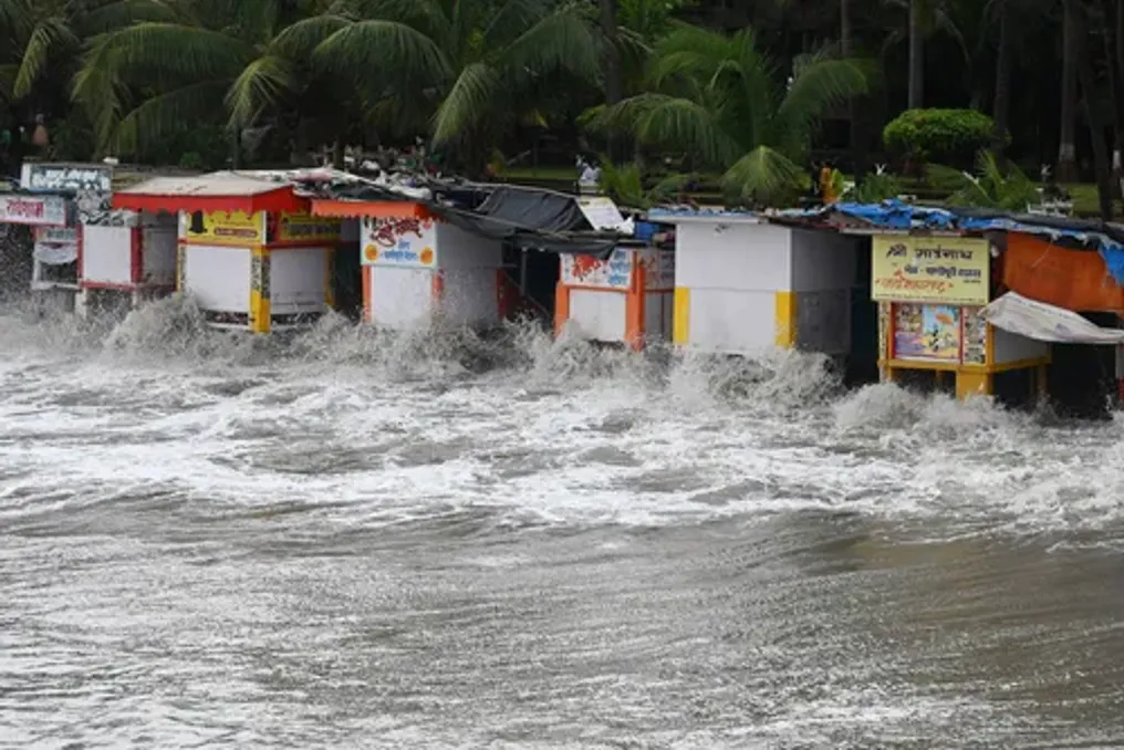
Cyclone Murasu heads towards the east coast of India; strong winds and heavy rains expected
Read more
IOL
iol.co.za

Cyclone Murasu heads towards the east coast of India; strong winds and heavy rains expected

The second cyclone is heading towards the east coast of India in less than a week. According to the Indian Meteorological Department (IMD), Storm Murasu is expected on Monday night.

It is forecasted that Cyclone Murasu will make landfall between Nellore and Narsapur, bringing strong winds and heavy rainfall to parts of Andhra Pradesh and Tamil Nadu.

The IMD reported that there is a high probability that it will pass along the southern coast of Andhra Pradesh as a severe cyclonic storm, with an expected wind speed of about 100–110 kilometers per hour (60–70 miles per hour), with gusts up to 120 km/h.

The point of landfall is expected to be located between Nellore and Narsapur, near the city of Ongole. Cyclone Murasu is predicted to be weaker than its predecessor in terms of wind speed, but it may cause further heavy rains in already affected regions.

The cyclone season has intensified due to the El Niño phenomenon, which has contributed to unprecedented warming and caused global changes in pressure, wind, and precipitation patterns.

Previously, last Wednesday, the Andhra Pradesh coast was affected by Cyclone Arnab, which brought heavy rains and claimed at least three lives.

The meteorological department warned that strong winds could damage thatched houses, tear off roofs, uproot trees, and also harm crops, plantations, and gardens.
Similar stories

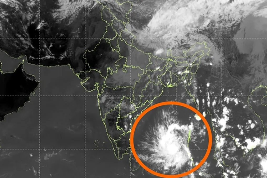
Low-pressure area in Bay of Bengal may turn into cyclonic storm, warns IMD
Read more
www.aajtak.in

Low-pressure area in Bay of Bengal may turn into cyclonic storm, warns IMD

According to the India Meteorological Department (IMD), a low-pressure area formed over the South Andaman Sea, North Andaman Sea, and the Andaman and Nicobar Islands continued its movement in the west-northwest direction. On October 31, 2026, at 8:30 AM, this area existed as a marked low-pressure area near the southeastern Bay of Bengal, the Andaman and Nicobar Islands, and the Andaman Sea.

The extent of this associated cyclonic circulation is up to an altitude of 7.6 kilometers above sea level. It is forecasted that this system will convert into a depression in the same area within the next six hours, after which it may strengthen further into a cyclonic storm within the next 24 hours.

IMD assesses that this system will continue to move in a west-northwest direction and is likely to reach the central western Bay of Bengal near the Andhra Pradesh coast around the evening of November 2, 2026. Since this system is still developing, continuous monitoring of its intensity and precise track is necessary.

Thunderstorms are expected at several locations in the coastal areas of the Andaman and Nicobar Islands. Sea conditions may be moderate to rough and occasionally very rough. Winds may blow from the southeast to the south at a speed of 37 to 46 kilometers per hour, with gusts reaching up to 55 km per hour.

Additionally, there is an increased risk of heavy rainfall in the coastal parts of Andhra Pradesh in the coming days. Farmers, fishermen, and coastal residents are advised to remain vigilant. Local vigilance signals may be activated at ports, and ships and boats traveling at sea need to exercise extreme caution.

Such weather systems are common in the Bay of Bengal during the months of October and November, which can cause heavy rainfall, strong winds, and high sea waves. Concerned state governments and disaster management teams have already started preparations. Citizens should pay attention to the regular updates issued by the IMD. If this system turns into a cyclone, a warning will be issued based on its intensity. Currently, it is in a developing stage, so there is no need to panic, but caution is mandatory. The meteorological department is continuously monitoring this situation and will issue additional alerts as required.

Meteorological Department warns of cyclone in the Bay of Bengal with threats on specific dates
Read more
www.aajtak.in

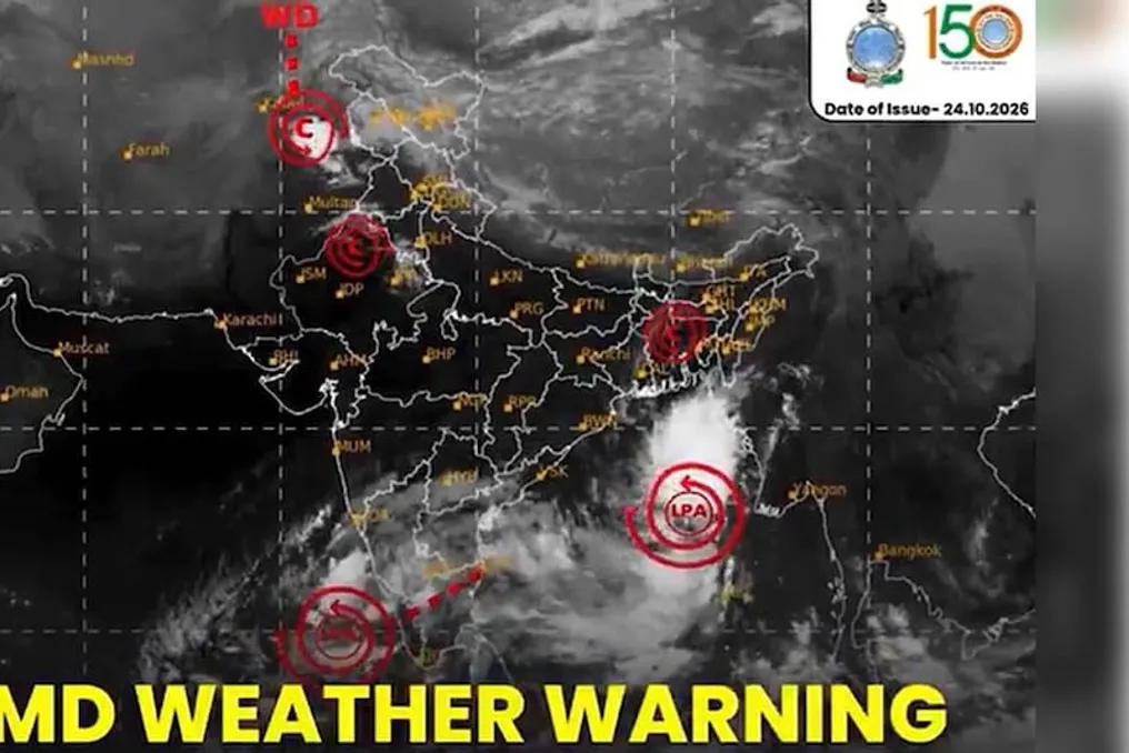
Meteorological Department warns of cyclone in the Bay of Bengal with threats on specific dates

The India Meteorological Department (IMD) has issued a warning that a low-pressure area formed in the east-central and southeast parts of the Bay of Bengal is rapidly intensifying. According to forecasts, it may become a depression by October 24, a deep depression by October 25, and transform into a tropical cyclone in the west-central part of the Bay of Bengal by the morning of October 26.

After this, the system will move in a northwest direction and is expected to reach the coast of Andhra Pradesh on the morning of October 28. There is a possibility of landfall between northern Andhra Pradesh and southern Odisha.

As a result of this system's impact, heavy rainfall is expected in various places in the coastal areas of Andhra Pradesh on October 27 and 28. There is also a risk of extremely heavy rains in Odisha and Telangana on October 28. Strong or very strong rain is forecasted for Odisha on October 27 and 29, with precipitation in some areas potentially exceeding 20 centimeters.

The coastal districts of Andhra Pradesh, such as Visakhapatnam, Srikakulam, and Vijayawada, may be most affected. Heavy rains and wind gusts may also affect the coastal areas of Odisha, including Ganjam, Gandham, and Puri. Flooding due to excess water is possible in some parts of Telangana. Sea waves may rise, and fishermen will be prohibited from going out to sea.

Heavy rains pose a threat of flooding in low-lying areas, road closures, power outages, and crop damage. Additionally, landslides are possible in hilly regions. Past experience shows that systems forming in late October often intensify rapidly due to persistent warm sea water.

State governments have taken precautionary measures in advance. Disaster management groups in Andhra Pradesh and Odisha have been placed on high alert, and rescue materials, boats, and medical teams have been prepared. Residents are strongly advised to follow official updates, avoid unnecessary travel, and remain in safe places. Fishermen have been advised not to venture into the sea.

IMD continues constant monitoring, as the intensity and trajectory of the system may change, making regular updates crucial. Due to climate change, storms can become more intense, so timely preparation is key. It is necessary to follow local authorities' instructions and avoid rumors on social media, obtaining information only from official sources such as the IMD website or app.

Popular