IMD forecasts November to be slightly warmer than average in most regions of India
Read more
The times of India
timesofindia.indiatimes.com

IMD forecasts November to be slightly warmer than average in most regions of India

The Indian Meteorological Department (IMD) has predicted that November in most parts of India will be slightly warmer than the average. According to the IMD statement, maximum (daytime) and minimum (nighttime) temperatures are expected to be above normal across most of the country's territory in November.

Furthermore, it is forecasted that less precipitation than usual will fall in a significant part of the country. However, there is a possibility of a cyclone forming, which could bring heavy rains to the states of Andhra Pradesh and Tamil Nadu.

Similar stories

Weather forecast in Balneário Camboriú indicates rain and mild temperatures during the long holiday weekend
Read more
viagemeturismo.abril.com.br

Weather forecast in Balneário Camboriú indicates rain and mild temperatures during the long holiday weekend

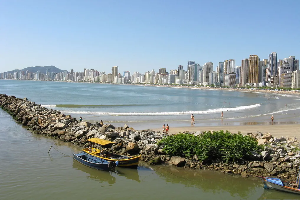
Balneário Camboriú, located on the coast of Santa Catarina, will face an extended holiday characterized by moderate temperatures and periods of climatic instability.

Forecast details in Balneário Camboriú

On Friday, the 30th, rain accompanied by thunderstorms is expected. However, conditions should improve on Saturday, the 31st, with no precipitation forecast. Instability will return on Sunday, the 1st, with showers predicted for the night, and will persist on Monday, the 2nd, the All Souls' Day holiday.

Throughout the period, temperatures will remain relatively stable, with maximums projected between 21°C and 23°C.

Specific daily conditions

On Friday (10/30), the sky is expected to be mostly cloudy, with expectations of rain showers and thunderstorms both in the morning and at night. Records indicate a minimum of 18°C and a maximum of 22°C, with a 92% chance of rain.

Saturday (10/31) will be marked by the appearance of the sun among the clouds during the day. Although the sky remains very cloudy at night, there is no forecast for rain. Expected temperatures are a minimum of 18°C and a maximum of 21°C.

On Sunday (11/1), the day will start with sun interspersed with clouds and cloudy periods. However, the night will bring a forecast of rain showers. Temperatures will vary between 18°C and 23°C, with a 63% probability of rain.

Finally, the All Souls' Day holiday on Monday (11/2) should feature predominantly cloudy skies, with the possibility of thunderstorms during the early morning hours and new rains in the late morning. Minimum temperatures will be 21°C and maximums 23°C, with an 85% chance of rain.

Weather forecast for Uzbekistan in November: cooling expected, possible snow in the mountains
Read more
podrobno.uz

Weather forecast for Uzbekistan in November: cooling expected, possible snow in the mountains

In early November, Uzbekistan will maintain relatively warm weather, but a temperature drop is predicted for the second half of the month. Daytime temperatures will gradually decrease from 17–22 degrees to 5–10 degrees. Some days may see rain, and with a sharp drop in temperature, brief snowfall is possible.

According to Uzhydromet data, during the first ten days of November, nighttime temperatures are expected to be from 5 to 10 degrees, and daytime temperatures from 17 to 22 degrees. In the second and third ten-day periods, the climate will become cooler: nighttime temperatures will range from 3–8 degrees down to 2 degrees below zero and 3 degrees above zero, while daytime air temperatures will rise to 5–10 degrees, with the possibility of reaching 15–20 degrees in certain periods.

The main form of precipitation throughout the month is forecast to be rain, and the total amount of precipitation is expected to remain within the climatic norm or be lower in some regions. Nevertheless, by the end of November, a snow cover will form in the mountainous areas, which at altitudes above 2,000–2,200 meters can reach 25–40 centimeters.

It is important to note that the November weather in Uzbekistan shows significant year-to-year variability. For example, November 2023 was the warmest on record, with the average monthly temperature exceeding the norm by 3–6 degrees, and temperatures in most regions did not drop below zero.

There have also been periods of severe cold. Over the last century, temperatures as low as 10–15 degrees below zero have been recorded in most regions in November. In Karakalpakstan and Khorezm region, frosts of up to 18–21 degrees have been observed in individual years, and on the Ustyurt Plateau, temperatures dropped to 26–28 degrees.

Precipitation can also significantly exceed average figures. For instance, in November 2011, Tashkent received 167 millimeters of precipitation against a norm of 51 millimeters; rain and snow fell for 19 days, and by the end of the month, the height of the temporary snow cover reached 20 centimeters. Termez recorded 148 millimeters of precipitation in the same month against a norm of 20 millimeters.

Long-term trends indicate a gradual warming in Tashkent: over the past fifty years, the average monthly temperature in the capital has increased by approximately 0.14 degrees per decade.

Scientists develop method to predict El Niño up to one year in advance
Read more
olhardigital.com.br

Scientists develop method to predict El Niño up to one year in advance

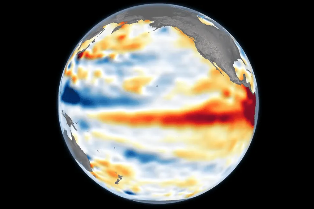
Scientists have identified a method capable of determining the reliability of El Niño and La Niña forecasts with a horizon of up to one year. This new discovery has the potential to improve warnings about extreme weather events, granting more time for communities and authorities to prepare against droughts, floods, and other environmental consequences.

The study, published in the scientific journal Science Advances this Friday (23), analyzed a set of over 7,500 historical forecasts generated by climate models from nine countries. The researchers concluded that the conditions observed in the Pacific Ocean at the time a forecast begins significantly affect its accuracy in subsequent months.

The most relevant finding demonstrated that forecasts initiated under La Niña conditions maintained a good level of performance, even when attempting to anticipate the behavior of the climate system for an entire year. In contrast, those forecasts that began under neutral conditions proved considerably less reliable.

El Niño and La Niña represent opposite phases of the phenomenon known as the El Niño-Southern Oscillation (ENSO), a natural climate pattern linked to variations in the sea surface temperatures of the tropical Pacific. These changes impact atmospheric circulation, potentially altering rainfall and temperature patterns in various parts of the globe.

Although these events generally peak around December and can be predicted with certainty about six months in advance, projecting them over longer periods remains a scientific challenge.

The research indicates that monitoring the initial state of the ocean helps distinguish between forecasts with a higher chance of being correct and those that require greater caution. According to Mandy Freund, a co-author of the study and a researcher at the University of Melbourne (Australia), the stable performance of forecasts initiated during La Niña suggests that these circumstances make the tropical Pacific system more predictable over the following year.

The ability to anticipate these phenomena with greater certainty can assist governments, emergency services, and populations in planning preventive actions, organizing resources, and mitigating risks. However, scientists emphasize that there are still steps to complete before this discovery can be directly implemented in daily forecasts, although the study already offers a path to refine alert systems and increase preparation time for seasonal climate changes.

Popular