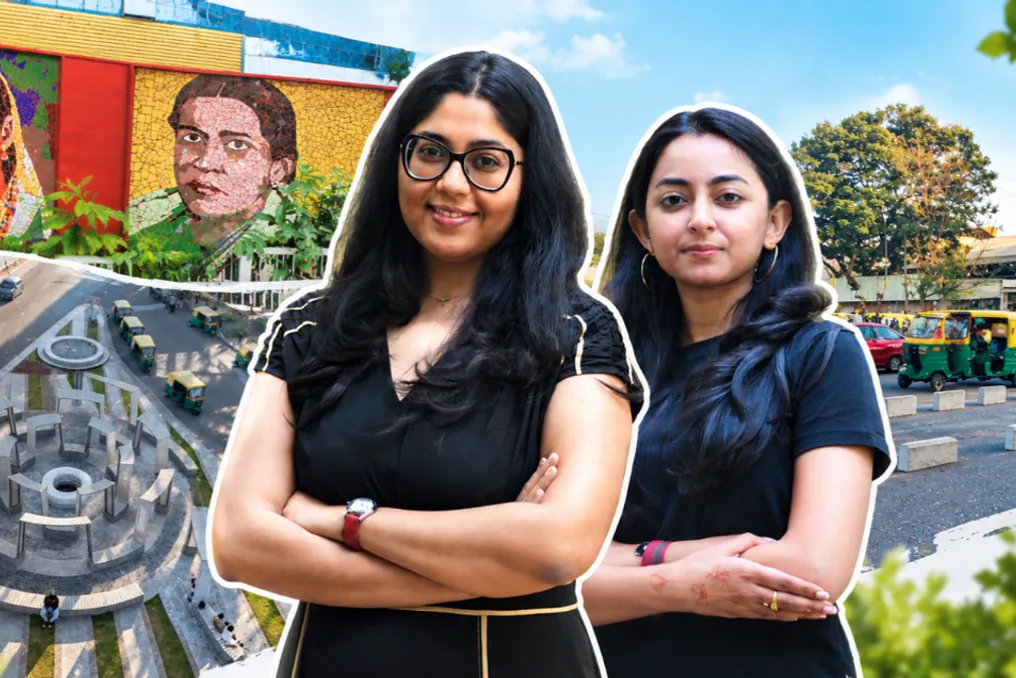
In the Racecourse intersection area of Bengaluru, pedestrians had to spend more time than necessary among moving vehicles. One turn provided cars with a wide lane, forcing pedestrians to navigate through traffic.
When urbanists Nishita Parmar and Vedanti Agarwal studied this intersection, they discovered an unexpected fact: one left turn was used by a relatively small number of vehicles, while significantly more people needed to cross that section.
The question arose as to why such a large space was allocated for cars. Collaborating with lead designer Monica Shah and the Compartment S4 team, they helped redesign the intersection by including a pedestrian refuge island, allowing people to pause during the crossing.
This work was part of the Orbital project, commissioned by the Bruhat Bengaluru Mahanagara Palike (BBMP) with support from the Sustainable Mobility Network. This example illustrated the overarching question guiding their work across Bengaluru: how can streets and their surrounding spaces better serve pedestrians?
Why did one left turn take up so much space?
The team began its work at Racecourse by observing how people and vehicles actually moved. They counted traffic, tracked pedestrian routes, and noted points of conflict between them.
Parmar notes: 'When we actually went out and mapped this intersection, we realized that the volume of vehicles going left from the road was much lower compared to the volume of pedestrians.'
This meant that pedestrians were crossing a wider stretch of moving traffic than was necessary. 'We call this pedestrian exposure time. To get from A to B, it took longer, which means you are exposed to moving traffic for longer,' she explains.
The designers proposed a more compact turn, changes in traffic flow, and a refuge island to separate the crossing. For a person walking to college, work, or elsewhere, reducing the time spent among vehicles could make the journey easier.
This is especially important for the intersection serving Race Course, educational institutions, and other destinations. Students and other pedestrians pass through this area daily, and events attract large groups of people.
By December 2023, BBMP began reconstruction work at the Race Course Road intersection, including plans for pedestrian crossings, seating areas, and waiting zones. In February 2025, local media reported the completion of the reconstruction, noting the installation of benches for pedestrians and office workers. Compartment S4 also marked its Race Course Junction project as complete.
The physical intervention has been documented, although a before-and-after comparison showing reduced crossing time or decreased traffic conflicts was not available for this story.
Why test the design on the street first?
Parmar received her architecture education at CEPT Ahmedabad. Her experience in urban design and strategy, including working with the domestic workers' union in Jaipur, introduced her to how public infrastructure affects daily life.
Agarwal, who holds a Master's in Urban Design from UC Berkeley, has worked on urban mapping, landscape-based planning, transit-oriented development, and ecologically sensitive design in India and the US, including with WRT in San Francisco and Studio POD in India.
Their approach starts with observation, not assumptions. Before making permanent changes, the team tested how the redesign functioned on the street. This matters because people rarely move exactly as a blueprint predicts. Someone might cut across the road; a driver might turn differently when traffic increases. Observing these movements allows designers to identify problems and adjust plans before construction becomes permanent.
Parmar asserts: 'Problems never fall into one category. There is a traffic problem, there is a utility problem, there is a space constraint problem, there is a traffic problem, and all of this together forms an urban problem.'
They started looking for places where one intervention could solve multiple issues, including inconvenient road edges and spaces left under flyovers. 'We started mapping these areas or these spots where some kind of intervention is possible to make it a flagship project and show how spaces—that is, negative or deformed spaces in the city—can be viewed differently,' she says.
Turning such ideas into real spaces also requires navigating government permits, budgets, and construction limitations. 'If we aim for something very high right away, it might not pass or might lack the budget to implement,' Parmar explains.
'Whatever intervention we make, it solves not just one specific thing but considers all aspects of the problems in the urban context,' she adds. This approach led the team to the Shivananda flyover.
Transforming unused space under a flyover into a public park
In Shivananda, a large area beneath the flyover remained unused, while passersby had barely 1.5 feet of sidewalk to walk on. The team's research showed that pedestrians were already using this route between residential areas, universities, and Race Course. The designers wondered if some unused land could become a more welcoming place for them.
Parmar states: 'The flyover occupied a lot of unused space. So we thought: let's take it and integrate it with the intersection.'
Their solution is Pause Park, designed with seating areas, platforms, steps, swings, greenery, and art. The goal was to provide people with a place to sit and spend time in an area where they previously had no reason to stop.
Work to tidy up this area continued until June 2023, when BBMP built benches and public toilets following residents' objections to the initial proposal for a basketball court and roller rink, citing safety concerns near moving traffic. In February 2025, city officials named Shivananda Circle one of their designed intersections. However, a report dated May 31, 2025, indicated that final touches on the mini-park, including swings and greenery, were still in the final stages. It was not possible to confirm independently the exact opening date for the public or whether all amenities are currently available. Nevertheless, this idea raises a valuable question for a city full of flyovers: can the land beneath them offer something useful to the people who pass by every day?
Will people use these spaces?
For road intersections, the team can analyze crossing times, traffic flow, and potential conflicts between pedestrians and vehicles. Agarwal states: 'For intersections, it is important to see how smooth the flow of movement has become. These things are more objective.'
The team also studies how urban design can reduce heat impact. After creating the space, they conduct post-occupancy studies to see how people actually use it. 'For open spaces, it is important to go during the busiest hour and see if the community has adopted it,' says Agarwal. Are children playing there? Are elderly people comfortable sitting there? Can different groups use the space? Such observations help demonstrate whether the public space is functioning as intended and what might require changes.'
What is needed to build a better street?
For the designers, the challenge is ensuring visibility of the work behind the final design. Research, community consultations, and inter-departmental coordination take time, even if the public only sees the finished product. Shah says: 'Research is an intangible component, but ultimately it drives the project. The government wants to see 3D renders.'
Parmar notes that many government agencies are more familiar with architecture and structural consulting than with the process that requires urban design. 'They don't always understand that achieving an urban design proposal requires a different kind of process,' she says.
Therefore, the team works on how projects are commissioned and executed, including surveys, public engagement, procurement, and implementation. 'We help governments revise standard operating procedures for how designers should interact with such projects,' says Parmar.
At Racecourse, their work began with noting how much road space was allocated to an underutilized turn. In Shivananda, they studied people squeezing along a narrow sidewalk next to a large, unused area. In both places, the first step was the same: paying attention to how people live in an already built city, and using that understanding to make it better for them.
}, {