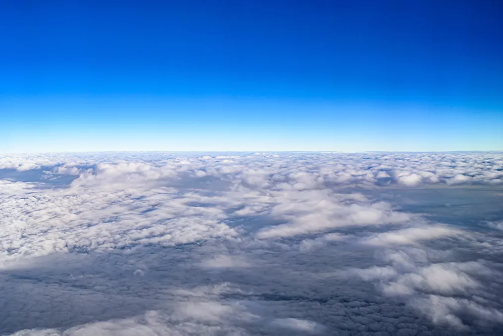
The five layers of the Earth's atmosphere and their respective functions
Read more
Super Abril
super.abril.com.br

The five layers of the Earth's atmosphere and their respective functions

The Earth's atmosphere, this essential gaseous layer surrounding the planet, is structured into five distinct zones: the troposphere, stratosphere, mesosphere, thermosphere, and exosphere. These layers work together to maintain the planet's thermal balance, protect against meteorite impacts, and filter ultraviolet radiation. The primary distinction between them lies in the variation of altitude and temperature, which follows a pattern of decrease, increase, decrease, and new increase across the layers, with each playing vital roles for existence.

The troposphere constitutes the layer closest to the surface, where life develops. Its thickness varies according to latitude and season, situated between 0 and 12-18 km. It houses approximately 80% of the total atmospheric mass and almost all the water vapor. Climatic phenomena, such as storms, winds, and rain, occur in this region due to convection and water vapor. It is also the flight path for helicopters and the point of flight for most commercial aircraft, although temperatures can drop to -60°C at higher altitudes.

Above the troposphere, starting around 8 km and reaching about 18 km, is the stratosphere. Its most notable function is the presence of the ozone layer, located between 15 and 35 km, which absorbs a large part of solar ultraviolet radiation, specifically all UV-C and almost all UV-B, which are the most harmful to living beings. Due to this absorption, the temperature in the air increases in the stratosphere with elevation, unlike the troposphere; its base registers about -60°C and can reach 0°C at the top. This thermal stability results in few vertical air currents.

The mesosphere, located between 50 km and 80 km in altitude, is crucial for the planet's defense. It is at this level that numerous meteoroids disintegrate upon entering the atmosphere at high speed, vaporizing or burning due to friction and compression with the air. The mesosphere is the coldest layer, reaching temperatures of approximately -90°C to -100°C at its apex. Furthermore, it is in the mesosphere that rare noctilucent clouds appear, formed by ice crystals and visible only during twilight.

Rising between 85 km and 600 km is the thermosphere, characterized by extremely rarefied air. This layer is the scene of spectacular events, such as the aurora borealis in the Northern Hemisphere and the aurora australis in the Southern Hemisphere. Auroras are generated by the collision of charged particles from the solar wind with oxygen and nitrogen atoms and molecules, resulting in light emission. The thermosphere also contains the ionosphere, a band extending from 60 to 1,000 km in altitude. Being charged with ions, it is fundamental for the transmission and reception of radio waves, housing many satellites in low orbit and the International Space Station (ISS). Although the temperature (due to particle agitation) can reach 1,000°C, the heat would not be perceived due to the scarcity of particles for energy transfer.

There is no defined limit between the atmosphere and space; the air progressively becomes more rarefied until it merges with the interplanetary medium. By convention, the International Air Federation (FAI) establishes the Kármán line, at an altitude of 100 km, as the boundary between the atmosphere and space. This value has a physical basis, as at this height, the air density is so low that an airplane would need to fly above orbital velocity to generate lift, which is impractical. Interestingly, this line is located in the middle of the thermosphere, not the exosphere. Thus, the atmosphere continues far beyond the point designated as 'space,' and it is in this transition area that the exosphere is found.

The exosphere extends from 600 km to 10,000 km in altitude. In this domain, where the air is so dispersed that it resembles the vacuum of space, certain satellites circulate. Similar to the thermosphere, temperatures are high due to particle agitation, but the perceived temperature is cold. The exosphere truly represents the zone of passage between what belongs to Earth and the vast cosmos.
Similar stories

Earthquake reveals unknown layer of the Earth and alters knowledge about the planet's interior
Read more
olhardigital.com.br

Earthquake reveals unknown layer of the Earth and alters knowledge about the planet's interior

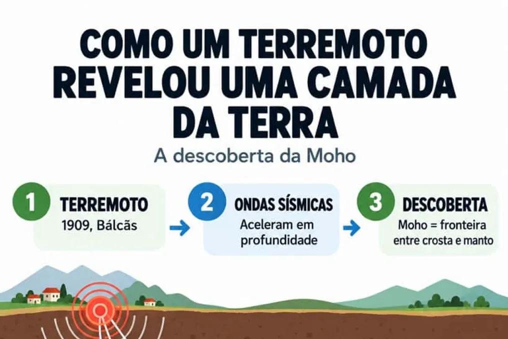
A seismic event that occurred in Europe 117 years ago transformed the scientific understanding of the planet's internal structure, revealing the existence of a hidden boundary beneath the Earth's surface.

Investigating the depths of the planet constitutes a monumental challenge for science. Although spacecraft have crossed the boundaries of the Solar System, the deepest human drilling has reached only a little over 12 kilometers into the crust. Due to the impossibility of direct access to the deepest regions, much of what we know about the Earth's interior is based on indirect methods, such as analyzing seismic waves, which allows us to study structures tens, hundreds, or even thousands of kilometers below the surface.

The planet's internal structure can be compared to a hard-boiled egg: the shell represents the crust, the white corresponds to the dense mantle, and the yolk is the core, located more than six thousand kilometers from the surface.

By analyzing an earthquake recorded on October 8, 1909, in the Kupa River valley area in the Balkans, near modern-day Croatia, the Croatian scientist Andrija Mohorovičić observed a peculiar phenomenon. The waves generated by the tremor showed a sudden acceleration upon reaching a certain depth in the subsurface. This unexpected acceleration led to the discovery of the division between the Earth's crust and the mantle, a dividing layer that was named the Mohorovičić Discontinuity, but is globally known by scientists simply as the Moho.

Thiago Maia, a physicist, astrophysicist, and specialist in natural phenomena, who is also an ambassador for the World Climate Declaration in Brazil, stated that this finding revolutionized geophysics. He demonstrated that tremors can serve as a tool for indirect subsurface sounding. According to Maia, the discovery of the Moho proved that the Earth has internal layers with distinct characteristics, notably the transition between the crust and the mantle, which revolutionized geophysics and validated the use of earthquakes to investigate the interior without the need for drilling.

Maia emphasizes that, even after more than a hundred years, the Moho remains fundamental to understanding the planet's structure. He stresses that although humans have never drilled into the mantle in its natural state, it is possible to study deep regions using seismic waves produced by earthquakes.

The specialist points out that the depth of this layer varies according to the location on the planet. Beneath the oceans, the Moho is located around six kilometers, while under continental masses, its thickness reaches thirty-five kilometers, although these values may undergo regional variations. Most researchers attribute this velocity change to the transition between different types of rock; when passing from the crust to the mantle, the formations acquire distinct compositions and characteristics, with the mantle often being linked to rocks like peridotite, which are denser and richer in minerals.

However, Maia makes a crucial caveat: the Moho should not be seen merely as a perfectly delimited physical barrier. It is primarily a discontinuity detected by the behavior of seismic waves. The increase in seismic velocity is usually interpreted as a consequence of a substantial modification in the properties and composition of the rocks, marking the passage from crustal rocks to mantle formations, often rich in minerals such as olivine and pyroxenes, as explained by the physicist in an interview with Olhar Digital.

The analysis of these geological vibrations has consolidated itself as a primary method for mapping the Earth's interior. By examining the speed, direction, reflection, and refraction of seismic waves, scientists can delineate the boundaries between planetary layers and infer vital properties of the subsurface, such as depth, composition, rigidity, temperature, and the physical state of the materials.

However, this indirect method has significant limitations that prevent a complete view of the planet's center. The captured signals do not provide an exact and immediate portrait of deep structures, since completely different geological formations can generate analogous signal patterns. Furthermore, the accuracy of the analyses depends on the position of the epicenters and the distribution of seismographic stations globally, forcing researchers to correlate seismology data with rock studies, gravity measurements, and laboratory simulations.

To validate theories and overcome the limitations of indirect measurements, geologists seek to drill through the crust to reach the upper mantle. Obtaining a direct sample of the mantle would represent a decisive scientific advance. Maia highlights that such a sample would allow for empirical verification of the composition and properties of mantle rocks, enabling discoveries about their minerals, temperature, pressure, presence of water, and other elements, in addition to deepening the understanding of mantle movement and its influence on volcanism and Earth's evolution.

Although the idea of drilling to the mantle seems simple, practical execution faces immense technical obstacles, especially in oceanic environments. Areas near submerged volcanic chains have thinner crusts and are interesting targets for drilling. However, the extreme heat emanating from the magma can melt and damage drilling equipment before the objective is reached.

The first attempt at oceanic drilling occurred in 1961 off the coast of Mexico, but it reached shallow depths. Decades later, the deepest wells on the seabed barely exceeded the two-kilometer barrier. A new perspective emerged with the activation of the Japanese research vessel Chikyu. This vessel is part of an international program focused on collecting samples from the seafloor and was designed to exceed previous depth limits. Three zones in the Pacific Ocean were pre-selected for the project: areas off the coast of Mexico, Nicaragua, and north of Hawaii.

Despite the planning, the journey to the mantle remains unprecedented due to high costs and the technical challenges inherent in open-sea operations. Nevertheless, the scientific community continues to develop new technologies aimed at eventually crossing the Moho and unraveling the secrets of the Earth's interior.

Popular