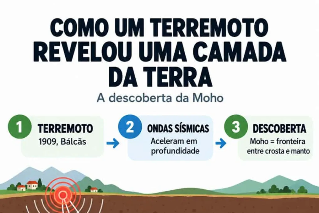
A seismic event that occurred in Europe 117 years ago transformed the scientific understanding of the planet's internal structure, revealing the existence of a hidden boundary beneath the Earth's surface.
Investigating the depths of the planet constitutes a monumental challenge for science. Although spacecraft have crossed the boundaries of the Solar System, the deepest human drilling has reached only a little over 12 kilometers into the crust. Due to the impossibility of direct access to the deepest regions, much of what we know about the Earth's interior is based on indirect methods, such as analyzing seismic waves, which allows us to study structures tens, hundreds, or even thousands of kilometers below the surface.
The planet's internal structure can be compared to a hard-boiled egg: the shell represents the crust, the white corresponds to the dense mantle, and the yolk is the core, located more than six thousand kilometers from the surface.
By analyzing an earthquake recorded on October 8, 1909, in the Kupa River valley area in the Balkans, near modern-day Croatia, the Croatian scientist Andrija Mohorovičić observed a peculiar phenomenon. The waves generated by the tremor showed a sudden acceleration upon reaching a certain depth in the subsurface. This unexpected acceleration led to the discovery of the division between the Earth's crust and the mantle, a dividing layer that was named the Mohorovičić Discontinuity, but is globally known by scientists simply as the Moho.
Thiago Maia, a physicist, astrophysicist, and specialist in natural phenomena, who is also an ambassador for the World Climate Declaration in Brazil, stated that this finding revolutionized geophysics. He demonstrated that tremors can serve as a tool for indirect subsurface sounding. According to Maia, the discovery of the Moho proved that the Earth has internal layers with distinct characteristics, notably the transition between the crust and the mantle, which revolutionized geophysics and validated the use of earthquakes to investigate the interior without the need for drilling.
Maia emphasizes that, even after more than a hundred years, the Moho remains fundamental to understanding the planet's structure. He stresses that although humans have never drilled into the mantle in its natural state, it is possible to study deep regions using seismic waves produced by earthquakes.
The specialist points out that the depth of this layer varies according to the location on the planet. Beneath the oceans, the Moho is located around six kilometers, while under continental masses, its thickness reaches thirty-five kilometers, although these values may undergo regional variations. Most researchers attribute this velocity change to the transition between different types of rock; when passing from the crust to the mantle, the formations acquire distinct compositions and characteristics, with the mantle often being linked to rocks like peridotite, which are denser and richer in minerals.
However, Maia makes a crucial caveat: the Moho should not be seen merely as a perfectly delimited physical barrier. It is primarily a discontinuity detected by the behavior of seismic waves. The increase in seismic velocity is usually interpreted as a consequence of a substantial modification in the properties and composition of the rocks, marking the passage from crustal rocks to mantle formations, often rich in minerals such as olivine and pyroxenes, as explained by the physicist in an interview with Olhar Digital.
The analysis of these geological vibrations has consolidated itself as a primary method for mapping the Earth's interior. By examining the speed, direction, reflection, and refraction of seismic waves, scientists can delineate the boundaries between planetary layers and infer vital properties of the subsurface, such as depth, composition, rigidity, temperature, and the physical state of the materials.
However, this indirect method has significant limitations that prevent a complete view of the planet's center. The captured signals do not provide an exact and immediate portrait of deep structures, since completely different geological formations can generate analogous signal patterns. Furthermore, the accuracy of the analyses depends on the position of the epicenters and the distribution of seismographic stations globally, forcing researchers to correlate seismology data with rock studies, gravity measurements, and laboratory simulations.
To validate theories and overcome the limitations of indirect measurements, geologists seek to drill through the crust to reach the upper mantle. Obtaining a direct sample of the mantle would represent a decisive scientific advance. Maia highlights that such a sample would allow for empirical verification of the composition and properties of mantle rocks, enabling discoveries about their minerals, temperature, pressure, presence of water, and other elements, in addition to deepening the understanding of mantle movement and its influence on volcanism and Earth's evolution.
Although the idea of drilling to the mantle seems simple, practical execution faces immense technical obstacles, especially in oceanic environments. Areas near submerged volcanic chains have thinner crusts and are interesting targets for drilling. However, the extreme heat emanating from the magma can melt and damage drilling equipment before the objective is reached.
The first attempt at oceanic drilling occurred in 1961 off the coast of Mexico, but it reached shallow depths. Decades later, the deepest wells on the seabed barely exceeded the two-kilometer barrier. A new perspective emerged with the activation of the Japanese research vessel Chikyu. This vessel is part of an international program focused on collecting samples from the seafloor and was designed to exceed previous depth limits. Three zones in the Pacific Ocean were pre-selected for the project: areas off the coast of Mexico, Nicaragua, and north of Hawaii.
Despite the planning, the journey to the mantle remains unprecedented due to high costs and the technical challenges inherent in open-sea operations. Nevertheless, the scientific community continues to develop new technologies aimed at eventually crossing the Moho and unraveling the secrets of the Earth's interior.