Wednesday weather forecast: strong winds, rough seas, and rain to affect parts of South Africa
Read more
IOL
iol.co.za

Wednesday weather forecast: strong winds, rough seas, and rain to affect parts of South Africa

The South African Weather Service has issued yellow level 1 and 2 warnings regarding damaging winds and waves, and is also forecasting rainy weather in the eastern regions of South Africa for Wednesday.

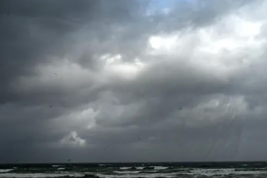
Damaging winds and waves are expected to hit the coastal areas of South Africa on Wednesday, October 7th. The South African Weather Service warns of dangerous sea conditions, while rain and thunderstorms will affect the eastern provinces.

SAWS has issued a yellow level 2 warning for damaging winds and waves along the KwaZulu-Natal coast, where conditions may disrupt beach activities and hinder navigation at sea. Additionally, a yellow level 1 warning for damaging waves is in effect along an extensive stretch of coastline between Alexander Bay and Plettenberg Bay.

This warning remains in effect until Thursday, and small vessels are expected to risk capsizing, with difficult navigation at sea. KwaZulu-Natal will face scattered thunderstorms. This province is expected to experience the main impact of Wednesday's unstable weather, accompanied by cloudiness and cool conditions, as well as isolated rain and thunderstorms.

Precipitation will become more common in the eastern parts of the province, where the probability of rain is 60%, while it is 30% in other affected areas. Fresh or strong southwesterly or westerly winds are forecast along the KwaZulu-Natal coast, which will then become moderate from the south in the afternoon. The province is also expected to experience a very high ultraviolet burn index.

Rain will extend to Mpumalanga and Limpopo. Mpumalanga is expected to have partly cloudy and cool to warm weather, although the sky will become cloudy with isolated rain and showers in the eastern areas. A 30% chance of rain is indicated for the affected parts of the province. Limpopo will be partly cloudy and warm, with cloudy weather and isolated rain and showers forecast for the southeast. According to the precipitation table, the probability of rain in the affected areas is 30%.

Gauteng will remain warm and dry. Partly cloudy and warm weather is forecast across the province, with temperatures rising in the far north. Residents are advised to take precautions against prolonged sun exposure, as the ultraviolet burn index is rated as very high.

North West and Free State will remain good and cool to warm, with no significant rainfall. The Eastern Cape will become moist in some places. The eastern half of the Eastern Cape will experience cloudy weather and patches of morning fog in the northern areas, with isolated rain and showers in the morning before the weather becomes partly cloudy and cool. The western half of the province will first be partly cloudy, then partly cloudy and cool, with good weather in places in the northern areas.

Strong coastal winds in the Northern and Western Cape. In the Northern Cape, there will first be partly cloudy weather in the south, followed by predominantly good and cool to warm weather. Fresh or strong southeasterly winds are expected along the coast. In the Western Cape, it will be good in the west, and partly cloudy and cool elsewhere, although it will be warm in the northwest. Coastal winds will generally be moderate or fresh, becoming strong along the west coast. The Western Cape will also experience a very high ultraviolet burn index.

Given the forecast of damaging waves along parts of both the west and east coasts, meteorologists have warned that sea conditions could become dangerous, especially for small vessels.


Similar stories

Severe storms, hail, and floods threaten the provinces of Gauteng, Limpopo, and North West
Read more
iol.co.za

Severe storms, hail, and floods threaten the provinces of Gauteng, Limpopo, and North West

The South African Weather Service has issued Level 2 yellow warnings for severe thunderstorms across the provinces of Gauteng, parts of the North West, and Limpopo for Wednesday. Residents in various parts of the country will face another period of adverse weather, including strong thunderstorms, damaging winds, and the risk of flooding in central areas.

Simultaneously, the extreme fire danger level remains high in certain sectors of the Western and Northern Cape.

For Wednesday, September 30th, the South African Weather Service announced a Level 2 yellow warning for severe thunderstorms over Gauteng, central Eastern North West, and central and western Limpopo. Heavy rain, strong destructive winds, hail, and excessive lightning are expected. Meteorologists warn that the storms could lead to localized flooding on vulnerable roads, low-lying areas, and bridges, as well as damage to settlements and infrastructure.

Precipitation forecasts indicate a 60% probability of scattered rain and thunderstorms in many areas of Gauteng, Limpopo, and Mpumalanga. In some parts of the North West and KwaZulu-Natal, the probability of isolated rain and thunderstorms is 30%, and isolated rains are also expected along the East Cape coast.

Gauteng prepares for cold and stormy conditions

Wednesday in Gauteng is expected to bring cloudiness and cold, accompanied by scattered rain and thunderstorm showers. The province is under a Level 2 yellow severe thunderstorm warning, putting residents at risk of heavy downpours, hail, damaging winds, and excessive lightning. Drivers are strongly advised to exercise extra caution where heavy rain affects roads, as localized flooding is possible in vulnerable spots.

Cold and humid conditions for Limpopo and Mpumalanga

Limpopo is expected to be cloudy and cold, with scattered rain and thunderstorm showers. The severe thunderstorm warning applies to the central and western parts of the province. Mpumalanga may also expect an unsettled day with cloudy and cold to very cold weather, accompanied by scattered rain and thunderstorm showers. The probability of precipitation across the province is forecast at around 60%.

The North West will be cloudy, windy, and cold to cool before becoming partly cloudy. Scattered rain and thunderstorm showers are expected, with the central and eastern parts included in the Level 2 yellow warning.

Destructive winds threaten the East Cape coast

A separate Level 2 yellow warning for destructive winds has been issued for the municipalities of Nelson Mandela Bay, Buffalo City, as well as the municipalities of Ndlambe Valley, Ngqushwa, and Sandayrs River. These winds may cause localized damage to settlements, disrupt beach activities, and create difficult navigation conditions.

The western half of the East Cape will be partly cloudy in the south early in the day, then become clear and cool to warm. The eastern half will be cloudy along the coast initially, with rain expected east of the Kei River, after which the weather will become clear and cool elsewhere.

Free State will be cool with scattered storms

East Free State will first be cloudy, then become partly cloudy, windy, and cold to cool. Isolated or scattered rain and thunderstorm showers are forecast, except in the southeastern parts of the province. KwaZulu-Natal may experience morning fog inland, followed by cloudy and cool to cold conditions. Isolated rain and precipitation are forecast, corresponding to approximately a 30% probability in affected areas.

Fire danger and extreme heat in the west

While the northeastern inland areas face storms and cold weather, parts of the western region face a completely different threat. For the municipalities of Matzikama, Cederberg, and Bergrivier in the Western Cape, as well as Camiesberg in the Northern Cape, extremely high fire danger is forecast. Very hot and uncomfortable conditions are also expected in Camiesberg.

Otherwise, the Western Cape will be clear and warm to hot, becoming very hot over the West Coast district. The UV index in the province is expected to be very high. The Northern Cape will be partly cloudy in the northeast, where isolated rain and thunderstorms are possible, but otherwise, the weather will be clear, windy, and cool to warm. Patches of morning fog are expected along the coast.

Severe thunderstorms, hail, and strong winds expected in some regions of South Africa on Tuesday
Read more
iol.co.za

Severe thunderstorms, hail, and strong winds expected in some regions of South Africa on Tuesday

The South African Weather Service has issued a Level 2 yellow warning for severe thunderstorms on Tuesday, as parts of South Africa will be under threat of heavy rain, hail, destructive winds, and lightning.

Extensive areas of South Africa are expected to face severe thunderstorms on Tuesday. The regions of Gauteng, North West, and other areas will encounter heavy rainfall, strong winds, hail, and excessive lightning.

The South African Weather Service has declared a Level 2 yellow warning for severe thunderstorms on Tuesday, covering the North West, Gauteng, Mpumalanga Highlands, southwestern Limpopo, northern Free State, and the northeasternmost parts of the Northern Cape.

These storms may lead to localized flooding on vulnerable roads, low-lying areas, and bridges, while strong winds and hail can cause localized damage to settlements and infrastructure.

Rainfall forecasts show a 60% probability of showers and thunderstorms in Gauteng and parts of the North West and Mpumalanga, while other central and eastern parts of the country are forecast to have a 30% chance of precipitation.

Gauteng prepares for a cold and stormy Tuesday

Residents of Gauteng may expect a sharp change in weather to cloudy and cold on Tuesday, although temperatures in the far north will be slightly milder. Isolated showers and thunderstorms are forecast across the province, with a probability of precipitation reaching 60%. The UV index will be moderate.

Thunderstorms will spread to the North West, Mpumalanga, and Limpopo. The North West is expected to have cloudiness, wind, and coolness with isolated showers and thunderstorms. This province is under a Level 2 yellow warning and has a 60% chance of rain in some places.

Mpumalanga will be cloudy and cold with isolated showers and thunderstorms. Thunderstorms will become more isolated over northern Lowveld, and the probability of precipitation will reach 60% in some parts of the province.

Limpopo will also experience cloudy and cold conditions, with isolated showers and thunderstorms becoming scattered in the southwestern and south-central areas. The chances of rain in the province range from 30% to 60%.

Rain reaches Free State and Northern Cape

Eastern Free State will be cold, while the rest of the province will be cloudy and cool. Isolated showers and thunderstorms are forecast, which will become scattered in the north. The chances of rain in different parts of the province range from 30% to 60%.

The Northern Cape will mostly be fine and warm, but the east is expected to have partly cloudy conditions and isolated showers and thunderstorms, where the probability of rain is around 30%.

Western Cape avoids thunderstorms

The Western Cape is expected to remain mostly dry, as no rain is indicated in the precipitation forecast. In the morning, the northeastern areas will be partly cloudy, and then the weather will become fine, cool, or warm, with hot conditions along the west coast.

Strong winds are possible along some parts of the coast, and fresh to strong northeasterly winds are expected along the south coast in the morning. Strong or near-stormy southeasterly winds are expected along the southwest coast. The UV index will be very high.

The western half of the Eastern Cape will initially be partly cloudy along the coast, then become fine and cool. The eastern half will be partly cloudy and cool south of the escarpment, later becoming cloudy along the coast.

Evening rain is expected along the coast east of the Kei River with a 30% chance of rain for some parts of the province.

KwaZulu-Natal may experience fog in the morning and evening over inland areas, while the rest of the time will be cloudy and cold or cool. Isolated showers and rain are forecast, which will become scattered along the coast and in the far north. The probability of rain in affected areas ranges from 30% to 60%.

Popular