
Civil Defense issues storm alert for the interior of São Paulo this Sunday
Read more
Grupo Globo
g1.globo.com

Civil Defense issues storm alert for the interior of São Paulo this Sunday

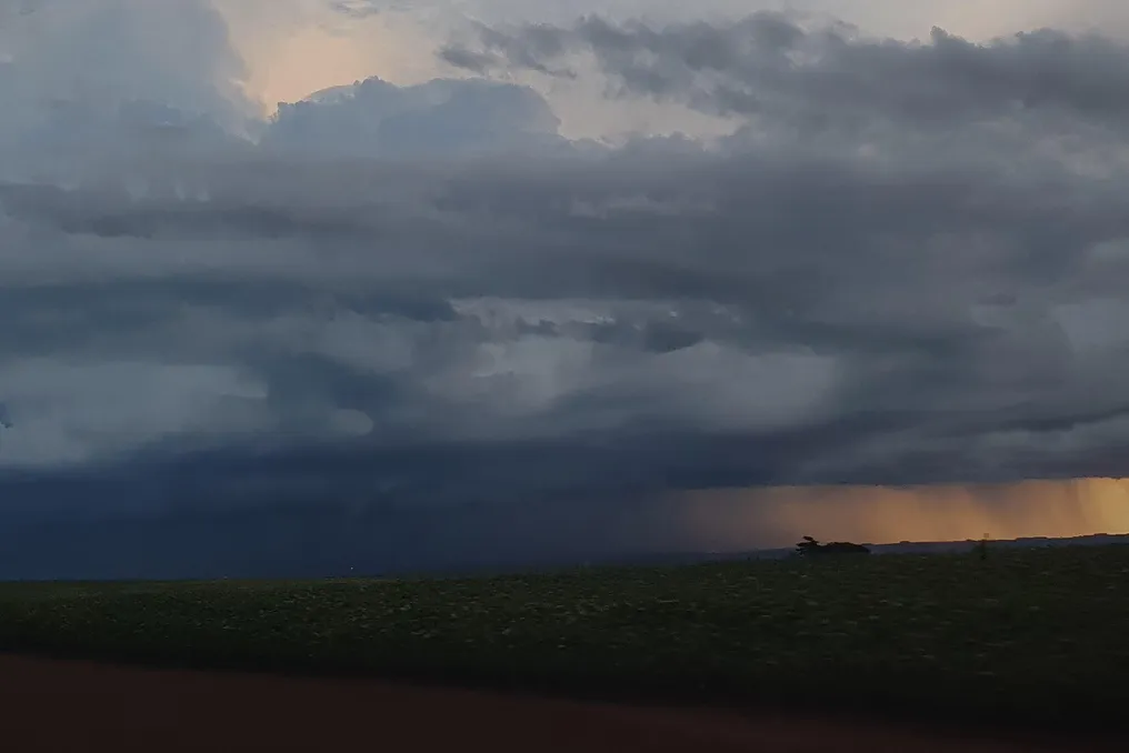
The Civil Defense of the state of São Paulo released a warning about the possibility of storms, including lightning and strong winds, scheduled for this Sunday, the 4th, in several cities located in the interior of São Paulo.

The areas of Itapeva, Marília, Presidente Prudente, Sorocaba, and Bauru are predicted to be the most susceptible to being impacted. In these municipalities, there is a high probability of intense rainfall, which could cause problems, especially in localities considered more fragile.

In addition to these specific regions, the meteorological forecast for the rest of the state also points to rain showers accompanied by lightning and gusts of wind.

Next few days

The climatic instability is expected to persist throughout the state starting Monday, the 5th. Projections indicate that there will be continuous rain in the following days, with periods of moderate to heavy intensity, in addition to lightning and strong winds.

On Monday and Tuesday, the 6th, the largest volumes of precipitation are expected in the regions near the border with Paraná.

The continuation of rains may increase the risk of flooding, overflows, rising levels of rivers and streams, as well as falling trees. Therefore, the Civil Defense advises the population to stay away from flood-prone areas and not to stay near trees, metal structures, or in open spaces during thunderstorms with lightning.

To receive alerts from the Civil Defense, citizens can send a text message (SMS) to the number 40199, providing the ZIP code of their area of interest.
Similar stories

East of Minas receives severe weather alert due to heavy rains, winds up to 100 km/h, and hail
Read more
g1.globo.com

East of Minas receives severe weather alert due to heavy rains, winds up to 100 km/h, and hail

The National Institute of Meteorology (INMET) issued a severe weather alert for East Minas Gerais, forecasting intense rainfall, winds of up to 100 km/h, and the occurrence of hail.

According to INMET, precipitation is expected to range between 30 and 60 millimeters per hour, or accumulated amounts of 50 to 100 millimeters throughout the day. This warning will be active from midnight until 11:59 PM. Furthermore, strong winds are predicted, reaching speeds between 60 and 100 km/h, along with the possibility of hailstones falling.

The institute warned about several risks associated with this weather event, including possible interruptions in electricity supply, damage to crops, falling trees, and flooding.

In a bulletin released this Thursday (the 1st), INMET confirmed that East Minas is under an orange danger warning for storms this Friday.

Cold front alters climate in Southeast

The passage of a cold front is altering meteorological conditions across much of the Southeast region, according to INMET. On Friday, the weather will be unstable, with forecasts for thunderstorms and rain in various areas of the region. Specifically in East Minas, the alert is classified as a storm danger warning.

The institute also anticipated isolated rain showers for the west, center, and east of Minas Gerais during the day.

Cities covered by the alert

The affected regions include municipalities in the Ipatinga area, such as Antônio Dias, Açucena, Belo Oriente, Coronel Fabriciano, Ipatinga, Jaguaraçu, Joanésia, Marliéria, Mesquita, Naque, Periquito, Santana do Paraíso, and Timóteo. Another region covered is Governador Valadares, encompassing Alpercata, Capitão Andrade, Coroaci, Divino das Laranjeiras, Engenheiro Caldas, Fernandes Tourinho, Frei Inocêncio, Galiléia, Governador Valadares, Itanhomi, Marilac, Mathias Lobato, Nacip Raydan, São Geraldo da Piedade, São Geraldo do Baixio, Sobrália, Tumiritinga, and Virgolândia. This regional list is based on the municipal division of the Ipatinga and Governador Valadares microregions.

Instability persists on Saturday

On Saturday (the 3rd), the weather is expected to remain unstable in much of the Southeast. INMET predicted rain accompanied by thunderstorms in Minas Gerais, Espírito Santo, and Rio de Janeiro, with most of the region under a yellow potential danger warning for storms. In other locations in Minas Gerais, only isolated rains are expected, and the institute also reported that temperatures will tend to decrease in the region.

Safety guidelines

In situations of wind gusts, INMET advises people to avoid sheltering under trees due to the risk of electrical discharges and falls. It is also not recommended to park vehicles near transmission towers or advertising signs. The general recommendation is to turn off electrical equipment and the main power panel, if it is safe to do so.

For more information, citizens can contact Civil Defense at 199 or the Fire Department at 193.

Popular