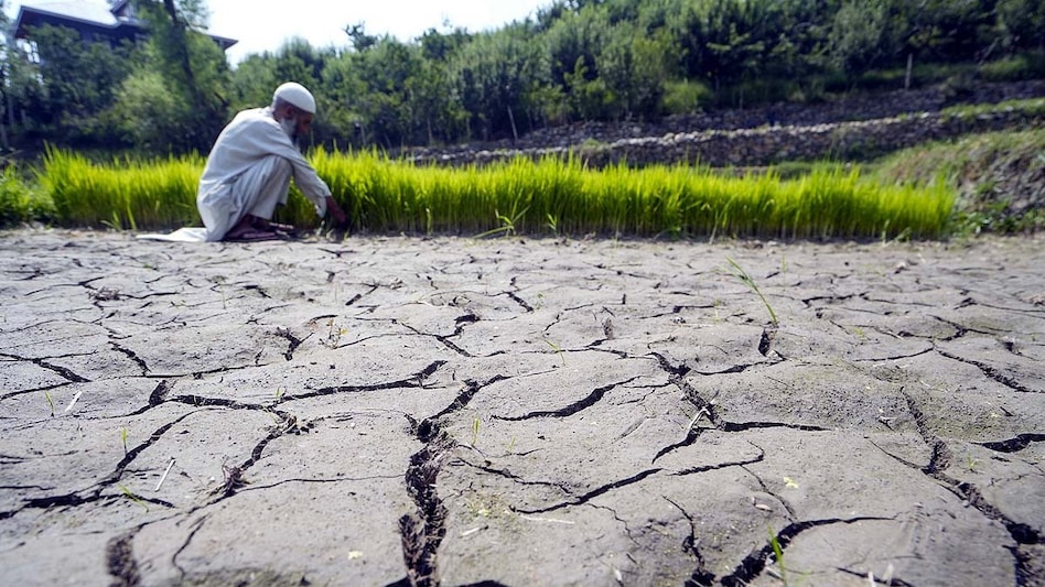
Fourth Weakest Monsoon Since 2001 Season: 80% of Harvest Destroyed in Maharashtra Due to Lack of Rainfall
Read more
Aaj Tak
www.aajtak.in

Fourth Weakest Monsoon Since 2001 Season: 80% of Harvest Destroyed in Maharashtra Due to Lack of Rainfall

Due to the strong El Niño phenomenon, the monsoon in India this year proved weak. Between June and September, the country received 12.6% less than the normal amount of rainfall. During this period, 759.4 millimeters of rain were recorded against a normal of 868.6 millimeters. Consequently, the 2026 monsoon became the fourth weakest since 2001. The lack of precipitation significantly impacted agriculture and water resources.

The situation is particularly severe in the Marathwada region of Maharashtra. According to a report prepared by local correspondents of Amar Ujala, about 80% of crops perished here, and only about 12% of the water remained in several reservoirs.

The history of this monsoon is related not only to the overall decrease in rainfall but also to when and where it fell. In June, rains were very sparse, and the number of low-pressure atmospheric systems was also low. This prevented the monsoon from gaining sufficient strength in many areas. Later, some low-pressure systems formed in the Bay of Bengal, causing rains in some places. Odisha was a prime example of such a phenomenon, where record rainfall was observed thanks to these systems.

The start of the monsoon season was weak. In June, the entire country received approximately 35% less than the normal amount of rainfall. In many states, rainfall was significantly below expectations. Partially, this was due to insufficient formation of low-pressure systems in the Bay of Bengal. These systems are critically important for the monsoon as they carry moisture from the sea to the interior regions of the country. When there are fewer such systems, rainfall weakens in several regions.

In July, the rainfall situation slightly improved: the country received approximately 1% more than the normal amount. This partially compensated for the initial monsoon deficit. However, in August and September, rains became rare again, which reflected in the overall figures for the entire monsoon season.

Overall, between June and September, the country received 759.4 millimeters of rain against a normal of 868.6 millimeters, indicating a deficit of about 109 millimeters. This is why the 2026 monsoon is recognized as the fourth weakest after 2001.

Although a weakening of the monsoon was anticipated due to El Niño, the low-pressure systems that formed during the season helped mitigate the rainfall deficit in certain regions. Low-pressure systems forming in the Bay of Bengal move into the eastern and central parts of India, ensuring good rainfall in many states. This year, after the formation of such systems, rainfall increased in some areas.

Odisha became the most obvious exception. Thanks to numerous low-pressure systems in the Bay of Bengal, Odisha experienced heavy rains, including record precipitation in some places. This showed that the impact of El Niño was not uniform across the country; while some areas experienced a deficit, other states saw heavy rains due to weather systems.

During the four months of the monsoon, several states experienced a rainfall deficit compared to the norm. Drought continued in some areas. This directly affected the Kharif early harvest crops. Where rains did not arrive on time, soil moisture decreased, negatively affecting the growth of crops such as soy, cotton, and arhar. The prolonged absence of rainfall led to the wilting of crops in several places.

The most serious consequences are felt in Marathwada, Maharashtra. Due to the prolonged rainfall deficit, standing crops suffered significant damage.

In districts such as Latur, Bid, Parbhani, and Dharashiv, the situation is extremely difficult. Between June and September, the normal rainfall expected in these areas was 679.5 millimeters, but only 424.5 millimeters were actually recorded. The lack of rain directly damaged the fields: soy turned yellowish, cotton growth stopped, and arhar began to dry up. Sugarcane harvest was also affected.

In these areas, about 80% of the crops were destroyed. Farmers invested money in seeds, fertilizers, labor, and other necessities for growing the harvest. Now that the crop has died, most of their income is lost. Furthermore, there is a problem with clearing the dead crop from the fields, which will require additional expenses.

Farmer Ram Bellade from Savargaon Gokde in Latur planted eight acres of soy, arhar, and jowar. About one and a half lakh rupees were spent on this planting. Since the crop died, it is now necessary to remove the dry plants from the field to prepare the land for the next season. Reports indicate that this may cost up to five thousand rupees per acre. Sugarcane is also drying up in many places. The cane, which usually reaches a height of 20–25 feet, reached only 10–12 feet this year before starting to wilt.

The lack of rainfall affected not only the crops but also reservoirs and other water sources. The water level in Latur...

2
Similar stories

India received less than the average annual rainfall during the 2026 Southwest Monsoon
Read more
timesofindia.indiatimes.com

India received less than the average annual rainfall during the 2026 Southwest Monsoon

According to data from the India Meteorological Department (IMD), during June-September of this year, India received 87.4 percent of its Long Period Average (LPA) rainfall, making this monsoon the fourth lowest since 2001.

The country recorded 759.4 mm of rainfall against a normal seasonal average of 868.6 mm, indicating a deficit of approximately 13 percent for the period from June 1 to September 30. IMD reported this on Wednesday.

Seasonal rainfall was characterized by uneven distribution across various regions of the country; despite heavy rains at the end of the monsoon period, many areas registered significant deficits.

A senior IMD official told Reuters that India received 12.6 percent less rainfall than the average for June-September, with the El Niño weather pattern contributing to the weakening of precipitation. The meteorological department forecasts that India is likely to receive below-normal rainfall in October, and most regions are expected to see below-average rainfall from October to December.

The LPA used by IMD denotes the average amount of rainfall recorded in a specific region over a set period, calculated based on a long-term period, usually spanning 30 to 50 years. The 2026 monsoon was the first deficit season since 2015. IMD classifies seasonal rainfall as deficient if it is 10 percent or more below the LPA.

The monsoon started with a rapid advance after reaching Kerala on June 4, which was three days later than usual, but then stalled for almost two weeks before reaching North-West India in the first week of July. In June, the country faced a rainfall deficit of over 35 percent, the highest figure in 12 years.

Rainfall activity increased in subsequent months due to the formation of several low-atmospheric systems over the Bay of Bengal, which moved inland. Four such systems formed in July, six in August, and three in September, including a deep depression that moved along the coast from North Andhra to South Odisha on September 23-24. These systems helped ensure a substantial amount of rainfall in central and eastern parts of India, thereby reducing the overall seasonal deficit.

However, the impact of this deficit varied greatly depending on the region. Odisha recorded the wettest monsoon in the last 20 years, while the Eastern and Northeastern region approached the driest monsoon since data collection began in 1901. South India experienced a rainfall deficit exceeding 23 percent, making it the driest Southwest Monsoon since 2002. Western Rajasthan recorded a deficit of 31 percent, and rainfall in Punjab was 42 percent below normal.

IMD's final assessment was made after a late storm of heavy rains reduced the country's overall deficit, but the June-September season still concluded significantly below the long-term average.

Deep depression in the Bay of Bengal leads to low pressure over Madhya Pradesh and unusual weather in Pakistan
Read more
www.aajtak.in

Deep depression in the Bay of Bengal leads to low pressure over Madhya Pradesh and unusual weather in Pakistan

In September, the weakening of the southwest monsoon and a gradual decrease in rainfall are traditionally expected in India. However, in 2026, during the last weeks of September, many regions of the country have experienced heavy rains, floods, and landslides in mountainous areas.

Simultaneously, rains are occurring from Bihar to Uttar Pradesh, floods in Odisha, snowfall and landslides in Uttarakhand, avalanches in Nepal, which has disrupted the Char Dham pilgrimage. The question arises whether this is related to El Niño or to the formation of a low-pressure area after a deep depression formed in the Bay of Bengal, which attracted a western atmospheric wave.

The immediate cause of these rains is a meteorological system that formed in the Bay of Bengal. In the third week of September, a low-pressure area formed in the bay, which gradually transformed into a depression and then into a deep depression. This system reached the land near the coasts of Andhra Pradesh and Odisha around September 23-24.

Afterward, it moved in a northwest direction, weakening in the areas of Madhya Pradesh and Uttar Pradesh. According to meteorological service data, despite the weakening, this system continued to bring moist air. Due to its remaining strength, a low-pressure area formed over the northern and central parts of Uttar Pradesh.

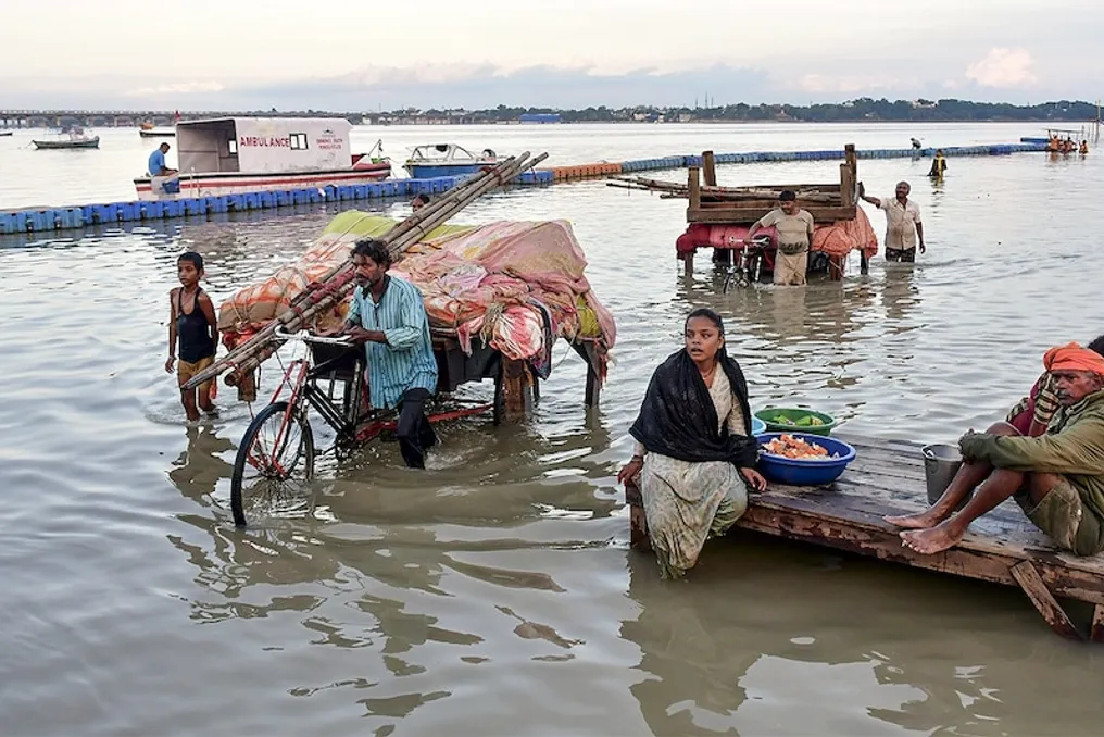
When a deep depression reaches land, it attracts surrounding air masses. As a result, moisture from the Bay of Bengal moved northward, causing heavy rains in Eastern and Central India. In Odisha, rivers rose to critical levels, creating a situation similar to flooding. Anomalously heavy precipitation was also recorded in Bihar and Uttar Pradesh.

El Niño plays a significant role in this entire situation. In 2026, the equatorial Pacific Ocean remains in a state ranging from strong to very strong El Niño. Typically, El Niño weakens the Indian monsoon by altering atmospheric circulation and reducing monsoon humidity.

This year, the total rainfall across the country was approximately 15 percent less than normal, leading to arid conditions in several places. However, El Niño does not always have a uniform impact. Systems such as deep depressions in the Bay of Bengal can locally increase humidity.

Several depressions formed in the bay this year, bringing some relief to Eastern and Central India. Thus, while El Niño reduced the overall volume of precipitation, local weather systems suddenly caused heavy rains at the end of September. This is why intense precipitation is still observed in some areas during the monsoon withdrawal period.

Another important reason for the rains in North India is the western atmospheric wave. Western air systems coming from the Mediterranean through Pakistan are active in winter but sometimes activate in September-October.

During this period, there was an interaction between the low-pressure area that came from the Bay of Bengal and the western atmospheric wave. The low-pressure area drew moist air northward, while the western atmospheric wave provided cold air at upper levels. Their combined effect made the atmosphere unstable, leading to heavy rains and snowfall in mountainous regions.

Landslides and snowfall in Uttarakhand occurred precisely because of this. The Char Dham pilgrimage routes were disrupted due to road damage from heavy rains and landslides. Heavy rains also affected Nepal under the influence of this system, leading to an avalanche near the base camp of Himalung Himwal. Flooding in Odisha occurred due to rising river levels, and thousands of people were evacuated to safe places. Fields were flooded in Bihar and Uttar Pradesh, damaging crops in several areas. Landslides and snowfall in Uttarakhand impacted tourism and religious travel.

It is predicted that rains may also occur in the Delhi-NCR, Punjab, Haryana, Rajasthan, and Chandigarh regions from September 28 to 30 under the influence of the western atmospheric wave. These rains may be more intense than usual due to existing moisture.

According to the meteorological service, rain is possible in northwestern India from September 28 to 30 under the influence of the western atmospheric wave. The risk of landslides and flash floods remains high in mountainous areas. It is likely that the strong El Niño condition will persist in the coming months, which may affect the winter season.

From a scientific perspective, the main reason for the anomalous rains in September lies in the deep depression of the Bay of Bengal and the subsequent low-pressure area, which, combined with the western atmospheric wave, increased humidity. El Niño weakened the monsoon, but local systems remained active.

Due to climate change, such phenomena are becoming increasingly unpredictable and intense. The public should pay attention to meteorological service warnings and exercise extra caution in mountainous areas.

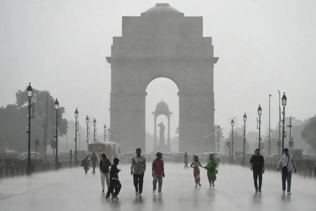
Despite poor monsoon in the region, Delhi received excess rainfall due to the change in trajectory of low-atmospheric systems
Read more
timesofindia.indiatimes.com

Despite poor monsoon in the region, Delhi received excess rainfall due to the change in trajectory of low-atmospheric systems

The capital of India, New Delhi, demonstrated unexpected success in the current monsoon. As of September 16, the Haryana meteorological division recorded an 8% surplus of seasonal rainfall, while neighboring districts experienced a deficit of 23%. The wider northwestern region of India showed a deficit of 10%. This unusual pattern of precipitation suggests that the intensification of El Niño and climate change may have contributed to the capital receiving unexpected moisture abundance.

A map of district rainfall across the region shows that Delhi is on the border of a good monsoon zone this year. Directly north of the capital lies a band of districts with insufficient rainfall, starting with neighboring Sonipat (-32%), Rohtak (-47%), and extending to Hoshiarpur (-53%) and Kapurthala (-69%) in Punjab. This zone includes over 30 districts of Haryana, Punjab, as well as adjacent Rajasthan, Himachal Pradesh, and western Uttar Pradesh.

The reason why Delhi became a wet spot next to a drought-stricken area is explained by the shift in the direction of low-pressure systems arriving from the Bay of Bengal this season, likely influenced by El Niño. Furthermore, the unique interaction of these systems with western disturbances has provided significant assistance in the rainfall in Delhi-NCR.

Most of the monsoon rainfall in central and northwestern India occurs under the influence of moisture-laden low-pressure systems, including depressions, which move inland from the Bay of Bengal. However, contrary to expectations, the number of such systems does not decrease in El Niño years. According to a study published in Climate Dynamics in 2024, the number of Bay of Bengal depressions increased during El Niño years between 1979 and 2020, averaging 3.9 during July-August compared to 2.4 in normal years.

This year, 10 low-pressure systems were recorded, including four depressions in July-August, exceeding the norm of less than nine. What usually changes in El Niño years is the direction of movement of these low-pressure systems. IMD Director-General Mrutinjai Mohapatra noted: 'In El Niño years, there is a downward air movement over South India and its adjacent northern parts. This hinders the formation of low-pressure systems in southern latitudes, such as in the central part of the Bay of Bengal, which usually head towards the Andhra Pradesh-Odisha coast in the south.'

This is where Delhi benefited, especially in August, when up to six low-pressure systems affected India, including two depressions. Due to the northward shift, most of these systems penetrated deep into the territory through northern Odisha and Bengal, moving north-northwest, affecting Odisha, Bengal, Jharkhand, Uttar Pradesh, Uttarakhand, and the Delhi region, while the impact on Rajasthan, Haryana, and Punjab was smaller.

Another factor, likely related to climate change, also played a role. Western Disturbances (WDs) are moist wind systems moving eastward from the Mediterranean region that traditionally bring rainy weather to North India in winter and early spring. Historically, WDs are rare during the monsoon period because the jet stream causing these disturbances usually migrates north of the Himalayas by April-May. However, in recent years, the jet stream has consistently delayed its retreat, which scientists attribute to global warming. This year, from June to August, 16 WDs were recorded—eight only in August, according to IMD.

There were several instances of interaction between the eastern monsoon system and WDs, which intensified rainfall in parts of North India, including Delhi. For example, the onset of the monsoon over the capital on July 2 occurred during an active period of WDs. The heaviest rains in Delhi (July 8-9, July 29, August 7-8, August 25) happened when both the monsoon system and WDs were active simultaneously. These interactions also caused heavy rains in western Uttar Pradesh and left a catastrophic mark in the mountains—the landslide at Bandipora (Jammu and Kashmir), deadly flash floods in Chamba (Himachal Pradesh), and the forced closure of about 290 roads in Himachal Pradesh and Uttarakhand; however, they apparently did not have a significant impact on Haryana and Punjab.

Popular