Bleeding Glacier Blood Falls in Antarctica: A Scientific Explanation of the Red Color
Read more
Getaway
getaway.co.za

Bleeding Glacier Blood Falls in Antarctica: A Scientific Explanation of the Red Color

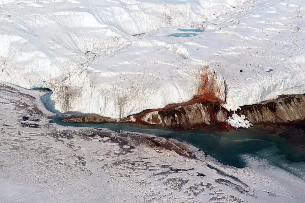
There are places on Earth that seem almost unreal. One such place is Blood Falls, which flows from Taylor Glacier in the McMurdo Dry Valleys of Antarctica. Against the backdrop of white ice and bare rocks, a deep crimson stream emerges from the glacier, coloring the ice as it moves toward Lake Bonney. This creates the impression that the glacier itself is wounded.

However, the reality is no less fascinating. The red hue is caused by iron-containing, hypersaline water trapped beneath Taylor Glacier. When the brine reaches the surface and contacts oxygen, the iron oxidizes, forming the characteristic rusty-red color that gave Blood Falls its name.

But the color is only the beginning of the story. Blood Falls was first documented during the Terra Nova Expedition in 1911, when Australian geologist Thomas Griffith Taylor explored the glacier, which was subsequently named after him.

For decades, scientists knew about the link between the color and iron, but the source of the water remained a mystery. Subsequent research revealed an extensive system of hypersaline brine beneath the glacier. Unlike regular water, this brine can remain liquid even at temperatures significantly below freezing due to its extremely high salt concentration.

Radar surveys have shown that the brine extends beneath the glacier, indicating that Blood Falls is not just a superficial trickle, but the outlet of a much larger hidden hydrological system. As the oxygen-poor brine exits the glacier, the dissolved iron begins to oxidize. Scientists have also discovered tiny iron-containing nanoparticles in the water, which helps explain the intense color visible at the edge of the glacier. Thus, what looks like blood is essentially an unusual experiment in natural chemistry unfolding in the Antarctic landscape.

Even stranger is what lies beneath the glacier. Scientists have discovered microbial communities living in the brine despite the absence of sunlight. Some microorganisms derive energy not through photosynthesis, but through chemical reactions involving compounds such as iron and sulfur.

It also seems that the brine has a more ancient history. Chemistry and microbial communities point to a connection with seawater that entered Taylor Valley during a warmer period in the past of Antarctica. As the climate cooled and the glacier advanced, part of this salty water became isolated under the ice, where freezing further concentrated its salts.

This means that the strange red flow seen today may be linked to a marine environment that existed long before the landscape turned into the frozen desert we know. New research published in 2026 added another layer of mystery. Scientists studying samples from the McMurdo Dry Valleys found marine microorganisms around the mouth of Taylor Glacier, including groups such as diatoms and dinoflagellates. Some of these showed signs of biological activity, supporting the idea of preserved marine influence in this isolated environment.

This is why Blood Falls intrigues scientists far beyond Antarctica. The environment beneath the glacier provides a rare natural laboratory for studying how life can survive in extreme cold, high salinity, and darkness. It may also help researchers understand what life could look like in similar harsh conditions elsewhere in the Solar System, where liquid water might exist beneath layers of ice.

Blood Falls can easily be dismissed as a strange photographic curiosity. One image is enough to stop scrolling: a glacier in one of the most inhospitable places on Earth seemingly bleeding into the snow. But if you look closer, the story becomes much more remarkable. Beneath the ice lies a system of ancient, salty water. Within it, microorganisms survive without sunlight. On the surface, iron reacts with oxygen and transforms an ordinary runoff into one of Antarctica's most surreal natural spectacles.
Similar stories

Investigation of the Mysterious Underwater Cave System Wondergat in the North West
Read more
getaway.co.za

Investigation of the Mysterious Underwater Cave System Wondergat in the North West

A dark freshwater body has unexpectedly opened up in the North West region. From the surface, Wondergat appears deceptively calm, but beneath it lies a complex network of underwater caves and rock formations descending into darkness.

This massive sinkhole, located approximately 30 km from Mahikeng and 60 km from Lichtenburg, was formed by the dissolution of surrounding dolomite by groundwater, which ultimately led to the collapse of an underground cave. Currently, the oval opening measures about 75 m by 100 m and reaches a depth of approximately 58 m.

The name, which roughly translates from Afrikaans as 'wonderful opening,' seems fitting when one realizes how much of Wondergat is submerged. Wondergat is considered one of the known freshwater diving spots in South Africa, but this location is not intended for casual visitors.

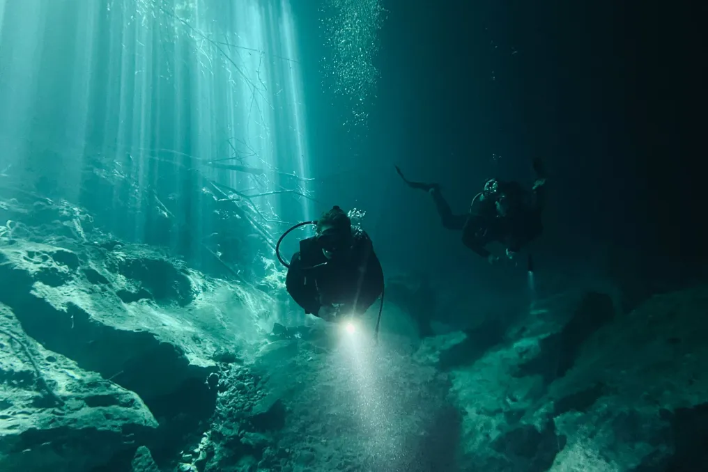
Divers descend through clear freshwater past steep rock walls before reaching a series of underwater spaces, including the northern and southern caves, the overhang, and the Leopard Cave. A chambered cave is located deeper within the system. Experienced divers use guide ropes and marked nets for navigation in the caves.

Conditions can be demanding: water temperature usually ranges from 14°C to 21°C, and visibility depends on conditions and depth. The site is used by advanced, technical, and instructor divers, necessitating appropriate training and equipment.

Historically, Wondergat has been recorded at depths exceeding 70 m, although the current maximum depth is around 58 m. Over time, it is gradually becoming shallower due to natural processes. In this underwater world, the landscape changes its character: sunlight fades, walls narrow, and the usual perception of a lake gives way to something much more subterranean.

Geological features are part of Wondergat's charm. The dolomite that formed the sinkhole remains underwater, creating caves and passages that divers explore. Furthermore, underwater stromatolites have been discovered at this site, adding another layer to the already unusual geological landscape.

Natural fauna is also present. Among the freshwater species recorded in Wondergat, one can find knifefish and southern mouth bass, with striped tilapia being particularly associated with this location.

However, the rocks attract attention. Wondergat resembles an entrance to a watery geological world more than a dive into a lake. It is important to note that the underwater environment of Wondergat has claimed the lives of divers, and memorial stones have been placed beneath the surface in memory of those who died. The site has also been used for specialized and technical diving training, including by the South African Police Service Special Operations Tactical Group.

This story serves as a reminder that Wondergat is not a tourist attraction to be visited without proper preparation. Divers must possess the requisite qualifications, experience, and equipment, and the site is recommended for group dives rather than solo ones.

For those staying overnight, campsites, barbecue areas, sanitary facilities, and electricity are available, allowing one to spend a night by the water before returning to the surrounding landscape.

There is something captivating about a place whose main feature is invisible from the surface. In Wondergat, a quiet body of water conceals shafts, caves, and rock formations shaped over geological time. For experienced divers, diving here means entering a landscape few see. For everyone else, a simple observation from the edge provides insight into the strange connection between water, rock, and time.

New WHO report shows glacier retreat and river shrinkage worldwide
Read more
cgtn.com

New WHO report shows glacier retreat and river shrinkage worldwide

According to a report published on Thursday by the World Meteorological Organization (WMO), rivers worldwide experienced one of the driest periods in over three decades in 2025.

WMO Secretary-General Celeste Saulo noted that the planet's water reserves previously served as a kind of 'savings account' that could compensate for episodic droughts, but this reserve is now depleting.

The report, 'State of Global Water Resources,' demonstrates that the water cycle on Earth is becoming increasingly unpredictable, fluctuating between severe deficit and surplus. Over the last seven years, the number of rivers with 'normal' flow has been the lowest since 1991.

For the seventh consecutive year, basins with 'normal' conditions were an exception, accounting for only 34% to 38%, which is significantly lower than the average of 46% during the period from 1991 to 2020.

Total terrestrial water resources—including groundwater, lakes, rivers, soil moisture, vegetation, ice, and snow—have been declining since the mid-2010s. The report warns of a continued long-term reduction in freshwater reserves and glacier retreat, which poses serious consequences for the planet, its population, and its economy.

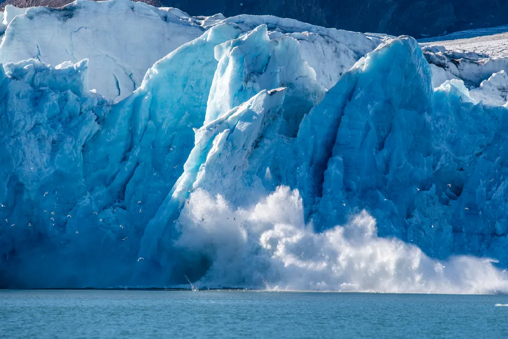
2025 marked the fourth consecutive year of mass glacier loss, creating short-term threats such as floods and a long-term problem of water insecurity. Between 2023 and 2025, glaciers lost mass annually, reaching a cumulative loss of 1400 gigatons of water—approximately one-third of the world's annual freshwater withdrawals.

Ice loss affected all 19 glacial regions, including Central Asia, Iceland, Russian Arctic, Western Canada, and the United States. Wayne Jenkinson, WMO Director for Hydrology and Cryosphere, stated at the conference that it was 'one of the three worst years in observation history.'

Over the past five years, national meteorological and hydrological services have recorded record floods and droughts. It is noted that in some areas there was no time for recovery between these events.

Celeste Saulo emphasized that water recognizes no borders, as the water balance of a basin depends on events in other countries, and the melting of a glacier in one country changes water availability for populations hundreds of kilometers downstream. This is why the WMO must ensure data exchange, standards, and early warning systems.

Popular