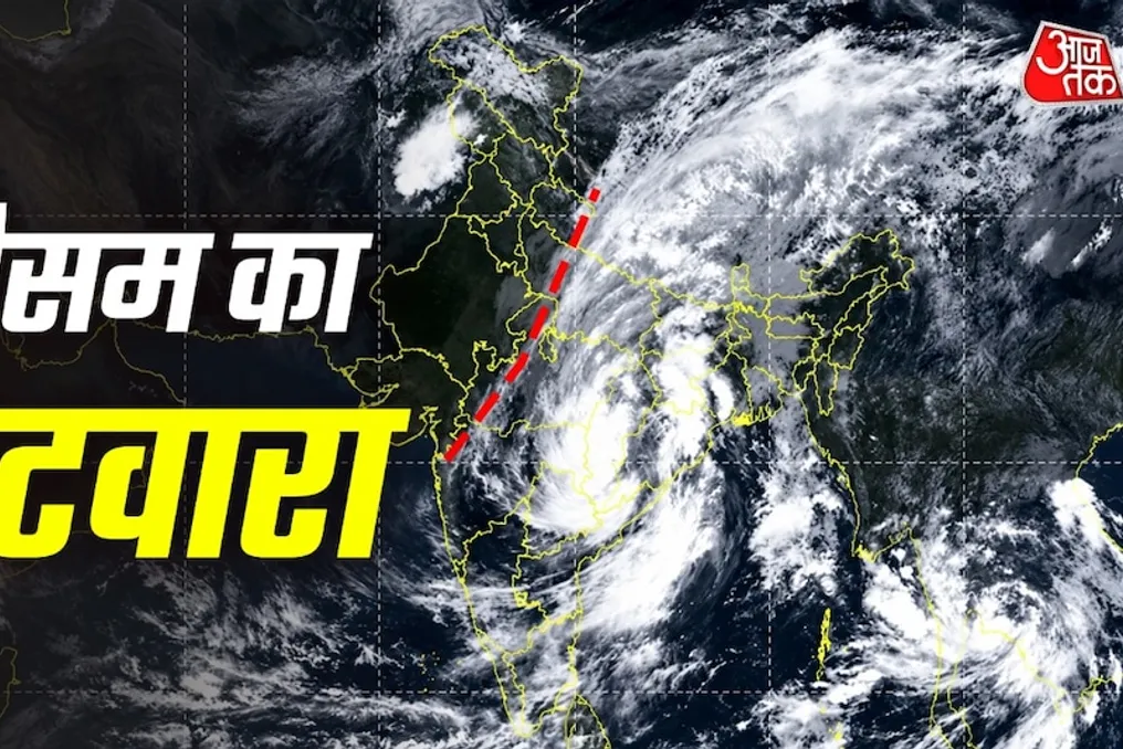
Currently, Indian weather exhibits a clear contrast: dense clouds hang over the central, eastern, and southern parts of the country, while the sky in the northwestern part remains clear. This image was taken by the INSAT-3DS satellite on September 24th. It clearly shows an extensive cloud mass stretching across the Indian subcontinent, as well as parts of Southeast Asia and South Asia.
This contrast corresponds to the weakening of a deep depression. As the depression weakens, its moisture and clouds concentrate in one direction, while another area remains open. The satellite image vividly captures this uneven distribution.
In the INSAT-3DS thermal channel, the brightest areas indicate cold and high clouds, which is potentially linked to heavy rainfall, especially if an active weather complex is associated with them. Large areas of central, eastern, and southern India appear bright in the image, indicating the presence of high and thick clouds capable of bringing rain. Meanwhile, northwestern India appears relatively dark or clear, meaning less or no cloud cover.
Such images are extremely useful for meteorologists as they allow them to immediately identify areas prone to rain and arid zones. A recent deep depression affected coastal areas and is now weakening. The moisture and energy of the weakening system are not distributed evenly across the country but often concentrate in a specific band.
For this reason, clouds are visible over Central India, the East, and the South, while clear skies persist in northwestern states such as Rajasthan, Punjab, and Haryana. This division directly affects people's daily lives. In areas with dense clouds, there is a risk of heavy rains, flooding, or localized inundation. At the same time, in areas with clear skies, temperatures may rise and humidity may feel lower.
Satellite system networks like INSAT-3DS serve as the 'eyes' for the meteorological service. Ground observatories provide information only about a limited area, whereas the satellite provides a map of the entire country simultaneously. Thermal images work even at night because they show cloud height based on temperature, making forecasts more accurate. Scientists also analyze such images to understand the direction and intensity of the weather system's movement. During the weakening of a deep depression, this monitoring is crucial to rule out sudden reactivation or the development of a new system. Cloud areas extending into neighboring countries also provide insight into regional weather patterns.
People in areas with dense clouds should pay attention to official weather warnings, and residents of low-lying areas need to be vigilant. At the same time, people working outdoors in the clear northwestern regions should take care to protect themselves from the sun. This dramatic split highlights the diversity and complexity of weather in India. The simultaneous presence of rain in one part and dry weather in another is common, but the satellite image demonstrates this on a scale that is easily understandable even to the average person.
The meteorological service continues constant monitoring and will issue recommendations according to the development of the situation. Overall, this INSAT-3DS image is not only scientifically significant but also serves as a simple way for the public to understand weather unevenness. This division, related to the weakening of the depression, may persist for the next few days, so residents of all regions should follow local forecasts.