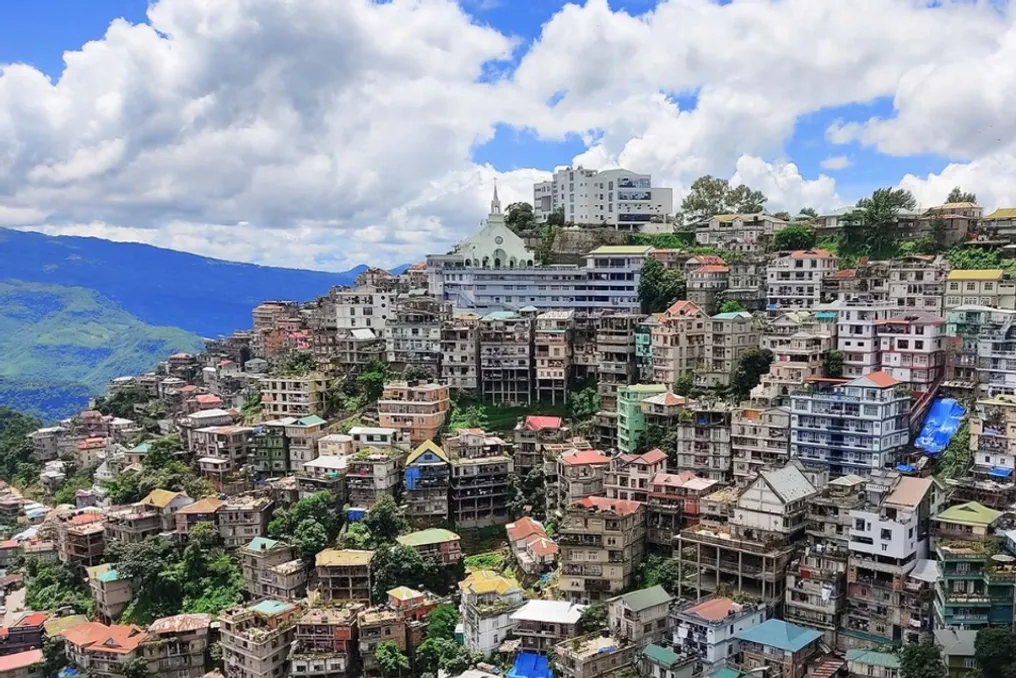
The latest WHO air quality database recorded the lowest annual PM2.5 levels among settlements in the Indian cities of Lunglei and Tura. Furthermore, four out of the five lowest readings were registered in the states of Meghalaya and Mizoram.
Discussions about air pollution in India often focus on large cities struggling with high levels of particulate matter. However, the country's air quality map looks different outside its largest industrial and urban centers.
The WHO Air Quality Database, version 8.0, published in June 2026, contains measurements of ground-level PM2.5, PM10, and nitrogen dioxide from 8023 settlements across 127 countries and territories. This data covers measurements collected between 2010 and 2024.
Analysis of Indian records in this database showed five locations with the lowest recorded annual average concentrations of PM2.5: Lunglei in Mizoram, Tura and Nongstoin in Meghalaya, Dawki in Meghalaya, and Kolasib in Mizoram. Their recorded annual PM2.5 concentrations range from 6 to 8 micrograms per cubic meter.
It is important to note that these places are not those officially recognized by the WHO as the cleanest in India. All five measurements are from 2021, so they cannot be considered current air quality indicators for 2026. Additionally, the WHO warns that its database is not exhaustive, and monitoring coverage and measurement methods vary in different locations.
Details of the Five Locations
Lunglei, Mizoram
With the lowest reading at 6 micrograms per cubic meter, Lunglei ranks first in the Indian dataset. This city is located in the southern part of Mizoram and serves as the administrative center of the Lunglei district. The district administration describes the city as the second-largest settlement in the state and is situated in the south-central part of Mizoram, at an altitude of approximately 1222 meters. The district also shares an international border with Bangladesh.
Tura, Meghalaya
The city of Tura, which is the administrative center of the West Garo Hills district in Meghalaya, also recorded a level of 6 µg/m³. It is located at the foot of the Tura range and surrounded by the hilly landscape of the Garo Hills. The West Garo Hills district administration defines Tura as the district administrative center and the second-largest city in the state after Shillong. Tura's relatively small urban development differs significantly from India's largest metropolises, where dense traffic, construction, and industrial activity can contribute to particulate pollution.
Nongstoin, Meghalaya
Further east, Nongstoin, the administrative center of the West Khasi Hills district, recorded an annual PM2.5 concentration of 7 micrograms per cubic meter in 2021. Nongstoin is situated in the predominantly hilly western landscape of Meghalaya. The Meghalaya government designates Nongstoin as the administrative center of the West Khasi Hills.
Dawki, Meghalaya
The fourth lowest reading was recorded in Dawki, where 8 micrograms per cubic meter was measured. Dawki is located in the West Jaintia Hills of Meghalaya, near the international border with Bangladesh. The Indian Ground Ports Authority describes Dawki as a border location associated with Bangladesh and is located approximately 84 km from Shillong. This place is better known to travelers for the Umngot River and the border landscape than as a major urban center, which once again highlights that the WHO database includes settlements of varying sizes, not just large cities.
Kolasib, Mizoram
The fifth location is Kolasib in Mizoram, which also recorded 8 micrograms per cubic meter. Kolasib is located at the northern end of Mizoram, bordering Assam to the north. The district administration designates Kolasib as the administrative center. Thus, Lunglei and Kolasib mean that two of the five lowest readings in the WHO database came from Mizoram.
What Does a PM2.5 Reading of 6 or 8 Mean?
PM2.5 refers to fine particulate matter with a diameter of 2.5 micrometers or less. These particles can originate from various sources, including the burning of fossil fuels and other human activities. The WHO database uses ground-level measurements designed to reflect the air quality in a city or village, rather than simply reporting readings from a single monitoring station.
Why Are Four Out of Five Locations in Northeast India?
The geography is noteworthy: four out of five locations are situated in Meghalaya or Mizoram. These are predominantly hilly regions of Northeast India with smaller urban centers compared to India's major mega-regions. For instance, Tura is located at the foot of the Garo Hills, while Lunglei is in the mountainous landscape of southern Mizoram.
However, WHO data alone is insufficient to claim that hills, forests, or geography are the cause of the lower readings. Annual PM2.5 concentrations are shaped by numerous factors, including local emissions, transport, industry, fuel use, weather, topography, as well as the scale and location of monitoring. A low annual average does not mean that pollution is absent throughout the year; short-term pollution episodes can still occur even in areas with relatively low annual concentrations.