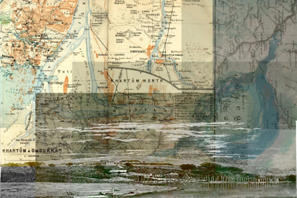
The violence exercised during the colonial period in African cities transcended political spheres, infiltrating deeply into spatial organization. This influence can be observed in urban patterns, land ownership systems, drainage infrastructure, and residential zones, perpetuating inequality and forcing displacement to this day. Cities such as Kinshasa, Khartoum, and Kampala manifest this heritage in their urban morphology, acting both as historical records and as active structures that define access to services and occupation of flood-prone areas, catalyzing climatic instabilities that are now reaching geological dimensions.
Kinshasa: Extraction inscribed in the urban layout
Kinshasa illustrates this dynamic. The capital of Congo was born from a colonial project marked by extreme violence, to the point where the atrocities committed by Leopold II in the 'Free' State of Congo were described as 'crimes against humanity.' The built environments function as living archives of extractivism. In Lubumbashi, for example, colonial complexes were conceived in 1910 to serve as a mining hub for the Union Minière du Haut Katanga. Furthermore, the Matadi-Kinshasa Railway, in Lower Congo, was built to function as a corporate channel, not as a public link between Congolese communities.
Kinshasa, known as Kin la belle, is an extensive and highly urbanized metropolis, characterized in modern African urbanism by its rapid growth and high density. Analyzed as an urban palimpsest, as done by Lagae in his work Tales of the Tangible City, it reveals itself as a city in constant mutation, expanding from an initial settlement established in 1883, which was small and controlled by the colony.
The development of Kinshasa occurred around pre-existing communities in the Malebo Pool, centuries before the nineteenth century. The river already organized the exchanges and circulations of the Teke, Humbu, and other peoples. However, in 1881, Stanley took possession of this landscape in the name of Leopold II, founding Léopoldville (Léopoldville-Ouest) near Ngaliema. The original village of Kinshasa became a second post in 1883 (Léo-Est). The result was a small colonial outpost, focused on administrative and extractive infrastructure, and not on internal integration, encompassing the Matadi-Kinshasa railway (then, Matadi-Léopoldville).
With the expansion of Léopoldville in the 1910s, the urban logic became spatially clear. Administration and commerce occupied the 'center' (functional, not positional), while European residential areas (ville européenne) were segregated from native neighborhoods with orthogonal layouts (cités indigènes) to the south, across the monumental east-west axis of Avenue Albert I (now Boulevard du 30-Juin). Neutral zones, such as the former Parc de Bock and the sanitary cordon, established spatial boundaries that marked a drastic drop in environmental quality between racially separated areas. Colonial planning neglected drainage in favor of subdivision; the first cités had simple roads but no sewage system, relying on dry latrines still used today. With increasing density, poor drainage, combined with the flat and floodable terrain of northern Kinshasa and the slopes of the southwest, caused frequent floods, erosion, and landslides.
In 1923, Léopoldville became the capital of Belgian Congo, expanding to Kalina (present-day Gombe) and eventually merging with Kinshasa to form the capital city, renamed Kinshasa in 1966. In the 1950s, population growth skyrocketed, exceeding the capacity of development plans. Neighborhoods such as Kasa-Vubu, Ngiri-Ngiri, Bandalungwa, Matete, Lembe, and Ndjili emerged with single-story houses alongside two-story buildings, while the center acquired modernist and tropical-modernist architecture for offices, hotels, and commerce, along the main axes (former Avenue Royale and Avenue Albert I, now Avenue des héros nationaux and Boulevard du 30-Juin), including buildings such as the Banque Commerciale du Congo and the Institut national de la sécurité sociale, alongside colonial bungalows and 'regionalist' style villas.
The inherited colonial structure continues to influence mobility, inequality, and access to services in the post-independence period, even with the addition of dimensions by state institutions, customary practices, and self-construction that dismantle segregationist barriers. Employment and infrastructure remain concentrated, while housing expands into a vast periphery in a 'spatial explosion,' causing congestion and long commutes. Added to this is vulnerability to erosion, flooding, and the precariousness of drainage, sewage, and water supply networks, making limited access to potable water a daily routine for a large part of the population.
Khartoum: A city built to monitor its own population
Although seemingly distinct, Khartoum, in Sudan, shares intrinsic similarities with Kinshasa. Its formation occurred under Kitchener in 1898, after the reconquest, following an orthogonal layout inspired by the British Union Jack, conceived for military and administrative control based on hypervisibility. The wide streets (even wider than adjacent plots), large squares, pronounced diagonal avenues, and converging strategic axes provided the imperial capital with unobstructed lines of sight, allowing state artillery a free field of fire in case of anti-colonial uprisings. This mapping also facilitated racial and class segregation, echoing the sanitary cordon of physically isolated concessions in Congo.
The colonial land use zoning classified the population into three hierarchical categories: European, Egyptian, and a third class designated for the 'natives'—nicknamed Khartoum 3, where the former Deims resided. Similar to the indigenous cités, Sudanese housing regulations managed settlements according to labor needs while restricting population growth within Khartoum. Another form of segregation was the allocation of European and Sudanese populations in distinct urban zones on opposite sides, justified by supposed racial differences in adaptation to the tropical climate and the alleged need to protect Europeans from 'diseases,' ensuring them access to prevailing winds and gardens, given the belief at the time that the Sudanese population tolerated overcrowding and lack of ventilation. This socio-spatial distinction in housing, plot size, density, and standard of living persists to this day, although it is now more linked to class and socioeconomic status.
The cities of Khartoum, Omdurman, and North Khartoum, known as Bahri, constitute the Greater Khartoum conurbation. Their trajectories and scales vary—Khartoum, where McLean expanded Kitchener's master plan; the organic development of Omdurman under the Mahdist State; and the evolution of Bahri as an industrial hub. All converge on the Blue Nile and White Nile rivers. It is easy to compare with Kinshasa, whose northern and western limits are defined by the Congo River. Similarly, despite Doxiadis and Mefit creating master plans in 1975 to organize Greater Khartoum on a metropolitan scale, accelerated growth systematically surpassed the limits of formal planning, allowing the city to transform into a polycentric and dispersed conurbation.
Christian Norberg-Schulz, in his seminal work Genius Loci: Towards a Phenomenology of Architecture, framed Khartoum's gestalt as a fusion of the desert plain, the river confluence, and the imposed rigid architectural order. In both Kinshasa and Khartoum, colonial agents forcibly imposed a rigorous geometry onto existing landscapes and communities, physically inscribing an orthogonal grid, grandiose avenues, structural segregation, and a hierarchical ordering.
Kampala: A different geometry, the same logic
Kampala, in Uganda, was reorganized by similar mechanisms, although it presents distinct manifestations compared to Kinshasa and Khartoum. Unlike Kinshasa, which was dismantled for exploitation, or Khartoum, which was destroyed in the war of 1885, Kampala developed from the transformation of Buganda's real mobile 'capital'—Kibuga, located on Mengo hill during the reign of Kabaka Mwanga II in 1884, which moved hills with each new kabaka—into a racially segregated city, following the colonial model. A nearby hill, originally an impala hunting ground, became the site of the British Lugard Fort, demolished in 1890.
The Buganda Agreement of 1900 formalized a land tenure system that maintained pre-colonial acquisition lines, allocating Mailo lands to the kabakas and chiefs, while reserving Crown land for the colonial state, creating a dual city. Due to the irregular topography and the presence of wetlands, the urban fabric did not suffer the imposition of a strict geometric layout. However, urban planning institutionalized this division, especially with the completion of the Uganda-Kenya railway, strengthening the colonial core around Old Kampala and consolidating Nakasero as the administrative and colonial center.
The 1912 plan introduced formal urban planning, with utopian visions based on the regulations of the 1903 Town Planning Ordinance—marks that persist in the center, including the current Supreme Court and Constitutional Square. Regulatory milestones such as the 1919 Simpson Plan and the 1930 A. E. Mirams Plan solidified racial zoning. The European population occupied elevated and spacious areas, such as Nakasero and Kololo, separated by green belts, golf courses, and road networks derived from the sanitary 'mosquito theory'; Asian commercial areas developed separately along the Kitante valley in Kamwokya, while local communities were widely excluded and confined to regions with fewer services. Kampala grew from its original hill and surroundings to encompass six other hills (totaling 21 today), with Mengo serving as the center of Buganda and Nakasero as the colonial administrative center.
The fragmentation of land ownership, unequal infrastructure, and land use zones resulted in a divided system that pushed local populations into low floodplains and unplanned flood valleys. In the 1950s, Kendall implemented a new colonial policy of 'inclusion' when planning residential areas in Kampala, Nakawa, and Naguru, but unequal access to housing, services, and mobility remains.
Architecture as exclusion
An editorial by Amira Osman et al., The Urban Ecologies of Divided Cities (2023), points to similar multi-scalar injustices in various regions.