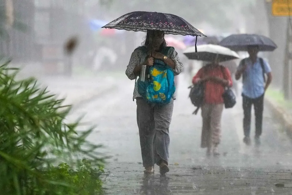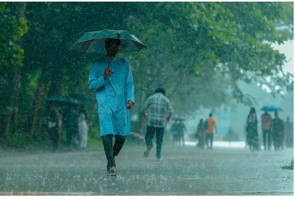
Bengal Bay weather system triggers IMD warnings in several states, including Delhi and Uttar Pradesh
Read more
Aaj Tak
www.aajtak.in

Bengal Bay weather system triggers IMD warnings in several states, including Delhi and Uttar Pradesh

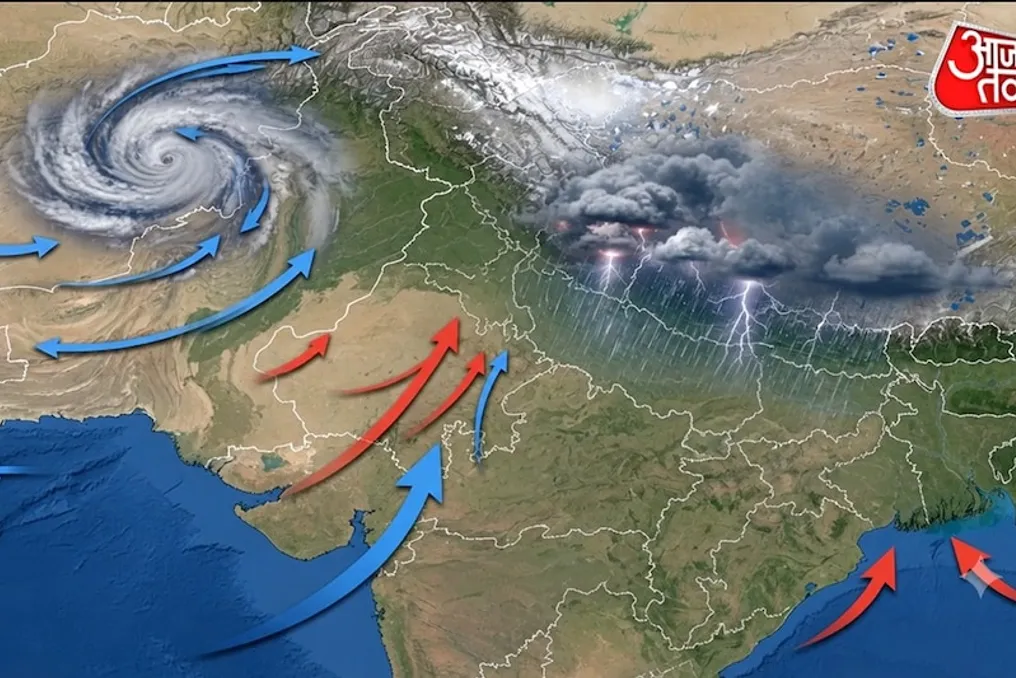
Weather across many parts of the country is preparing for changes. A system formed in the Bay of Bengal is intensifying, and its influence is already being felt in eastern and southern states. It is predicted that this weather system will have the greatest impact on Odisha, where a warning for heavy rainfall has been issued for the next two days.

Meanwhile, clear weather is expected in the Delhi-NCR region on Tuesday, but increased rain and thunderstorms are possible in the latter half of the week. This change will also affect the weather in various parts of Uttar Pradesh.

On Tuesday, September 22, there are no heavy rainfall warnings in Delhi-NCR. According to the IMD update from September 22, there are no warnings for Delhi, Haryana, and Chandigarh from today until September 24. However, the probability of thunderstorms and strong winds is forecasted for September 25–27. Thus, large-scale rains are not expected in Delhi, Noida, Ghaziabad, Gurugram, and Faridabad on Monday, although weather changes are possible by the end of the week.

In Eastern Uttar Pradesh, weather activity may increase from September 24. According to the meteorological department, a thunderstorm and strong wind are possible on September 24, and the period of heavy rains is expected to begin on September 25. The heavy rain and thunderstorm warning is in effect in Eastern Uttar Pradesh from September 26 to 28. In Western Uttar Pradesh, changes may start from September 25, when thunderstorms and strong winds are expected, and heavy rains are forecast from September 26 to 28.

Between September 22 and 25, precipitation is expected in several districts, including Dehradun, the capital of Uttarakhand, as well as Chamoli, Pithoragarh, Almora, Uttarkashi, and Nainital. The meteorological department notes that by September 25–26, the precipitation zone may expand and reach many places where very heavy rains with thunderstorms are possible. At the same time, light rain is possible in Himachal Pradesh today, and the weather will remain normal in the following days.

The meteorological department warned of extremely heavy rainfall in several districts of Odisha on September 23 and 24. Heavy or very heavy rain may continue on September 25, and rain is expected in some places on September 26. On September 23, a red alert has been issued for Kandhamal, Gajapati, Gangajam, and Puri due to the warning of extremely heavy rainfall exceeding 20 centimeters. On September 24, a red alert has also been set for Kalahandi, Kandhamal, and Rayagada. The weather impact may persist for the next few days, and heavy rains could lead to flooding and other problems in some areas.

The intensification of the weather system in the Bay of Bengal will also affect the sea. Strong winds are expected near the coast of South Odisha and North Andhra Pradesh between September 23 and 24. In the Bay of Bengal, located to the west-northwest, wind speeds may reach about 75 kilometers per hour on September 23. Therefore, fishermen and people going out to sea were advised to exercise extra caution.

Wet weather is also expected in Kerala this week. From September 21 to 25, light or moderate rain is possible in several districts. Heavy rains are possible in some places in Pathanamthitta, Kottayam, Alappuzha, Ernakulam, Idukki, and Thrissur. Residents of areas at risk of flooding or landslides are advised to remain vigilant and follow local authorities' advice.

Thunderstorms and lightning are expected in Assam and Meghalaya on September 22. Heavy rains are possible there from September 23 to 25. In Sub-Himalayan West Bengal and Sikkim, thunder and lightning and strong winds may also be observed on September 22. Heavy rains are expected from September 23 to 24, and very heavy rains on September 25.

Similar stories

Despite poor monsoon in the region, Delhi received excess rainfall due to the change in trajectory of low-atmospheric systems
Read more
timesofindia.indiatimes.com

Despite poor monsoon in the region, Delhi received excess rainfall due to the change in trajectory of low-atmospheric systems

The capital of India, New Delhi, demonstrated unexpected success in the current monsoon. As of September 16, the Haryana meteorological division recorded an 8% surplus of seasonal rainfall, while neighboring districts experienced a deficit of 23%. The wider northwestern region of India showed a deficit of 10%. This unusual pattern of precipitation suggests that the intensification of El Niño and climate change may have contributed to the capital receiving unexpected moisture abundance.

A map of district rainfall across the region shows that Delhi is on the border of a good monsoon zone this year. Directly north of the capital lies a band of districts with insufficient rainfall, starting with neighboring Sonipat (-32%), Rohtak (-47%), and extending to Hoshiarpur (-53%) and Kapurthala (-69%) in Punjab. This zone includes over 30 districts of Haryana, Punjab, as well as adjacent Rajasthan, Himachal Pradesh, and western Uttar Pradesh.

The reason why Delhi became a wet spot next to a drought-stricken area is explained by the shift in the direction of low-pressure systems arriving from the Bay of Bengal this season, likely influenced by El Niño. Furthermore, the unique interaction of these systems with western disturbances has provided significant assistance in the rainfall in Delhi-NCR.

Most of the monsoon rainfall in central and northwestern India occurs under the influence of moisture-laden low-pressure systems, including depressions, which move inland from the Bay of Bengal. However, contrary to expectations, the number of such systems does not decrease in El Niño years. According to a study published in Climate Dynamics in 2024, the number of Bay of Bengal depressions increased during El Niño years between 1979 and 2020, averaging 3.9 during July-August compared to 2.4 in normal years.

This year, 10 low-pressure systems were recorded, including four depressions in July-August, exceeding the norm of less than nine. What usually changes in El Niño years is the direction of movement of these low-pressure systems. IMD Director-General Mrutinjai Mohapatra noted: 'In El Niño years, there is a downward air movement over South India and its adjacent northern parts. This hinders the formation of low-pressure systems in southern latitudes, such as in the central part of the Bay of Bengal, which usually head towards the Andhra Pradesh-Odisha coast in the south.'

This is where Delhi benefited, especially in August, when up to six low-pressure systems affected India, including two depressions. Due to the northward shift, most of these systems penetrated deep into the territory through northern Odisha and Bengal, moving north-northwest, affecting Odisha, Bengal, Jharkhand, Uttar Pradesh, Uttarakhand, and the Delhi region, while the impact on Rajasthan, Haryana, and Punjab was smaller.

Another factor, likely related to climate change, also played a role. Western Disturbances (WDs) are moist wind systems moving eastward from the Mediterranean region that traditionally bring rainy weather to North India in winter and early spring. Historically, WDs are rare during the monsoon period because the jet stream causing these disturbances usually migrates north of the Himalayas by April-May. However, in recent years, the jet stream has consistently delayed its retreat, which scientists attribute to global warming. This year, from June to August, 16 WDs were recorded—eight only in August, according to IMD.

There were several instances of interaction between the eastern monsoon system and WDs, which intensified rainfall in parts of North India, including Delhi. For example, the onset of the monsoon over the capital on July 2 occurred during an active period of WDs. The heaviest rains in Delhi (July 8-9, July 29, August 7-8, August 25) happened when both the monsoon system and WDs were active simultaneously. These interactions also caused heavy rains in western Uttar Pradesh and left a catastrophic mark in the mountains—the landslide at Bandipora (Jammu and Kashmir), deadly flash floods in Chamba (Himachal Pradesh), and the forced closure of about 290 roads in Himachal Pradesh and Uttarakhand; however, they apparently did not have a significant impact on Haryana and Punjab.

Meteorological service forecasts heavy rains in Delhi-NCR and Northern Indian mountain regions from September 16 to 18
Read more
www.aajtak.in

Meteorological service forecasts heavy rains in Delhi-NCR and Northern Indian mountain regions from September 16 to 18

Although the monsoon season usually begins to gradually weaken by mid-September, the weather in North India has changed again. According to the latest forecast from the India Meteorological Department (IMD), heavy rain is expected in Chandigarh, Punjab, Haryana, Delhi-NCR, Jammu and Kashmir, Himachal Pradesh, and Uttarakhand from September 16 to 18. Extensive and significant downpours are predicted in many places, which may be accompanied by thunderstorms, lightning strikes, and strong winds.

This new weather situation arose due to the activation of a new atmospheric system in the final phase of the monsoon. In Delhi-NCR, the weather in recent days has been variable: alternating between bright sunshine and sudden light rains. Even on September 15, the sky could remain cloudy with the possibility of localized precipitation.

The situation will intensify on September 16 and 17. Quite heavy rain is expected in Haryana, Chandigarh, Delhi, and Punjab, with the possibility of heavy downpours in some areas. This increases the risk of city flooding and transportation disruption.

In the mountainous regions, the impact of the rains may be even more serious. Heavy rains and thunderstorms are forecasted in Jammu and Kashmir and Ladakh from September 15 to 17. Strong precipitation is also possible in Himachal Pradesh and Uttarakhand in different locations. In the mountains, sudden rains can trigger rising river levels, landslides, and road closures, so tourists and local residents are advised to remain vigilant.

Experts note that while such active periods are not unusual for the end of the monsoon in September, the intensity of rainfall in some areas might be higher this time. Fluctuations in temperature are observed due to high humidity and local weather systems. In cities like Delhi, it has become common for the sun to shine in the morning, followed by clouds after noon.

Heavy rain directly affects agriculture, as crops are currently being cultivated in Punjab and Haryana. Flooding can damage harvests, and there is a risk of inundation in low-lying areas in densely populated regions like Delhi-NCR. Falling trees or power line breaks due to lightning strikes and strong winds are also possible.

According to analysts, these rains are part of the last active stage of the monsoon. The IMD indicated that the monsoon withdrawal process may begin around September 19 in parts of Western Rajasthan. Thus, the rains from September 16 to 18 could be one of the last major downpours of the season, after which a gradual improvement in weather and an increase in temperature is expected.

The meteorological service regularly publishes updates. Residents are advised to avoid unnecessary travel, especially in mountainous areas. It is necessary to prevent water accumulation in homes and use electrical equipment cautiously. Local administrations should ensure the readiness of drainage systems and emergency services.

Decisions regarding schools, colleges, and offices may be made depending on the weather conditions. Overall, the weather in North India will remain active over the next three days. Although heavy rains can bring relief from heat and humidity, it is crucial to remain vigilant.

India Weather: September Forecast, Warnings for Rains and Storms in 15 States
Read more
www.aajtak.in

India Weather: September Forecast, Warnings for Rains and Storms in 15 States

Although the second week of September is usually associated with the end of the monsoon season, weather conditions in various parts of the country show a continuation of rains. The Meteorological Department (IMD) has issued a warning about the probability of rain, thunderstorms, and strong winds in Delhi-NCR and several other states.

According to IMD forecasts, the weather may change in about 15 states on September 10. In some areas, winds of 50 to 65 kilometers per hour are expected, accompanied by rain and thunderstorms. Although the probability of rain in Delhi-NCR today is low, the situation may change in the coming days.

In the capital and surrounding areas, light clouds are expected on Thursday. The maximum temperature is forecast to be around 35 degrees, and the minimum 27 degrees Celsius, which may cause a feeling of heat due to high humidity. However, relief is not far off: according to the meteorological department, weather changes may begin on September 11. The most intense rains are expected on September 12 and 13, after which the weather may become clearer on September 14, and rain is possible again on September 15.

There is a risk of heavy rains with thunderstorms and strong winds in several districts of Uttar Pradesh. A warning for thundershowers and strong winds has been issued for Gorakhpur, Bahraich, Ghazipur, Azamgarh, Varanasi, Fursatganj, Lakhimur, Prayagraj, Kanpur, Gautam Buddha Nagar, and Jaunpur. Wind speeds in these places may reach 65 kilometers per hour. Lucknow is also expected to have cloudy skies, with a maximum temperature of 32 degrees and a minimum of 26 degrees Celsius.

The Meteorological Department has also issued an orange alert for heavy rains in several districts of Bihar. Heavy rainfall may occur in Gopalganj, Siwan, Shivahar, East Champaran, Katihar, Patna, Bhojpur, Baksar, Saran, Vaishali, Samastipur, Lakhisarai, Khagdia, Munger, Bhagalpur, and Muzaffarpur. The rains are expected to be accompanied by strong winds of about 50 kilometers per hour and possible lightning strikes. A maximum temperature of 32 degrees and a minimum of 27 degrees Celsius is forecasted for Patna.

Madhya Pradesh may be one of the states with the highest amount of precipitation. A warning for very heavy rains is issued for many places, including Bhopal, Indore, Dewas, Ujjain, Guna, Khandwa, Panna, Sheopur, Narmadapuram, Narsinghpur, Chhindwara, Katni, Jabalpur, Ashoknagar, and Neemuch. During the rains, wind speed may reach 60 kilometers per hour. A maximum temperature of 31 degrees and a minimum of 23 degrees Celsius is expected in Bhopal.

In most districts of Jaipur, Bharatpur, Ajmer, Kota, and Udaipur in Rajasthan, the monsoon may weaken in the coming days. A decrease in monsoon activity is also predicted in the districts of Jodhpur and Bikaner in western Rajasthan over the next five days. Nevertheless, light or heavy rains are possible in Alwar, Bharatpur, Digha, Dausa, and Karauli. Today, a maximum temperature of 34 degrees and a minimum of 25 degrees Celsius is expected in Jaipur.

Rainfall is expected to continue in some parts of Uttarakhand and Himachal Pradesh. A warning for heavy rains has been issued for Uttarakhand from September 10 to 13, as well as a risk of thunderstorms and lightning in some areas from September 10 to 14. Heavy rains may fall in Himachal Pradesh on September 14 and 15. Constant precipitation poses a threat of landslides and traffic disruptions in mountainous regions.

According to IMD forecasts, very heavy rains are possible in Chhattisgarh on September 12. Heavy rains are expected in Western Madhya Pradesh from September 12 to 14, in Eastern Madhya Pradesh on September 11, and in Vidarbha from September 12 to 13. In West India, in Konkan and Goa, Central Maharashtra, Gujarat, and Surat-Kachha, increased rainfall is also expected in the coming days. Extensive rain is forecasted for Konkan and Goa from September 9 to 15. The weather will remain active in eastern and northeastern India: thunderstorms and strong winds are possible in Bihar, Jharkhand, Odisha, West Bengal, Sub-Himalayan West Bengal, and Sikkim.

Although discussions about the return of the monsoon usually begin in mid-September, this time a number of atmospheric systems is prolonging the rainy period. This is affecting various regions of the country. On the one hand, the rains help relieve the heat and stuffiness, but on the other hand, constant precipitation can lead to urban flooding, transportation problems, and drainage issues. Furthermore, there is a risk of landslides in mountainous areas and floods in lowlands.

Popular