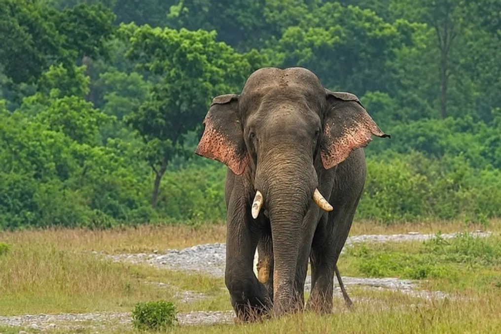
North Bengal application helps reduce elephant-human conflict, cutting crop losses from 50% to 5%
Read more
The Better India
thebetterindia.com

North Bengal application helps reduce elephant-human conflict, cutting crop losses from 50% to 5%

Elephants can appear suddenly in tea gardens. In North Bengal, where elephant movements often intersect with farms, tea plantations, and villages, knowing about the animal's approach can drastically change the situation. Today, this warning can be received via mobile phone.

The HEC Alert application, developed by the Nature and Wildlife Foundation NWA, is designed to provide residents of elephant habitats with early warnings that an elephant has been spotted nearby. HEC stands for Human-Elephant Conflict. A registered user can report an encounter with an elephant, after which users in the immediate vicinity receive a notification. The application uses GPS to determine observation locations and displays recent sightings of elephants around the user's position.

The main idea is to give people time to react before an encounter escalates into a conflict. The Better India examined NWA documents, the HEC Alert platform, and the current description of the application to understand the evolution of the system and how technology integrates into the overall community response in North Bengal.

When an elephant becomes a warning

The HEC Alert system is built around an information chain: where is the elephant—in a tea garden, in crops, or moving towards a settlement, and in what direction? And who needs to know about it?

NWA first announced the public release of HEC Alert on March 18, 2020, following extensive development and testing. The first countries where the application became available were India and Thailand. At the time, NWA stated that registered users could report real-time elephant encounters and receive alerts for incidents within a 25-kilometer radius. The organization also planned to eventually provide HEC data to registered NGOs, scientists, and government agencies.

More than six years later, the system has evolved into something more than just a notification service. The HEC Alert application and NWA's public online elephant database now operate on a unified database. The organization invites communities, volunteers, citizen scientists, and other interested parties to share observations. This data is then viewed through the platform, where elephant activity is displayed using maps and heat layers. This creates a record of encounters that might otherwise remain only an oral warning.

The technology is not intended to replace the person standing at the edge of a field; its purpose is to connect that person with others who need to know this information.

People behind the alert

Anujit Basu, Secretary of the Nature and Wildlife Association (NWA), told The Better India that the application functions as an early warning network within a 25 km radius. He noted: 'The HEC Alert application works like a buzzing early warning system within a 25-kilometer radius. When an elephant is reported, the alert reaches people in the surrounding areas, allowing them to know that an elephant or herd is moving nearby. The application has satellite and map modes, so users can understand the location and movement of elephants and respond accordingly.'

However, Basu emphasizes that the application is only part of a larger system. 'The true strength of the model lies in the community,' he asserts. NWA has both general volunteers and people who are part of response teams. According to Basu, a QR code-based system is used to add volunteers to specific teams. Currently, there are three such teams operating in three locations, with about 10 people in each group. Most of them are farmers or residents living along the forest boundary.

This is important because the people receiving alerts are not necessarily unfamiliar with elephant behavior. They know the fields, forest edges, and trails around their homes. They know where crops are grown and where elephants have previously appeared. Basu says: 'When someone sees an elephant, the information can be passed on, and the appropriate team can be mobilized.'

In areas without mobile connectivity, teams also use less-than-five-watt radios to transmit information. This creates a communication system with multiple routes: the application when connectivity is available, radio communication when it is not, and local people who understand what elephant movement might mean for their community.

Why Kurseong matters

This is particularly relevant to the Kurseong landscape. Elephant habitats in North Bengal are not separated from human activity. Regional studies have identified zones of elephant usage in the Terai and Duars areas, including forest patches, tea plantation landscapes, and agricultural areas.

A previous assessment of elephant ecology in North Bengal also recorded extensive instances of crop raiding and highlighted Kurseong as one of the areas affected by human-elephant conflict. The report documented cases of crop theft, loss of life, and property damage across the wider landscape between 2013 and 2018. In these areas, the alert system operates within a narrow time window between animal movement and human response.

From alert to response

Here, the human factor is as important as the application itself. NWA's HEC program utilizes local teams and response mechanisms alongside digital reporting. The public HEC platform describes the application as a tool for reporting sightings and alerting nearby users. Then, HEC teams and managers can use the collected information to monitor and analyze specific conflict zones.

The current Google Play listing for the application describes the same basic principle: reporting an elephant sighting automatically sends notifications to nearby users, and recent sightings can be viewed around the user's location. This requires GPS positioning. The current version has also gone beyond the initial reporting and alerting model. Its September 2026 entry records over 10,000 downloads and includes team management features, the ability to join teams, full-screen elephant photos, and one-on-one chats between team members. For a system operating in a conflict scenario, these features can help link a sighting to people who can take action based on that information.

Radio when the phone goes silent

Any early warning system dependent on mobile phones has an obvious limitation: network availability is not always guaranteed. Therefore, according to Basu, the NWA community response also relies on radios. Radio does not provide maps or a digital database. It provides something simpler—a way for one person to tell another that an elephant has been sighted.

Basu notes that volunteers are unpaid. They are farmers and other residents living along the forest boundary, and they understand the risks associated with elephant movement. Their participation also changes the nature of the response. Community members are not just receiving external wildlife warnings; they are becoming part of the alert network themselves.

What numbers can and cannot say

Basu reports that in some areas around 2020–21, crop losses reached 50–60 percent. He points out that in areas where this model was implemented, this figure dropped to approximately 4–5 percent. These figures represent NWA's own assessment and should be considered in context. They do not prove that the application alone caused the reduction.

A study conducted in West Bengal showed that technological approaches can make warnings and responses more prompt, but it also concluded that no single mitigation measure is sufficient for the entire state. Effective approaches must consider the landscape, human activity, elephant behavior, and local conditions. The HEC Alert model itself reflects this reality: technology works alongside people who know the landscape and understand the challenges of living near elephants.

A database built on observations

There is another function in the alert system. The public HEC NWA database allows observations to be collected via the website and application and incorporated into a central database. The organization states that communities, citizen scientists, volunteers, and other stakeholders can provide data, while HEC teams and managers can use this information to monitor and analyze conflict zones. Over time, recurring observations help identify patterns in where and when elephants are reported. This differs from receiving a single message on WhatsApp saying 'Elephant near village'; the message disappears. A registered observation can become part of a broader picture that can help communities understand elephant migration and prepare for the next encounter.
Similar stories

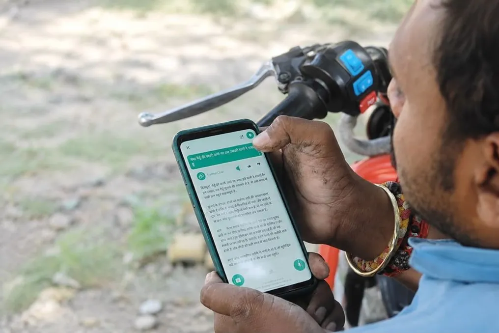
Free AI-powered app helps Indian farmers detect crop diseases early
Read more
thebetterindia.com

Free AI-powered app helps Indian farmers detect crop diseases early

When black spots began appearing on mango saplings, Shiv Kumar Yadav, the nursery owner, realized something was wrong. The farmer, who owns a four-acre nursery in Varanasi district, Uttar Pradesh, observed white fungal mold spreading across the young plants, causing healthy leaves to drop. He recalled: 'I didn't know what the disease was, but I knew I needed to act fast.'

Like many farmers across India, his initial reaction was to seek advice from local pesticide sellers and neighboring farmers. However, the advice either came too late or was too general to solve the problem. By the time the farmers received the necessary recommendations, damage had already been done.

Shiv decided not to rely on luck. Instead of trying another pesticide based on guesswork, he used his smartphone. He photographed the infected saplings, uploaded the image to the app, and described what he saw. Within seconds, he received a diagnosis along with clear instructions on how to handle the issue. He removed the affected parts of the plants, improved drainage, avoided overwatering, and applied the recommended fungicide at the prescribed dose.

He noted: 'Within a few days, the spread of the disease was under control. This helped me save a large number of saplings and reduce my losses.'

For more than 150 million farmers in India, such solutions cannot wait. A sudden pest attack, an unknown disease, or unexpected rain can change the course of an entire season.

Recognizing this problem almost two decades ago, the organization 'Digital Green India' spent years ensuring that expert agricultural knowledge reached farmers at the most critical moment. Their latest development—a free AI-powered application called 'FarmerChat'—has already reached nearly a million users across the country, helping farmers make faster and more informed decisions in the field.

When information exists, but doesn't reach the field

Agricultural knowledge is lacking in India. Research institutions are constantly developing improved farming methods. Agricultural universities study pests, diseases, and climate-resilient cultivation techniques. Government agencies regularly release advisory materials. Despite this vast reservoir of expertise, many small farmers still find it difficult to get practical guidance when problems arise.

According to Nidhi Bhasin, CEO of Digital Green India, the problem has always been timely delivery of information. 'The gap in Indian agriculture was never simply that the information was absent,' she told The Better India. 'The problem was ensuring it reached the farmers in the right language, at the right time, and in a format they could actually use.'

The organization, launched in March 2008, initially focused on strengthening the country's existing agricultural extension system, not replacing it. The non-profit collaborated with state government bodies, State Rural Livelihood Missions, agricultural departments, and grassroots organizations to create video tutorials for farmers, teaching practical farming methods in local languages.

Over the years, these efforts expanded to Bihar, Jharkhand, Odisha, Andhra Pradesh, Telangana, Maharashtra, Karnataka, Madhya Pradesh, and Uttar Pradesh. Today, the organization has released over 10,000 agricultural videos and reached about 6.5 million farmers and extension workers through its various initiatives, with women making up the majority of participants.

As internet access and smartphone penetration improved in rural India, the organization realized it could bring the same proven knowledge directly into farmers' pockets. This led to the launch of FarmerChat in October 2024.

A New Chapter Led by Technology

Nidhi Bhasin is leading this progress, having joined Digital Green India as CEO in September 2024 after more than 25 years working in the social development sector. 'I spent years studying social impact, and years studying how technology can create change,' she says. 'This space allowed me to combine both aspects and solve problems where they matter most. Agriculture supports millions of livelihoods, so even small improvements can make a huge difference.'

Why was FarmerChat created?

The idea for FarmerChat arose from a simple observation: farmers need immediate advice. When making any agricultural decision—whether determining irrigation timing, identifying a pest, selecting seeds, or reacting to weather changes—timing is critical. Waiting for an agricultural inspector's visit for several days can lead to the loss of the entire harvest.

Climate change has only amplified the urgency of these decisions. Unpredictable rainfall, rising temperatures, and the emergence of unfamiliar pest outbreaks have made farming increasingly unpredictable, forcing small farmers to seek reliable information that can help them react immediately.

'This is the gap this platform needed to fill. Agriculture is incredibly time-sensitive. A farmer might need to decide today whether to irrigate, spray, or protect the crop from changing weather. Waiting for advice for several days can lead to devastating losses, so we wanted to put timely and reliable guidance directly into the hands of the farmer, in the language and format they are comfortable with,' states Bhasin.

Unlike many digital platforms that provide general information, this app was designed to offer personalized recommendations based on the farmer's specific situation. The app is available for free on Android via the Google Play Store. Farmers can ask questions via text, record a voice message, or upload a photo of their crop. Currently, the platform supports English, Hindi, Marathi, Kannada, Telugu, and Odia.

'It is an AI-powered agricultural assistant in the farmer's pocket,' she explains. 'It is designed to move the farmer from confusion to action. Regardless of whether someone asks a question by voice, text, or image, they receive advice in the same language and in the same format they are comfortable working with.'

The decision to make the platform free for farmers was a deliberate one. As a non-profit organization, it does not generate revenue from the app. Instead, the costs of creation, maintenance, and expansion of the app are supported by philanthropic organizations, corporate social responsibility partnerships, and ecosystem partners. The CEO states: 'Our goal was never to charge farmers for knowledge. Support from philanthropists and CSR partners allows us to keep the app completely free while continuously improving the platform and making it accessible to more farmers.'

From Photo to Solution in Seconds

A farmer can input a question, record it by voice, or upload a photo of their crop. But behind this simple interface lies a process that integrates multiple layers of information before providing an answer. After submitting a request, the platform first determines the farmer's location, crop, growth stage, and local weather conditions. It then searches a verified agricultural knowledge base, created using government advisories, scientific research, and Digital Green's own learning repository collected over nearly two decades. Only after combining this information is an answer generated in the farmer's preferred language—either as text or an audio message.

'Our goal is not just to answer a query. We integrate local conditions, crop information, and verified agricultural knowledge so that farmers receive timely, reliable, and useful advice in the field,' she clarifies. The app provides consultations on crops, livestock, aquaculture, and smart farming practices, but two types of questions consistently dominate.

When Every Leaf Tells a Story

Crop diseases rarely announce themselves. The first signs are often easy to miss: a few spots on leaves, darkening stems, or fruits that do not develop properly. If no action is taken, these small changes can quickly spread throughout the field.

Previously, farmers mostly relied on guesswork. Some brought infected leaves to local pesticide shops. Others sought advice from neighbors or waited for inspectors to visit. The platform streamlines this entire process. The farmer directly photographs the affected crop and uploads the image. If more information is required, the app asks clarifying questions about the crop or location before analyzing the symptoms against weather conditions and verified agricultural data. It instantly identifies the probable disease or pest attack and recommends suitable treatment. Farmers receive both chemical and organic options, along with the exact quantity to use, the application method, and additional precautions. If doubts remain, they can continue the dialogue. The CEO notes: 'Farmers ask us how much fungicide they should use or if they should spray again in a few days.' 'The app allows them to keep asking questions until they feel confident enough to take action.'

This advice changed Shiv Kumar's nursery. 'Before, diagnostic delays meant rapid disease spread, and I lost valuable saplings. Now I can detect problems early, act immediately, and avoid unnecessary expenses,' he says. In one season, he calculated saving about 10,000 rupees by reducing plant losses and avoiding repeated pesticide applications.

Another farmer, Vishvesh Kumar Singh from Babiuan village in Varanasi, faced something similar after yellow and brown spots appeared on nearly an acre of wheat. He uploaded the symptoms through the app. The platform recommended carbendazim and hexaconazole in the correct dosage, and also advised him on irrigation and field monitoring. 'I avoided repeated pesticide applications and only used the amount that was truly necessary,' he says. 'This reduced my cultivation costs and prevented further disease spread.' He calculated that timely intervention saved him between 8,000 and 10,000 rupees per season.

Sometimes the best advice is to wait

Not every agricultural decision involves treating a disease. Many relate to timing. Should fertilizer be applied today or after the next rain? Should irrigation happen now or can it wait? Is this the right week to plant potatoes? For generations, farmers relied on experience, local observations, and conversations with neighbors to answer these questions. But unpredictable weather has made these decisions much more complex.

Instead of offering one standard recommendation, the platform studies the farmer's location, crop stage, weather forecast, and advisory datasets before suggesting whether to apply fertilizer immediately, divide it into smaller doses, or postpone it altogether. Bhasin recalls the example of Anu Kumari, a farmer from Bihar, who was preparing to plant potatoes when dark clouds started gathering overhead. Instead of relying on intuition, she consulted the app. It predicted rain and advised her to postpone planting. Heavy rain came the next day. 'If she had planted that day, most of the crop would have been washed away,' she says. 'By waiting, she avoided a loss of almost 5,000 rupees.'

A similar experience changed the approach of Urmili Devi, a small farmer from Mirzapur, to managing her wheat and rice fields. She first encountered the platform during a Digital Green meeting in July 2025 while seeking reliable advice on fertilization and irrigation. During the wheat season, the app recommended balanced fertilizer based on the crop's growth stage, suggested the correct time for irrigation, and advised on weed and pest control. 'This helped me use only the resources I truly needed, and compared to the previous season, I earned about 7,000–9,000 rupees more on my wheat,' she says.

Training AI to Stay Grounded in Reality

Wild elephant with tractor wheel around its neck appears in Assam tea plantation
Read more
www.aajtak.in

Wild elephant with tractor wheel around its neck appears in Assam tea plantation

Stunning videos and photos of a wild elephant have appeared in the Numaligarh area of Assam. The elephant was spotted in the Bokiyal tea plantation with a tractor wheel around its neck. The elephant was moving through the plantation looking for food when it was noticed by local residents.

Upon discovering that a wheel was stuck around the wild elephant's neck, anxiety increased among local residents. Residents suggest that the wheel might have gotten stuck on the elephant's neck while wandering in the area, but there is no precise information on how this happened yet.

This unusual situation was captured on camera. The photographs show the tractor wheel around the animal's neck. The incident has caused concern among local residents regarding the safety and health of the elephant.

This case has also raised questions about the harm caused by waste discarded in areas frequently traversed by wild elephants. Specifically, old and discarded tires can pose a danger to wildlife.

Local residents at the Bokiyal tea plantation in Numaligarh were astonished by the sight of the elephant with the stuck wheel. After the photos of this wild elephant foraging for food appeared, the incident became a topic of discussion. The main concern of the local residents relates to the safety of the elephant and the wheel stuck around its neck. The event also raised the question of what threat discarded tires and other garbage can pose to wild animals in elephant habitats.

Popular