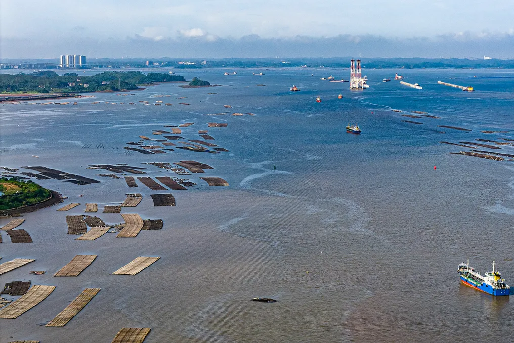
The Pinlu Canal officially opened for navigation on Wednesday, providing Southwest China with a shorter route to the coast and international markets. This 134.2-kilometer waterway connects the shipping network of the Yangtze River with Bibao Bay in the Guangxi Zhuang Autonomous Region of Southern China.
The canal is designed for vessels up to 5,000 tons and marks the completion of a major river-to-sea transport project, integrating advancements in hydraulic engineering, environmental protection, and regional logistics. The total construction cost amounted to 72.7 billion yuan (approximately $10.75 billion).
Designing the River-to-Sea Route
The canal establishes a connection between the Yangtze River system and Bibao Bay through a network of waterways and locks. Key elements of the navigation system include three double locks in Madao, Qishi, and Qinyan. The project underwent trials with vessels testing passage through the locks, overtaking, maneuvering, anchoring during ebb tide, and night navigation.
On Tuesday, authorities announced the navigation classification for the canal. The inland section is temporarily classified as Class B navigation zone, while the river-to-sea junction in Qinzhou Bay is classified as equivalent to a Class A navigation zone. These classifications determine the navigation requirements for vessels using this route.
Mangrove Protection and Habitat Restoration
Environmental protection was an integral part of the canal's construction process. As part of the project, 14,490 mu (966 hectares) of mangrove forest were cleared. The area of mangrove forest at the estuary is 3,649 hectares.
Furthermore, the project involved relocating 9,572 mature mangrove trees and planting 275,000 mangrove saplings elsewhere, with a survival rate exceeding 90%. At the Qinyan junction, a fish pass dam helps restore migratory routes previously disrupted by the water control structure. A 240-meter elevated wildlife crossing, covered with soil and vegetation, was also built to allow animals to cross the canal. These measures demonstrate the integration of environmental protection into the canal's construction.
A Shorter Route to the Sea
The canal will reduce the inland waterway route between Southwest China and the sea by approximately 560 kilometers compared to the route via Guangzhou Port. It is estimated that annual logistical savings will amount to about 5.2 billion yuan. By connecting inland waterways to Bibao Bay, domestic goods are expected to reach foreign markets more easily, and imported goods can penetrate deeper into the country.
The long-term impact of the canal on trade and industrial distribution will depend on the efficiency of its connection with ports, logistics facilities, and existing transport networks.
What Canals Could Change the Situation
The Panama and Suez Canals serve as examples of how major waterways shape maritime trade routes. The Panama Canal connects the Atlantic and Pacific Oceans. According to the Panama Canal Authority's 2024 annual report, the canal's direct contribution to Panama's GDP in the 2024 fiscal year was estimated at 2.9%. The Suez Canal is a vital route connecting Europe and Asia. In 2024, UNCTAD reported that the average daily number of transits through the canal dropped by 57% compared to the previous peak due to disruptions.
These examples illustrate how waterways influence shipping routes, transportation costs, and the geography of trade. The Pinlu Canal serves a different function, connecting inland China to Bibao Bay. Its impact on regional logistics and trade will depend on how effectively it integrates with river transport, ports, and regional trade networks.