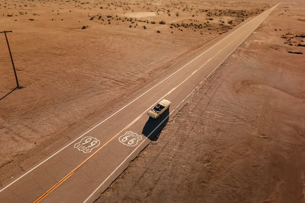
The 35th parallel North, an imaginary line crossing the globe at 35 degrees north of the Equator, served as a reference point for American lieutenant Edward Fitzgerald Beale to organize an expedition in the mid-19th century. The objective was to establish a trade route connecting Fort Smith, in Arkansas, to the West Coast metropolis of Los Angeles, California. This initiative was crucial for the development of the young American nation, which depended on the physical integration between its East and West regions, driven by industrial expansion and the promises of Pacific prosperity.
In 1857, after the expedition was approved by James Buchanan, the interior of the North American continent was still vast and sparsely populated, marked by rock formations, deserts, and indigenous lands without direct control from Washington. Beale received a budget of $200,000 from Congress, and his mission went beyond merely charting a path; he needed to verify the logistical viability of crossing the continent.
To achieve this, he implemented an unusual strategy: he imported dromedaries and camels from the Middle East and the Mediterranean, guided by the Syrian-Ottoman driver Hadji Ali, locally known as 'Hi Jolly.' The logic was to test the resistance of these animals to extreme heat, lack of water, and the difficult terrains of New Mexico and Arizona, assuming that if they could endure it, any commercial convoy could as well.
A pioneering path through the desert
The route opened by the lieutenant was named the Beale Wagon Road and demonstrated that following the 35th parallel North offered the most suitable topography to cross the Rocky Mountains and the Mojave and Sonoran deserts. Decades later, engineers from the Atchison, Topeka and Santa Fe Railway analyzed the same maps and confirmed Beale's accuracy. The railways built rapidly in the late 19th century largely followed the original caravan route.
The arrival of the 20th century brought a mechanical revolution, with animal-drawn vehicles and steam locomotives sharing space with internal combustion gasoline engines. Although Beale's old route and secondary roads were still dirt tracks, subject to mud in the spring and dust in the summer, early automobile enthusiasts began to desire better infrastructure for their vehicles.
Before the automobile dominated, cyclists initiated the change. In the 1890s, the popularity of bicycles led to the political organization of groups like the League of American Wheelmen. They founded the Good Roads Movement, a social and political movement demanding that the government provide paved, drained, and leveled roads, which also gave rise to the first rallies.
With the emergence of the first automobiles, drivers and clubs like the AAA joined the movement. The discussion evolved from mere urban leisure to a matter of national economic integration, as commerce between rural and urban areas would be paralyzed without adequate roads.
The major catalyst in the 1920s was the Ford Model T. Launched in 1908 and popularized starting in 1913 with Henry Ford's assembly line, this vehicle took the automobile out of aristocratic luxury status, making it an essential tool for the middle class and farmers in the Midwest. Due to manufacturing advances, the cost of the Model T dropped drastically, from over $800 to less than $300, making it accessible to working families.
The rapid proliferation of Henry Ford's fleet challenged the American road system. In a short time, the country had millions of cars circulating in a chaotic network, with roads maintained unevenly by counties, lacking uniform signage, where private associations used arbitrary colors to indicate paths that often led to private property or potholes.
The pressure from the Good Roads Movement and the growing number of drivers forced federal intervention. Federal laws of 1916 and 1921 (Federal Aid Road Acts) stipulated that states needed to standardize and interconnect their roads to receive federal funding. This initiated the national standardization project proposed in 1925, with Cyrus Avery, a businessman from Tulsa, Oklahoma, as a central figure, and he ended up being called the 'Father of Route 66.'
The diagonal vision and the battle for the number
Cyrus Avery, an influential oil industry businessman from Tulsa, held significant political power, having served as president of the Oklahoma State Highway Commission and a leader in highway associations. His prestige was enough for the United States Secretary of Agriculture to include him in the decision-making team regarding the future of American highways in 1925. Avery perceived something that traditional planners in Washington ignored: while most proposed major highways followed purely horizontal (East-West) or vertical (North-South) axes, he vigorously advocated for a diagonal route.
His proposal was to connect the industrial and financial center of the Midwest, represented by Chicago, Illinois, to the ports and agricultural lands of Southern California, crossing diagonally through Missouri, Kansas, Oklahoma, Texas, New Mexico, and Arizona. This diagonal geometry had a clear economic benefit: allowing small farmers in the central plains to sell their goods by truck, without depending exclusively on railway monopolies, integrating them into large urban distribution centers.
To organize the confusion of private roads, the U.S. Department of Agriculture and the AASHO created the United States Numbered Highway System in 1925. This plan aimed to replace named routes with a rigid mathematical numbering system, reserving odd numbers for North-South routes and even numbers for East-West routes (with the lowest numbers in the North and the highest in the South). Multiples of 10 were reserved for major transcontinental highways.
However, Avery's ambition generated intense political dispute. Since his idealized route was the main commercial corridor between Chicago and Los Angeles, Avery insisted it receive the round number U.S. 60, immediately granting it the status of a national superhighway. However, the governor of Kentucky, William J. Fields, and Eastern planners contested this, arguing that according to federal rules, number 60 belonged to a strictly East-West highway connecting Newport News, Virginia, to Springfield, Missouri, passing through Kentucky.
This deadlock paralyzed the approval of the national road system for almost a year. The resolution occurred in April 1926, during a meeting in Springfield, Missouri. Avery and his chief engineer, John Woodruff, consulted the list of unassigned numbers and found 66. Although not a multiple of 10 nor holding official transcontinental status, the double number presented superior aesthetic and marketing advantages: it was visually symmetrical on emblems, easy to remember, and possessed a striking sonic alliteration in English ('Sixty-Six'). Avery conceded 60 to Kentucky and sealed the deal. Thus, on November 11, 1926, the U.S. Route 66 officially came into being.
Initially, Route 66 had a length of 2,448 miles (approximately 3,940 kilometers), but it was a precarious mosaic; in 1926, less than 20% of the stretch was paved, with most consisting of gravel, bare earth, or wooden planks in the California sand.
In the early years, traveling on Route 66 was similar to Beale's expedition. The cars of the time, with inefficient radiators and rudimentary drum brakes, required drivers to have mechanical knowledge and great physical fitness. Steep sections, such as the curves of Sitgreaves Pass in the Oatman mountains, Arizona, forced many drivers to use reverse gear in their Ford Model Ts due to the gravity feed system. Full paving of Route 66 was only achieved in 1938, thanks to New Deal public works under the presidency of Franklin D. Roosevelt.