
Severe Weather Warning Issued in South Africa: Floods, Thunderstorms, and Strong Winds Expected
Read more
Getaway
getaway.co.za

Severe Weather Warning Issued in South Africa: Floods, Thunderstorms, and Strong Winds Expected

South Africa is bracing for adverse weather conditions, including heavy rain, severe thunderstorms, destructive winds, and rough seas in several regions of the country on Tuesday, September 15th. The South African Weather Service (SAWS) has issued several yellow-level warnings.

A Level 4 yellow warning for heavy rainfall, which may lead to flooding of roads and settlements and cause serious transport disruptions, has been issued for the eastern part of Namaqualand in the Northern Cape and Central Karoo in the Western Cape.

SAWS has also issued a Level 2 yellow warning for severe thunderstorms and excessive lightning for some areas of the Northern Cape and Western Cape. Furthermore, a Level 1 yellow warning for thunderstorms is in effect along the northeastern coast and adjacent inland areas of the Eastern Cape.

According to the SAWS forecast for Tuesday, the weather will be partly cloudy with cool to warm temperatures, featuring isolated or scattered rain. Strong winds are expected in parts of the North-West, Northern Cape, Free State, Limpopo, and Eastern Cape, while KwaZulu-Natal is under a Level 2 yellow warning due to strong winds and waves.

The meteorological service warned that the prevailing conditions could damage temporary structures, infrastructure, and informal settlements, as well as cause power and communication outages.

The extended forecast for Thursday and Friday, September 17–18, 2026, predicts partly cloudy weather with cool to warm conditions, featuring isolated or scattered showers and thunderstorms, but with extensive coverage in the southeast. Cold or very cold weather is expected in the western regions.

In the Gauteng province, residents can expect partly cloudy and warm weather with isolated rain and thunderstorms. Mpumalanga and Limpopo are expected to have partly cloudy weather with morning drizzle and fog along the escarpment, as well as isolated rain and thunderstorms.

The Northern Cape is forecast to be cloudy, windy, and cool to cold, with scattered rain and thunderstorms that will become widespread in the eastern and central parts. The Western Cape is also expected to be cloudy and cool to cold, with scattered rain and thunderstorms.

SAWS additionally warned of an extremely high risk of fire in some areas of Limpopo. The service strongly urged residents in affected areas to take necessary precautions, as severe weather can disrupt traffic, infrastructure operations, and the functioning of essential services.
Similar stories

Strong thunderstorms, heavy rain, and hail expected in South Africa on Monday
Read more
iol.co.za

Strong thunderstorms, heavy rain, and hail expected in South Africa on Monday

South Africa is preparing for strong thunderstorms, heavy precipitation, hail, and strong winds on Monday. The South African Weather Service (SAWS) has issued an Orange Level 6 warning for some regions of the country.

Residents of South Africa should prepare for a rainy and stormy Monday, as strong thunderstorms, intense rainfall, hail, and wind gusts are forecast in many parts of the country. SAWS has declared an Orange Level 6 warning for severe thunderstorms, with rainfall of 30 to 50 mm possible in affected areas.

These storms may be accompanied by winds exceeding 40 km/h, stronger gusts, more hail, and excessive lightning. SAWS warned that such conditions could trigger localized flooding in roads and informal settlements, serious transport disruptions, structural damage, falling trees, and power outages.

Additionally, a Yellow Level 2 warning has been issued for some areas in the North West, Free State, and along the border with Lesotho, where localized flooding and strong winds are possible.

Gauteng is expected to have cloudy and cool weather on Monday with scattered rain and thunderstorms. Temperatures in Johannesburg will range from 10°C to 14°C, in Pretoria from 13°C to 16°C, and in Soweto from 11°C to 15°C.

In the Free State, cloudy, cool, and humid weather will persist with a risk of heavy rain, especially in the central and eastern parts of the province. Temperatures are forecast to fluctuate between 10°C and 19°C in Bloemfontein, 12°C and 19°C in Welkom, and 9°C and 13°C in Bethlehem.

The North West is expected to have cool conditions, widespread precipitation, and moderate to strong winds. Temperatures in Mahikeng will range from 14°C to 20°C, in Rustenburg from 13°C to 19°C, and in Potchefstroom from 12°C to 19°C.

KwaZulu-Natal will face cold or cool weather accompanied by widespread rain and scattered thunderstorms. Temperatures in Durban are expected to be from 16°C to 21°C, in Pietermaritzburg from 8°C to 18°C, and in Ladysmith from 9°C to 16°C.

Limpopo is expected to have partly cloudy or cloudy weather with isolated showers. Temperatures are forecast to be between 12°C and 18°C in Polokwane and 17°C to 23°C in Musina.

The Eastern Cape will experience cool conditions with scattered rain expected both inland and along the coast. In Gqeberha, temperatures will range from 15°C to 23°C, and in East London from 16°C to 21°C.

Conditions in the Northern Cape will vary from cold to warm. Strong thunderstorms are possible in the eastern parts of the province, while western areas are expected to remain sunny and dry. Temperatures in Kimberley will range from 11°C to 22°C, and in Upington from 12°C to 27°C.

Most of the Western Cape should be warm and sunny. However, a Yellow Level 2 warning for destructive winds remains in effect along the southwest coast. Temperatures in Cape Town are expected to be from 15°C to 29°C, and in George from 11°C to 27°C.

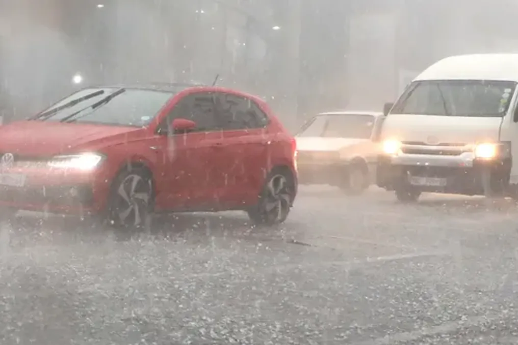
SAWS strongly urged residents in affected inland areas to take necessary precautions due to the movement of severe weather across the country. Residents were advised to avoid crossing low bridges and exercise extra caution when traveling, especially in areas where heavy rain and thunderstorms are expected. Drivers are advised to closely monitor changing road conditions, especially where heavy precipitation may lead to flooding and reduced visibility.

Popular