48 Hours Around Lake Kivu in Rwanda: A Travel Guide
Read more
Getaway
getaway.co.za

48 Hours Around Lake Kivu in Rwanda: A Travel Guide

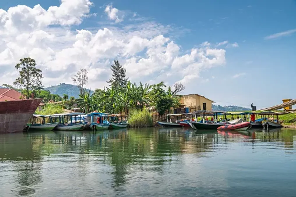
Rwanda is traditionally associated with mountain gorillas, misty forests, and the tidy streets of Kigali. However, the pace of life is different in the western part of the country. Here, hills descend to Lake Kivu, one of the large lakes of the African Rift Valley, where small fishing boats move across deep green waters, and villages are situated on the slopes.

With 48 hours available, it is recommended to use Kibuye as a base and focus on Karongi and the central part of the lake. This time is sufficient to enjoy the scenery without rushing to see other attractions.

Landscape Exploration and Activities

Karongi, known locally as Kibuye, is located roughly in the middle of the Lake Kivu shoreline in Rwanda. The town is surrounded by green hills and scattered bays, giving it a calmer character compared to Rubavu, which is located at the northern end of the lake.

The landscape itself forms the first impression: behind the water rise hills covered with eucalyptus, banana plantations, and other vegetation, while the lake opens up towards a group of islands and distant shorelines.

Karongi has become one of Rwanda's coastal tourism centers. Various types of accommodation are available here, such as Bethany Hotel, as well as activities including boat trips, kayaking, hiking, and participation in local community events.

Upon arrival, it is advised not to rush to fill the entire day with activities. It is better to find a spot with a view of the lake, order lunch, and immerse oneself in the more relaxed rhythm of Kivu.

The best way to understand Lake Kivu is the lake itself. You can join a boat tour to the islands and protected bays around Karongi. A half-day tour may include islands such as Napoleon and Amahoro, depending on the route and weather conditions. Napoleon Island (locally known as Nyamunini Island) is particularly famous for its colony of fruit bats, while Amahoro offers a quieter spot to stop on the water.

The journey is an integral part of the experience. From the boat, you can see steep green hills seemingly growing directly out of the lake, and small communities and cultivated slopes demonstrate the close connection between daily life and the water. Attention should also be paid to traditional fishing boats. At dawn and dusk, the sound of singing fishermen rowing across the lake has become one of Karongi's distinctive features.

Before sunset, return to the shore and find a viewpoint by the lake. This is one of those places where the simplest moments can become the most memorable. As the light softens over the hills, the boats begin to head home, and the surface of the lake changes color.

If you are traveling with a guide or a local operator, it is worth inquiring about opportunities to participate in fishing. Community-based tourism initiatives around Lake Kivu offer a chance to learn about local fishing traditions, including evening outings with fishermen. Spending a night in Kibuye and letting the lake set the pace is an excellent option.

Coffee and Agriculture Around Lake Kivu

The history of coffee cultivation in Rwanda is closely linked to the hills around Lake Kivu. Coffee was introduced to Rwanda in 1904 and has since become one of the country's main cash crops. Approximately 450,000 smallholder farmers produce coffee across the country, with many of the most accessible tourist experiences concentrated in the Lake Kivu region.

One of the most atmospheric places to learn about this process is the Kinunu coffee processing station, located on the shores of Lake Kivu. This station collaborates with hundreds of local farmers and is accessible by boat or bicycle, allowing visitors to combine a visit to the coffee mill with other activities around the lake.

The coffee experience here is more than just tasting a good cup. Depending on the season and tour, you can see how coffee grows on the hillside slopes, learn how the berries are harvested, and visit the processing station where beans are sorted, pulped, fermented, graded, and dried.

Some Lake Kivu tours combine a boat trip to Kinunu with a farm visit, processing demonstration, roasting, and tasting. The harvest is usually collected from February to May, when the ripe berries turn a rich red color. However, the landscape where coffee is grown is worth visiting even outside the harvest season, especially for those interested in agriculture, food, and the communities behind Rwanda's signature coffee.

Viewing the lake from the plantation allows one to see why this region is ideal for a slower travel pace: the landscapes and experiences are inextricably linked.

Hiking Trails and Water Sports

The Congo-Nile Trail is a route that runs along the western side of Lake Kivu, connecting Rwandan coastal towns and rural communities. This path stretches for approximately 227 km and passes through hills, plantations, villages, and spots with stunning lake views.

It is not necessary to complete the entire route to enjoy it. One can choose a convenient section for a hike or organize a shorter excursion in the vicinity. The trail can also be explored by bicycle, choosing short segments to experience the landscape without committing to a multi-day adventure.

Here, the experience of interacting with Lake Kivu transforms from mere observation to full immersion. Instead of viewing Rwanda's famous green hills from a car, you walk through them, passing by cultivated slopes and rural homes, observing the everyday landscape at a slower pace.

By midday, you can return to the water. Depending on energy levels, this might mean kayaking, canoeing, or simply finding a quiet stretch of shore. Lake Kivu is one of Rwanda's main destinations for water recreation, offering visitors kayaking, boat trips, and swimming.

Or you can do nothing at all. After two days dedicated to boats, coffee plantations, and hills, a lakeside lunch followed by an hour watching the water might seem like the most fitting conclusion to the trip.

If your itinerary allows for another day, you can travel north to Rubavu, formerly known as Gisengi. This town is located at the northern end of Lake Kivu and has a livelier atmosphere than Kibuye, with a waterfront lined with hotels, restaurants, and bars. Its location also makes it a convenient base for combining a visit to Lake Kivu with a trip to Volcanoes National Park.

Rubavu also serves as an important starting point for the Congo-Nile Trail and provides access to coffee-growing areas in the northern part of the lake.

Lake Kivu perfectly complements a broader trip through Rwanda. Tourists who have spent time trekking in the country's forests or exploring Kigali can use the lake as a change of scenery. Instead of another packed schedule, there is space here: boat trips, long views, rural walks, coffee grown on the surrounding hills, and evenings by the water. This is perhaps the greatest advantage of Lake Kivu. It offers a different picture of Rwanda—one where the journey is as important as the destination, and where two days can feel surprisingly far removed from a typical safari or trekking itinerary.

The best way to explore the Lake Kivu region is by combining land travel, boat trips, and organized activities. Karongi is a natural base for a 48-hour itinerary, whereas Rubavu is suitable if you are entering or leaving the region from the north. Boats can connect visitors with islands and certain coastal experiences, while sections of the Congo-Nile Trail can be explored on foot or by bicycle.

For visits to coffee plantations and processing stations, it is recommended to arrange the visit in advance. The Rwanda Tourism Information Service advises booking plantation visits through a tour operator or the Rwanda Development Board, rather than contacting farms directly.

Lake Kivu can be visited year-round, but the experience will vary depending on your goals. Coffee lovers should plan their trip around the main harvest, which usually takes place from February to May, when coffee berries are picked and processed. For hiking, cycling, and boating, daily conditions are more important than chasing the 'best' season. Local conditions must be checked, and activities should be organized with experienced guides, especially when venturing onto the lake or into rural areas. Regardless of the season, light layers, comfortable walking shoes, sun protection, and rain gear should be packed. Rwanda's hills can bring variable conditions, and the weather is part of what keeps the landscape so green.

Rwanda is famous for its mountains, forests, and wildlife, but Lake Kivu reveals another side of the country. Here, attractions are not limited to a national park or one iconic site; they are spread throughout the landscape: coffee plants on steep slopes, fishermen crossing the lake, boats heading toward small islands, trails winding through villages, and sunsets reflecting on the water. Dedicate 48 hours, and it will be enough to experience all of this without rushing. Come for the lake, stay for the coffee and hills, and leave with a calmer perception of Rwanda than the one with which you arrived.

Similar stories

Great Kei Region Exploration: Rivers, Beaches, and the Khosa Culture in 72 Hours
Read more
getaway.co.za

Great Kei Region Exploration: Rivers, Beaches, and the Khosa Culture in 72 Hours

Great Kei is a quieter corner of the Eastern Cape where the river meets the sea, and small coastal settlements transition into green hills and rural landscapes. Over a period exceeding 72 hours, one can explore places such as Kei Mouth, Morgan's Bay, and Haga Haga, enjoying beaches, walks, local cuisine, and learning about the Khosa culture.

A journey through Great Kei should begin at Kei Mouth, where the Great Kei River flows into the Indian Ocean. This river originates where the Black Kei and White Kei rivers converge, northeast of Kathcart, and flows approximately 320 kilometers to its mouth at Kei Mouth. It has long shaped the landscapes and communities around it, remaining a popular spot for fishing, water sports, and bird watching.

One of the most memorable spots is the historic Kei Mouth ferry. This vehicle ferry connects to Great Kei and leads into the wild coast. It is also one of Kei Mouth's main attractions and a reminder of the close connection between travel in this part of the Eastern Cape and the river. Time should be set aside to watch the ferry pass before moving along the coast.

The mouth of the Great Kei is a natural place conducive to slowing down. Depending on conditions, one can spend a day fishing, birdwatching, kayaking, or exploring the river by boat. The estuary and surrounding vegetation support diverse avifauna, and the river itself remains an important part of the area's recreational life.

If the preference is for the land, one can take a walk through Kei Mouth and along the coast. The area also provides access to trails leading into Morgan's Bay. Relaxed and local dinners are recommended; Great Kei is not meant for rushing between restaurants and attractions. Its appeal lies in long meals, seafood, rustic food, and evenings outdoors. One can stay overnight in Kei Mouth or slightly further, in Morgan's Bay.

Traveling along the coast between Morgan's Bay and Haga Haga involves a change in the Great Kei landscape: from riverine areas to beaches, cliffs, rocky shores, and small coastal villages. The start of this section is Morgan's Bay, also known as Gxarha, where a long beach is situated beneath dramatic coastal cliffs. The beach is popular for walks, and trails lead along the cliffs to the Cape Morgan lighthouse. The cliffs themselves rise approximately 50 meters above the waves, making this a prime spot for coastal views.

For a longer walk, the routes continue towards Dobbel Mouth reserve and further to Haga Haga. The distance from Morgan's Bay to Dobbel Mouth is about 4 km, and the path to Haga Haga adds another 8–9 km, so planning must account for physical fitness and weather. The Cape Morgan lighthouse is also a worthwhile stop. From Morgan's Bay beach, the trail leads to the lighthouse through coastal and wooded terrain, then continues towards Kei Mouth. This is a good example of what makes this stretch of the Eastern Cape special: no tight schedule is required, as the landscape itself provides most of the entertainment.

Next is Haga Haga, a small coastal village known for its beach, stone coves, and relaxed atmosphere. The municipality describes Haga Haga as a family-friendly coastal destination with safe swimming beaches and ocean views. It is an ideal place to do little: stroll on the beach, explore stones at low tide, have lunch, and watch the waves. For travelers with children, it is a simple place to spend several hours due to the shallow stone coves and calm rhythm.

The second night can be spent in the Haga Haga or Morgan's Bay area. There are numerous accommodation options in the wider area: from hotels and lodges to self-catering units and campsites. The Great Kei municipality lists tourist offerings such as Morgan Bay Tourism, Crawfords Beach Lodge, Olivewood Private Estate, and Yellowwood Caravan Park.

On the final day, it is recommended to leave the coast and venture inland. Great Kei is more than just its beaches. Inland, the landscape becomes more rural, featuring farms, villages, and open land stretching towards Kumre (Komge). The municipality extends from the Indian Ocean to the Kubusi River, with the landscape becoming drier as one moves inland. Kumre, better known as Komga, is a service and business hub for the surrounding agricultural areas and offers a different perspective of Great Kei than the coastal villages.

Instead of viewing the town as a quick stop, the trip inland should be used to appreciate the changing scenery. Roads pass through farmlands and rural settlements where the pace of life noticeably differs from more well-known coastal destinations. The rural areas around Great Kei also play an important role in the region's cultural identity. The municipality emphasizes traditional storytelling, cultural tours, historical sites, and everyday rural life as ways visitors can experience the Khosa heritage in the area.

Where possible, one should choose experiences organized by locals rather than simply passing through. A guide, a community experience, or a meal prepared by local hosts can add context to the landscapes you traverse. Food is an especially good way to immerse oneself in history. Opportunities to try traditional dishes and local delicacies should be sought, allowing hosts to explain the ingredients and traditions behind them.

In the afternoon, one can return to the coast, leaving enough time to stop at viewpoints and small villages along the way. If there is another night, one can return to Morgan's Bay or Kei Mouth and conclude the trip by the water. If further travel is planned, the main connection to the broader Eastern Cape road network is provided by the N2 road.

Great Kei is not dependent on a single main attraction. Its appeal lies in the combination of various landscapes: the river and its estuary, the old ferry in Kei Mouth, the cliffs and beaches of Morgan's Bay, the quiet shores of Haga Haga, and the inland rural communities. Together, they create a place that feels distinctly like the Eastern Cape, without requiring a packed itinerary. It also serves as a reminder that the Eastern Cape coast extends far beyond the more famous Wild Coast destinations. In Great Kei, one can experience beaches, rivers, hiking, food, and Khosa heritage within a relatively compact area. The best way to get to know this region is to move slowly: follow the river, stop when a view catches your eye, eat local food, and leave room in the plan for unplanned stops.

Always check local conditions before entering the water. The Great Kei municipality temporarily closed Kei Mouth beach in January 2026 after the discovery of a dead whale shark and reports of sharks at several municipal beaches. Conditions and closures can change, so current local notifications should be checked before swimming, surfing, or fishing.

A 48-Hour Journey Through the Olive Groves of Karoo, South Africa
Read more
getaway.co.za

A 48-Hour Journey Through the Olive Groves of Karoo, South Africa

Although olive oil may not be the first association when thinking of the Karoo, olive groves have become part of the agricultural history of this region amidst the dry mountains and vast sky. A 48-hour road trip through the towns of Prince Albert, De Raad, and Calitzdorp offers a different way to experience the Karoo and Little Karoo, following the path from tree to bottle, while allowing time to visit farm kitchens, historic settlements, and dramatic mountain landscapes.

This route is particularly suited for gastronomy-focused holidays, but you do not need to be an olive oil expert to enjoy it. Along the way, there are tastings, farm lunches, local produce, and many reasons to slow down.

The route should begin in Prince Albert, one of the most atmospheric towns in the Great Karoo, with the Swartberg Mountains rising in the background. In close proximity to the town, at the O for Olive at Swartrivier Farm, you can learn about the traditions of growing olives in the region. This farm has over 3000 mature olive trees on a 20-hectare property, including Mission, Manzanilla, and Leccino varieties.

The best way to gain experience is through a guided farm tour. The program includes visiting the olive groves, sorting tables, the fermentation room, and the olive press, concluding with a tasting and a light lunch at Café O. Tours must be booked in advance.

The appeal of the location lies in the contrast: beyond the greenhouses stretches the dry, open Karoo, while inside the farm, the landscape becomes green under the mountains. Visitors are advised to allocate time for lunch at Café O, a restaurant at Swartrivier Farm. The menu includes light lunches, tapas, fresh bread, and local products, and the farm shop sells cold-pressed extra virgin olive oil, olives, tapenades, and other goods. The cafe's open area overlooks the Swartberg Mountains.

If you haven't taken a farm tour yet, you can combine lunch with a tasting. This is a simple way to start distinguishing between oils—from fruity and bitter notes to the peppery aftertaste characteristic of many good cold-pressed olive oils.

After lunch, you can spend free time exploring Prince Albert itself. The city's architecture in Cape Dutch, Karoo, and Victorian styles, small galleries, and quiet streets deserve a walk. Here, the route transforms into something more than just a gastronomic journey: olive farms are woven into a landscape shaped by generations of agriculture and settlement.

As evening falls, you can have a Karoo-style dinner and go to bed early. The next day, the route delves into the Little Karoo.

Leaving Prince Albert, head to De Raad, where the olive route continues at De Rustica Olive Estate winery. This estate offers olive oil tours that begin in the greenhouses and then move on to tastings of various varieties. Guests can learn how olives are grown and harvested, and how the fruit turns into oil. During the harvest season, which usually runs from April to July at De Rustica, visitors can also see the extraction, filtering, and storage processes.

Tasting is the main lesson. Instead of viewing olive oil as a universal culinary ingredient, visitors begin to understand how different varieties produce different aromas, flavors, and levels of bitterness and pungency. The estate also has a coffee shop where you can stop for breakfast, drinks, and light snacks against the backdrop of the Little Karoo landscape.

From De Raad, continue towards Calitzdorp, allowing the landscape to become part of your plan. It is here that the advantage of a self-driving route over simply visiting a few farms becomes apparent. The distance between stops allows time to appreciate the changing landscape—dry plains, mountainous masses, and isolated farms alternating with the greener agricultural scenery found in other parts of the Western Cape.

If you travel during the olive harvest, the route becomes especially interesting, as this is when the greenhouses operate most actively. Closer to Calitzdorp, the olive trail ends at Pètra Olives, located on Droëkloof Olive Estate beneath the Swartberg Mountains. The first olive trees on this estate were planted in 2007, and today its greenhouses include Frantoio, Leccino, Mission, Manzanilla, Coratina, Koroniki, and Picual varieties. The farm is still managed by the sixth generation of the Nel family.

The location makes this stop suitable. The relationship between the mountains, climate, and agriculture is particularly clear here, as the olive trees grow in a landscape better known for its harshness than its greenhouses. Pètra's oils have also received recognition at the annual SA Olive competitions, making this farm worthwhile for anyone interested in South African olive oil production.

At first glance, the Karoo might seem an unlikely place for olive cultivation. Its dry climate and sharp temperature fluctuations are part of what makes the region unique. Olive trees are well-adapted to Mediterranean-type conditions, and producers in the Karoo and Little Karoo have created greenhouses that work in harmony with the region's climate, not against it. This adds an interesting agricultural history to the route. The landscape is not just scenery between tasting rooms; it is part of what goes into the bottle.

The variety of cultivars also means that no two tastings will be the same. Frantoio, Coratina, Mission, Manzanilla, and other varieties can yield oils with noticeably different characteristics. The period from April to July is especially appealing if you want to see olive production in action, although exact harvest dates vary depending on conditions and location. For example, De Rustica indicates the period from April to July as its harvest season.

For a quiet weekend dedicated to food and scenery, it is worth traveling outside the busiest periods and booking farm events in advance. Keep in mind that many small producers operate on limited schedules or by appointment. Check opening hours before you leave, especially if planning your route around tastings.

The best approach to this route is not to rush from one producer to another. Allocate time for a long lunch, take photos, stroll through Prince Albert, and leave room for unexpected farm shops or roadside stalls. Most importantly, taste the oils correctly. Try them with bread, compare different varieties, and pay attention to the aroma, bitterness, and pungency. By the end of the weekend, olive oil will cease to be just a condiment and will become an expression of the place.

72-Hour Route in Namibia's Erongo Region: Rock Art, Wildlife, and Granite Mountains
Read more
getaway.co.za

72-Hour Route in Namibia's Erongo Region: Rock Art, Wildlife, and Granite Mountains

Namibia is often associated with vast dunes, desert-adapted wildlife, and long stretches of empty road. However, the landscape in the Erongo region takes on a different character. Here, massive granite formations rise above dry valleys, ancient San art is preserved in caves and overhangs, and wild animals move across a landscape shaped by an ancient volcanic complex.

The Erongo Mountains National Park now protects 180,000 hectares of this mountainous wilderness, with conservation areas more extensively connected by open terrain. This region is also ideal for a short road trip. In 72 hours, you can combine a visit to the small town of Omaruru with organized walks, viewing rock art sites, wildlife observation, and overnight stays beneath majestic granite formations, concluding the trip in Spitzkoppe.

This is not a traditional safari route; rather, it is a journey into one of Namibia's most captivating landscapes, where geology, archaeology, wildlife, and living culture intersect.

Omaruru should be used as a starting point for exploring the Erongo Mountains. The town is a convenient place to stock up before entering the more remote mountain landscape, where distances between attractions and accommodation can be significant.

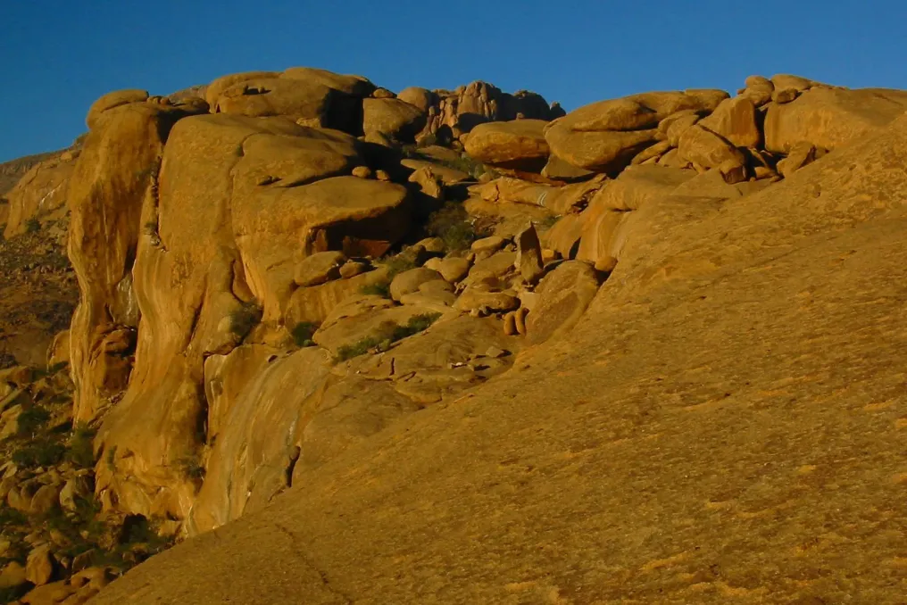
Leaving Omaruru, the road begins to replace urban scenery with open scrubland and granite. The further the traveler progresses toward the mountains, the more dramatic the landscape becomes. The Erongo Mountains are remnants of an ancient volcanic complex, dominated by weathered granite boulders and unusual rock formations. For example, at Ai Aiba Rock Painting Lodge, these formations are estimated to be about 130 million years old.

One option is Ai Aiba – Rock Painting Lodge, which is dramatically situated among granite boulders at the foot of the Erongo range. Its location, hiking opportunities, nature watching, and experience of rock art make it particularly suitable for a first introduction to the region.

Other accommodation options within the Erongo Mountains National Park include Ameib Guesthouse and Camping, Erongo Rocks, Omandumba Guest Farm, Ombu Guest and Hunting Farm, Omukutu Nature Farm, and Black Rock Campsite.

Do not expect the landscape to be barren just because it is dry. The Erongo Mountains support a surprising diversity of mammals, including the mountain hartebeest, kudu, oryx, springbok, klipspringer, steenbok, aardvark, brown hyena, leopard, cheetah, and the nearly endemic black mongoose. Over 200 bird species have also been recorded in and around the mountains.

A good way to start is with an organized nature tour. At Ai Aiba, wildlife viewing can be combined with stops at rock art sites, making the impression less like a typical hunt and more like an exploration of the entire ecosystem.

When the daytime heat subsides, it is worth going for a walk or watching the sunset. The Erongo landscape is especially impressive late in the day when shadows fall across the boulders, and the mountains become silhouettes against the sky. Organized morning and evening walks are available at Ai Aiba.

Make archaeology the focus of your second morning. The Erongo Mountains contain extensive collections of ancient paintings and engravings, some dating back thousands of years. Only at Ai Aiba are over 200 San rock art sites documented, which visitors are taken to during organized tours.

Instead of just viewing the paintings as a photo stop, it is worth taking a guided tour. Interpretation helps to understand what is seen and places the artwork within a broader landscape. At Ai Aiba, a special rock art and nature tour lasts about three hours and combines selected painting sites with the surrounding mountain scenery.

You can then head to Omandumba to see a different perspective on the history of the Erongo Mountains. The San Living Heritage Museum was established in Omandumba in 2008 and is run by the San people themselves. Visitors can learn about the traditional hunter-gatherer culture through activities such as bush walks, traditional hunting demonstrations, handicraft making, dancing, and medicinal plant explanations.

This experience is also directly linked to the environment. Omandumba is home to rock art and archaeological evidence related to San communities that lived and hunted in this region in the past. It is worth allocating several hours without rushing. The cultural experience provides context to the rock art already encountered, making the mountains seem not just like untouched wilderness, but a living landscape with a long human history.

After the morning walk and exploration, it is best to forgo the idea of including another major attraction. The Erongo region encourages slow travel. You can have lunch, rest at your accommodation, or take a shorter organized walk. Omandumba offers activities such as walks, rock art tours, and sunset viewing, while Ai Aiba features organized walks and mountain activities.

It is also a good chance to notice the small details of the landscape: lizards basking on rocks, birds moving between thorny trees, and tiny plants surviving in the cracks between granite boulders.

For the second night, choose an accommodation option that keeps you close to the landscape. If you prefer comfort, lodges like Ai Aiba offer private chalets set against the backdrop of granite formations. If you are traveling independently, the park also offers camping and farm stay options.

Evenings can be simple: dinner, a drink, a blanket, and a sky full of stars—that is enough.

On the final morning, head to Spitzkoppe. The landscape changes again as the characteristic granite peaks of Spitzkoppe emerge from the surrounding plains. The journey itself is part of the appeal: Namibia's roads create a cinematic transition between landscapes.

You should try to arrive with enough time for exploration, not just for photography. Spitzkoppe is one of Namibia's most recognizable geological landmarks, but there is more than just a dramatic silhouette here. Ancient rock art, unusual rock formations, hiking trails, and the desert scenery make it an ideal concluding chapter to a road trip through Erongo. Organized activities around Spitzkoppe may include visits to rock art sites, rock arches, and other geological features, while more active travelers can embark on organized mountain hikes.

Start early if you plan to hike, especially in warmer months. Bring plenty of water, wear appropriate footwear, and do not treat the rocky terrain as a quick roadside attraction.

Allow yourself time simply to observe the changing landscape. As the sun sets, the granite formations become increasingly dramatic, making Spitzkoppe one of the best places on this route to end the trip. Spitzkoppen Lodge offers 15 private chalets, each with its own bathroom and outdoor viewing deck. If possible, extend the trip by one night. Stargazing over the granite peaks is a worthy conclusion to three days spent traveling through one of Namibia's most atmospheric regions.

The appeal of Erongo lies in its diversity. It combines ancient geology, desert wildlife, San rock art, modern cultural experiences, hiking, and unique accommodation, all without the need to cover vast distances between completely different parts of the country.

The conservation model of the Erongo Mountains National Park is another reason to visit this region. The park unites private properties into one large protected landscape, with fences removed in many places, allowing wildlife to move freely.

A three-day trip through Erongo works best when you resist the urge to see everything. Spend time observing the mountains. Hike instead of driving when conditions allow. Participate in an organized rock art tour. Listen to the stories connected to the landscape. Observe wildlife among the granite boulders. The reward is a slower, multifaceted experience of Namibia, where the desert is not just something you drive through, but a landscape to be understood.

Erongo can be visited year-round, but conditions vary significantly by season. Winter usually brings cooler days and cold nights, while summer can be hotter and may bring rainfall. Regardless of the time of year you visit, plan time for outdoor activities considering the heat, bring enough water, and follow local guidance when hiking or exploring remote areas.

This is a journey, not a race. Some attractions and accommodations are located on gravel roads, so allow more time than a straight line on a map might suggest. Suitable transport, good navigation, and sufficient fuel and water are important when traveling outside major towns.

Rock art sites and cultural experiences are best appreciated with guides. They provide interpretation, help visitors navigate the area, and allow for responsible engagement with sensitive archaeological sites. For instance, the San Living Heritage Museum offers several structured activities, and Ai Aiba conducts specialized rock art and nature tours.

Bring sturdy walking shoes, sun protection, a hat, binoculars, a reusable water bottle, and layered clothing for cool mornings and evenings. A camera is useful, but don't forget the binoculars. Since over 200 bird species have been recorded around the Erongo Mountains, this region is particularly interesting for ornithologists.

From the granite boulders of the Erongo Mountains to the ancient San paintings in Omandumba and the towering formations of Spitzkoppe—this is Namibia in its most diverse form. Wildlife is part of the history, but geology, archaeology, culture, and the simple pleasure of watching the desert change color as the sun moves across the sky are equally important. If famous Namibian safari destinations and desert icons are already on your list, add Erongo. It offers something else, where the mountains themselves are the destination.

Popular