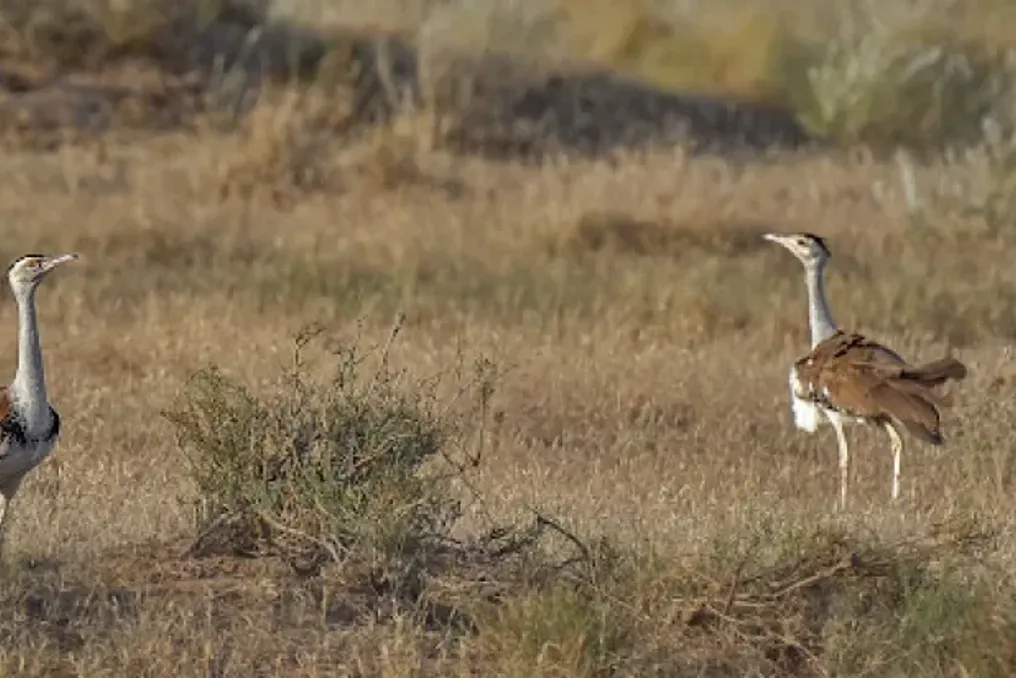
Scientists from the Wildlife Institute of India (WII) have identified sixteen priority conservation zones covering 18,000 square kilometers in the semi-arid Deccan landscape. The goal of these measures is to prevent the local extinction of the critically endangered Indian crane.
This giant terrestrial bird species, reaching almost a meter in height and being one of the heaviest flying birds on Earth, once inhabited all eleven states of India and parts of Pakistan. Today, fewer than 150 individuals remain in the wild, with populations in the south—Maharashtra, Karnataka, Telangana, and Andhra Pradesh—on the brink of complete disappearance.
Researchers, using precise satellite data obtained from GPS-tagged birds combined with detailed ecological layers, discovered that only 6.6 percent of the 720,000 square kilometers of the Deccan Plateau remains suitable habitat for this iconic species.
The investigation showed that the survival of the Indian crane depends on a complex combination of open grasslands and traditional low-intensity agricultural lands. Using maximum entropy modeling, the research team determined that the most critical factors determining the birds' habitats are seasonal rainfall patterns, especially during the hottest summer months, and moderate vegetation cover at the beginning of the monsoon season.
The cranes actively avoid dense, tall forests as well as heavily urbanized centers, preferring vast open spaces. There, they can perform complex mating displays, safely nest on bare ground, and forage for insects, seeds, and small reptiles.
To validate their digital computer models against real-world conditions, researchers conducted a large-scale field campaign across the Maharashtra landscape. More than 30 teams surveyed thousands of kilometers across 372 grid cells while interviewing over 1,400 local residents. Although no visual sightings of the elusive bird were made during the field trips, local ecological knowledge corroborated recent observations in 72 key areas.
When comparing these priority conservation zones with random areas in the region, it was found that the cranes' preferred sites contained a significantly higher proportion of cultivated land and natural local grasslands, and noticeably less dense deciduous forest.
The sharp decline in the crane population in South India over recent decades is attributed to rapid land transformation. Vast tracts of traditional arid farms, where farmers historically grew low-water-use legumes and oilseeds, leaving fields fallow, have been quickly converted to high-intensity cash crops such as sugarcane and cotton.
Combined with growing networks of power lines, expanding roads, irrigation canals, and the misclassification of natural open grasslands as unproductive 'wastelands,' the birds' extensive ranges have been fragmented into isolated, highly vulnerable patches.
This study significantly advances previous conservation efforts by shifting the focus from rigid, static protected area boundaries to dynamic management across the entire landscape. Traditional sanctuaries, such as Nannaj in Maharashtra or Rollapadu in Andhra Pradesh, have historically faced challenges because cranes are wide-ranging birds that naturally move through vast human-controlled agricultural mosaics, rather than remaining in small enclosed parks.
Previous works often relied on spontaneous human observations, whereas this study utilizes precise GPS telemetry data collected from wild birds, which significantly reduces observer bias and reveals subtle habitat preferences. Furthermore, by integrating species distribution models with local community knowledge, researchers provided a validated high-resolution spatial roadmap that identifies functional habitats outside the formal network of reserves.
Nevertheless, the study has certain regional and ecological limitations. The primary tracking dataset was based on a small sample of three GPS-tagged individuals, a limitation caused by the extreme rarity of the bird and ethical sensitivity regarding the capture of a critically endangered species. In regions like the Deccan Plateau, rapid socio-economic changes pose constant challenges; real-time land-use changes, such as the sudden installation of solar farms or high-voltage power lines, can alter habitat suitability faster than long-term satellite models can record.
Moreover, implementing conservation strategies across four different states—Maharashtra, Karnataka, Telangana, and Andhra Pradesh—requires complex inter-state political coordination and land policy that balances the livelihoods of local farmers with ecological restoration.
Restoring and protecting these priority conservation zones benefits far beyond saving a single bird species. The Indian crane serves as a vital flagship species for India's semi-arid Open Natural Ecosystems (ONE), which include natural grasslands, scrublands, and traditional agricultural pastures. Protecting these habitats safeguards an entire group of coexisting threatened animals, including grey wolves, Indian foxes, black antelopes, and colorful birds.
For human communities, preserving these semi-arid landscapes promotes the revival of sustainable, traditional dryland farming methods that require minimal use of chemical pesticides and less intensive groundwater extraction. Protecting open grasslands helps maintain regional hydrological cycles, prevents soil erosion, and supports a sustainable pastoral lifestyle. Ultimately, this spatial structure provides policymakers with a practical plan to balance green infrastructure development with biodiversity conservation, ensuring that economic progress is not achieved at the cost of losing India's natural heritage.