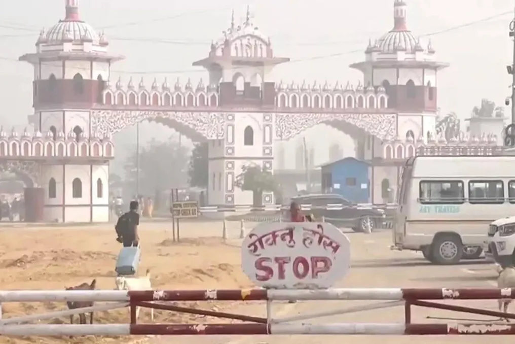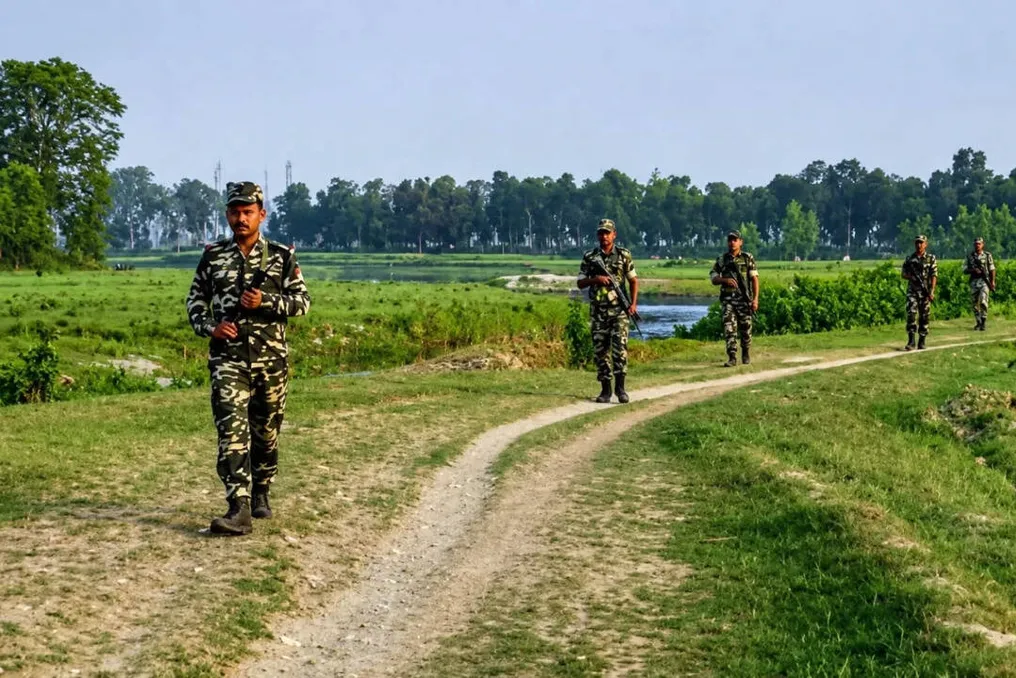
India and Nepal are turning to the use of unmanned aerial vehicles (drones) to map a section of their border that is formally supposed to remain undeveloped. This area is known as Dasgajha—a buffer zone or unclaimed land along the border between India and Nepal. However, parts of this zone have actually been occupied, cultivated, or built upon.
Both countries now intend to document this discrepancy through aerial surveys. At the thirteenth meeting of the Committee of Land Inspectors in Lucknow, India and Nepal agreed to use drones to map cross-border occupation, including incursions into Dasgajha. The joint survey is expected to begin after the monsoon season, around September or October, and will take three years.
Afterward, both sides will jointly analyze the aerial photographs to determine which territory is being used by citizens on the other side of the recognized border. This step followed remarks by Nepalese Prime Minister Bhalendra Shah in parliament in May, where he stated that India was encroaching on Nepali land, and Nepal was also occupying Indian land in some places.
The Nepalese Ministry of Foreign Affairs later clarified that Shah was referring to cross-border occupation and incursions into Dasgajha, not raising new territorial claims against India.
What is Dasgajha?
Dasgajha literally means 'ten yards' and refers to the buffer zone along the India-Nepal border. There is some variation in the description of its width. Indian reports usually indicate a buffer zone of 10 yards, while research by the Nepalese Institute of Foreign Affairs describes a buffer of 20 yards, with 10 yards extending from the border on each side.
The basic principle is that the immediate area around the international border should remain free of settlement, which simplifies identification, inspection, and maintenance of the border. In reality, this is difficult to implement along an open border spanning about 1880 km, which passes through agricultural lands, settlements, forests, roads, and river systems, with communities on both sides maintaining deep social and economic ties.
The Nepalese Institute of Foreign Affairs has documented the presence of people living in makeshift houses and tents in Dasgajha. Even when security forces remove such settlements, people may return.
Why are India and Nepal using drones to map the border?
The open border shared by India and Nepal does not have a continuous fence, and people regularly cross it for work, trade, family visits, and other purposes. However, an open border does not mean an undefined border; the international border is established using boundary pillars, maps, and geographical coordinates. Dasgajha provides an additional buffer around this line.
Maintaining physical markers has been a constant problem. According to the Nepalese Department of Survey, 8554 boundary pillars were installed along the border, of which 1325 are missing, and 1956 are partially or completely damaged. The absence of a pillar itself does not change the international border, as its location can be restored using survey data, coordinates, and maps. But on the ground, the absence of a marker significantly complicates determining the border trajectory, especially where fields, houses, and roads are close to the line.
The drone survey goes beyond Dasgajha. India and Nepal also want to map what officials call cross-border occupation. These are instances where citizens of one country live, cultivate, or otherwise use land located on the other side of the legally recognized border. The Nepalese Ministry of Foreign Affairs stated that this is what Shah referred to when speaking of Nepal occupying Indian territory, linking the issue specifically to the Fixed Boundary Principle used in river sections.
What if a river moves, but the border remains fixed? Many sections of the India-Nepal border run through or along rivers. Rivers naturally change their course due to erosion, sediment deposition, and the formation of new channels. This can create complex situations where the legal border is tied to a position established in earlier surveys. Under the Fixed Boundary Principle, the border can remain unchanged even if the surrounding river changes. The result can be a very unusual situation: a farmer may continue cultivating land that his family has used for generations, only for a later survey to establish that this land is now on the other side of the international border.
Missing boundary pillars and shifting river courses complicate an already complex border on the ground. The Nepalese Ministry of Foreign Affairs cited such river changes as one reason for cross-border occupation. The Nepalese newspaper Kantipur reported that decades of river course changes have shifted thousands of hectares of land from one side of the border to the other.
Most of the border is mapped
The new drone survey is not an attempt to redraw or rediscover the India-Nepal border. Technical work on the border dates back to 1981, when the Joint Technical Committee on the Nepal-India Border was established. After many years of surveying, the committee prepared 182 strip maps covering about 98 percent of the border. The maps were finalized in 2007 and excluded the unresolved areas of Kalapani and Susta. The Indian Ministry of External Affairs also noted that the strip maps covering 98 percent of the border were authenticated in 2007.
However, these maps were never officially ratified by both countries as a final settlement. Nepal insisted on resolving outstanding disputes, while India sought their approval. Nevertheless, they remain important technical reference information.
Why are boundary pillars a problem? A line on a map can be difficult to locate in the field without a physical marker. This is why India and Nepal maintain thousands of boundary pillars along the frontier. But many of them have been damaged, destroyed, or lost, especially in areas affected by rivers and erosion. Both countries are working to restore them. At the seventh meeting of the Border Working Group in July 2025, India and Nepal agreed to jointly build new pillars and repair damaged ones as part of their technical border works.
The Border Working Group, established in 2014, deals with issues such as clearing unclaimed land, building and maintaining boundary pillars, updating records of cross-border property, and other technical border matters. It does not cover the unresolved disputes of Kalapani and Susta. The technical mechanism functions on three levels: the Border Working Group, the Committee of Land Inspectors, and Joint Field Teams. Field teams conduct ground surveys, while the CLI and BWG review the results and determine the next technical steps. India and Nepal are using drone technology to survey parts of their open border where physical markers and changing landscapes create uncertainty.
Why use drones now?
The immediate goal is simple: to gain a much more accurate picture of what is happening on the ground. UAVs will capture aerial photographs of areas suspected of cross-border occupation. Then, Indian and Nepalese officials will jointly analyze the images and compare them with existing maps, coordinates, boundary pillars, and field data. Aerial photographs can precisely show where fields, houses, roads, rivers, and other physical objects are located relative to the established border.
However, the most important element is not the drone itself, but the joint verification. If both countries work with the same imagery and agree on the technical facts of a specific location, it becomes easier to determine what further action is needed. A jointly verified report can ultimately serve as a basis for negotiations on removing incursions, restoring land, or, if necessary, compensation.
Is this related to Kalapani and Lipulekh?
The India-Nepal border includes several separate disputes. Kalapani, Lipulekh, and Limpiyadhura concern Nepal's territorial claims in the western sector and competing interpretations of historical maps, documents, and the course of the Kali or Mahakali rivers. Susta is another separate dispute related to the change in the course of the Gandak or Narayani River. The current technical mechanism does not cover these unresolved areas. The 2025 WG agreement specifically excluded Susta and Kalapani-Lipulekh-Limpiyadhura from its technical work. The Dasgajha operation is more focused: it concerns unclaimed land, border infrastructure, and cross-border occupation along the established border.
What does this drone survey actually mean? At first glance, sending drones into Dasgajha might seem like a relatively routine survey. It is far from that. The India-Nepal border is unique: it is open to people, yet legally defined; socially intertwined, yet internationally sovereign. Over decades, rivers have changed their course, settlements have expanded, farms have crossed invisible lines, and boundary markers have disappeared. This has created a gap between the border on maps and the border perceived on the ground. Drones are an attempt to bridge this gap with evidence. They will not resolve Kalapani, nor will they redraw the map, nor will they solve all land disputes on their own. But they can provide India and Nepal with something often lacking in sensitive border discussions: a common, current, and verifiable snapshot of what is actually happening on the ground.