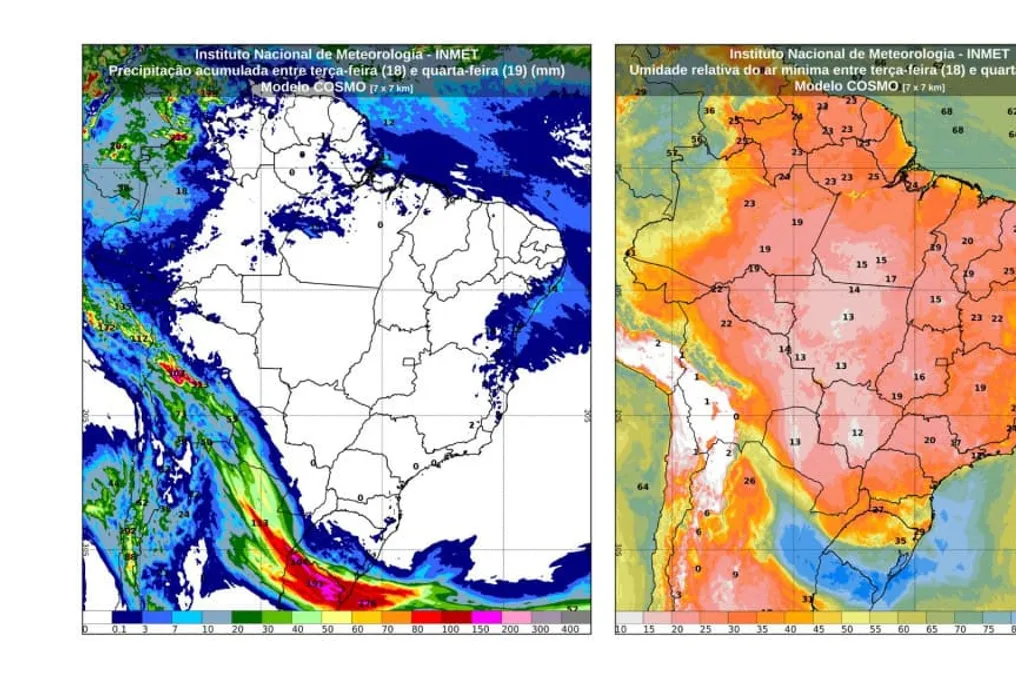
Due to the passage of a low-pressure area at higher altitudes in the atmosphere, the weather in Brazil will undergo significant transformations this Tuesday (25th) and Wednesday (26th). Inmet forecasts that the Center-West, Southeast, and northern South regions will experience a higher incidence of clouds, rain, and thunderstorms, with potential for storms and hail in certain locations.
Meanwhile, in the North and Northeast areas, hot and dry weather conditions are expected to persist across most of the territory. In the South, although the cold is beginning to decrease, there is still a possibility of frost occurring.
The movement of this atmospheric system should drive the formation of heavy clouds, intensifying the chances of heavy rains. This change will be most noticeable in the Center-West and Southeast regions.
Detailed regional forecasts
The state of Mato Grosso do Sul will concentrate a considerable portion of precipitation in the Center-West region, with showers accompanied by thunderstorms predicted for Wednesday. Isolated rain may also occur in southern Goiás, southern Mato Grosso, and the Federal District.
In the Southeast, the presence of many clouds has already been observed since Tuesday morning. Rain is expected on the northern coast of Rio de Janeiro and Espírito Santo. In the afternoon, rain should reach parts of São Paulo, Minas Gerais, and other areas of Rio de Janeiro.
On Wednesday, the weather will become more unstable. São Paulo and southern Rio de Janeiro may record thunderstorms, while Minas Gerais and other areas of Rio de Janeiro will have rain showers. Inmet maintained a yellow alert for potential danger of storms in much of São Paulo and Rio de Janeiro.
In terms of temperature, São Paulo will remain cold, with a minimum of 14°C and a maximum of 20°C. In Rio de Janeiro, thermometers will fluctuate between 16°C and 27°C.
Tuesday starts with the possibility of frost in much of Rio Grande do Sul and the Catarinense Range. Paraná and Santa Catarina may also present isolated rain.
Intensification of rains in the South
On Wednesday, the intensity of the rain will increase. Paraná may record showers with thunderstorms, and Santa Catarina will also have areas under rain. There is a yellow warning for potential danger of storms valid for all of Paraná and western Santa Catarina.
In Porto Alegre, the predicted minimum temperature is 5°C, and the occurrence of frost in lower areas of the city has not been ruled out.
In the North, Roraima and Amazonas are the areas where the main rains are concentrated. On the other hand, Tocantins, as well as the south and southeast of Pará, should maintain stable weather and low air humidity.
Conditions in the Northeast
In the Northeast, rain tends to be more limited to the coastal strip, while the interior will be dominated by heat, little cloud cover, and dry air. In Teresina, temperatures may reach 37°C.
The most significant climate change will occur between Tuesday and Wednesday, a period when the increase in clouds and rain will affect the Center-West, Southeast, and South regions, raising the risk of storms in several states.