South Africa is a country where one can observe an incredible diversity of landscapes: standing over a canyon in the morning, walking through an ancient forest during the day, and swimming over a coral reef a few days later. These landscapes are not only picturesque but also hold some of the oldest stories on Earth.
From mountains formed billions of years ago to wetlands where whales, turtles, and hippos inhabit one coast, South Africa offers numerous outstanding natural wonders.
Cape Town cannot be imagined without Table Mountain. This flat-topped mountain rises above the city and the Cape Peninsula, being much more than just a famous backdrop. It is part of the Cape Floral Region protected areas, which is recognized as a UNESCO World Heritage site due to the exceptional concentration of endemic plant species.
Table Mountain has been part of the human landscape for millennia. Archaeological findings indicate human presence dating back 30,000 years, and the name Khoi Khoeriekaggo translates to 'Mountain in the Sea'. Table Mountain was declared a national monument in 1958, then a nature reserve in 1964, and the Cape Peninsula National Park was established in 1998, after which it was renamed Table Mountain National Park in 2003.
Why Visit Table Mountain
Visitors can hike up the mountain, explore the fynbos, enjoy views from the summit, or travel further south through the national park to the Cape Point. The park also offers opportunities for cycling, rock climbing, paragliding, bird watching, snorkeling, and whale watching.
Blyde River Canyon is one of those landscapes that makes you stop and think. It is carved into the Drakensberg plateau and stretches across a dramatic landscape composed of cliffs, forested slopes, and the Blyde Dam. The Blyde River Canyon Nature Reserve is part of the Route Panorama and covers about 29,000 hectares. The tourism company South African Tourism calls it the third largest canyon in the world, and the combination of lush vegetation and open red sandstone makes it one of the most characteristic geological landscapes in the country.
The wider Route Panorama connects several famous tourist and geological sites in the Mpumalanga province, including God's Window, Bourke's Luck Potholes, and Three Rondavels.
Tips for Visiting Blyde River Canyon
It is recommended to move slowly along the scenic route, stopping at viewpoints, studying the geological formations, and hiking in the reserve if the trails are open. This landscape is particularly attractive to photographers, especially when fog descends over the plateau.
Few places demonstrate the ecological diversity of South Africa as vividly as iSimangaliso. Located along the KwaZulu-Natal coast, this World Heritage site combines beaches, coral reefs, coastal dunes, freshwater lakes, wetlands, mangrove swamps, grasslands, and savannas.
The park was included in the UNESCO World Heritage list in 1999, and in 2025, its World Heritage boundaries were significantly expanded within the iSimangaliso Wetland Park – Maputo National Park transnational park.
The importance of this place is not limited to its beauty. iSimangaliso hosts over 6,500 species of plants and animals, including nesting loggerhead and leatherback turtles, dolphins, migrating whales, and whale sharks.
How Best to Explore iSimangaliso
This destination allows visitors to see several ecosystems in one trip. One can go on safari, explore the wetlands, spend time at Lake St Lucia, or head to the coast for marine activities. Depending on the season and location, one might encounter hippos, crocodiles, turtles, whales, and a huge variety of birds.
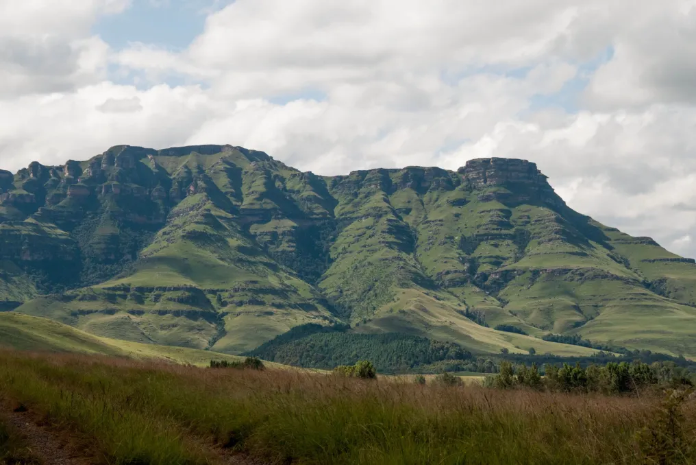
The Drakensberg impresses with its grandeur, which is difficult to capture in photographs. Its basalt cliffs, golden sandstone formations, high-altitude grasslands, and deep river valleys are part of the transboundary Maloti-Drakensberg World Heritage Site, which extends into Lesotho. However, the mountains also carry a historical layer. San communities lived here for over 4,000 years, leaving thousands of images of rock art in caves and rock shelters. UNESCO recognizes this area as containing the largest and most concentrated group of rock paintings in Southern Africa.
The mountains are also important for biodiversity, as they host many endemic plant species and endangered birds such as the Cape and Bearded Vultures.
Recommendations for Visiting the Drakensberg
The Drakensberg is best experienced on foot, whether you are looking for a short mountain hike, a multi-day trek, or a tour to rock art sites. It is also worth taking time just to sit and observe the landscape, as the scale of the landscape is part of the experience.
In the dry landscape of the Northern Cape, the Orange River suddenly plunges into a granite canyon near the Augrabies Falls. The main waterfall drops 56 meters into the canyon, and the surrounding national park protects the stunning landscape of granite formations, arid vegetation, and quiver trees.
The park was created in 1966 initially to preserve the geological landscape around the waterfall. The name Augrabies comes from the Nama word 'Aukoerebis', meaning 'place of great noise', which fits the description of the Orange River flowing strongly.
There is also a complex history associated with the surrounding area. In 1973, communities living in Riemvasmaak were forcibly relocated under apartheid, and parts of this territory were later incorporated into the national park.
How to Explore Augrabies Falls
One can start the tour from the waterfall viewpoints and then delve deeper into the park. Scenic roads lead to places like Moon Rock and Ararat, while hiking options include short routes and the multi-day Klipspringer trek. Stargazing is also one reason to stay overnight due to the clear sky and limited light pollution in the area.
Where local forest meets rugged coast, Tsitsikamma feels almost prehistoric. The name comes from the Khoisan word meaning 'place of much water', and the landscape justifies this name, offering forests, fynbos, deep river gorges, and open coastline.
The Tsitsikamma Coastal and Forest National Parks were established in 1964, creating what SANParks describes as Africa's first marine national park. Today, the Tsitsikamma section is part of Garden Route National Park and protects about 80 km of rocky coastline, as well as important marine and forest habitats.
This area also has a deep human history, including Khoisan cultural sites, caves, shell middens, rock art, and later evidence of forestry and fishing industries.
What to Do in Tsitsikamma
One can walk the famous Mouth Trail to the Storms River suspension bridge, take a boat trip through the gorge, or complete the five-day Otter Trail trek of 42 km along the coast. Kayaking, wild swimming, snorkeling, and other water adventures are also available.
Some natural wonders impress with what they allow you to see, while others impress with what they tell us. The Barberton Makhonjwa Mountains belong to the latter category. These mountains contain some of the oldest and best-preserved volcanic and sedimentary rocks on Earth, dating back 3.6 to 3.25 billion years. These rocks provide evidence of early Earth conditions, including ancient oceans, volcanism, meteorite impacts, and continental formation processes.
The site was added to the UNESCO World Heritage List in 2018. Its geological record spans approximately 340 million years of early Earth history, allowing visitors to glimpse times long before dinosaurs, forests, or even complex life.
How to Explore the Barberton Makhonjwa Mountains
Visitors can follow the Barberton Makhonjwa Geotrail through the mountains, stopping at geological viewpoints. This is a particularly good place for those who prefer landscapes with additional context, as the stones underfoot tell a story.
The history of South Africa becomes even grander at Cradle of Humankind, where a meteorite impact over two billion years ago left behind the oldest, largest, and most deeply eroded known complex structure of a meteorite impact in the world. The impact occurred about 2.023 billion years ago. The resulting structure originally extended much further than the landscape visible today, but erosion over billions of years has exposed the geological layers beneath the original crater. UNESCO describes Cradle of Humankind as the only known example providing a complete geological profile of an astrobleme beneath the crater floor.
Exploring Cradle of Humankind
It is best to explore the Cradle of Humankind area at a slow pace, utilizing geological sites, scenic drives, outdoor activities, and the surrounding Vaal River landscape. The focus here is less on finding one dramatic view and more on understanding the extraordinary scale of what happened in this place.
The charm of South Africa's natural wonders is that there is no single definition of what makes a place exceptional. A mountain can be wonderful because it supports an entire floral kingdom. A wetland can be valuable because whales, turtles, birds, and freshwater ecosystems coexist. A waterfall can carry geological and cultural history, and a simple rock formation can preserve evidence from billions of years ago. This is what makes traveling through South Africa such a rewarding experience. You need to look beyond the photograph, and a much larger story usually awaits.