
Windy, rainy, and cool weather expected in parts of South Africa over the weekend
Read more
IOL
iol.co.za

Windy, rainy, and cool weather expected in parts of South Africa over the weekend

South Africa is preparing for mixed winter weekend weather: most of the country will be predominantly dry and stable, but the southern and southeastern regions will face cooler weather, strong winds, and possible precipitation.

On Saturday, Gauteng is expected to have mostly clear and warm weather with a high UV index. Mpumalanga and Limpopo provinces will also be clear and warm, although morning fog is forecast for the east, and temperatures in Lowveld may rise to high levels. The North West province will be clear and warm, but wind is expected in the far southwest.

In Free State, the weather will be clear but windy, with temperatures ranging from cool to warm. The Northern Cape will see partial cloudiness in the southwest in the morning, where it will be cold. In the rest of the province, the weather will be clear and cool to warm, with strong winds expected in the far east.

The Western Cape feels distinctly like a winter region: cloudiness and morning fog are expected in the southern areas. The rest of the province will be partly cloudy and cool to moderate. Chances of rain remain limited, with a 30% probability of isolated showers around the southwest Cape on Saturday, especially towards the evening.

The Eastern Cape will be one of the least stable regions. The western half will be cloudy with morning fog in places and partly cloudy with cool weather, although it will be warmer in the northeast. At night along the coast west of Gqeberha, there is a 30% chance of light rain. The eastern half will be partly cloudy and cool to warm, with morning fog south of the escarpment and windy conditions in places.

Strong winds will be a main feature of the Eastern Cape coast, where squally gusts are possible. A Level 2 yellow warning for destructive winds has been issued for parts of the province, including Joe Gqabi, Chris Hani, Nelson Mandela Bay, and several coastal municipalities. Another Level 2 yellow warning covers destructive winds and waves from Plettenberg Bay to Port Alfred from mid-morning, extending to Coes Bay in the evening.

KwaZulu-Natal will enjoy clear and warm to hot weather before cloudiness increases in the east during the day. Coastal winds will strengthen from the southwest during the day and spread northward. The UV index will be very high.

On Sunday, dry weather is expected to persist inland, with predominantly clear and warm conditions in the northern and central parts of the country. Temperatures will be warm or hot in some areas of Limpopo and Mpumalanga, while cooler air will remain closer to the southern coast. Fog and coastal clouds will continue to be observed in the southern and eastern areas in the morning.

The Western Cape will remain partly cloudy or cloudy at times and cool to moderate, with the next chance of light rain over the southwestern areas. Windy conditions will persist along the Eastern Cape coast, and strong southwesterly winds and rough seas will make coastal activities and navigation dangerous in affected areas.

Similar stories

Sunday weather forecast: cool morning, warm day, and fire threat warnings
Read more
iol.co.za

Sunday weather forecast: cool morning, warm day, and fire threat warnings

Residents of South Africa can expect mostly good weather on Sunday, characterized by cool morning temperatures and moderate or warm conditions throughout the day. According to the South African Weather Service (SAWS), no weather-related warnings or advisories have been issued; however, extremely high fire danger conditions are expected in some areas of the Northern Cape, Western Cape, and Eastern Cape.

The affected areas include the Ubuntu municipality in the Northern Cape, the Beaufort West municipality in the Western Cape, and the Dr. Beyers Naude municipality in the Eastern Cape. Temperatures will vary significantly across the country.

Upington is expected to be the warmest of the major centers with a temperature of 28°C, followed by Gqeberha at 27°C. In Gauteng, Pretoria and Johannesburg should reach maximums of 22°C and 21°C respectively, while Vereeniging will only reach 19°C.

Cape Town will start with patches of morning fog, after which the weather will become clear, with a maximum temperature of 19°C. George is expected to reach 22°C.

In KwaZulu-Natal, Durban is expected to have good weather with a minimum of 15°C and a maximum of 23°C. Richards Bay is expected to reach 24°C, and Pietermaritzburg may reach 25°C.

Elsewhere, Polokwane is forecast to reach 22°C, Mahikenga 23°C, Kimberley 23°C, and Bloemfontein 21°C. SAWS also predicted a high level of UV radiation in Durban and a very high level in Cape Town.

Weather Forecast: Snow, Rain, and Strong Winds Expected in South Africa on Tuesday
Read more
iol.co.za

Weather Forecast: Snow, Rain, and Strong Winds Expected in South Africa on Tuesday

The South African Weather Service forecasts widespread precipitation, snowfall, and frost across large parts of the country on Tuesday, issuing warnings of dangerous weather conditions for the provinces of Eastern Cape, KwaZulu-Natal, and Mpumalanga.

Residents of South Africa should prepare for another day of harsh winter weather on Tuesday, as snow, heavy rain, gusty winds, and very low temperatures are expected in large areas of the country.

The Weather Service warned that the most severe conditions are likely in the Eastern Cape, where a Level 6 warning for blizzards has been issued.

Heavy snow is expected in parts of eMalahleni, Sakhexiswa, Senku, Elundini, and Matatile, which could lead to serious disruptions in transport, temporary road closures, and inaccessibility of certain settlements.

The probability of precipitation will be highest in the eastern territories of the country. Mpumalanga will face chances of widespread rain and downpours from 60% to 80%, while KwaZulu-Natal and the eastern half of the Eastern Cape may expect a 60% chance of rain, which increases to widespread fall along the coast.

Extremely cold weather is expected in most regions of South Africa on Tuesday. Gauteng is forecast to have a 30% chance of showers and rain, and Free State has a 30% chance of showers, which could rise to 60% in the eastern areas.

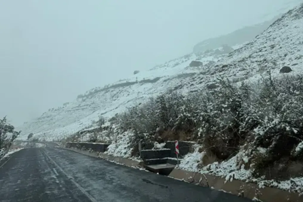
Snow is expected in the mountainous areas of the Eastern Cape and on the western uplands of KwaZulu-Natal; light snowfall is also possible in areas bordering Lesotho, in the Free State. Light snowfall may occur in Beaufort West of the Western Cape in the morning.

Very cold conditions are forecast in Gauteng, Mpumalanga, Free State, KwaZulu-Natal, and most of the Eastern Cape, with strong winds expected to exacerbate the situation.

Along the KwaZulu-Natal coast, stormy winds and rough seas may disrupt maritime activities and navigation, and later in the day, gale-force winds are expected along part of the Western Cape coast.

In Gauteng, residents can expect a cloudy, cold, or very cold day with scattered showers. Mpumalanga will remain cloudy and cold with widespread rain, while Limpopo is forecast to have isolated or scattered thunderstorms, especially in the southeast.

The North West will be cool and windy with isolated rain and thunderstorms.

The Weather Service advised drivers, farmers, and residents of affected areas to take necessary precautions, as the combination of snow, rain, strong winds, and sub-zero temperatures can lead to dangerous travel conditions, livestock losses, and disruptions to essential services.

Popular