Botswana Footprints offers comprehensive services for booking tours, campsites, and lodges in Botswana
Read more
Getaway
getaway.co.za

Botswana Footprints offers comprehensive services for booking tours, campsites, and lodges in Botswana

Planning an adventure in Botswana can seem like a complex task due to the need to coordinate camping permits, national park fees, lodge bookings, and off-road logistics through numerous operators. The company Botswana Footprints solves this problem.

This booking company is based in Maun, which serves as the gateway to the Okavango Delta, and helps alleviate the stress of planning a safari in Botswana, whether the traveler prefers self-driving in the wilderness or joining a fully organized mobile tented safari.

Essentially, Botswana Footprints acts as a single hub for all travel needs in Botswana: campsites, national parks, reserves, and lodges. Instead of independently searching for and paying for every part of the trip, the company's team handles the entire itinerary and consolidates everything into one payment.

After booking, they send vouchers worldwide, allowing travelers to arrive in Botswana with all necessary documentation, bypassing border hassles.

A distinguishing feature of the company is that its consultants are on-site in Maun and have personally visited every lodge and campsite they book. This ensures that recommendations are based on real knowledge of the destinations, rather than just being taken from a brochure.

The company specializes in some of Botswana's most sought-after (and notoriously difficult to book) locations. Furthermore, they can arrange bookings at any lodge or hotel across Botswana, as well as campsites and lodges abroad in Namibia (in the Caprivi Strip area) and Zimbabwe (Victoria Falls).

For the growing number of travelers who wish to navigate the wild areas of Botswana independently, the company connects them with vetted 4x4 rental operators. If the traveler is using their own vehicle, Botswana Footprints manages the administrative aspects: permits, park reservations, and all necessary documentation for independent road trips.

Lodge Bookings:

The Okavango Delta and Botswana itself offer the most picturesque and luxurious lodges with unique offerings; by providing their budget, clients can receive assistance in curating the perfect stay in Botswana.

Campsite Bookings for Self-Drive:

Route planning combined with booking campsites, lodges, and national parks is offered. This is ideal for those who want to enjoy the freedom of the open road without the headache of administrative procedures.

Mobile Tented Safaris:

Both private and scheduled mobile tented safaris are available for those seeking the classic Botswana experience under canvas.

Specialized Safaris:

The company organizes bespoke trips, including family safaris, horseback safaris, birdwatching safaris, photographic safaris, honeymoons, and fishing safaris.

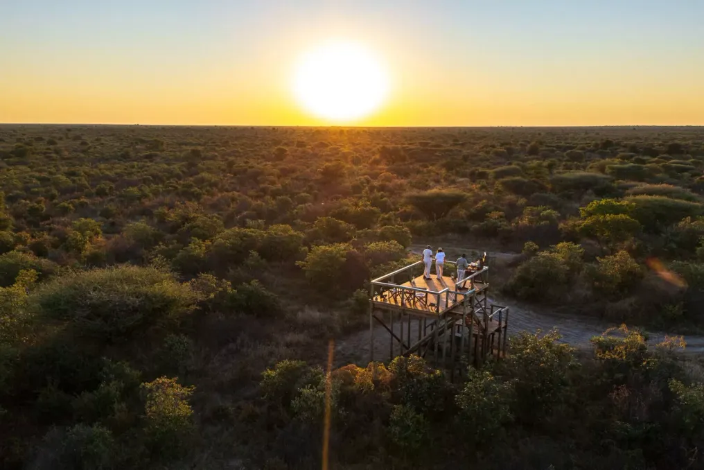
Whether you dream of sunsets in the Kalahari, tracking leopards in the tall grass, or cruising the Okavango waterways on a mokoro, Botswana Footprints will help make the logistics an easy part of your journey.

Contact Information: Botswana Footprints Booking Company, Plot 533, Mathiba Road, Maun, Botswana.

Similar stories

World Cities Best Explored on Foot
Read more
getaway.co.za

World Cities Best Explored on Foot

Some cities are best understood by walking. Walking transforms the space between attractions into part of the experience itself, revealing local markets, cafes, street vendors, architecture, and daily life that can easily be missed while sitting in a car.

From the winding streets of Marrakech to the boulevards of Ljubljana, these cities reward travelers willing to slow down and explore the city at the street level.

Tbilisi

Tbilisi is a city where wandering without a strict plan can be the best way to explore. Its Old Town is a mosaic of narrow alleys, wooden balconies, colorful facades, churches, and courtyards, whose architecture reflects the city's position at the crossroads of Europe and Asia.

Start your journey near Abanotubani, a historic district with sulfur baths, and then climb up the Old Town towards Metekhi. Stop to admire the characteristic wooden balconies before continuing towards the Dry Bridge area, where everything from Soviet-era souvenirs to works of art and antiques is sold at an open-air market.

The reward here is not just reaching the next attraction. It is the opportunity to see how centuries of history coexist with cafes, wine bars, residential buildings, and everyday city life. Be sure to visit the Dry Bridge Market, the Abanotubani sulfur baths, and enjoy the views from Narikala Fortress.

Kyoto

Kyoto's main temples and shrines are enough reason to visit, but walking between them reveals another side of the former imperial capital. In the Gion district, atmospheric streets are framed by traditional machiya wooden houses, and nearby Higashiyama offers alleys leading to temples, gardens, and small shops.

Further into the city, Nishiki Market introduces travelers to Kyoto's culinary culture, offering stalls with pickled vegetables, sweets, seafood, and other local delicacies. Walking also allows one to appreciate quieter details: a paper lantern near a restaurant, a tiny garden behind a wall, or the sound of a passing bicycle in a residential alley.

Try starting early, especially in the popular Higashiyama and Gion districts, when the streets are less crowded and the city feels less rushed. Don't miss: Gion, Higashiyama, Nishiki Market, and Philosopher's Path.

Lisbon

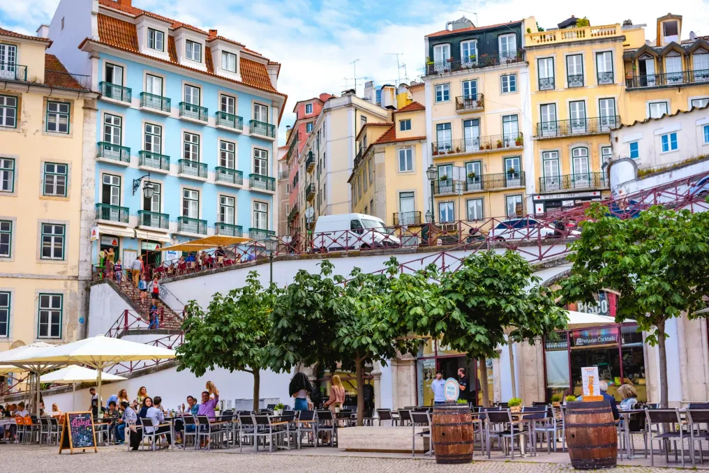
Lisbon is a city of hills, viewpoints, and streets that seem designed to delight curious pedestrians. In the Alfama district, narrow alleys wind between brightly colored buildings clad in tiled facades and balconies adorned with laundry.

This district rises to São Jorge Castle, from where views of terracotta roofs and the Tagus River can occasionally be seen. Nearby Mouraria offers a different perspective, with multicultural restaurants, small shops, and streets shaped by generations of immigrants.

A walk through Lisbon also involves embracing the hills. Instead of viewing them as an inconvenience, use them to structure your day: climb to a viewpoint, stop for a pastel de nata or coffee, and then descend into another neighborhood. The city changes noticeably from one street to another. Don't miss: Alfama, Mouraria, Miradouro da Senhora do Monte, and the streets around Baixa.

Marrakech

The Medina of Marrakech is best experienced at a slow walking pace. Inside the old city walls, narrow passages lead through souks filled with leather, spices, lamps, textiles, and handicrafts. The atmosphere constantly changes: one moment you pass a quiet entrance to a riad, and the next you are surrounded by stalls and the shouts of vendors.

Start at Jemaa el-Fna square and follow the alleys into the souks. While walking, look not only at the purchases. Ordinary doors may hide richly decorated riads, and small workshops display the work of artisans. The Medina can seem chaotic, especially during peak hours, but this is part of the experience. Walking forces you to interact with the city rather than just observe it. Take time to pay attention to direction and allow room for deviations from the route. Don't miss: Jemaa el-Fna, souks, Madrasa Ben Youssef, and the Mellah.

Ljubljana

Ljubljana proves that a city does not need to be huge to be interesting. The Slovenian capital has a compact historic center located around the Ljubljanica River. Bridges, public squares, cafes, and market stalls create a cityscape that is easy to explore without a car.

Start at the Central Market, then cross the Triple Bridge into the Old Town. Follow the river, stopping at cafes or riverside restaurants, and then climb up to Ljubljana Castle to enjoy views of the city rooftops and surrounding hills. The best thing about this city is its pace. Ljubljana encourages lingering, not rushing between attractions. Its pedestrian-friendly center means that ordinary activities—buying fruit at the market, having coffee by the river, or watching cyclists pass by—become part of sightseeing. Don't miss: Central Market, Triple Bridge, Ljubljanica River embankment, and Ljubljana Castle.

Naples

Naples is not flawless in the conventional sense, and that is why it deserves a spot on this list. Its historic center is dense, noisy, and wonderfully unpredictable. Laundry hangs over narrow streets, scooters weave through gaps, tiny restaurants spill onto sidewalks, and ancient churches appear among ordinary shops.

A walk through Spaccanapoli gives a concentrated view of the city's character. This long, narrow route passes through the historic center, past churches, cafes, pizzerias, and shops. Naples is also a city where food becomes part of the walk. Stop to eat a slice of pizza, sfogliatella, or have an espresso, and then continue exploring. The experience is not about making every street beautiful, but about seeing the city as it truly is. Don't miss: Spaccanapoli, Via dei Tribunali, the historic center, and the Quartieri Spagnoli.

Istanbul

Few cities make a walk as geographical as Istanbul. A daytime stroll here can take you from Byzantine monuments and Ottoman mosques through bustling markets and neighborhood cafes, ending by the Bosphorus.

Start near Sultanahmet, where Hagia Sophia and the Blue Mosque are the center of one of the city's most historic parts. From there, move towards the Grand Bazaar and Eminönü, where ferries, street food vendors, and passengers create a constantly moving urban landscape. Continue towards Galata and Karaköy to discover the other side of the city, where independent shops, cafes, and restaurants occupy historic buildings.

A walk through Istanbul also makes it impossible to ignore its connection to water. The Bosphorus is not just a picturesque backdrop; it is part of how the city moves, feeds, and connects. Don't miss: Grand Bazaar, Eminönü, Galata, Karaköy, and the Bosphorus waterfront.

George Town

George Town on Penang Island is a city best understood one street at a time. Its historic center combines Chinese shophouses, Indian temples, mosques, colonial buildings, clan houses, cafes, and colorful street art. The result is a cityscape reflecting the diverse communities that have shaped the city over generations.

Walking also makes it impossible to avoid George Town's culinary culture. Food courts and street stalls are found throughout the city, offering Malaysian dishes alongside Chinese, Indian, and Peranakan influences. A walking route can easily turn into a gastronomic tour with stops for noodles, curry, sweets, or coffee. Look up while walking. Intricately decorated shophouses and old signs are as much a part of the experience as the ground-level attractions. Don't miss: Armenian Street, Little India, Clan Jetties, street art routes, and George Town food courts.

The appeal of these cities is not just that they are easy to navigate without a car. Walking changes what you pay attention to. Traveling by transport usually breaks the city down into points on a map: hotel, museum, restaurant, viewpoint. Walking connects these points. The journey becomes part of the destination. You notice a woman arranging flowers near a shop, the smell of bread from a neighboring bakery, children playing in the square, or an old building not mentioned in any guidebook. You learn how locals use public spaces, where people actually eat, shop, and meet. There is also a useful degree of unpredictability when walking. You might turn wrong, discover a market you didn't plan to visit, or find a small cafe simply because you are tired and need a place to sit. These are often where the most memorable travel moments happen. Trying to cross the entire city on foot can turn a pleasant day into an endurance test. Instead, choose one or two neighborhoods and explore them thoroughly. Popular historic areas are often most atmospheric before the crowds arrive. Starting early can also make the walk more comfortable in warmer places like Marrakech. Do not fill every hour with attractions. Allocate time for wandering, stopping for coffee, browsing the market, or following an interesting street. It sounds obvious, but cobblestones, hills, and uneven historic streets can quickly demand comfortable shoes. A good pair of walking shoes is one of the most useful things to bring. The best cities for walking do not necessarily require you to walk everywhere. Use trains, trams, buses, or ferries to get to the neighborhood, and then explore it on foot.
Exploring Lesotho's Forgotten Western Highlands in 72 Hours
Read more
getaway.co.za

Exploring Lesotho's Forgotten Western Highlands in 72 Hours

Instead of following the standard route through Sani Pass, one can explore a quieter part of the Kingdom in the sky, located in Lesotho's western highlands. Here, winding roads lead to sandy valleys, traditional villages, waterfalls, and mountain trails.

A three-day trip is enough to see some of the most memorable landscapes of western Lesotho, especially in the areas of Morija, Malaleale, and Semonkong. During the trip, you can replace a car with a Basotho pony, hike in the mountains, try local cuisine, meet communities, and stand above one of South Africa's most impressive waterfalls.

This journey is intended for travelers who prefer to slow down and truly experience the place, rather than just ticking off sights.

Starting the Journey in Morija

The route begins in Maseru, from where you travel south towards the mountains, with the first stop in the historic town of Morija. This town is home to the Morija Museum and Archives and the Maeder House, one of Lesotho's oldest surviving buildings. The Protestant mission in Morija was founded in 1833, making it one of the country's most significant historical settlements.

After visiting Morija, you head towards Malaleale. The landscape gradually changes as the lowlands give way to rugged valleys and majestic sand formations. Part of this experience includes crossing the 'Gate of Paradise Pass'. Soon the road opens up into the mountains around Malaleale, where the landscape is adorned with traditional villages and grazing animals.

Malaleale is an ideal place to slow down. This area is particularly known for horseback riding, hiking, mountain biking, and cultural events. Lesotho's tourism authorities describe the Central Horse Trekking/Hiking route as a journey through rural mountainous terrain that can connect Malaleale with Semonkong, including opportunities to stay in traditional Basotho villages along the way.

You don't need to plan a multi-day trek to enjoy this. Instead, you can book a shorter pony excursion and let the Basotho ponies do what they have done for generations: navigate mountain trails. The essence of this experience is not just moving from one viewpoint to another; on horseback, you can watch shepherds move livestock across the hills, pass by remote settlements, and see how people and animals naturally fit into the highland landscape.

It is worth taking time to wander around Malaleale instead of spending the whole day in a hotel. Look for traditional rondavels, fields carved into the slopes, and locals engaged in daily activities. A local guide can provide context to what you are seeing, ranging from traditional architecture and agriculture to the importance of horses in rural life. It is here that the trip begins to feel completely different from a typical mountain getaway. The scenery is magnificent, but the people and the pace of life give it meaning.

Local Traditions and Overnight Stay

After a day outdoors, choose a simple and local dinner. Seek opportunities to try traditional Basotho food, including pap, vegetables like moroho, beans, and other hearty dishes. A home-cooked meal in the mountains is much more memorable than rushing back to Maseru for dinner. The goal of this trip is to experience Lesotho, not just photograph it.

It is best to spend the night in the Malaleale area, and if the weather is clear, go out after dark. Away from city lights, the highland sky becomes another attraction.

Day Two: Adventure Between Malaleale and Semonkong

The second day is dedicated to adventure in the heart of the trip. The official Central Horse Trekking/Hiking route connects Malaleale and Semonkong through rural mountainous terrain, although the full route is conceived as a multi-day horse or hiking expedition, not a quick drive. For a 72-hour plan, you can travel between these two bases and include shorter walks, viewpoints, and stops in villages along the way.

Do not rush this section. The road itself is part of the attraction. The western highlands are made for spontaneous stops. You can stop wherever it is safe and admire the valleys, cliffs, and distant peaks. In warmer months, the mountains can be surprisingly green, while winter brings harsh beauty to the landscape and the possibility of snow at higher altitudes. Lesotho's tourism body notes that summer is especially suitable for hiking and exploring the countryside, while winter offers snow and skiing opportunities in other parts of the country.

Don't forget to keep your camera ready to capture small details: colorful blankets, horses on mountain trails, shepherds on slopes, and villages hidden in valleys. Semonkong is situated in a dramatic mountain setting near the Maletsunyane River, surrounded by the Maluti Mountains. Semonkong Lodge offers a base for exploring the area by pony, mountain bike, or on foot. The town and surrounding countryside are particularly attractive to adventure lovers, offering activities such as hiking, mountain biking, horseback riding, fishing, and waterfall activities.

If time permits, take a short hike until sunset. The changing light over the hills is reason enough to linger.

Climax: Maletsunyane Waterfall

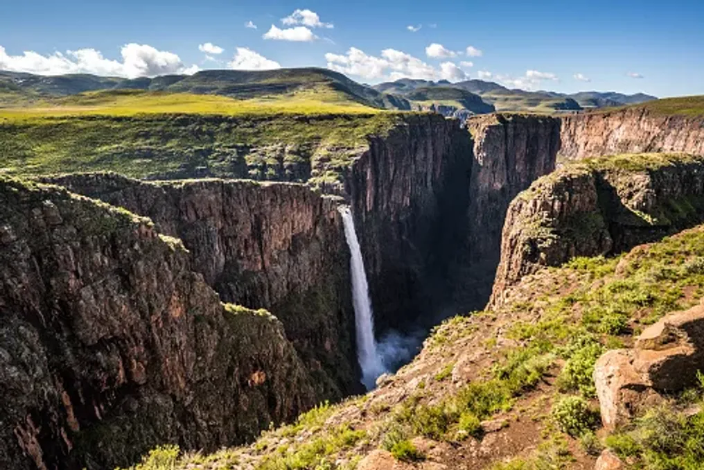
The last morning brings the biggest natural spectacle of the trip. The Maletsunyane Waterfall plunges 192 meters into a dramatic canyon, making it one of the highest single-drop waterfalls in South Africa. The waterfall is also a central element of adventure tourism in Semonkong, offering organized tours from the local area.

There are several ways to see Maletsunyane. You can walk to enjoy the surrounding scenery, or organize a horseback tour for a more traditional Lesotho experience. The local tourism offering combines the waterfall with hikes and horse rides, allowing the trip itself to be part of the adventure, rather than just arriving at a viewpoint.

When you finally reach the canyon, take time to absorb it. The waterfall seems almost too large against the backdrop of the surrounding mountains, and the water disappears into the canyon below. For thrill-seekers, Semonkong offers one of Lesotho's most famous adventures: a zip line descent near the Maletsunyane Waterfall. The commercial descent exceeds 200 meters and is promoted by Lesotho Tourism as the longest commercial single-drop descent in the world. This is not necessary for everyone. For everyone else, simply standing above the waterfall, watching the spray rise from the canyon, and listening to the water below is an adventure in itself.

After viewing the waterfall, find a place to sit and eat while the mountains entertain you. Manong Restaurant, located near the waterfall, is advertised as a place to enjoy food with a view of the falls. Its name refers to the bearded vultures inhabiting the area. It is a fitting final stop: food, mountain air, and the waterfall stretching out below.

If the return journey allows extra time, consider adding Thaba Bosiu to the itinerary. This mountain is closely associated with King Moshoeshoe I, the founder of the Sotho kingdom, and served as his residence and military fortress from 1824 until his death in 1870. Lesotho Tourism also promotes a three-day historical trekking and horseback riding route that follows Moshoeshoe's footsteps to Thaba Bosiu. Even a short visit adds an important historical layer to the journey.

After several days of scenery and active recreation, it reminds you that these mountains are not just beautiful nature. They have shaped the history and identity of the country.

Lesotho is often reduced to a pass, a ski resort, or a stopover point on a longer road trip through South Africa. But this underestimates the country. The western highlands offer something slower and deeper. You can spend the morning on horseback, take a walk through a mountain village in the afternoon, and see a 192-meter waterfall the next day. You can sleep under the mountains, eat locally prepared food, and travel for hours on roads where the scenery changes around every bend. Most importantly, you don't need to plan an epic expedition. A long weekend might be enough to feel it. And once, seeing the mountains from behind a Basotho pony, standing above the Maletsunyane Waterfall and watching the last light disappear behind the highlands, three days might leave you wanting to book three weeks.

Lesotho is accessible by road from South Africa through several border posts, making a road trip one of the easiest ways to explore the country. For this route, allocate enough time for the mountain roads, rather than planning days around rigid arrival deadlines. If you want to hike between Malaleale and Semonkong, organize a corresponding multi-day route with a guide, rather than trying to improvise it as a car trip. Lesotho is a year-round destination. Summer is ideal for hiking and exploring the countryside, while winter brings colder conditions and the possibility of snow at high altitudes. The western highlands reward travelers who leave room for surprises: a village worth photographing, a mountain trail that looks too good to ignore, or a roadside view that makes you stop.

Best Walking Routes Along the Rivers of South Africa
Read more
getaway.co.za

Best Walking Routes Along the Rivers of South Africa

Walking along a river gives a hike a more measured pace, as visitors stop to observe the water, cross banks, navigate stones, or pause by an attractive water body. South Africa is rich in impressive rivers, and exploring them doesn't always require a canoe or raft; many of the most enjoyable aquatic adventures are done on foot, following the rivers through mountain valleys, gorges, forests, and increasingly rugged landscapes.

Routes range from a trail near Cape Town to a multi-day trek in the Northern Cape. Here are some places where the best way to experience the river is simply to follow it.

If you enjoy hikes with water underfoot, Kromrivier is a good starting point. This trail is located in the Limietberg mountains near the Du Toitskloof pass. It follows the Krom River through fynbos scrub, rocky terrain, and river sections before reaching waterfalls and clear stone pools. The focus here is not on summiting a peak, but on following the water upstream, with elements of jumping over boulders and crossing rivers that add an adventurous character.

The trail is relatively close to Cape Town, but once you are among the rocks and flowing water, the city seems distant. GETAWAY previously highlighted the Kromrivier trail as one of South Africa's lesser-known aquatic havens, emphasizing the combination of rocky ravines, pools, and waterfalls.

It is important to remember that river conditions can change rapidly after rain. Permits from CapeNature are required, and tourists should check conditions before setting out, rather than assuming a familiar route will have the same water level every time.

Best Use Case:

A day hike where the river is part of the adventure, not just a sight to be viewed from a viewpoint.

Near Durban, the landscape changes abruptly as the Molweni and Nkutu rivers cut deep into the Krantzkloof gorge. This creates a network of wooded ravines, cliffs, waterfalls, and pools, with trails descending from the gorge edges into cooler, greener areas. Instead of following one continuous river trail, the experience here is moving through the water-shaped landscape.

The wider Molweni area also features community-organized hiking routes, including the Nogxaza Falls and Granite Slide trails. A recent eThekwini biodiversity report notes that hiking is currently the primary ecotourism product in the Molweni area, and these trails were developed as part of the region's growing conservation offering.

Krantzkloof is particularly suitable for those who want a wilderness experience without venturing deep into the countryside. The rivers have carved out unexpectedly wild landscapes near one of KwaZulu-Natal's major urban centers.

Best Use Case:

A forest, gorge, and waterfall landscape without the need for a multi-day expedition.

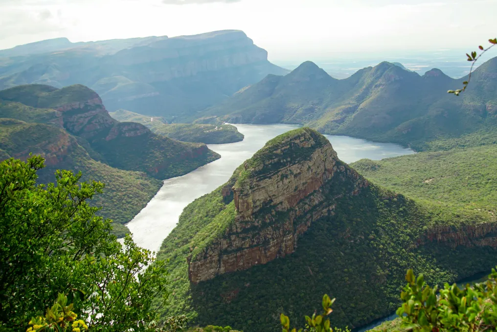
The Blyde River is responsible for one of South Africa's most recognizable landscapes, but the best way to grasp the scale of the canyon is to get off the road and walk through it. In the Blyde River Canyon Reserve, there are several hiking options, including the day hike Belvedere and the longer Waterval Trail. The latter is approximately a three-day route running from Paradise Camp towards Bourke’s Luck Potholes, traversing various sections of the canyon landscape.

This route is designed as a self-contained hiking adventure, with basic accommodation available along the way. It is not the type of river trip where you spend the whole day by the water; rather, the river serves as a connecting thread to the landscape. You walk through high mountain canyons, forested areas, and dramatic terrain while Blyde shapes the surrounding scenery.

For experienced hikers, the longer route transforms a place often visited by car sightseeing into a full-fledged trekking adventure.

Best Use Case:

A multi-day river landscape experience and for those seeking more than just a viewpoint.

The Orange River looks completely different when it reaches the arid Northern Cape. In the Augrabies Falls National Park, it has carved a massive canyon, culminating in the 56-meter-high Augrabies Falls. The park's most serious hiking option is the Klipspringer Hiking Trail, a three-day, 35.8 km route divided into three days. SANParks describes it as a challenging hike, with the second day being the hardest. The trail requires advance booking and is closed from October 15 to March 31 due to extreme heat.

For a shorter experience, there is the 8-kilometer Dassie interpretive trail, which follows the gorge and then returns to camp. The appeal of this location is not lush vegetation or cool mountain pools, but quite the opposite. The Orange River cuts through a vast, dry landscape of granite, rock, and desert vegetation, making the contrast between water and wildlife particularly stark.

And if you arrive when the river is running strongly, you will understand why the name given by the Khoi people, Aukoerebis, translates to 'Place of Great Noise.'

Best Use Case:

Dramatic landscapes, long treks, and observing how the river shapes the arid environment.

Oorlogskloof is a place that rewards travelers willing to slow down. The harsh landscape of the reserve is dissected by rivers and gorges, and waterfalls and pools serve as natural attractions along the walking routes. What makes Oorlogskloof interesting is the sense of scale. The water here is not just a place to swim at the end of a trail; it is part of a much larger landscape of cliffs, valleys, and open wilderness of the Northern Cape.

In warmer months, the pools along the river sections can provide a pleasant respite, but tourists should never take the river for granted. Rainfall upstream can quickly alter conditions, even if the weather above seems clear.

Best Use Case:

Wilderness with a sense of solitude, dramatic rock formations, and travelers who prefer less-trodden paths.

This route is slightly different. The walk along the Karkloof River was not designed as a traditional tourist trail. In 2017, a team from Karkloof Conservancy, WWF-SA, Endangered Wildlife Trust, and GroundTruth traversed about 65 km of the Karkloof River over six days, moving from source to confluence. Their goal was to assess the river's condition, including its biological health, water quality, and surrounding riparian environment. Thirty-seven sections were assessed along the route. It is an interesting reminder that a river trek can be more than just recreation.

The Karkloof River is part of the uMngeni catchment basin and flows into the uMngeni River and the Albert Falls dam, which is a vital water resource for Durban. You do not need to replicate the entire six-day research expedition to appreciate the idea. The river can be the destination itself, but it can also serve as a way to explore the landscape.

Best Use Case:

Curious tourists, nature-conscious travelers, and those who want to see rivers outside the usual focus of adventure tourism.

Hiking along rivers requires attention. A mountain route may have a summit as an obvious reward, whereas a river route is more unpredictable. The landscape changes depending on rainfall; water levels rise and fall, rocks become slippery, and a crossing that was easy last week might be unsafe next week. This is part of the appeal, but it also means that river hikes require more preparation. Check the weather and trail conditions before heading out, especially after heavy rain. Wear shoes with good grip and expect them to get wet on crossing sections. Carry enough water and food, even when the river is running alongside you, as untreated river water cannot be automatically considered safe to drink. And never underestimate moving water. If the river floods or a crossing looks unsafe, turn back. There is no photograph worth risking your life for.

To have a true river adventure, you don't need to float down the river. Sometimes the best experience is walking alongside it, crossing it, climbing above it, and finally sitting by a pool with tired legs and wet boots. South Africa's rivers flow through some of the most dramatic landscapes, from the sandy and forested gorges of KwaZulu-Natal to the granite wilderness of the Northern Cape. So next time you are looking for a water adventure, leave the canoe at home. Find a trail, follow the river upstream, and see where it takes you.

Popular