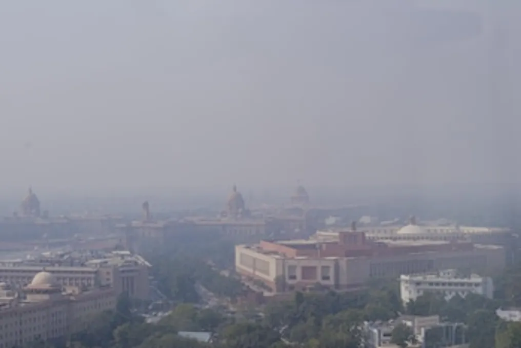
Delhi Master Plan forecasts population growth to 32 million by 2047 and outlines infrastructure needs
Read more
Business Standard
business-standard.com

Delhi Master Plan forecasts population growth to 32 million by 2047 and outlines infrastructure needs

According to the Delhi Master Plan for 2047 (MPD-2047), the population of India's capital, Delhi, is projected to increase from the current 22.6 million in 2026 to approximately 32 million by 2047. It is planned that the population will reach 24.8 million by 2031, 26.9 million by 2036, and 29.2 million by 2041.

This projected growth places a significant strain on basic services, raising questions about the speed of necessary infrastructure construction. MPD-2047 is oriented towards an infrastructure-driven growth model, where new construction will be determined by the availability of roads, public transport, water supply, sewerage, drainage, electricity, and digital communication.

Water supply may become the main constraint for Delhi

Water supply represents one of the most complex challenges. In 2021, Delhi's water supply volume was 935 million gallons per day (MGD) against an estimated demand of 1380 MGD. By 2047, the Delhi Jal Board (DJB) forecasts a drinking water requirement of about 1600 MGD, necessitating an additional volume of 401 MGD. This extra volume is planned to be secured through short- and medium-term measures (110 MGD) and medium- to long-term interventions (291 MGD).

The detailed plan for increasing water supply, based on the current availability of about 1000 MGD, involves adding 401 MGD, bringing the total availability to 1401 MGD by 2047. Nevertheless, this still leaves a substantial gap compared to the forecasted demand of 1600 MGD. Furthermore, the proposed supply partially depends on projects outside Delhi. The medium- and long-term plan includes 275 MGD from water harvesting projects in the Renukaji, Lakhwar, and Kishau rivers, although the document notes that this estimate is highly preliminary. MPD-2047 indicates that the increase in surface water will depend on cooperation with the states of Uttar Pradesh, Haryana, and Himachal Pradesh, as well as intervention from the Central Government.

The problem of large volumes of sewage

Increased water supply for a growing population inevitably leads to an increase in the volume of sewage requiring collection and treatment. MPD estimates that a population of 32 million people, consuming 50 gallons per capita per day, will generate about 1280 MGD of sewage, assuming 80 percent of supplied water becomes wastewater. Currently, Delhi has a sewage treatment capacity of 814 MGD, with about 744 MGD being treated. The detailed plan for 2047 targets a total treatment capacity of 1285 MGD, which will consist of the existing capacity of 814 MGD, an additional capacity of 231 MGD, and 240 MGD through decentralized treatment plants in land consolidation zones.

Moreover, there is a network coverage issue: according to the plan, only about 83 percent of Delhi's population is currently connected to the sewerage network.

Drainage: Growth amid recurring flooding

Infrastructure expansion for a larger population will require not only increased supply volumes but also solutions for water movement in an increasingly built-up city. MPD identifies recurring flooding and inundation as issues requiring a long-term approach to drainage. The plan calls for the implementation of more efficient stormwater infrastructure and low-cost flood prevention measures, including wetland restoration, using parks for rainwater harvesting, and preventing solid waste from entering drainage systems.

The Delhi Drainage Master Plan, being prepared by the Delhi government, aims to address drainage issues over the next 30 years in the face of rapid urban growth and frequent flooding. The plan also stipulates that new construction must ensure no increase in overall runoff using methods such as ponds, parks, permeable pavements, green belts, and rainwater harvesting structures.

Delhi may generate almost twice as much waste

Waste management is another area that will sharply increase along with the population. Estimates suggest that Delhi generates 13,500 tons of municipal solid waste per day in 2026. By 2047, this figure is projected to rise to 25,764 tons per day, representing an increase of approximately 91 percent. MPD notes that currently, only about 47.5 percent of municipal solid waste is recycled, with the rest being deposited in landfills in Bhalswa, Ghazipur, and Okhla. Existing landfills have already exceeded their capacity, forcing Delhi to manage both legacy waste and a significantly larger future stream simultaneously.

The plan provides for the use of reclaimed landfills for future waste processing infrastructure and the creation of sanitary engineering dumps, and additional capacity for biomethanization and other types of treatment will be required to manage the projected increase in waste.

Peak electricity demand could reach 25,500 MW

Energy demand presents another major requirement for expansion. In 2021, Delhi's traditional power generation capacity was 7,161 megawatts (MW), with an additional 923 MW provided through power purchase agreements and renewable energy partnerships. MPD forecasts that peak electricity demand could reach 25,500 MW by 2047.

The Delhi Transco plan illustrates how this demand reflects on physical infrastructure. Currently, Delhi has 43 substations at the 220 kilovolt (kV) level; four are in the pipeline or under development, and MPD-2047 proposes adding 37 more 220 kV substations. At the 400 kV level, there are eight substations, two of which are in the pipeline, and it is proposed to build 10 more. Two additional 765 kV substations are also proposed. Expansion also requires land parcels: according to revised guidelines from the Central Power Authority, a 220 kV substation must occupy at least 10,000 square meters, and a 400 kV substation must occupy at least 40,000 square meters.

MPD establishes infrastructure as a condition for growth

MPD-2047 does not provide a simple answer to whether Delhi's infrastructure can support 32 million people. Instead, it details the scale of infrastructure that needs to be built, expanded, or modernized before such a population arrives. By 2047, Delhi will need to provide about 1600 MGD of drinking water, treat about 1280 MGD of sewage, manage 25,764 tons of municipal waste daily, and meet a peak electricity demand of 25,500 MW. Simultaneously, issues related to sewerage gaps, recurring flooding, and the sustainability of existing infrastructure must be addressed. Thus, the task is not merely accommodating 32 million people, but ensuring the readiness of the infrastructure required for them.
Similar stories

Delhi plans to create a 200-kilometer 'green-blue' corridor ecosystem from the Ridge to the Yamuna River
Read more
business-standard.com

Delhi plans to create a 200-kilometer 'green-blue' corridor ecosystem from the Ridge to the Yamuna River

According to the Delhi Master Plan (MPD) 2047, approved on Thursday, it is proposed to create a 'Ridge-Yamuna' connecting park spanning 200 kilometers. This project includes a 52-kilometer section along the Yamuna river floodplain aimed at strengthening continuity between the Ridge and the Yamuna and improving urban connectivity.

A public green pathway, 75 to 100 meters wide, is planned, equipped with bicycle and pedestrian paths, as well as passive recreation areas where possible. This corridor is part of a broader 'Green Linkage' network that will connect parks, forests, biodiversity parks, baolis, green streets, and ecological corridors. Furthermore, the plan provides for the integration of Delhi's green and water resources with drainage systems, wetlands, lakes, and other water bodies.

Currently, Delhi has 22% green cover, but these assets are unevenly distributed. The Ridge, classified as a reserved forest, covers about 7,784 hectares, accounting for nearly 6% of the National Capital Territory (NCT). Additionally, the city has 26 protected forests covering approximately 1,658 hectares, and the Delhi Forest Department maintains 40 unclassified forests as 'Urban Forests.' The city also boasts over 18,000 parks and gardens, seven biodiversity parks, and 746 parks managed by the Delhi Development Authority (DDA), which cover 6,830 hectares.

What does 'green-blue infrastructure' mean?

The Master Plan integrates Delhi's ecological resources within a wider framework of green-blue infrastructure. Blue assets include the Yamuna River itself and the extensive network of natural and artificial urban drainage, much of which is within the Najafgarh, Trans-Yamuna, and Barapullah catchment areas. Wetlands, lakes, and other water bodies are also included in this category.

The plan proposes a three-phased approach: firstly, conserving and improving existing natural sites; secondly, creating new green-blue assets; and thirdly, integrating green-blue elements into the built environment. According to the plan, this approach will ensure 'improved greenery, higher biodiversity, reduced temperature, decreased flooding and pollution, and increased climate resilience.'

Moreover, the document calls for replacing invasive and alien species negatively affecting the ecology with local flora, conducting reforestation using native species, and carrying out regular monitoring of ecological assets.

Restoring the Yamuna at the heart of the plan

The Master Plan has identified the Vizarabad-Okhla stretch of 22 km as a key restoration zone. This segment, which carries about 76% of the Yamuna's pollution load, constitutes less than 2% of the river's total length. The plan points out the lack of freshwater inflow below Vizarabad during the dry season, as the river receives treated and untreated sewage through drains.

It is proposed to implement 13 major projects covering about 1,700 hectares of the floodplain, focusing on restoring wetlands, natural depressions, floodplain ecosystems, and biodiversity, while simultaneously enhancing climate resilience and groundwater recharge. The plan includes draining existing wetlands to retain floodwaters and creating new wetlands by deepening natural depressions into retention basins. It also suggests developing riparian forests, meadows, and green buffers along the river.

The active floodplain area has been designated as a 'no-construction zone,' although certain recreational, public, and socio-cultural uses require appropriate permits. To improve water quality, the plan mandates intercepting and treating all 22 drains flowing into the Yamuna through sewage treatment plants, artificial wetlands, and bioremediation. Their corridors will be integrated with green zones and floodplains to form 'continuous ecological corridors.'

The 200-kilometer Ridge-Yamuna cycling corridor

One of the main proposals for ensuring connectivity under the plan is the 'Ridge-Yamuna' connecting park. It envisions an integrated 200 km cycling network, including a 52-kilometer section along the Yamuna floodplain, intended to strengthen the so-called 'Ridge-Yamuna continuity.' Where feasible along embankments, a public green path of 75–100 meters could be developed, incorporating bicycle and pedestrian routes, as well as quiet leisure areas, aiming to improve access to parks and the river and strengthen the link between the river and its residents.

Approaches to creating 'green buffers' along drains

The connectivity proposed in MPD-2047 also includes developing green buffers along drains in the form of urban green pathways, which will form a city network of green-blue assets connected by pedestrian and bicycle paths. These buffers can remain either as natural or landscaped green areas or develop into wetlands and marshes. They may also include bio-drainage ditches for collecting stormwater runoff and recharging groundwater. The plan states that some sections can be used for parks, yoga, sports, open exhibitions and performances, botanical gardens, community gardens, boating, and kiosks. Some green paths may also represent historical trails.

Planning 'green-blue' extends to suburbs

MPD-2047 has expanded its 'green-blue' strategy beyond protected natural areas. In land consolidation zones, existing plantations, wetlands, and low-lying areas must be converted 'into public parks and catchment ponds for aquifer recharge' while maintaining the existing drainage pattern. The plan also proposes creating 'microforests, urban forests, green roofs and terraces, community gardens, pollinator gardens, and urban wetlands,' as well as artificial reservoirs for groundwater recharge.

Streets with a right-of-way of 18 meters or more should be greened using 'allée landscaping,' plazas, and 'bio-drainage ditches along drains.' Unused areas, including the Rajghat and Badarpur power plants, can be repurposed for 'ecological, recreational, or other public needs.' The plan also aims to make the city 'one of the greenest megacities' through reforestation, multi-level green buffers, expansion of urban forests, and preservation of the Ridge, while promoting native trees and restoring local forests.

Delhi Master Plan until 2047 provides for construction of 4 million housing units and transit-oriented development
Read more
business-standard.com

Delhi Master Plan until 2047 provides for construction of 4 million housing units and transit-oriented development

The government has announced the Delhi Master Plan for 2047 (MPD-2047), which forecasts that the capital will require approximately 4 million additional housing units as its population approaches 32 million by 2047.

This plan aims to meet housing demand through the redevelopment and densification of existing areas, Transit-Oriented Development (TOD), land pooling, and planned expansion into new zones. Future construction will be closely linked to the availability of roads, public transport, water supply, sewage, and other infrastructure.

The Ministry of Housing and Urban Affairs approved MPD-2047 as a major modification of the Delhi Master Plan 2021. The new plan comes into effect from the date of publication of the notification in the Gazette of India.

Four Million Homes for Delhi's Growing Population

According to the plan, Delhi's housing need is estimated at nearly 4 million housing units between 2011 and 2047, based on an average household size of 4.5 people. Planning identified high land costs and a shortage of affordable housing as factors contributing to the growth of unauthorized settlements, slums, and denser urban villages.

MPD-2047 proposes a two-pronged strategy. In already developed or industrial areas (brownfield areas), redevelopment, regeneration, and densification are promoted through TOD, mixed-use projects, and infrastructure modernization. Existing DDA housing, cooperative housing societies, government colonies, group housing projects, and other planned residential areas can be redeveloped provided the necessary infrastructure is available.

The plan also supports the restoration of slums and jhuggi-jhopri clusters, providing a basis for the improvement, legalization, and redevelopment of unauthorized settlements. For new territories (greenfield areas), future expansion will largely be determined by the land pooling model and other policy-driven development models. The goal is to create more self-sufficient neighborhoods with a mix of residential, commercial, industrial, recreational, and public functions.

TOD and Land Pooling to Transform Large Parts of Delhi

Four policy-defined areas play a key role in the new spatial strategy. Land pooling zones cover about 200 square kilometers, while low-density zones occupy approximately 150 square kilometers. TOD zones extend over about 200 square kilometers along metro corridors and around RRTS, railway, and high-speed rail stations.

An additional 20 square kilometers along the implemented Urban Extension Road II (UER-II) section have been designated as a high-density corridor zone. TOD is one of the central elements of the plan. Denser and mixed-use development is envisioned within a 500-meter corridor on both sides of existing and planned or approved metro routes, as well as within a 500-meter radius of major regional and inter-state transport hubs.

These areas can accommodate housing, offices, commercial activities, and other compatible uses, with higher building intensity aimed at placing more housing and jobs near public transport. The high-density corridor along UER-II will allow for a combination of residential development, warehousing, logistics, and commercial activities. Similar provisions may be extended to future UER sections after their construction.

Metro and RRTS Networks to Support Higher Density Development

Transport infrastructure will form the backbone of this high-density urban development model. The plan indicates that the Delhi Metro network is about 416 km and can be expanded by another approximately 279 km. The RRTS network is projected to reach a length of about 383 km, improving regional connectivity between Delhi and centers such as Ghaziabad, Meerut, Panipat, Karnal, and Alwar.

MPD-2047 seeks to integrate housing and employment with mass transit while increasing the role of walking, cycling, and other forms of active mobility. It also proposes improving last-mile connectivity and multimodal integration around transport stations. New construction must follow an 'infrastructure first' model. Projects must be guided by the availability of roads, public transport, water supply, sewerage, drainage, electricity, and digital communication to limit unplanned sprawl.

Rising Demand for Water, Waste, and Energy

Sustaining a population of 32 million will require a sharp expansion of urban services. The Delhi Jal Board estimates the need for drinking water at approximately 1600 million gallons per day (MGD) by 2047. An additional requirement of 401 MGD has been forecasted, proposing increases through short-term, medium-term, and long-term measures, including additional raw water and upstream storage projects.

It is proposed that wastewater treatment capacity reach approximately 1285 MGD by 2047, compared to the installed capacity of 814 MGD mentioned in the plan. Regarding municipal solid waste, generation is projected to almost double from approximately 13,500 tons per day in 2026 to 25,764 tons per day by 2047. Peak electricity demand at that time is estimated to reach about 25,500 megawatts.

Green-Blue Network from Ridge to Yamuna

Environmental sustainability is another key pillar of MPD-2047. The document notes that about 22 percent of Delhi is currently covered with greenery, and the plan aims to strengthen forests, biodiversity parks, urban green spaces, and ecological corridors.

The plan envisions an integrated 'green-blue' infrastructure network stretching from the Delhi Ridge to the Yamuna River, encompassing river floodplains, wetlands, lakes, drains, and other water bodies. It proposes ecological restoration, increased tree cover, improved hydrology, and nature-based measures to combat urban heat and enhance resilience to flooding and climate change.

Business Districts, Logistics, and Narela Education Hub

MPD-2047 also elevates economic development to a larger role in land-use planning. The plan proposes investment-attractive business and commercial districts with modern office spaces and transport links, as well as industrial and logistics clusters connected to highways, railways, and urban extension corridors.

A proposed 138-hectare education hub in Narela is conceived as a cluster for universities, research institutes, vocational training institutions, and startups. Specialized economic zones and mixed urban centers linked to public transport are also suggested. The private sector is expected to play a larger role in both new construction and redevelopment, including land pooling.

Plan to Be Reviewed Every Five Years

Unlike a largely static planning system, MPD-2047 mandates periodic monitoring of its implementation. A detailed review must be conducted every five years, supported by key performance indicators and annual progress monitoring. The creation of a specialized interdisciplinary monitoring unit within the Delhi Development Authority (DDA), along with GIS databases and inter-agency data exchange systems, is proposed.

The plan also foresees broader use of AI-based planning, digital twin applications, and data-driven decision-making as Delhi expands, with the DDA positioned as the leading agency for the capital's next phase of urban development.

DMRC reports high punctuality of Delhi Metro: 99.95% of services on time
Read more
www.aajtak.in

DMRC reports high punctuality of Delhi Metro: 99.95% of services on time

Delhi Metro Rail Corporation (DMRC) presented data on train operations in Delhi, noting that they adhered to the schedule, and the punctuality rate reached 99.95% in 2026. The official statement emphasized that despite the expansion of the network over the past years, the operational reliability of the Delhi Metro has been maintained.

Furthermore, DMRC shared passenger flow statistics. The daily number of passengers on the metro has significantly increased: if it was about 82,000 people per day in the first year of operation, it has now reached an average of 6.406 million passengers. Last year, the Delhi Metro network set a record by transporting over 8.1 million passengers in a single day, on August 8, 2025.

DMRC clarified that a very strict criterion is used to assess adherence to the schedule. A train is considered delayed if it arrives at the final station with a delay exceeding 59 seconds from the planned time.

According to information from the Delhi Metro Rail Corporation, there is a continuous improvement in train punctuality. If this indicator was 98.27% in 2003, it rose to 99.64% by 2005, and since then it has consistently remained at around 99.9%.

The corporation reported that within the international benchmarking conducted by the 'Metro Community' (COMET) group of 45 metro systems, reliability was assessed based on a two-minute delay criterion. In this category, the Delhi Metro entered the top five global systems. It was also noted that the interval between trains on some of the busiest corridors has been reduced from seven minutes at the beginning of operation to 2 minutes and 18 seconds.

DMRC informed about the network development: the Pink Line or Line-7 has a length of 71.55 kilometers and includes 45 stations, operating on driverless technology. This section provides the possibility of transferring to most other Delhi Metro lines and offers alternative routes throughout the network. Overall, the Delhi Metro network has expanded to 416.5 kilometers, covering 12 lines, 303 stations, and 31 interchange stations, connecting Delhi and the National Capital Region.

Popular