Four historical irrigation and water structures of Iran—Si-o-se-pol in Isfahan, Band-e Amir in Fars, the Shadorvan large spillway in Khuzestan, and the historical hydraulic structures of Siraf in Bushehr—have been selected for recognition under the World Heritage Irrigation Structures (WHIS) program of the International Commission on Irrigation and Drainage (ICID).
This selection highlights the evolution of engineering solutions in water supply in Iran, as well as the complex methods that successive Iranian societies used to manage, accumulate, divert, and distribute water in various climatic and geographical conditions.
The recognition ceremony is scheduled for 2026 during the 26th International ICID Congress on Irrigation and Drainage and the 77th meeting of the ICID International Executive Council in Marseille, France, from October 12 to 17, 2026. ICID reported that the congress will focus on water resource sustainability and agriculture in the face of climate change.
The WHIS program is an initiative of ICID and differs from inscription on the UNESCO World Heritage List. Created in 2012, the program recognizes historical irrigation and drainage structures older than one hundred years that possess outstanding archival, technological, or historical value. Its goals include documenting the development of irrigation through civilizations, preserving historical water infrastructure, and drawing lessons from traditional approaches to sustainable water resource management.
Currently, the ICID WHIS registry includes 202 sites from countries such as Iran, China, India, Japan, Italy, and South Africa. Iran alone already has 12 such structures in the registry.
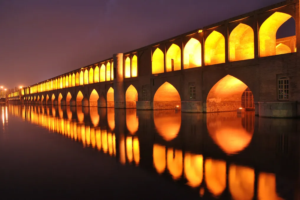
Si-o-se-pol, also known as the Allahverdi Khan Bridge, is one of the most famous historical structures on the Zayandeh Rud River in Isfahan. It was built during the reign of Shah Abbas I of the Safavid dynasty in the early 17th century and formed an important part of Isfahan's urban development and the Chahar Bagh avenue.
The bridge served not only as a crossing. Its connection to the Zayandeh Rud River made it part of the broader hydraulic and urban landscape of Safavid Isfahan. Its arches and structure allowed water to pass beneath the bridge while the crossing itself connected important parts of the expanding capital. Thus, its recognition within WHIS places the monument in a broader historical context of infrastructure, rather than viewing it solely as an architectural landmark.
Band-e Amir in Fars province represents an earlier phase of Iranian hydraulic engineering. Medieval sources attribute its construction to the Buyid ruler Azod ad-Dawla, who reigned from 949 to 983. This structure was designed to raise the level of the Kour River and create a reservoir to serve the adjacent agricultural area. Historical records describe water wheels that lifted water to higher levels for irrigation.
This site demonstrates the close relationship between hydraulic engineering and agricultural development. In a region where access to reliable water sources determined the viability of settlements and arable lands, the dam could alter water distribution in an otherwise arid landscape.
The Shadorvan large spillway is part of the much larger ancient hydraulic system of Shushtar in Khuzestan. This system predates the Islamic period in its engineering traditions and dates primarily to the 3rd century AD in its current form, with elements built on earlier foundations. UNESCO inscribed the Shushtar system on the World Heritage List in 2009, describing it as an exceptionally complete hydraulic complex combining canals, spillways, and other civil engineering structures for water supply, irrigation, milling, transportation, and other purposes.
The fourth site, the historical hydraulic structures of Siraf in Bushehr province, shows how water resource management contributed to urban life in one of Iran's driest coastal areas. Siraf was a major Persian Gulf port that flourished particularly in the 9th and 10th centuries. Archaeological research has documented wells, cisterns, aqueducts, drainage systems, and other mechanisms related to water collection, storage, and distribution.
Recent interdisciplinary studies have further examined Siraf as a deliberately planned landscape of water heritage. Researchers argue that its water infrastructure was integrated into urban development, rather than being merely a series of isolated responses to drought. The system included the collection, storage, and distribution of water within the settlement and the surrounding landscape.
Geoarchaeological surveys have also shown that the inhabitants of Siraf heavily relied on rainwater harvesting. Wells and cisterns on hills overlooking the settlement collected and retained fresh water in an environment characterized by very low precipitation and sporadic flash floods. Such infrastructure was vital for maintaining both daily life and agriculture.
Collectively, these four structures cover different periods, environments, and engineering approaches: the Safavid bridge and hydraulic structure in Isfahan; the medieval dam serving agriculture in Fars; the large ancient hydraulic complex in Khuzestan; and the integrated water management landscape associated with the ancient and medieval port of Siraf. Their selection illustrates the diversity of Iran's long history of adapting engineering solutions and settlement patterns to water availability and movement.