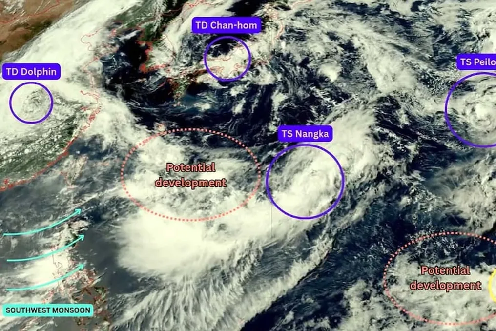
Currently, five storm systems are active in the western Pacific Ocean, with the possibility of two new ones forming. Among these systems are tropical storms Nangka and Pleau, tropical depression Chan-Hom and Dolphin, as well as Invest 90W. All of them have formed around a large monsoon system. At present, these systems do not pose a direct threat to India, but they are attracting attention due to their potential influence on weather in Asia.
The simultaneous formation of such a number of systems in the Pacific Ocean is causing changes in the weather across many regions, including China, Japan, and South Korea. Particular attention is being paid to the Dolphin system, which has been located approximately in one spot over central China for about 48 hours. Tropical depression Chan-Hom has weakened and reached Japanese waters, now moving towards South Korea.
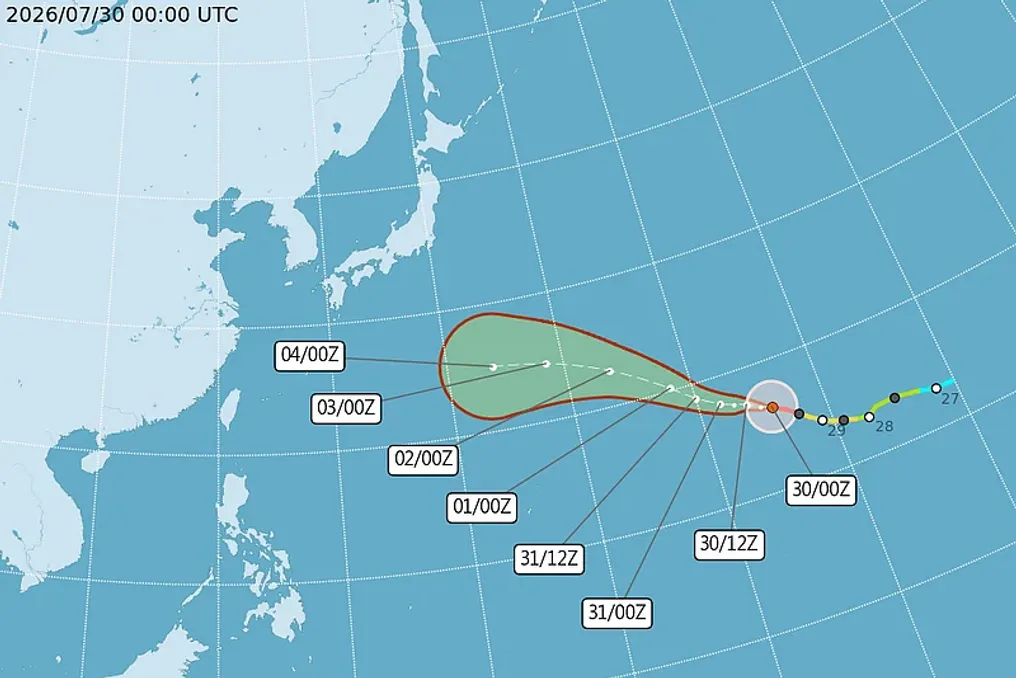
Nangka is currently north of the Mariana Islands and is expected to move in a northeasterly direction. After this, its speed may decrease, and it might turn north. Currently, no direct threat from Nangka is expected for major territories, and its further movement depends on surrounding winds.
Pleau is also located in the western Pacific Ocean and is far from large landmasses. Over the next approximately 12 hours, it is expected to weaken into a tropical depression, after which it may dissipate by merging with strong westerly winds. No threat to land has been declared from it at the moment.
Chan-Hom has already weakened and is in Japanese waters. According to records, it was the first tropical cyclone to make landfall in the Ibaraki region of Japan. It is now expected to reach South Korea on August 14. After that, it may weaken further and become a low-pressure system by the end of the week.
Dolphin was previously a super typhoon but has significantly weakened. It has been located approximately in one spot over central China for about 48 hours. According to the China Meteorological Administration, heavy rains are possible in the provinces of Southern Henan, Northern Hubei, and Central Jiangsu, with some areas forecasting up to 180 millimeters of precipitation.
Invest 90W is not yet a full-fledged tropical cyclone. Most meteorological models suggest that strengthening within the next 48 hours is unlikely, although some models indicate a possible gradual strengthening later. It may also merge with another system.
Another low-pressure area may form in the northern part of the Philippine Sea within the next 48 hours, which, like Nangka and Pleau, may move in the corresponding direction. Currently, this system does not pose a threat to major territories. Furthermore, another low-pressure system may develop near Invest 90W. According to the Philippine Meteorological Agency, the probability of it becoming a tropical cyclone within the next five days is assessed as low to medium. This system may reach the Philippine area of responsibility next week.
These systems currently pose no direct threat to India. However, the systems forming in the western Pacific Ocean are part of a broader monsoon pattern. Therefore, meteorologists are closely monitoring their direction and strength. Changes in these systems in the coming days may affect the weather in Asia and the monsoon winds.