The scarcity of leisure areas in Medellín's peripheral neighborhoods has restricted access to family interaction and play spaces. Furthermore, the absence of natural soil and permeable surfaces has aggravated the heat island effect, increased the risk of environmental pollution, hillside instability, and flooding caused by surface runoff in areas near streams.
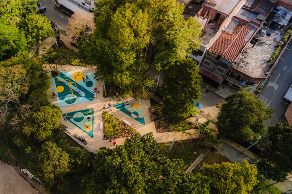
This project proposes the implementation of playful infrastructure and natural landscapes in contexts of neighborhoods lacking public space. Public land parcels ranging from 300 to 500 square meters have been identified, located near environmental corridors and local centers, some of which are underutilized or lack a defined plan. Each park was designed to be a family meeting point, functioning as a recreational and environmental scenario, utilizing geographical characteristics to convert topographical limitations into opportunities for creating collective spaces.
The parks are conceived to serve as gathering places, recreation areas, and outdoor classrooms. Their design is based on topography and natural elements, defining terraces, urban squares, and gardens along the path. The complex is complemented by children's toys, urban furniture, and lighting systems, ensuring that all parks have universal accessibility, even in areas with moderate or steep slopes.
The architecture uses topographical constraints as an advantage, allowing each level to function as a balcony facing the city, providing new spatial perspectives. Additionally, this adaptation serves as a containment structure in areas with steep inclines. The route becomes an educational and playful experience, as the act of playing occurs between the different levels, on ramps, and paths, integrating the park with its surroundings.
Nature ensures ecological continuity and defines public space through vegetative layers. Smaller plants act in the first phase of absorbing rainwater and as biological stabilizers. Medium-sized species function as routes for local fauna, while large species create microclimates through natural shade, reducing temperatures and strengthening the city's green network. Understanding topography allows leisure and meeting spots to be positioned in easily visible points, in public spaces where the community gathers, monitors the area, and strengthens social bonds.
Through landscaping, sustainable urban drainage systems are proposed, integrating water management with the use of permeable pavements and absorbent soils. The use of local materials and labor helps reduce carbon emissions related to transport and encourages construction to also be a process of training and job creation.
This model, which promotes the union between neighborhood structure and public spaces, can be applied in various contexts and topographies. This network of neighborhood parks represents both an urban and an environmental proposal to build a more just city, acting as a vector for social change through leisure, education, and community interaction.