In addition to space exploration, NASA dedicates a large part of its priorities and efforts to the constant observation of Earth. Through its Earth Science Division, the agency manages numerous missions. These missions utilize everything from orbiting satellites to terrestrial supercomputers, creating an integrated technological network to track global climate changes in real time.
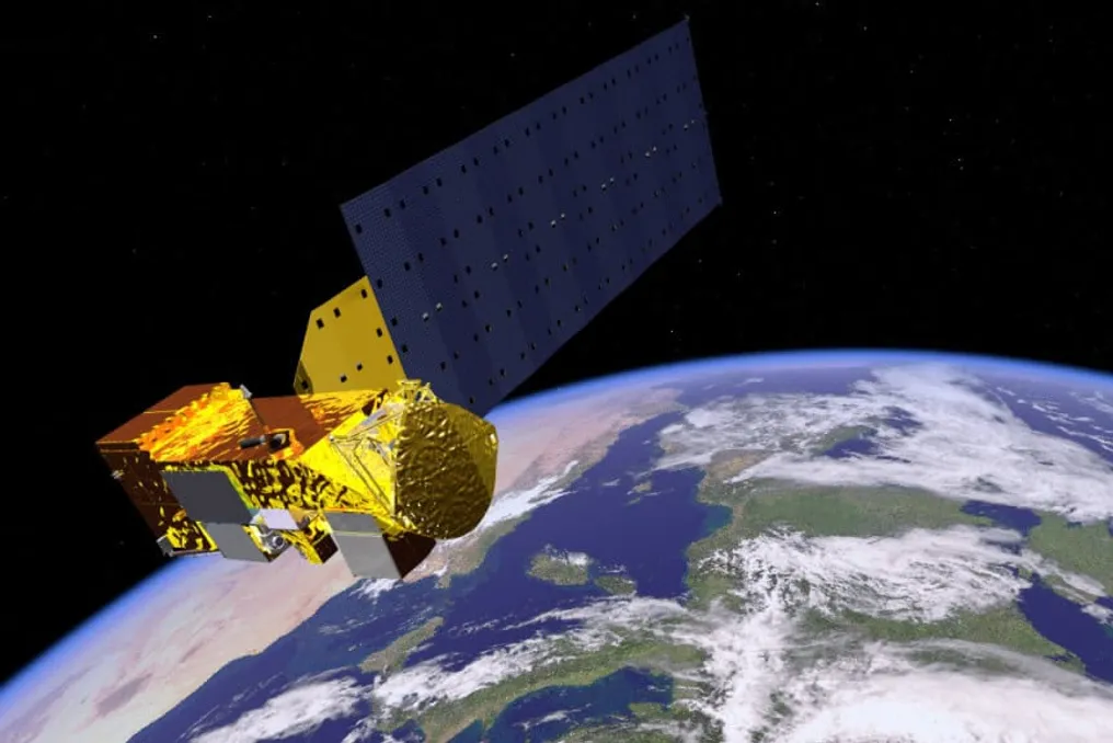
The basis of this structure is the Earth Observing System (EOS), which consists of low Earth orbit satellites. Notable equipment, such as the Terra and Aqua spacecraft, is responsible for recording vegetation cover and cloud amounts. Additionally, the Landsat program, which has been operational for over fifty years, documents changes in land use and the deforestation process.
Several other missions employ sophisticated technologies to measure variables not visible to the naked eye. The GRACE-FO satellite (Gravity Recovery and Climate Experiment – Follow-On) tracks fluctuations in Earth's gravity, which are caused by the movement of water masses and the melting of glaciers. This is a collaboration between NASA and the German Aerospace Center (DLR), initiated in 2018 to follow up on the original GRACE mission. The two satellites measure subtle variations in the gravitational field, enabling the monitoring of changes in ice mass, aquifers, oceans, and other elements of the Earth system.
More recently, the SWOT satellite (Surface Water and Ocean Topography) has the capability to map virtually all the planet's surface water, covering rivers, lakes, and oceans, with unprecedented precision. To monitor global warming, the agency uses infrared radiometers, which detect temperature trends both on the surface and in the upper atmosphere. Concurrently, radar altimetry, performed by the Sentinel-6 and Jason missions, measures sea level rise resulting from glacial melt and thermal expansion of water.
Regarding atmospheric analysis, high-accuracy sensors are needed to identify greenhouse gases. Instruments like the Orbiting Carbon Observatory (OCO) map both emission sources and natural sinks of carbon dioxide and methane. Installed on the International Space Station (ISS), the EMIT instrument (Earth's Mineral Dust Source Investigation) expands the scope of these measurements by using a spectrograph to analyze sunlight reflected by the Earth.
Brazilian astrobiologist Raíssa Estrela, a researcher at NASA's Jet Propulsion Laboratory (JPL), is directly involved in processing data from this sensor. In conversation with Olhar Digital, she clarified that the methodology used is similar to that applied in exoplanet analysis. She stated: 'With this information from reflected light, we can identify signals of various materials, from minerals to the presence of plastic. Plastic reflects light at a very specific wavelength, which allows us to detect where this material is accumulated on the planet.'
According to the researcher, orbital tracking aids in combating major global crises mapped by the United Nations (UN), including plastic pollution, which has increased since the 1970s, and biodiversity loss. Space monitoring also aims to protect nature from the effects of human activity, paying special attention to Brazilian territory. The astrobiologist highlighted: 'Brazil is the number one country in biodiversity on planet Earth. I find it very prestigious to come from a country that has the most biodiversity in the world.'
However, Raíssa warns that this natural heritage faces constant threats. She emphasized: 'It is biodiversity that is under threat, and will continue to be under threat, both due to climate change issues and anthropogenic advancement, as we know in Brazil, there is the issue of agriculture, the advance of soy, deforestation, which is leading to the loss of our forest and biodiversity, which is still number one on planet Earth, but could cease to be so if we don't act in time.'
To track these rapid transformations, NASA applies multiple methods. For example, to assess polar caps, the Ice, Cloud, and Land Elevation Satellite (ICESat-2) uses LiDAR (Light Detection and Ranging) technology. This system fires laser pulses onto the Earth's surface and measures the return time of the light to the sensor, allowing the thickness and variations of the ice layer to be determined with centimeter-level precision.
As summarized by the JPL researcher, the combination of these different instruments enables future modeling: 'There are several NASA sensors—EMIT, where I work, is one of them—but there are many others that monitor different properties of our planet, such as temperature, photosynthetic activity of vegetation, and levels of CO2 and methane in the atmosphere. They work together to provide an integrated view of the Earth system. We, scientists, use this data to analyze planetary health and feed future climate models and projections, seeking to prevent reaching a point of no return in our biodiversity, such as in the Amazon.'
All these orbital records generate a continuous flow of data that sustains international climate research. These combined indicators allow scientists to recognize long-term patterns and understand how the planet's distinct systems interact in the face of climate change.
This spatial data collection finds its purpose at the NASA Climate Simulation Center, located in Greenbelt, Maryland. There, supercomputers process petabytes of information daily to run the Goddard Earth Observing System (GEOS) model, a complex mathematical simulation that integrates data from oceans, atmosphere, land, and ice-covered areas.
Artificial intelligence and machine learning further enhance this work. Advanced algorithms rapidly analyze vast volumes of satellite imagery to locate forest fire hotspots, illegal deforestation, and the emergence of extreme weather phenomena, ensuring faster responses and alerts for society. A notable aspect of this operation is the agency's open data policy; all collected information is made freely available on the Earthdata platform, promoting transparency so that governments, research institutes, and global startups can develop effective strategies for adaptation and coping with climate impacts.