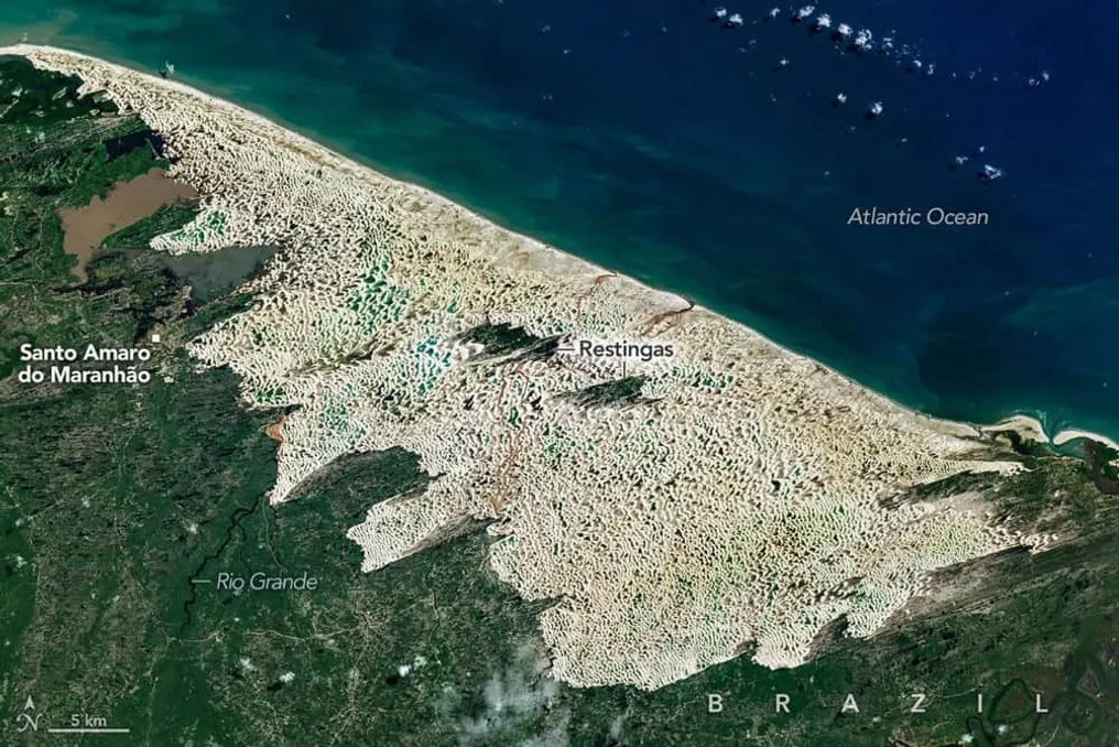
Satellite images captured by the Landsat 9 satellite, belonging to NASA, revealed the Lençóis Maranhenses National Park in Maranhão, highlighting one of the planet's most unique natural ecosystems. This location features a vast expanse of white dunes dotted with hundreds of freshwater lagoons.
The images, obtained in June 2026, show that despite its desert-like appearance, the region has an annual cycle characterized by the temporary presence of accumulated water between the dunes. This phenomenon is the result of the interaction between heavy rains, soil characteristics, wind movement, and geological processes that shaped this remarkable landscape on the Brazilian coast.
The name Lençóis Maranhenses derives from the curves of the dunes, which, when viewed from above, resemble wrinkled white fabric. The area covers about 900 square kilometers, containing large sand formations that can reach heights of approximately 30 meters.
Although it appears arid, the region receives about 1,250 mm of precipitation annually, a volume higher than recorded in some humid metropolitan areas. During the rainy season, water accumulates in the depressions between the dunes because layers of clay and rock prevent its infiltration.
The peak concentration of lagoons usually occurs between June and July. However, with the decrease in rainfall between August and November, the water table drops, causing many of these lagoons to disappear until December.
The color of the lagoons varies depending on factors such as depth, sediment quantity, the presence of microscopic algae, and dissolved organic matter; shallower waters tend to be bluish or greenish, while deeper ones exhibit darker tones.
The formation of the dunes is associated with the sand transport carried out by rivers such as Mearim and Parnaíba, which deposit large amounts of quartz on the coastal plain of Maranhão. Over hundreds of thousands of years, the constant action of the winds and changes in sea level were crucial for creating this landscape.
In the dry season, prevailing winds from the northeast can exceed 50 km/h, moving the dunes inland at estimated rates between 4 and 25 meters per year. This continuous displacement prevents the permanent establishment of vegetation in much of the sandy field.
Satellite records indicate that certain sections of the dune complex have advanced approximately 500 meters westward in the period between 1986 and 2026, demonstrating the dynamics of this natural sand transport system.
The environmental diversity of the area is notable, as the park is located in a convergence zone of several Brazilian biomes, including influences from the Amazon, Cerrado, and Caatinga. Near the dunes, ecosystems such as mangroves and restingas are found, adapted to sandy soils.
Recognized by UNESCO as a World Heritage Site in 2024, the park houses over 850 cataloged species, encompassing fish, birds, reptiles, mammals, and microscopic organisms. Among the threatened species present are the neotropical otter, the manatee, the guara, and the bush jaguar.
A peculiar inhabitant of the lagoons is the traíra, a predatory fish capable of surviving drought periods. When the water disappears, this animal shelters in moist mud areas under the sand, remaining dormant until the return of the rains.