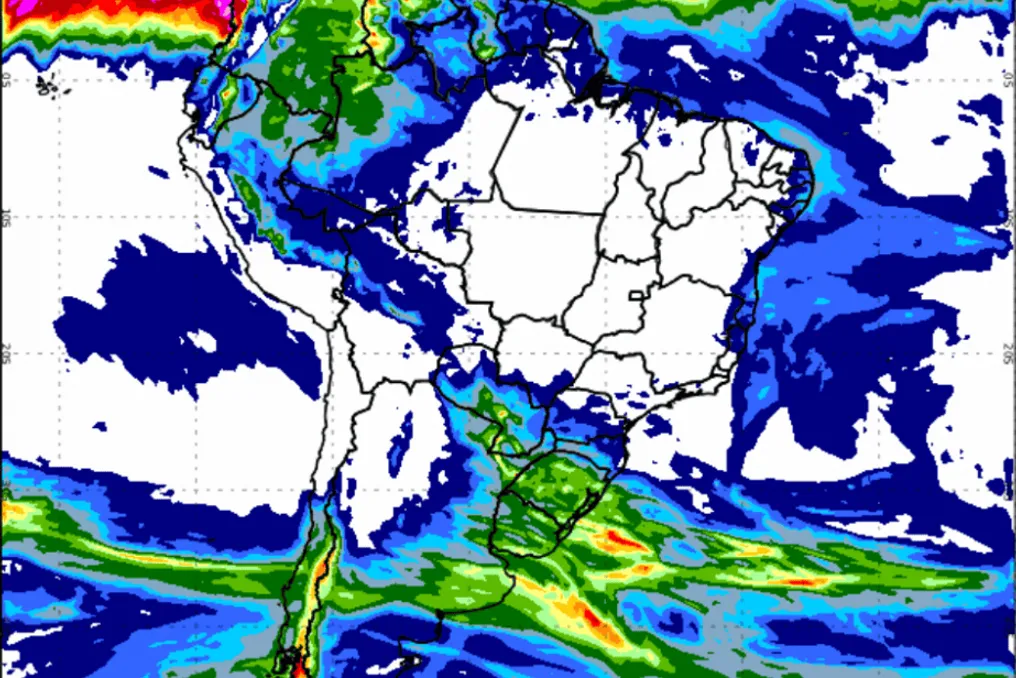
An extratropical cyclone is forecast to intensify severe weather conditions in the Southern Region of Brazil during Wednesday (5th) and Thursday (6th). According to Inmet, it is possible that the three states in the region will be affected by heavy rain, hail, and strong wind gusts.
The effects of this system may also extend to southern Mato Grosso do Sul, southern São Paulo, and areas adjacent to state borders. In contrast, the rest of the country's interior is expected to maintain a dry weather trend.
The Southern Region should receive the biggest impacts
Climate change will be most noticeable in the Southern Region, as the cyclone develops over the South Atlantic and has the potential to gain strength near the coast of South America, generating conditions favorable for strong winds, thunderstorms, rain, and hail.
On Wednesday, instabilities will begin to manifest in western and southern Paraná, western Santa Catarina, and northwestern Rio Grande do Sul. As the hours progress, these instabilities will spread to other parts of the three states, increasing the risk of storms.
The scenario predicted for Thursday remains similar, with projections of rain and thunderstorms, as well as the chance of new hail events, concentrated mainly in the south-central part of Rio Grande do Sul.
Among the main expected impacts are: continuous rain accompanied by thunderstorms; probability of hail in various locations in the Southern Region; wind gusts linked to the cyclone; and a drop in temperature in Rio Grande do Sul on Thursday.
Instabilities expand to other areas
The effects of this climate system also reach the Center-West. Southern Mato Grosso do Sul should face rain, thunderstorms, and the possibility of hail between Wednesday and Thursday. Simultaneously, areas in Goiás and the Federal District may record isolated rain showers.
In the Southeast, the forecast points to rain and thunderstorms in southern São Paulo, particularly on the border with Paraná. Additionally, the early morning may feature fog in sections of the coasts of São Paulo and Rio de Janeiro.
In the North, precipitation will remain concentrated between Amazonas and Roraima. In the Northeast, rains will continue to be limited mainly to the coastal strip.
Dry weather persists in most of the territory
While instability advances over certain regions, the country's interior maintains low air humidity levels. Inmet keeps active alerts for areas in the Center-West, Southeast, Matopiba, and some parts of the Northeast.
Storm alerts remain valid in part of the Southern Region and in southern Mato Grosso do Sul, as well as high wind warnings between the coast of Maranhão and Rio Grande do Norte.
Regarding temperatures, Porto Alegre is expected to register the lowest minimum, with a forecast of 11°C, and the maximum will be only 18°C on Thursday. On the other hand, Palmas (TO) and Teresina (PI) may reach 36°C.
Inmet informed that it will continue monitoring the cyclone, as its evolution may influence meteorological conditions in the Southern Region in the coming days.