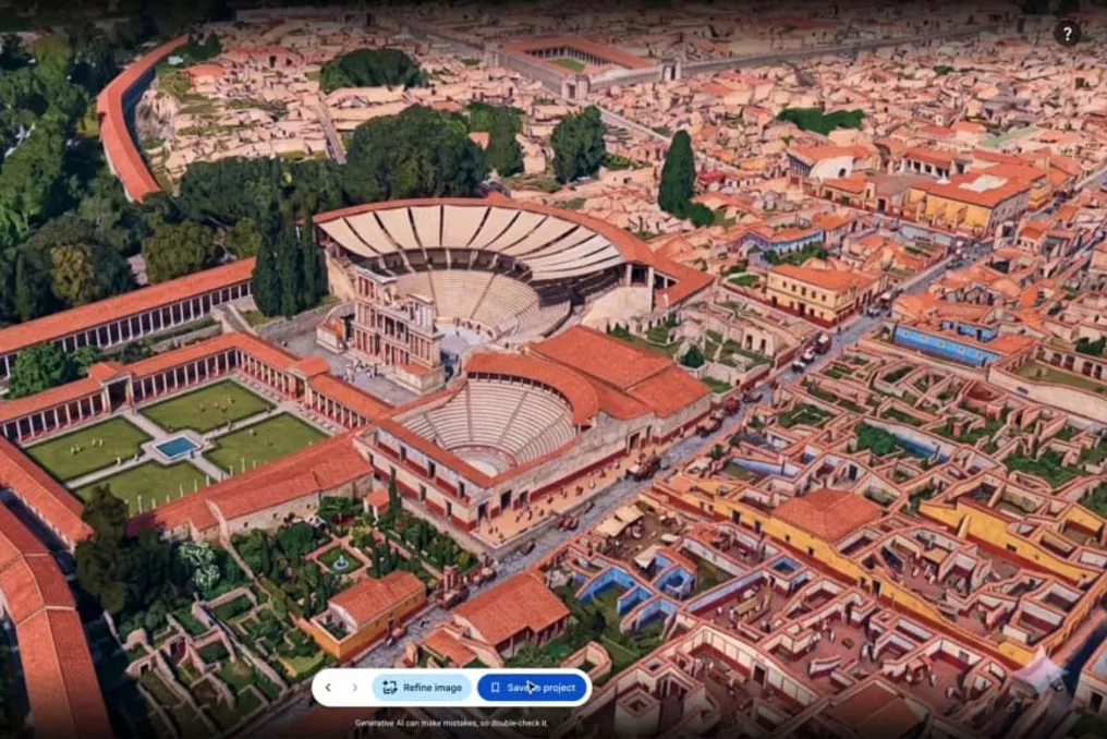
Google made a new feature available in Google Earth this Thursday, the 30th. This tool integrates satellite imagery, aerial photographs, and three-dimensional models with image generation technology called Nano Banana 2. With it, users can generate customized visual representations of existing locations simply by providing written commands.
Features and Educational Applications
This feature is globally accessible on the web version of Google Earth and was designed to assist in visualizing spatial transformations, conducting historical reconstructions, and conceptualizing new projects. The process begins with selecting a point on the map and providing a detailed description of the desired scene.
Bryan Horowitz, Google Earth Product Manager, presented this initiative as a way to expand the planet's digital exploration capabilities. The core idea is to allow students, professionals, and curious individuals to observe different versions of the same location using artificial intelligence based on authentic geographical references.
Transformation of Historical and Current Scenarios
The new capability allows users to virtually alter areas viewed in Google Earth through typed instructions. The system uses Nano Banana 2 technology to produce images that remain consistent with the real environment analyzed by the platform.
One example highlighted by Google is the ability to visually reconstruct past periods. Teachers can use this feature to show students what certain places were like in previous eras, such as transforming the ruins of Pompeii into a representation of a busy street during the Roman Empire.
Beyond the educational scope, the tool serves to enrich the understanding of tourist attractions and notable places, allowing for the creation of explanatory materials, such as personalized infographics, that add historical information related to these locations.
Support for Urban and Real Estate Planning
The tool was also developed to support professionals who need to present concepts before construction execution. Architects and urban planners can use artificial intelligence to simulate how vacant lots could be converted into new developments.
As presented by Google, an undeveloped space can be digitally transformed into a visual proposal for a commercial district, including open areas and planned structures. The goal is to simplify the assimilation of potential outcomes by clients and teams involved in the projects.
Additionally, the technology allows for the visualization of residential constructions before construction begins. An empty lot can receive a representation of a house or another architectural project inserted into the existing context, offering a preview of how the construction would integrate with the surroundings.
Creativity and Imaginary Visualizations
In addition to practical applications, the feature was promoted as a tool geared towards creativity. Users have the freedom to completely modify the appearance of known locations, creating futuristic or fantastical interpretations of certain regions.
Google exemplified this by virtually modifying its own campus in Mountain View, transforming it into a futuristic metropolis filled with elements such as illuminated walkways, glass structures, aerial vehicles, and vegetation integrated into the buildings. This demonstration illustrates how the technology can be applied to imagine changes in established spaces.
With the global release of the tool for Google Earth on the web, the company ensures that any user can select a point on the map and experiment with new ways of visualizing real environments through artificial intelligence.