Mahatma Gandhi once observed: 'Nature provides enough to satisfy every man's needs, but not every man's greed.' These words are particularly relevant today along the rivers of India.
Problems of Urban Rivers
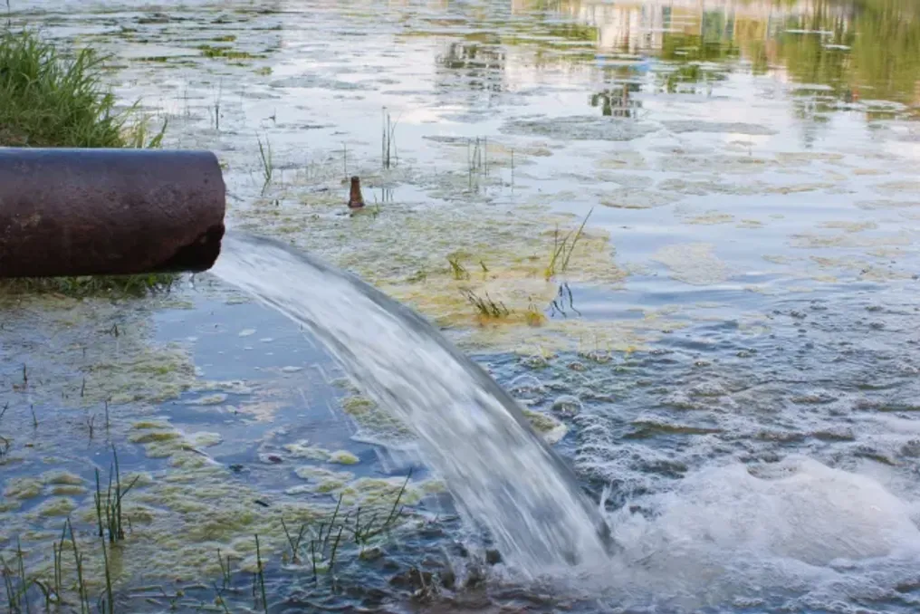
From Delhi to Mumbai, from Chennai to Hyderabad and Bangalore, the urban rivers of India exhibit similar problems. They have been narrowed, embanked, and then converted into channels for waste generated in rapidly growing cities. Rivers that once shaped settlements are now forced to exist by carrying sewage.
However, each river faces unique challenges. The Yamuna has lost a significant portion of its width due to floodplain encroachment and water diversion. A recent study showed that this river, which flows through northern and southern parts of the capital and is also known as the Kalindi, has shrunk by almost 68% over the last 220 years.
Ecological Condition of the Rivers
While the Yamuna struggles, the Sahibi River in the national capital has crossed a critical threshold and is in an ecologically degraded state, according to a report by the Central Water Committee of the Jal Shakti Ministry. Once an important seasonal river flowing through West Delhi, the Sahibi has gradually disappeared under the pressure of urban expansion. Today, most residents know it simply as the Najafgarh or Nala drain—a heavily polluted waterway carrying black sewage through the city.
Meanwhile, the Mithi River in Mumbai has turned into a stormwater drain overloaded by uncontrolled urban development. The Musi in Hyderabad and the Cooum in Chennai now carry far more sewage than fresh water, and the Vrishabhavathi in Bangalore has effectively become a municipal sewage channel.
Brahmaputra and Other Rivers
Even the mighty Brahmaputra in the Northeast, which is relatively cleaner than most urban rivers, is steadily losing land due to constant erosion amid increasing climate change and urban pressure. Together, they reveal a common truth: Indian cities have grown at the expense of the space available to rivers.
Delhi: The Yamuna That Lost Its Floodplain
No river illustrates this transformation as dramatically as the Yamuna. Researchers from Delhi University and the Indian Institute of Science Education and Research (IISER), Bhopal, found that the average width of the Yamuna in Delhi has shrunk by almost 68%: from approximately 658 meters in 1799 to about 210 meters today. Water flow has dropped by nearly 90%, mainly due to dams, canals, and water diversion projects.
Researchers also argue that the loss of floodplains has made Delhi more vulnerable to flooding. Embankments have restricted the river to an increasingly narrow channel, which helps explain why the capital experienced record floods in 2023 despite lower river flow than during the 1978 floods. The Yamuna has long held a central place in Delhi's political discourse. Every election brings new promises to clean the river, while opposition parties accuse each other of worsening its condition.
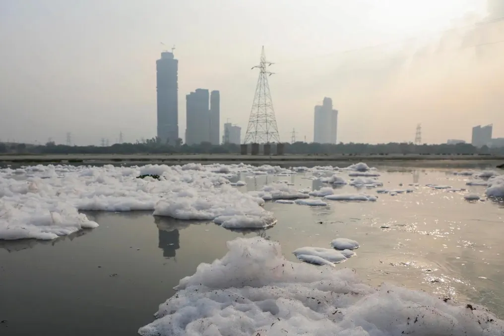
Despite repeated assurances, the river remains heavily polluted and is often described as being on the brink of biological death. Its condition cannot be ignored. Passing through Delhi, the Yamuna carries dark, contaminated water clogged with untreated waste. Downstream, it reaches Agra, where it flows near one of the world's greatest monuments—the Taj Mahal. The contrast between the immaculate marble monument and the foul-smelling river serves as an uncomfortable reminder of India's environmental problems.
Mumbai: When Flooding Exposed the Dying Mithi River
For Mumbai, the floods of July 26, 2005, were a catastrophe, claiming over 500 lives and revealing that decades of urban expansion had reduced the Mithi River to 17.8 km. According to the Mumbai Metropolitan Region Development Authority (MMRDA), suburban development over the last 25 years has 'sharply deteriorated' the water quality in the river. Once an important natural channel for stormwater runoff, the Mithi now carries untreated sewage, industrial effluents, municipal waste, and silt.
Wetlands and floodplains have disappeared under roads, industrial zones, and the Bandra-Kurla complex. Construction has narrowed the river, reducing its capacity to handle monsoon floodwaters. Although the Municipal Corporation of Mumbai stated that expansion and retaining wall construction have doubled storage capacity and tripled throughput since 2005, officials admit that pollution remains the most serious problem. The Maharashtra Pollution Control Board identifies untreated sewage, industrial discharges, and solid waste as the main causes of the river's ongoing degradation.
The BMC and MMRDA have undertaken works to expand, deepen, remove silt, build retaining walls, and implement pollution control measures along the river. The country's largest municipal body, the BMC, reported that retaining wall construction is nearly complete, while the MMRDA is implementing a sewage interception project and a pilot odor control project aimed at improving dissolved oxygen and reducing pollution. Renewed efforts to remove silt and combat illegal land grabbing have also been reported following an alleged silt removal scandal.
Hyderabad: The Musi Carrying Mostly Sewage
The Musi perhaps tells the clearest story of a river losing its natural identity. The Telangana government's Musi Waterfront Development Corporation stated that the river now flows 'almost dry' through Hyderabad because upstream reservoirs, watershed degradation, and urban encroachment have drastically reduced natural flows. What remains is mostly sewage.
The Union Ministry of Environment classifies sections of the Musi among India's 'priority polluted river stretches,' and the Jal Shakti Ministry reported that four treatment plants with a total capacity of 593 million liters per day have been created under the National River Conservation Plan. Nevertheless, untreated sewage continues to enter the river through numerous nalas or drains as Hyderabad continues to expand and transform into a full-fledged metropolis. The state is now proposing a 55 km waterfront restoration project focused on complete sewage interception, ecological restoration, and flood management, acknowledging that beautification alone cannot revive a river whose main problem is pollution.
Chennai: The Cooum Turned into an Urban Sewer Collector
The story of the Cooum is no less alarming. The river, which is about 65 km long, once supported transport and recreation before being overwhelmed by Chennai's urban growth. Government data presented in parliamentary records indicates a Biochemical Oxygen Demand (BOD) level in the Cooum of 105 mg/liter—one of the highest for urban rivers in India. Healthy water bodies usually have a BOD below 3 mg/liter.
Under the National River Conservation Plan, projects worth ₹404.25 crore have created 264 million liters per day of treatment capacity through four sewage treatment plants, according to the Ministry of Environment. However, this project includes both the Cooum and the Adyar rivers. Nevertheless, untreated sewage from the Cooum continues to enter the river through numerous drains. An audit by the Comptroller and Auditor General noted that Tamil Nadu itself described the Cooum as an 'urban sewer collector due to the discharge of municipal and industrial waste.'
The Chennai River Restoration Trust has cleared encroached areas, relocated thousands of families, and restored areas near Island Grounds. But officials continue to acknowledge that preventing sewage inflow remains a key challenge.
Bangalore: The Vrishabhavathi Carrying City Waste
If the Musi of Hyderabad resembles an open drain, the Vrishabhavathi of Bangalore has effectively become one. The Central Pollution Control Board describes the river as a 'drain for domestic and industrial sewage.' The river, before joining the Arkavathi after flowing into the Biramangala reservoir, carries a significant portion of Bangalore's treated and untreated sewage downstream.
The CPCB has repeatedly urged Karnataka authorities to strengthen sewage treatment, improve industrial effluent management, and protect floodplains. Heavy rains often wash garbage and plastic downstream. Residents near Bidadi complained that after every heavy rain, trucks carrying Bangalore waste accumulate around the bridges. The river illustrates how pollution generated in one city increasingly affects communities far beyond municipal boundaries.
Assam: Another Form of Brahmaputra Reduction
The Brahmaputra also feeds some of the fastest-growing urban centers in the Northeast. From Dibrugarh to the bustling metropolis of Guwahati, cities have grown and continue to expand along the banks of the mighty river. Unlike India's urban rivers, the biggest problem with the Brahmaputra is not just sewage. It is erosion.
Every year, villages, agricultural lands, and public infrastructure disappear as one of the world's largest braided rivers changes its course. Recognizing the scale of the problem, the World Bank and the Asian Development Bank signed a $200 million agreement in 2024 to strengthen flood and erosion management along 650 km of the river in Assam. Assamese government documents describe erosion as one of the state's biggest development challenges. Protective works continue around vulnerable areas like Majuli, and future planning increasingly relies on satellite imagery, GIS mapping, and hydrological modeling.
Although pollution levels remain significantly lower than in India's megacities, officials warn that urbanization and untreated sewage around cities like Guwahati are becoming a growing concern. The Brahmaputra demonstrates that shrinking rivers are not always linked to pollution. Sometimes rivers lose land, and people lose homes. The relentless erosion and annual floods of the Brahmaputra continue to threaten millions in the Northeast. Fed by abundant monsoon rains, the river frequently overflows its banks, leaving large parts of the region flooded.
Ganges: A River Struggling Under the Weight of Indian Cities
If the Ganges is India's most revered river, it is also one of the most stressed. Flowing through some of the country's fastest-growing cities, including Haridwar, Kanpur, Prayagraj, Varanasi, Patna, and Kolkata, the Ganges faces a different problem. Unlike the Yamuna, its main burden is industrial pollution, exacerbated by religious offerings, ritual waste, human remains, and huge crowds gathering during events like the Maha Kumbh.
Revered for centuries as 'Maa Ganga' and celebrated as a symbol of purity, the Ganges is now among the most polluted waterways in the world. The river is increasingly becoming a victim of urban expansion, pollution, and the reduction of natural floodplains. As cities grow, the Ganges' floodplains are steadily disappearing under roads, residential settlements, commercial properties, and embankment structures. These encroachments have narrowed the river's natural corridor, reducing its ability to flood during the monsoon, replenish groundwater, and sustain wetlands.
Pollution remains the river's biggest issue. Despite significant investments under the Namami Gange program, untreated sewage from expanding urban centers continues to enter the river through hundreds of drains. Industrial effluents, especially from tanneries, sugar mills, distilleries, and textile units, increase the pollution load, although regulatory enforcement has improved in recent years. During the dry season, reduced ecological flow due to dams and water diversion further limits the river's ability to dilute pollutants. Large-scale restoration efforts have expanded sewage treatment capacity, intercepted drains, and improved embankment infrastructure in several cities. Nevertheless, government assessments continue to emphasize that engineering projects alone are insufficient to revive the Ganges.