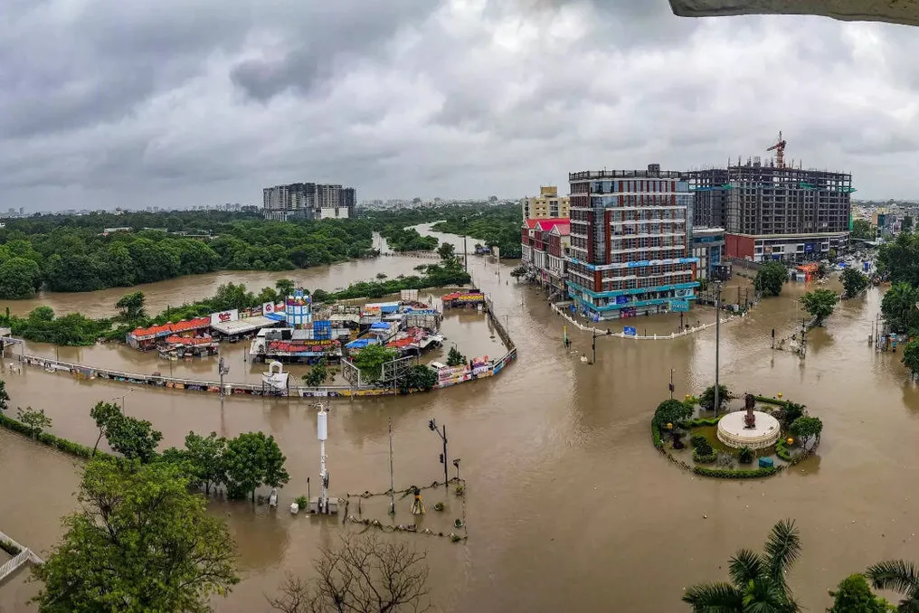
Every monsoon sees a recurring scenario in cities: roads become flooded, traffic movement stops, and delays in rainfall lead to water penetrating residential areas, offices, parks, schools, and hospitals. The transformation of potholes into indistinct objects, the overloading of drainage systems, and even several hours of heavy rain can disrupt daily life.
Causes of urban flooding
Extremely heavy rainfall and inadequate drainage systems are often blamed. However, researchers and government bodies are increasingly pointing to another factor—the rapid development of urban territories. As cities expand, open areas, wetlands, and vegetation are replaced by buildings, roads, sidewalks, and parking lots made of concrete, asphalt, and other impermeable materials. This significantly reduces the soil's ability to absorb rainwater.
Water that previously seeped into the ground and replenished aquifers now quickly runs off over hard surfaces and enters storm drains. During intense monsoon periods, the volume of surface runoff can exceed the capacity of these drains, causing inundation and urban flooding.
How concrete transforms precipitation into runoff
Urban flooding is no longer viewed solely as a consequence of abnormally heavy rains. Studies link it to how cities have developed, often at the expense of lakes, wetlands, vegetation, and open soils. Uncontrolled construction, encroachment on water bodies, and widespread cementation have altered the natural flow of water in the urban environment. Impermeable surfaces increase the speed and volume of runoff, while the disappearance of lakes and wetlands reduces the space for accumulating excess rainwater.
As a result, even if cities install more drains, the water may reach them faster than the system can convey it.
The Bangalore Example: Less Vegetation and Lakes
A 2017 study by the Centre for Environmental Sciences of the Indian Institute of Science showed that the urban area of Bangalore increased by more than 1000 percent since the 1970s. Over the same period, vegetation cover decreased by almost 88 percent, and the number of water bodies decreased by approximately 79 percent. According to the study, about 78 percent of Bangalore's surface became impermeable, leaving little room for rainwater infiltration into the soil.
In Bangalore, rainwater that previously recharged groundwater now runs off over concrete and asphalt into storm drains, increasing both the volume and speed of surface runoff. Researchers also studied the impact of concrete-lined drains. Such channels can move water faster than channels lined with soil and vegetation. However, concrete prevents infiltration and reduces surface friction, allowing large volumes of water to reach lower areas in a shorter time. The study suggests that this approach may simply shift the risk of flooding from one part of the city to another instead of solving the problem.
Furthermore, researchers found that the traditional Rajakaluve drain connecting City Market to Bellandur Lake narrowed from approximately 60 meters to 28.5 meters due to encroachments and physical changes. These findings were later mentioned in the Comptroller and Auditor General's report for September 2021 regarding stormwater management in Bangalore. The Comptroller and Auditor General identified several gaps in the city's stormwater management, including discrepancies in reported drain lengths and the absence of a complete registry of tertiary drains. The audit also documented the reduction of Bangalore's water bodies. Within the current city area of 741 square kilometers, their number dropped from 1452 in the early 1800s to 194 in 2016. Their total storage capacity decreased from approximately 35 million cubic feet, or nearly 991 billion liters, to about 5 million cubic feet, or approximately 142 billion liters. This loss of storage capacity has deprived the city of natural spaces to retain excess monsoon water.
Delhi: River Flooding and Local Inundations
Similar concerns were raised in a report by the National Institute of Disaster Management concerning floods in Delhi, focusing on July 2023. According to the report, Delhi's land use coverage increased from 46.2 percent in 1991 to 75.1 percent in 2011. The separately mapped built-up area grew from about 20 percent in 1985 to over 52 percent by 2018.
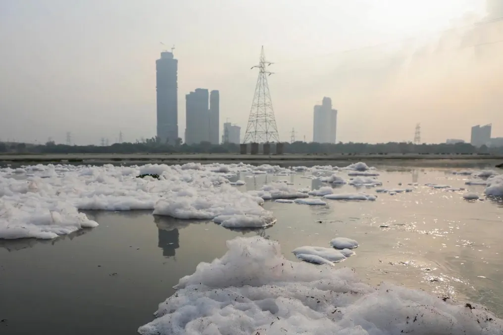
The Institute noted that the increase in impermeable surfaces reduced the time required for rainwater to reach the drains and the Yamuna River. This led to increased peak flows and heightened the probability of flash floods, even during rainfall that would otherwise not cause widespread disruption. The Institute distinguished between two types of flooding in the capital. The first occurs when high water levels in the Yamuna push river water back into Delhi's drainage network. The second is local urban flooding, where runoff from roads, sidewalks, settlements, and other built-up areas enters the drains faster than they can accommodate it.
NIDM identified cementation, pressure on drainage infrastructure, and encroachment on the Yamuna river floodplain as factors exacerbating the July 2023 floods.
Mumbai: Flood Mitigation and Concrete Expansion
In Mumbai, expenditure on flood control has increased, but so has the city's built-up area. The Brihanmumbai Municipal Corporation invested in river restoration, pumping stations, hazard mapping, and weather forecasting as part of flood mitigation measures. Simultaneously, infrastructure reconstruction and development projects continued, adding impermeable surfaces across the city. Approximately 38 percent of the BMC's annual budget was allocated to climate measures, with a significant portion directed towards flood and water resource management. Nevertheless, reconstruction projects were expected to add nearly 344 million square feet of built-up area. Officials quoted in the report stated that construction and reconstruction are progressing faster than flood mitigation and environmental restoration efforts.
Mumbai is also actively involved in paving roads with concrete in response to pothole issues and deteriorating road conditions. While concrete roads can provide greater durability, expanding hard surfaces without adequate water absorption measures can increase surface runoff of rainwater. The BMC's climate report for 2026-27 allocates nearly 48,164 crore rupees, of which 43 percent is reserved for five climate risks, including urban flooding.
Recommendations of the National Green Tribunal
By a resolution dated May 21, 2025, the National Green Tribunal issued directives to local authorities and development agencies across India, prohibiting uncontrolled cementation in urban construction and the building of roads, embankments, and sidewalks. The Tribunal mandated the use of permeable or semi-permeable pavements and instructed authorities to preserve unpaved spaces around trees. It specified that the Uttar Pradesh government order of March 23, 2018, should serve as the primary guideline for states and territories that have not yet developed their own rules. These guidelines recommend using permeable paving instead of solid concrete, restrict paving around lakes, ponds, parks, and green areas along roads, and require an unpaved zone of at least one meter around trees. They also call for the implementation of rainwater harvesting systems in large projects and structures to replenish groundwater, including ponds and soak pits, in new layouts.
Beginning Decementation Efforts
Some municipal authorities have begun implementing measures aimed at restoring open soils and protecting water bodies. Before Environment Day in 2025, Bangalore ordered the removal of concrete, cement, and stone blocks within a one-meter radius of roadside trees. The city also used drone aerial photography, GIS mapping, and digital lake records to identify illegal encroachments and support removal campaigns. In 2024, the Municipal Corporation of Delhi reported decementing the area around 24,000 out of approximately 41,000 trees identified in its jurisdiction. The Delhi Development Authority also conducted campaigns to demolish illegal constructions on the Yamuna river floodplain following directives from the Delhi High Court and the NGT. However, such measures remain limited compared to the speed at which Indian cities continue to build roads, residential complexes, commercial centers, and other infrastructure.
Drains Are Not Enough
Concrete remains a central element of urban construction due to its strength, wide availability, and ability to withstand heavy loads. It can be molded into various configurations, and it does not rot, rust, or burn. The problem is not a complete abandonment of concrete, but avoiding its use where permeable alternatives are possible. The NGT recommended using materials such as stabilized soil, coarse sand, fly ash bricks, stones, and perforated tiles for pedestrian and open areas. These materials allow at least some rainwater to penetrate the ground. Where avoiding concrete is impossible, measures such as bio-swales, rain gardens, soak pits, and retention tanks can be integrated into road and drainage systems. These structures slow down water flow and allow some of it to soak into the soil instead of sending the entire volume directly into the drains. Urban flooding cannot be solved merely by expanding drains or installing more pumps while the surrounding landscape continues to harden. Since monsoon rains are becoming harder to control, cities must also rethink their approaches to designing roads, sidewalks, open spaces, and neighborhoods. Restoring wetlands, protecting drains and floodplains, and creating more permeable surfaces will be as important as building new drainage infrastructure.