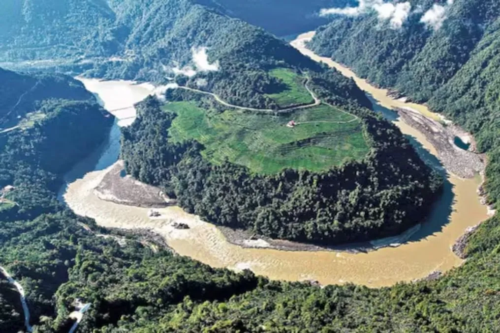
The construction of the Medog Hydropower Station, which is the world's largest hydropower project, raises serious concerns among Chinese state geologists. According to a study conducted by scientists, this station is located directly above an active fault line in Tibet.
Geographical Location and Discovery
The project site is only 50 kilometers from the border between China and Arunachal Pradesh. This fact has raised new alarms regarding the safety of the giant dam. Previously, the dam itself was already a subject of debate concerning China's ability to control the flow of the Brahmaputra River, especially after India suspended the Indus Water Treaty with Pakistan.
Study Details and Participants
According to the report published in the journal Sedimentary Geology and Tethyan Geology in Chinese under the auspices of the Chinese State Geological Survey Institute, the active Paicheng fault runs beneath the Yarlung Tsangpo River, where the Medog Dam is being built. In Tibet, the Brahmaputra River is known as the Yarlung Tsangpo. The study was a joint effort by geologists from Chengdu University of Technology, the Geological Survey of China's Center for Civil-Military Integration, and the Mid-Yarlung Tsangpo Natural Resources Research Station.
Scientists warned that this fault could critically affect the strength of the dam. The Medog Hydropower Station is a 'run of the river' type project with a capacity of 60 thousand megawatts, being built in the Medog County in Tibet on the Yarlung Tsangpo River. This river originates from the Angsi Glacier in western Tibet and flows 1625 kilometers across China.
River Route and Project Scale
After passing through the Great Bend near Namcha Barwa peak, the river enters India, where it is called the Brahmaputra. It flows 918 kilometers in India and then 337 kilometers into Bangladesh, where it is named Jamuna, before emptying into the Bay of Bengal. The total estimated cost of the project is 1 trillion yuan, equivalent to approximately 137 billion US dollars, making it the world's largest hydropower project. Annually, it will produce about 300 billion kilowatt-hours of electricity, almost three times more than the Three Gorges Dam.
China approved this project in December 2024, and construction began in July 2025, with a planned full commissioning by 2033. However, according to the Chinese state scientists themselves, this massive dam is being built over a geological 'ticking time bomb.'
Danger of the Paicheng Fault
The report states that the Paicheng fault has been active since the Pleistocene period, which began about 2.6 million years ago and included the Ice Age. Scientists note that this fault remains constantly active and could have a significant impact on the stability of the dam, roads, bridges, tunnels, and reservoir. They warn that future fault displacements could jeopardize the safety of the entire project.
Researchers also pointed out that the Pai area, where the Medog Dam is being built, belongs to one of China's most seismically active regions. Analysis of ancient lake sediments showed that this fault was active up to 9500 years ago. The fault's activity was confirmed by a magnitude 6.9 earthquake that occurred in the northern part of this fault in Tibet in 2017.
Soil Vulnerability and Landslide Risk
The study also emphasized that frequent displacements of this fault have already weakened the geological structure of the area. Scientists reported that the surrounding rocks have disintegrated and lost their strength. Simply put, the bearing capacity of the ground to support such a massive 60,000-megawatt structure and its huge reservoir has decreased compared to the initial assessment, especially during seismic events.
The team of scientists also cautioned that the ground around the reservoir has a loose and weak structure. When the reservoir is filled with water, combined with the influence of the fault and earthquakes, the risk of landslides and collapses significantly increases. Specialists insist on the necessity of strengthening safety measures, such as slope reinforcement, both during construction and operation.
International View on the Situation
India and Bangladesh are closely monitoring this situation, as the project could affect the river flow downstream. Nevertheless, experts believe that the main problem is not China's ability to stop the water flow, but the dangerous geological condition of the area.
Nilanjan Ghosh, a water expert at the Observational Studies Fund, noted that any attempt to change the direction of the water flow would lead to adverse consequences, as it could cause upstream flooding due to sediment accumulation. He also added that the Yarlung Tsangpo accounts for only 10–15 percent of the total volume of the Brahmaputra; the rest comes from tributaries and monsoon rains in India, meaning China cannot completely block the water.
Thus, despite China's own state research acknowledging that the world's largest project is built over an active fault line in one of the most seismically dangerous zones of the Himalayas, the main question is not about controlling the Brahmaputra's flow, but about the catastrophic consequences that could arise in the event of the collapse of such a giant dam and its reservoir.