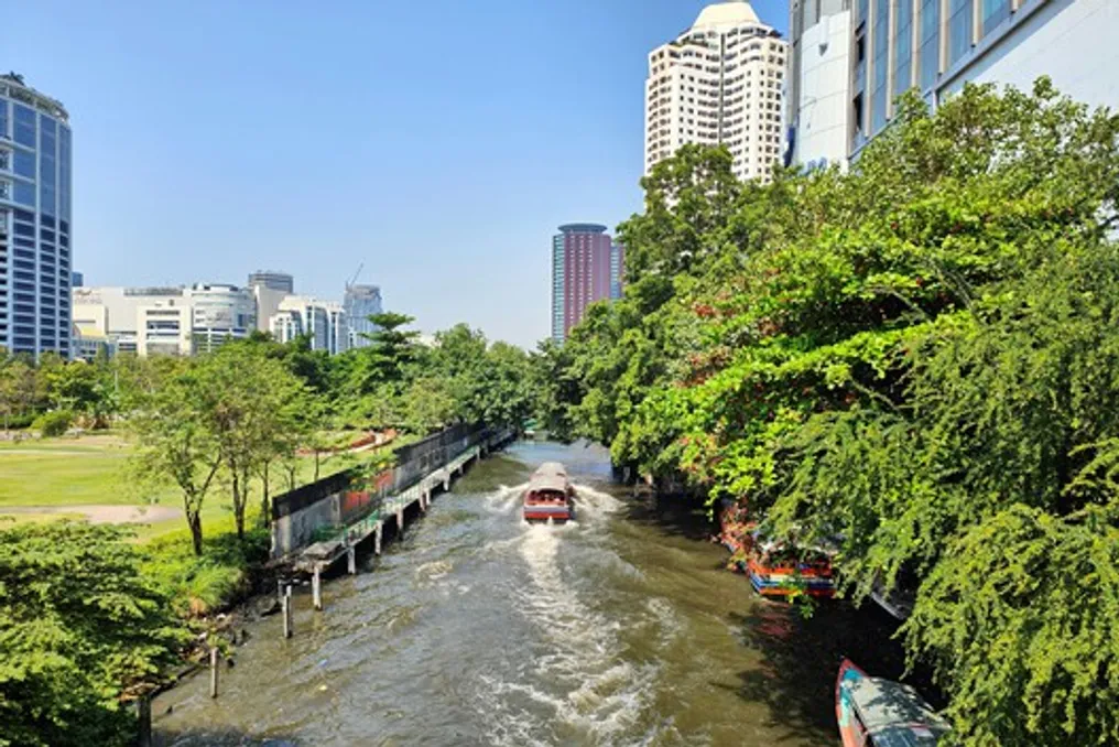
For most of the 20th century, architecture studied cities through transport arteries. The hierarchy of roads determines urban planning, intersections organize flows, and buildings are perceived by facades facing sidewalks. Roads seem so fundamental to urban life that they are often mistakenly taken as a universal condition. However, in many parts of Southeast Asia, cities developed according to a completely different spatial logic.
Rivers as primary infrastructure
Long before automobiles changed cityscapes, rivers served as streets, markets, civic spaces, and public infrastructure. Movement was predominantly by boat, trade occurred along the banks, and architecture was oriented towards water, not asphalt. Analyzing these cities through their waterways changes the very understanding of architecture: in this case, the infrastructure is not the street, but the river.
Examples of riverine urbanism
Throughout the region, navigable rivers determined the locations of settlement emergence and expansion. They connected agricultural landscapes of inland areas with maritime trade routes, allowing goods, people, and ideas to travel significant distances centuries before the advent of modern transport networks. Waterways functioned as the main structure around which urban life was organized.
The historic trading port of Hoi An vividly illustrates this connection. Commercial houses, warehouses, assembly halls, and markets were located directly along the Thu Bon River, where vessels provided direct access to regional and international trade. Property value near the river depended on direct access to navigation, trade, and exchange. As documented by UNESCO, the city's remarkably preserved urban network still reflects a period when proximity to the river, rather than a facade facing the street, was the priority.
Architectural differences
When movement occurs mainly by water, architecture develops differently. In cities built around land roads, buildings are usually oriented towards streets where entrances, shop windows, and public life are concentrated. Coastal cities invert this relationship: boats replace pedestrians as the main users of public space, and piers replace sidewalks, turning riverbanks into an active city facade. Access is designed for arrival by water, while land often serves as a secondary entrance. These differences manifest in the architecture itself, as the connection between the building and the infrastructure becomes immediate, blurring the clear distinction between movement and architecture that land roads later established.
Bangkok and Palembang: examples
Nowhere is this urban logic more evident than in Bangkok, where an extensive network of canals once earned the city the title 'Venice of the East.' Long before road construction transformed the metropolis of Bangkok, the canals served as the city's main circulation system. Residential houses opened directly onto the waterways, temples positioned their ceremonial entrances to the canals, and floating markets occupied strategic intersections where hydrotransport converged. The city's architecture viewed the canals as public space, and the canal banks became simultaneously a street, a market, and a place for neighbors to meet.
Urban history expert Mark Askew showed that this morphology gave rise to a city whose spatial organization was inseparable from its waterways, demonstrating the co-development of infrastructure and architecture. Palembang followed a similar urban logic, showing that riverine urbanism was a common phenomenon. Along the Musi River, Palembang's districts developed around a landscape where water remained the primary means of daily transport. Wooden houses were built on stilts or floated directly on the river, adapting to seasonal fluctuations and maintaining constant access to transport. Trade was conducted using ramps extended over the water, and domestic life was closely tied to the rhythm of the river. Here, architecture did not resist the dynamic nature of the waterways but integrated it into building methods, settlement patterns, and daily routines. The resulting urban form shows how ecological conditions, materials, and infrastructure were considered a single architectural problem.
Shifting paradigms
The dominance of riverine urbanism began to change in the 19th and 20th centuries when colonial administrations, and later national governments, actively invested in land road infrastructure. Roads reshaped the hierarchy of cities. New commercial districts emerged along streets, not along waterways; bridges redirected flows, diverting them from boats, and canals gradually became obstacles to movement instead of serving as supporting infrastructure. In Bangkok, countless canals were gradually drained to accommodate road networks, while urban investment focused on automotive mobility. Buildings that once had active public facades to the water slowly turned away from it, transforming riverbanks from civic centers into service corridors or residual zones. The city did not abandon its rivers overnight; it was the buildings that increasingly turned toward the streets rather than the water.
Modern perspective on waterways
In historical river cities, trade, transport, religious processions, and daily encounters took place in one shared space. The shoreline was not a specialized recreational landscape but an extension of ordinary urban life. When land roads took on this civic role, water became something cities crossed, rather than something they occupied. In Hoi An, changes in maritime trade routes and the gradual silting of the river reduced the port's international significance. Its preserved urban network continues to reveal an earlier spatial order in which architecture was oriented towards water as the city's main public sphere. These historical environments still allow one to read this former urban order. Infrastructure simultaneously reorganizes trade, social life, and architecture.
Today, many Southeast Asian cities are reevaluating their relationship with water, albeit under very different circumstances. Sea-level rise, increased flooding, and adaptation to climate change have spurred new interest in 'blue-green' infrastructure, sustainable urban planning, and water-sensitive planning. Institutions such as UN-Habitat, the World Resources Institute, and Deltares are increasingly advocating for urban strategies that integrate waterways into daily infrastructure, rather than isolating them behind engineering barriers. Although these strategies are motivated by contemporary environmental pressures, they resonate with the long-established spatial principles of the region's coastal cities.
Conclusions on the role of infrastructure
Historical riverine urbanism cannot simply be replicated because it arose from specific ecological, economic, and political conditions that are impossible to reproduce. Nevertheless, it reminds us that land roads are just one possible structure, and that architecture is always shaped by the systems through which people move. When circulation occurs by water, buildings, public space, trade, and civic identity develop according to different priorities. Infrastructure shapes the way we live, remember, and understand cities.
The coastal cities of Southeast Asia demonstrate that infrastructure has never been neutral. Every transport network favors certain relationships while weakening others. Land roads created urban forms that define much of modern architectural thinking; however, they do not represent the only model upon which cities thrived. Along the rivers of Bangkok, Hoi An, and Palembang, another urban tradition emerged—a tradition in which architecture faced the water, social life unfolded on the banks, and circulation itself shaped the city. In an era of climate uncertainty, these waterways are valuable not so much as historical curiosities, but as evidence that cities have long been organized by infrastructures vastly different from those assumed in current practice.